Acquisition of 1002 Area Complete!
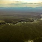
This summer I mapped all of the Arctic National Wildlife Refuge’s 1002 Area, as well as all of the glaciers draining into it, covering about 8000 km2 in total. The map resulting from these data will be the best map by far in the US Arctic, with a resolution of about 12.5 cm and the ability to resolve the shape of ice wedges, tussocks, polygons, and even caribou tracks, with a vertical accuracy of centimeters. This map will serve as the base map against which all future change will be measured in the northern part of America’s Last Great Wilderness, whether those changes are due to the climate, ecosystem, or man.
I mapped the entire 1002 Area and all of the glaciers draining into it. This map enormously expands the range the important scientific questions we can now begin to answer, as well as offers new tools for management and preservation of this unique landscape and ecology.
What did I do?
I mapped the 1002 Area and the glaciers draining into them using fodar, an airborne photogrammetric method for making topographic maps and orthorectified image mosaics with the accuracy of lidar at a fraction of the price. You can learn more about fodar on this website, but this recent blog gives a good summary of its history, its capabilities, and a variety of validation studies.
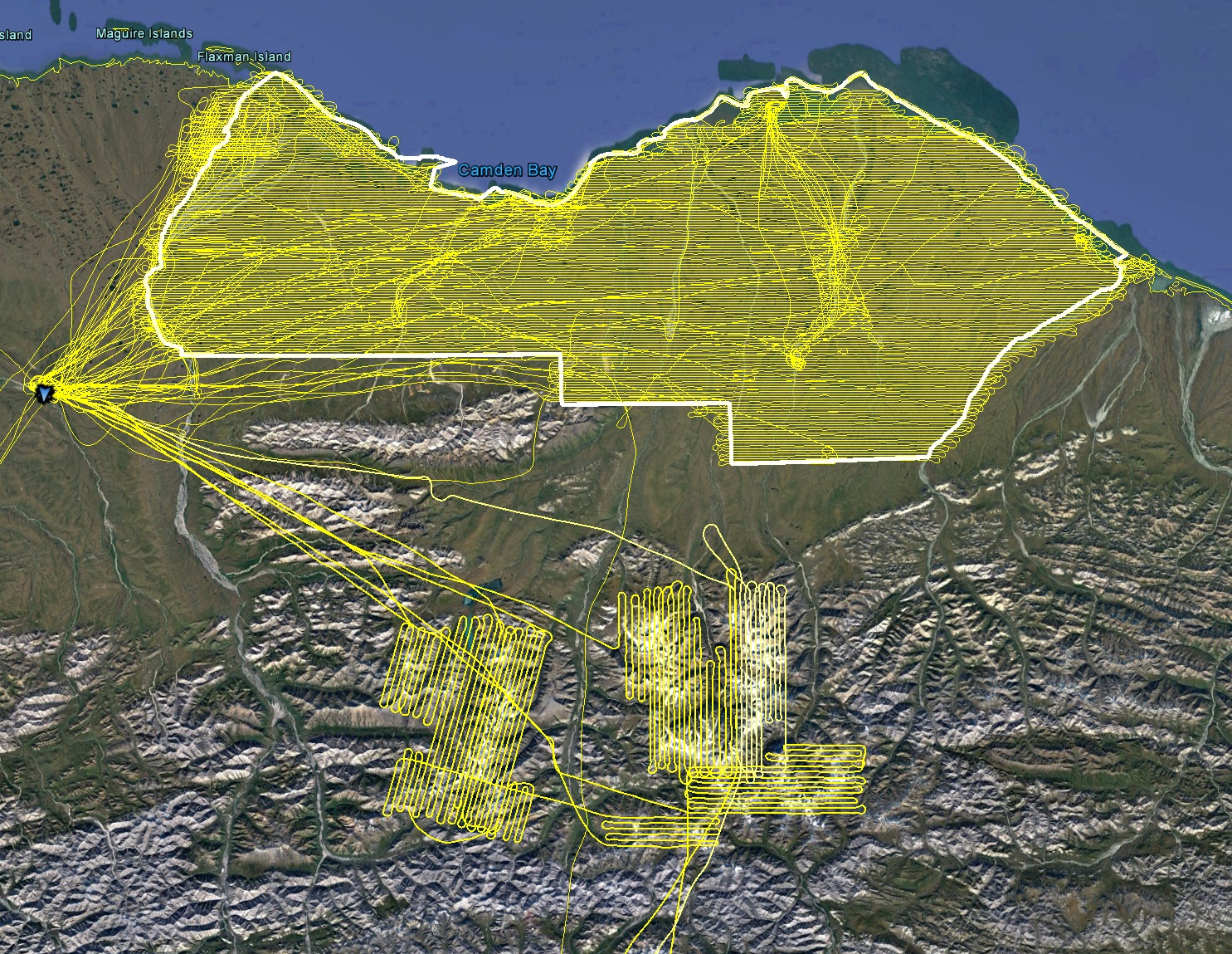
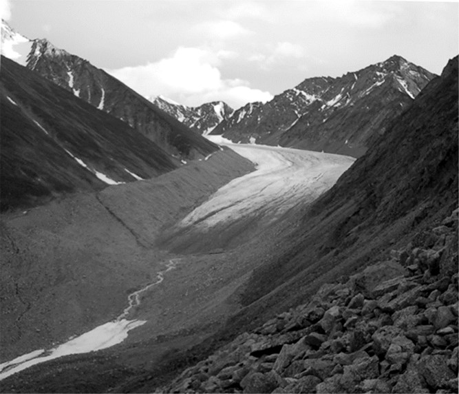
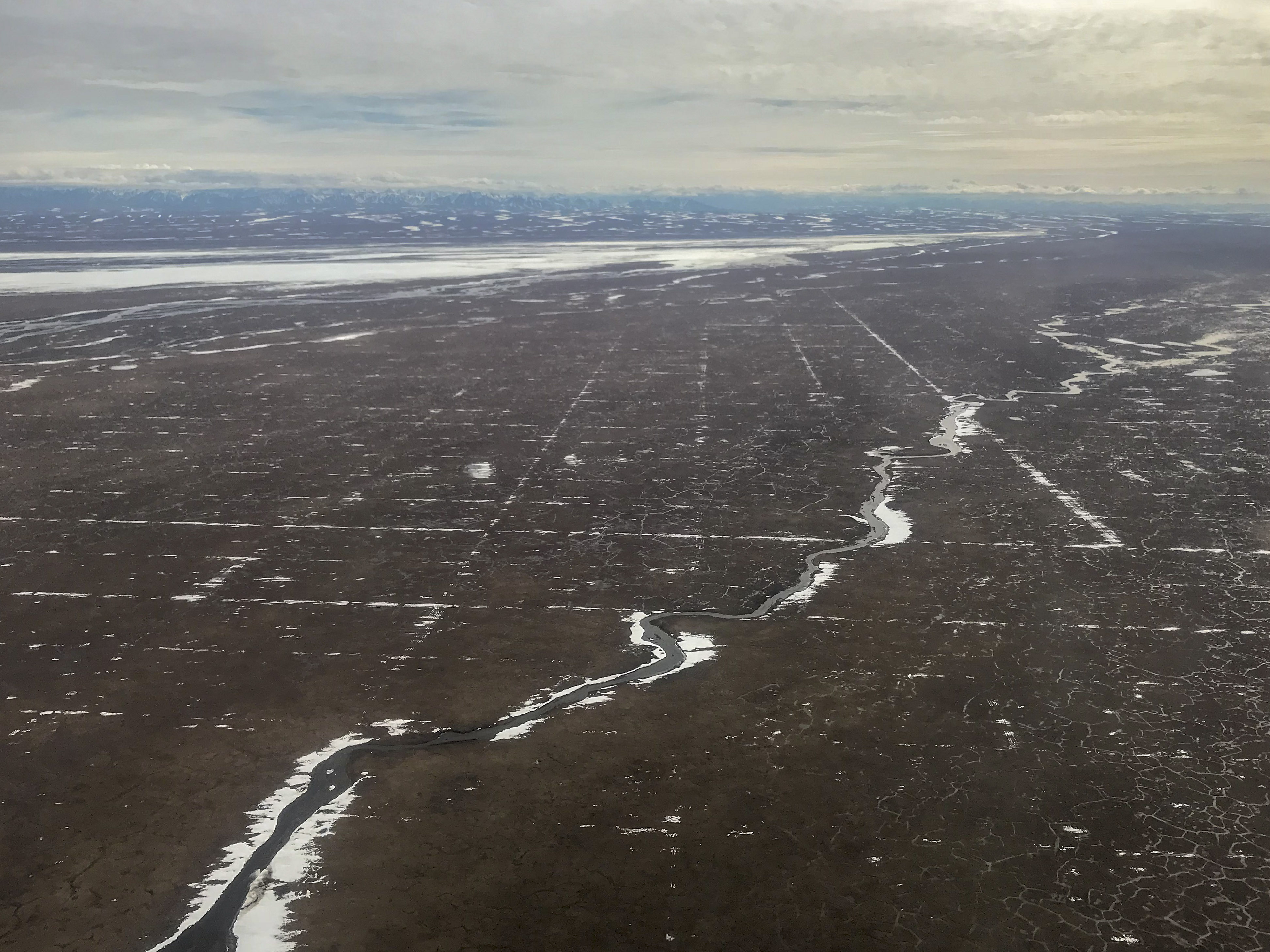
I planned the flight lines for the 1002 Area at 12.5 cm ground sample distance (GSD). In general this was achieved everywhere, over the course of about 200 hours of flying, including commutes, and about 150,000 individual photos. The flights lines for the glaciers draining into the 1002 Area were planned for about 25 cm GSD and include another ~15,000 photos. I flew a Cessna 206 for all of this work.
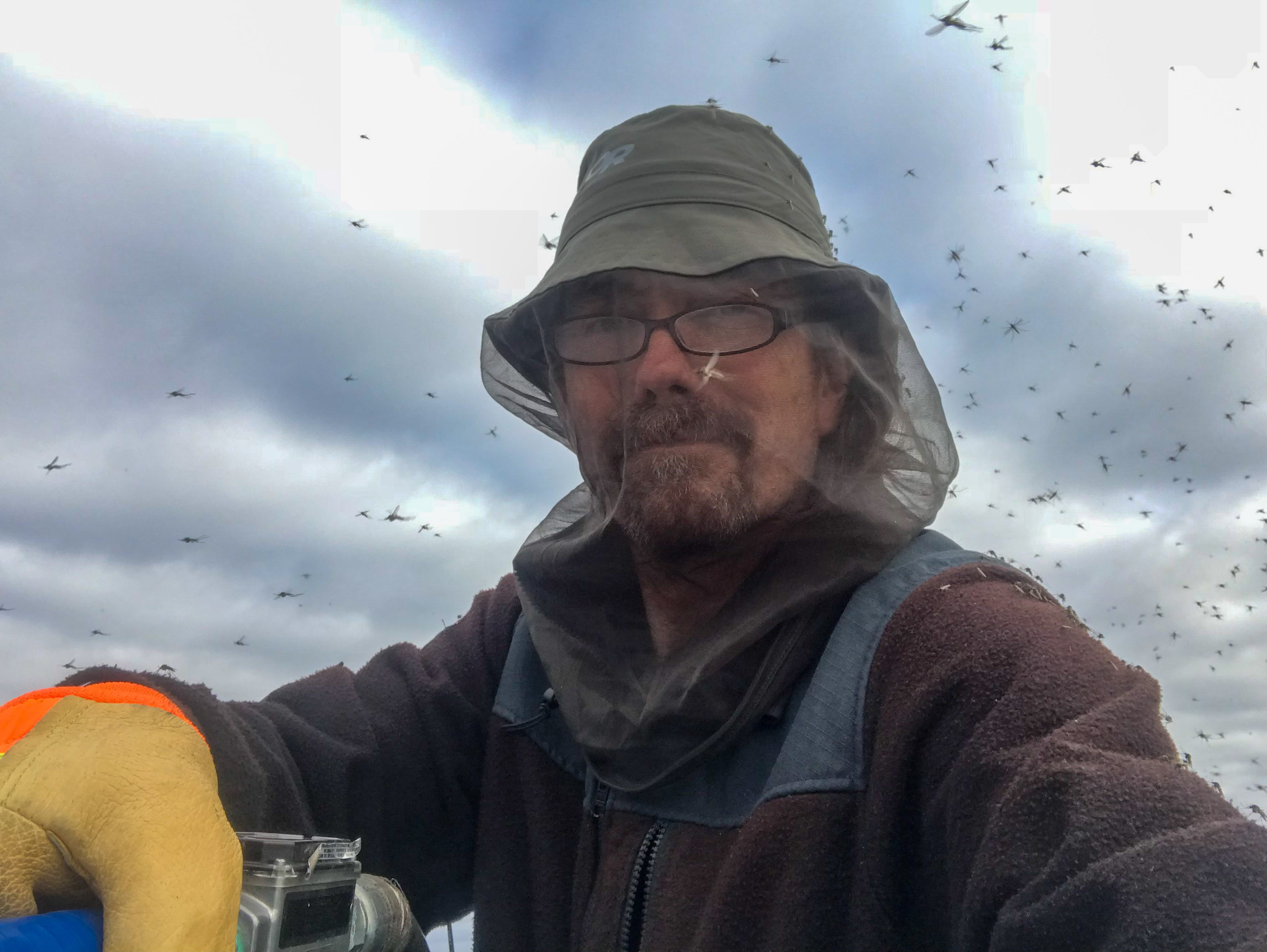
Fueling at Kavik River Camp. Fortunately it was not a bad bug year…
Mapping photo: The tussocks seen here will become part of the topographic map, with this image overlain perfectly on top of it.
Mapping photo: Evidence of permafrost degradation is evident throughout the 1002 Area, and this base map will help us document its changes of time and thereby improve our predictive models.
Mapping photo: Driftwood on the beach will become part of the topography. Birds use this driftwood for nesting habitat, and driftwood also makes good indicators of storm surge reach.
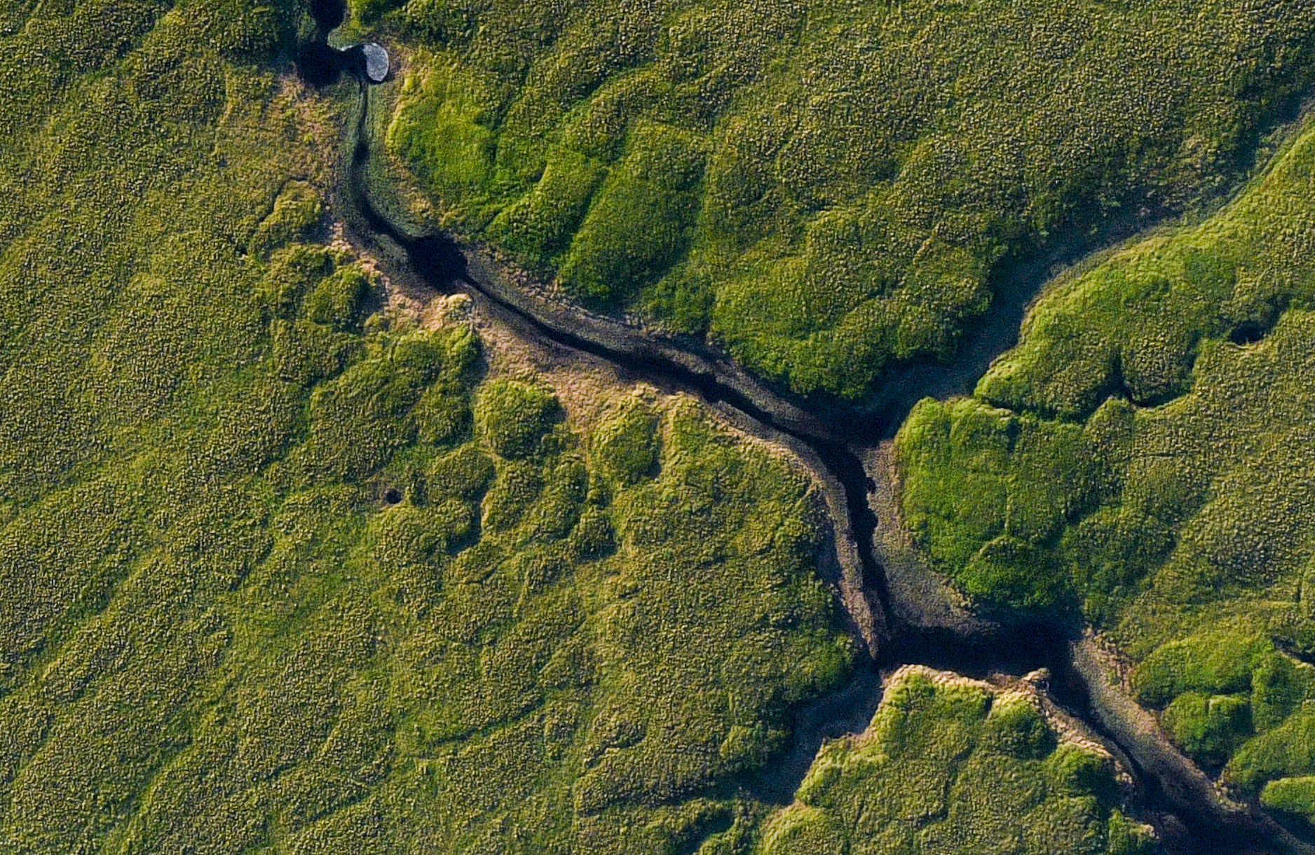
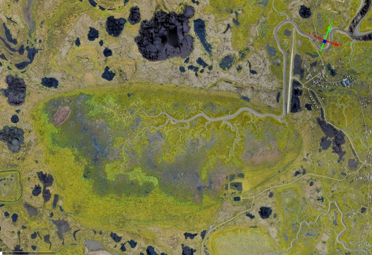
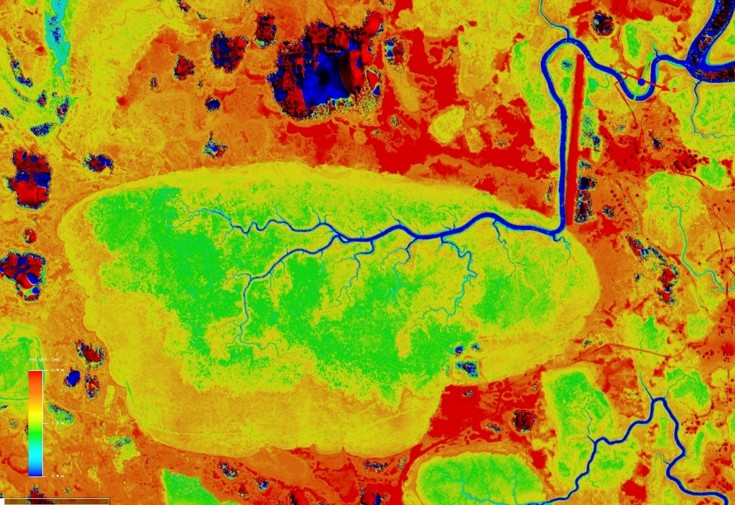
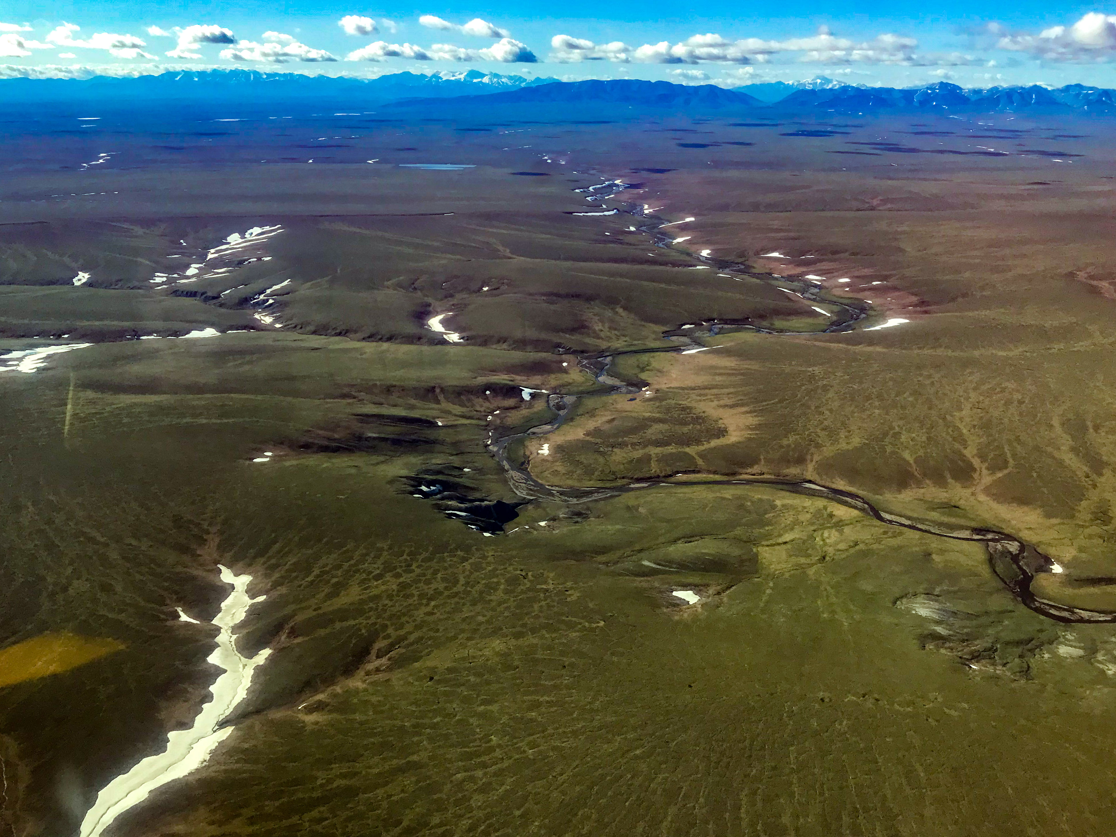
Mapping photo: The topography here is subtle, with variations in elevation of only centimeters routing water in different directions. The slightly soggy depressions promote differences in vegetation type and greeness. Where ice wedges have linked together, wetlands drain and the excess water spills onto the tundra. creating larger areas of green vegetation.
When did I do it?
Acquisitions began 24 June and ended 16 September 2018, for a total of 22 mapping days during that time. I began later in June than I had planned, due to a late snow-melt and continued snowfall through mid-June. From 24 June through 26 July, I based in the field near the 1002 at Kavik River Camp and utilized every weather window possible, acquiring about 95% of the 1002 area during that time. Weather was cool, foggy, and cloudy for much of this month — the mosquitos came late, the tundra flowers hardly bloomed, and it was barely a summer at all. The weather in the Brooks Range was awful, and for much of August I found myself stuck on one side or another and unable to make use of some good mapping days, as my glacier field research there utilized a different aircraft. I tried to acquire the data to minimize temporal discontinuities by not skipping over areas such that newer data would have to be fit between older data, and in general worked from north to south. Weather during acquisitions was a mixed bag — I tried to do it mostly during clear skies, but occasionally it was beneath dark storm clouds. Acquisitions of the 1002 Area ended 25 August and acquisitions for the glaciers ended 16 September. There was no new snow on the ground within the 1002 Area, but drifts remained from winter 2017-2018 through the acquisition period; new snow had fallen on the glaciers, obscuring the ice surface, but it was only about 20 cm based on observations within the mountains.
You can read some blogs describing the acquisitions and project here:
14 May: A beautiful start to our 2018 field season in the Arctic National Wildlife Refuge
1 July: Detecting tire tracks in the 1002 Area with fodar
11 July: End of week two mapping in the 1002
1 August: 1002 mapping nearly complete!
1 August: Latest view of the 2018 seismic exploration impacts near the 1002 Area
25 September: An alien in the Arctic
2 October: Happy 10/02 Day!
 Weather windows varied spatially and temporally, but not knowing what was ahead I utilized anything possible.
Why is it useful?
Time-series of high resolution topographic maps are essential to know how the ice rich ground in this area is responding to climate change and direct human impacts, as well as disentangling those two influences, such that we can build models with improved predictive power to help us understand and manage future change. This map will serve as the most accurate and highest resolution basemap to use to both as a GIS layer and to assess future change. Below are just a few examples of many.
Permafrost hydrology.
This map will yield unprecedented insights into the nature of permafrost terrain and its dynamics. There is no larger area in Alaska acquired at this resolution, which is sufficient for measuring the topography of every ice wedge and polygon within the 1002 Area. With this map we can assess relationships between slope and permafrost features like never before, as well as map the subtle and changing hydraulic connectivity between perched wetlands. By undertaking such studies with this map we will be able to spatially characterize the sensitivity of this region to disturbance. Future maps of similar quality can be used to measure change on the centimeter-level. For example, dynamics of thermokarst of thaw lakes is hugely sensitive to topography and exerts strong controls on it — this map will help us understand that important process better. The processes of interest to understanding the dynamics of permafrost and permafrost hydrology occur on the spatial scale of centimeters to decimeters — without topographic maps on this scale our ability to create predictive models is severely limited.
Coastal erosion.
Some of the highest rates of coastal erosion in Alaska are occurring on the Arctic Coast, but we barely know these rates. I have been mapping the coastline of Barter Island since 2014, but with this new map we will be able to do the same across the entire coast of the 1002 Area. In this paper we demonstrated that we have been able to measure the rate of erosion with unprecedented accuracy, with costs less than are needed to put someone into the field for a day, and in this paper we demonstrated that we can determine the mean high water line better than any other technique. Thus between my work here and my prior work mapping the entire west coast of Alaska, I have demonstrated mapping enormous stretches of coastlines for the purposes of coastal erosion purposes is an affordable, cost-savings measurement that allows us to understand problems before they become catastrophic.
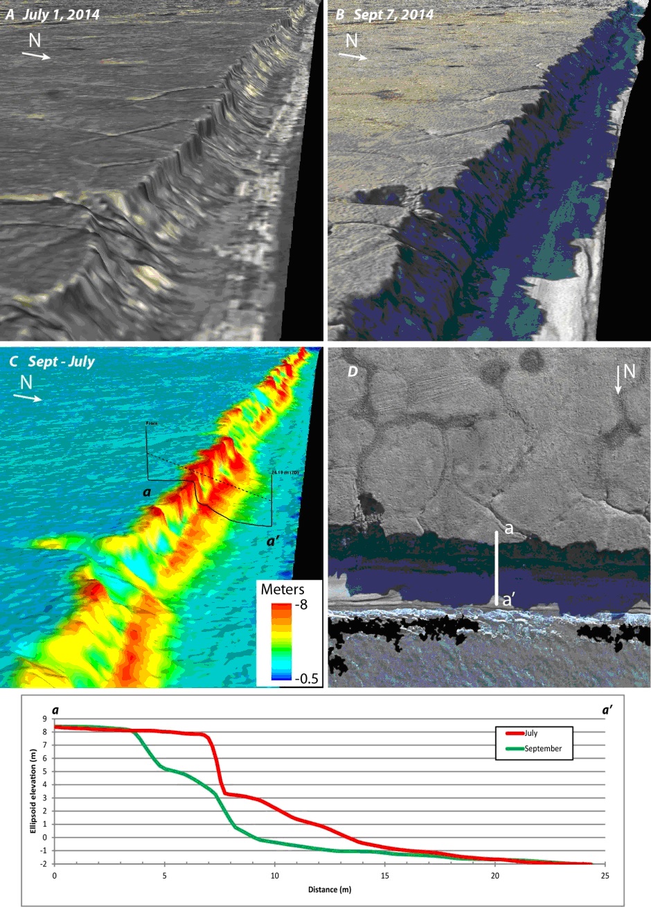
Here is an example of measuring coastal erosion within the 1002 Area using fodar data, taken from this paper (now expanded and updated in peer review). At top (A&B) are two synthetic 3D visualizations of fodar measurements of coastal bluffs acquired about 2 months apart. In C you can qualitatively see the massive erosion that occurred during that time due to storm action, which is shown quantitatively in the plot underneath. Using these data we can not only measure the amount of coastal erosion reliably and affordably, but use it to understand the dynamics involved, as described in the paper.
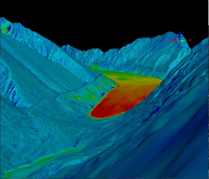
Glacier volume change.
The glaciers draining into the 1002 Area are small, but they exert a huge control over the downstream ecology, as described in this paper. The rivers flowing through the 1002 Area might go dry in summer if not for glaciers, which provide substantial discharge throughout summer, and the anadromous fish have figured this out as have the local Inupiat who fish them. The deltas of the glaciated rivers in the 1002 Area are the largest in Alaska’s northern coast, despite the watersheds themselves being the smallest — because of glacier silt and sand. Here birds from around the world come preferentially to these particular deltas, which are both large and support a stable freshwater invertebrate population. What will happen to the fish and birds when the glaciers here disappear? And how will we disentangle this from human development impacts in the area? To answer these questions, I wrote this paper and have been topographically mapping some or all these glaciers at least once per year since 2003 and many of them twice or more per year. The map I made this year is the first time since 2008-2011 since I mapped all of the glaciers here. Combined with estimates of total glacier volume based on these data, we now have a long enough time-series to understand whether to expect stream flow to increase or decrease in the short-term as these glaciers waste away to nothing in the next 50-75 years.
Snow depth.
By acquiring the same maps in future winters, we will be able to measure snow-depth in near-realtime by subtracting this summer map from those winter ones. I pioneered this technique over 4 years ago now, validating it’s accuracy both in flat/hilly terrain and in mountainous terrain throughout Alaska and within the Arctic NWR, as well as on North America’s tallest mountain. My research on McCall Glacier is the only long-term time-series of snow depth/density within the Arctic National Wildlife Refuge and my fodar mapping in the mountains since 2012 are the only wide-area measurements of snow thickness in Arctic Alaska. Snow and glacier melt in the mountains provides the majority of the water flowing through major rivers of the 1002 Area. Though I have mapped snow depth along several transects within the 1002 Area, what’s vitally needed now are wide-area measurements throughout winter each year from now onwards, given the likelihoods of oil and gas exploration which depends on this snow cover to protect the tundra and its ecosystems. Fortunately we now have the summer basemap needed for these measurements.
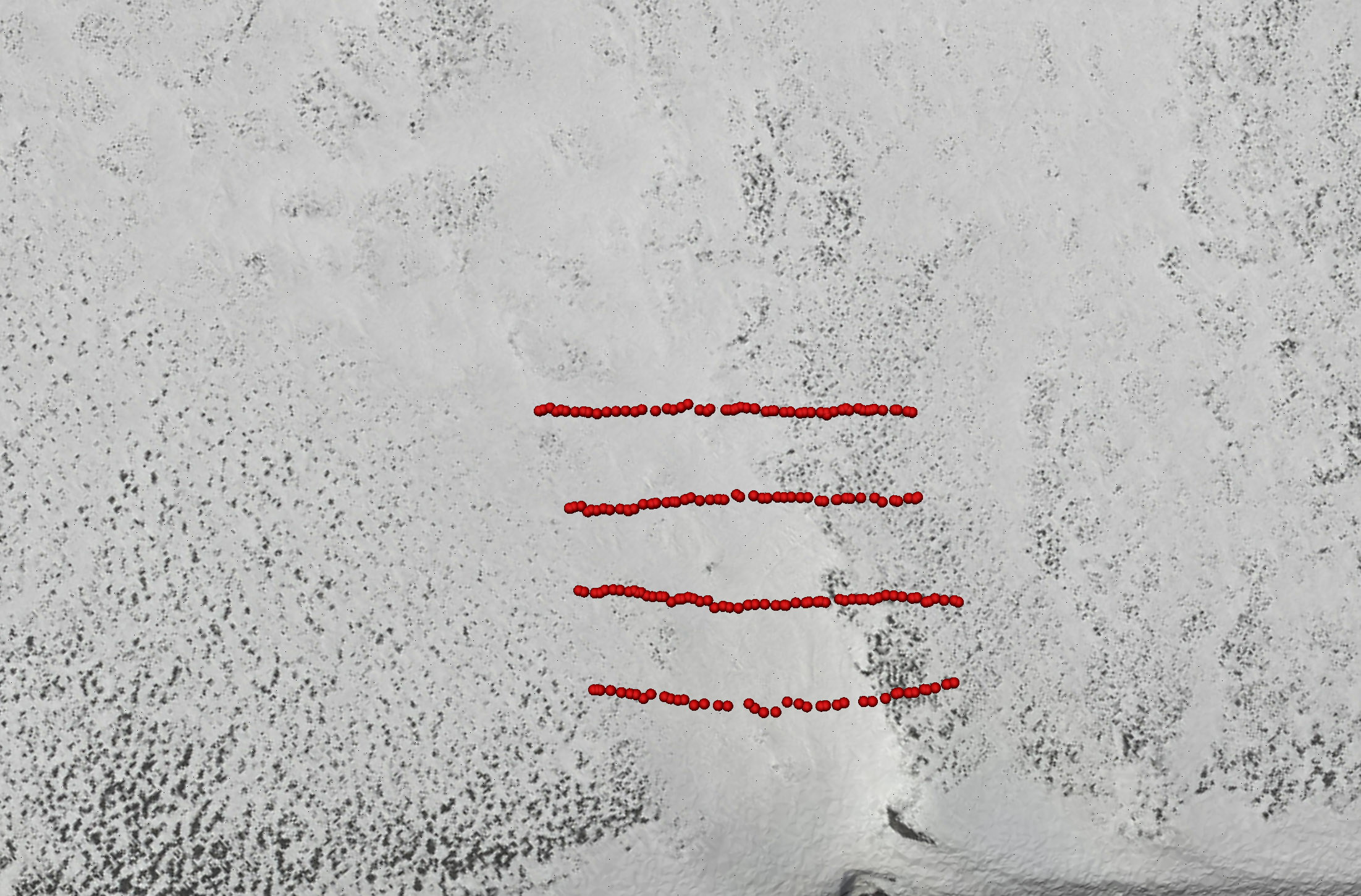
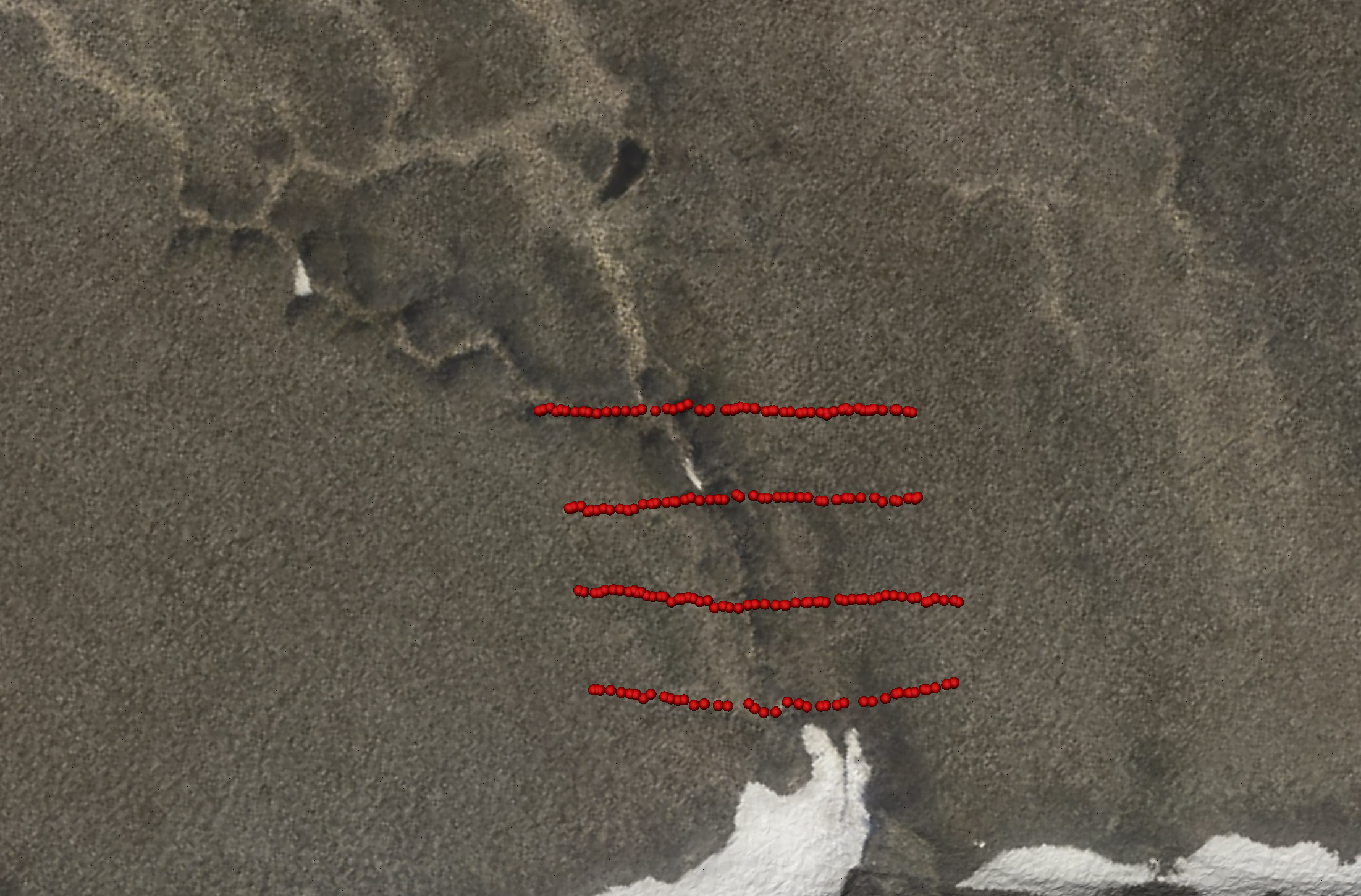
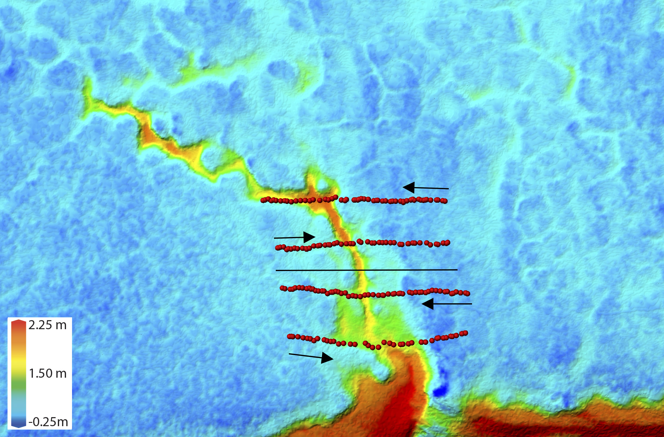
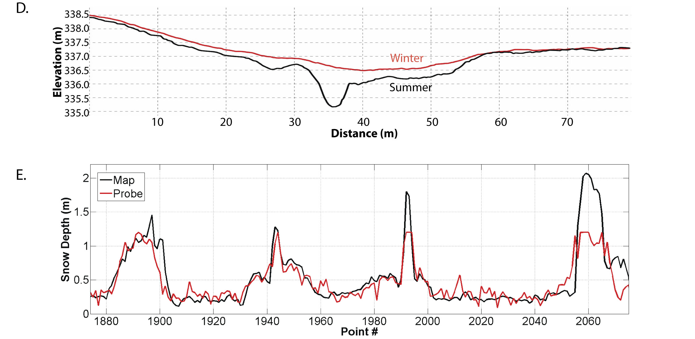
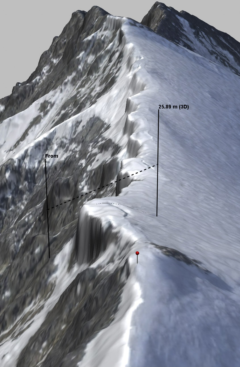
In D above, you can see the difference between the summer and winter DEM measurements seen in the previous image comparison; the distance between these lines is snow depth. In E is shown the field probe measurements compared to the fodar measurements of snow depth, back-and-forth over the gully seen in the image pairs above, with each of the four peaks in snow depth indicating where the gully was crossed. The measurements are statistically identical, with most deviations within 10 cm. The excursions above 1.3 meters are due to the snow probe being too short to reach the bottom of the gully. Our literature review in 2015 found no other published reports of measurements of snow depth with this accuracy, resolution, and spatial scale by any method, including ground methods. These figures were taken from this paper, where you will find many more similar examples, comparing fodar snow depth maps to thousands of snow depth probe measurements and to lidar.
Geological and other mapping.
The geology of the 1002 Area is unlike anything else in Alaska. This is the most tectonically active region north of the Yukon River, where mountains are actively trying to reach the coast, and are now only 20 miles away, leaving a rumpled and complicated landscape around it. Unlike the relative simple geology further west in the current oil fields, the 1002 Area is overlain by younger, squishier rocks that are highly faulted and folded, with lots of outcrops on the surface. Petroleum geologists have been intensively studying this area for over 30 years, and each new year of study leads to another mountain of data to reconcile to the previous years’ data. Now that we have an elevational basemap with a resolution of a rock hammer, these older data can be integrated together and newer data can be directly georeferenced to it, again at the footprint level of accuracy. The same is true of botanical and soils maps, which will find the perfectly orthorectified image mosaic especially handy, as individual tussocks can be identified using it. Given the massive earthquakes that occur here and the liklihood of massive climate impacts to the physical ecosystem, future maps can easily identify small changes occurring over the entire area, with enough spatial and temporal resolution to understand the processes involved.
The most tectonically active area of Alaska north of the Yukon River is in the 1002 Area, as seen in the upper right corner of this graphic from the Alaska Earthquake Center made yesterday. The geology here is complex and an accurate topographic map with a resolution finer than the size of a rock hammer will help integrate all of geological data acquired into a common base map.
All those earthquakes are occurring around the Sadlerochit Mountains (the first dark ridge in the background), causing the 1002 Area to rumple up as seen here. Though this is simply an oblique image taken with an iPhone, the fodar maps here will allow us to virtually examine every outcrop, tussock, and water track from anywhere in the world, along with all of the field data that can now be co-registered to it.
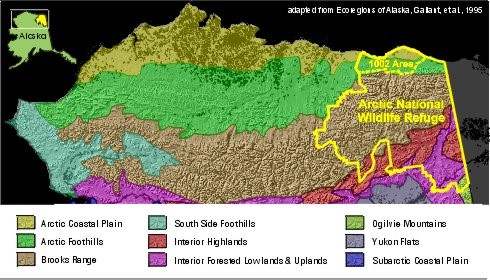
Here the mountains have swung far to the north, creating the only location on the North Slope of Alaska that a foothills ecosystem touches the Arctic Ocean, a foothills ecosystem that encompasses half of the 1002 Area as shown in the figure above adapted from this paper. This tundra vegetation and the ecosystem it supports are qualitatively different than that found within the oil fields to the west. Thus it is plate tectonics that is responsible for the unique ecosystem found here and nowhere else It plate tectonics that allows the caribou to choose between the E-W winds of the coast or the N-S winds of the mountains here and nowhere else. It is plate tectonics that causes the glaciers that attract the world’s migratory fish and birds here and nowhere else. It is plate tectonics that causes oil to accumulate beneath this ecosystem here and in so many other places. And it is ultimately plate tectonics that caused me to make the best map of the arctic landscape here and nowhere else. So it seems fitting we should use that map to study the geology and ecology it creates.
Impacts of seismic exploration.
While I would have mapped the 1002 Area eventually anyway, I did it this year because Congress recently opened it up for oil and gas exploration, the first step of which is to conduct subsurface geological mapping with 3D seismic techniques. I’m a big fan of seismic exploration, my PhD was all about that. However the plan that has been submitted for work this winter is highly flawed and will no doubt cause lasting impacts to this fragile landscape, and I think we can do better than business as usual. I detail a lot of this here and here. The short answer is simply this: the proposed work will create over 38,000 miles of grid lines, utilized by dozens of vehicles, some dragging a four star hotel for 300 people in the dark of winter, and we already know there is not enough snow here in winter to conduct business as usual, and business as usual has never accounted for the hilly, ice rich terrain which is already melting on its own. The only scientific studies of the long term impacts of seismic work (eg, this paper and its own prior work) using the same over-snow techniques showed that over 30% of the seismic lines were still visible in the tundra 5 years afterwards and over 10% of the camp-move trails had permanently scarred the tundra over 25 years later. This fodar map can help us in all of the ways I’ve outlined above to understand the sensitivities of permafrost hydrology, to understand glacier-ecosystem sensitivities, to map snow depth in real time, to improve our understanding of the geology to target seismic work better, and a host of other possibilities that can help us eliminate short and long-term impacts of this seismic work. That is, to develop this area responsibly and according to law requires that many of these studies be conducted before seismic work begins. But if not, I can also make a new map in 2019 to document the destruction that will no doubt occur if done this winter irresponsibly, and this could well shut down drilling operations permanently — a situation in which everyone loses. I’d rather not have to say I told you so. Let’s take our time and do this right. We can do better.
 This oblique photo show the aftermath of seismic work done near Pt Thomson, adjacent to the 1002 Area. I took this on my first day of mapping the 1002 Area, and a photo just like it appeared along with a story in the New York Times. I mapped these lines 3 times throughout the summer, and though there was some rebound all of the lines were still visible by eye and in my terrain measurements at the end of summer.
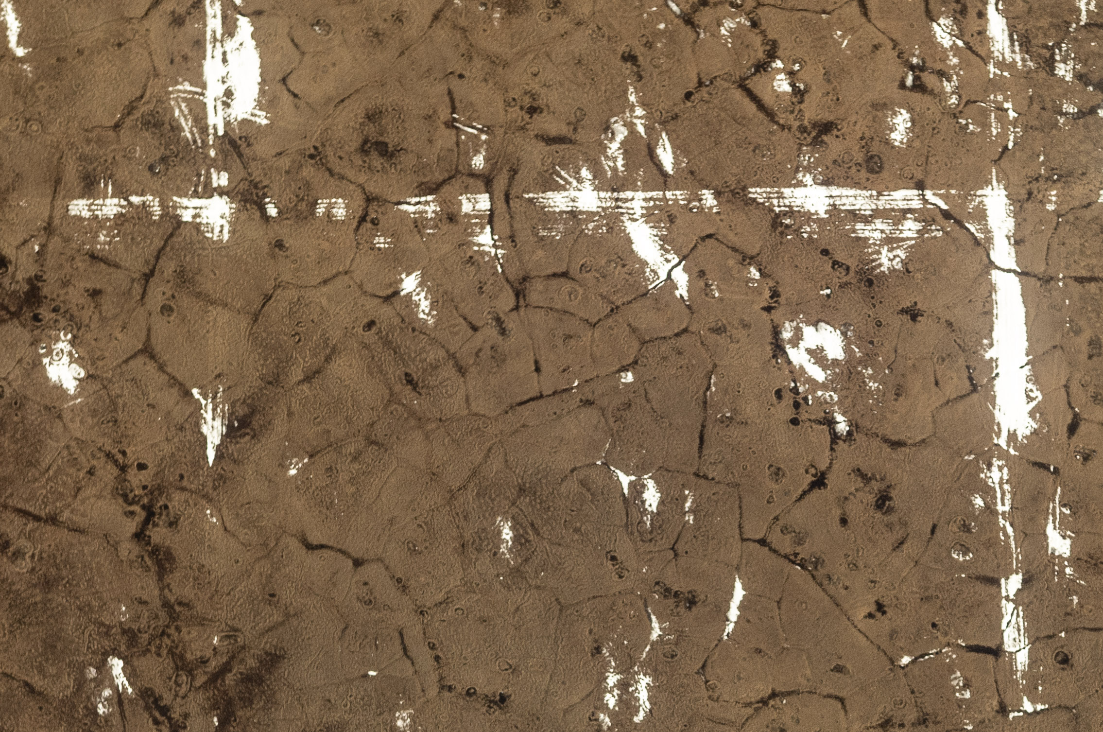
Here is piece of the orthomosaic I created of that seismic work in late June 2018. The snow has been crushed and compacted into the tracks left by the large vehicles.
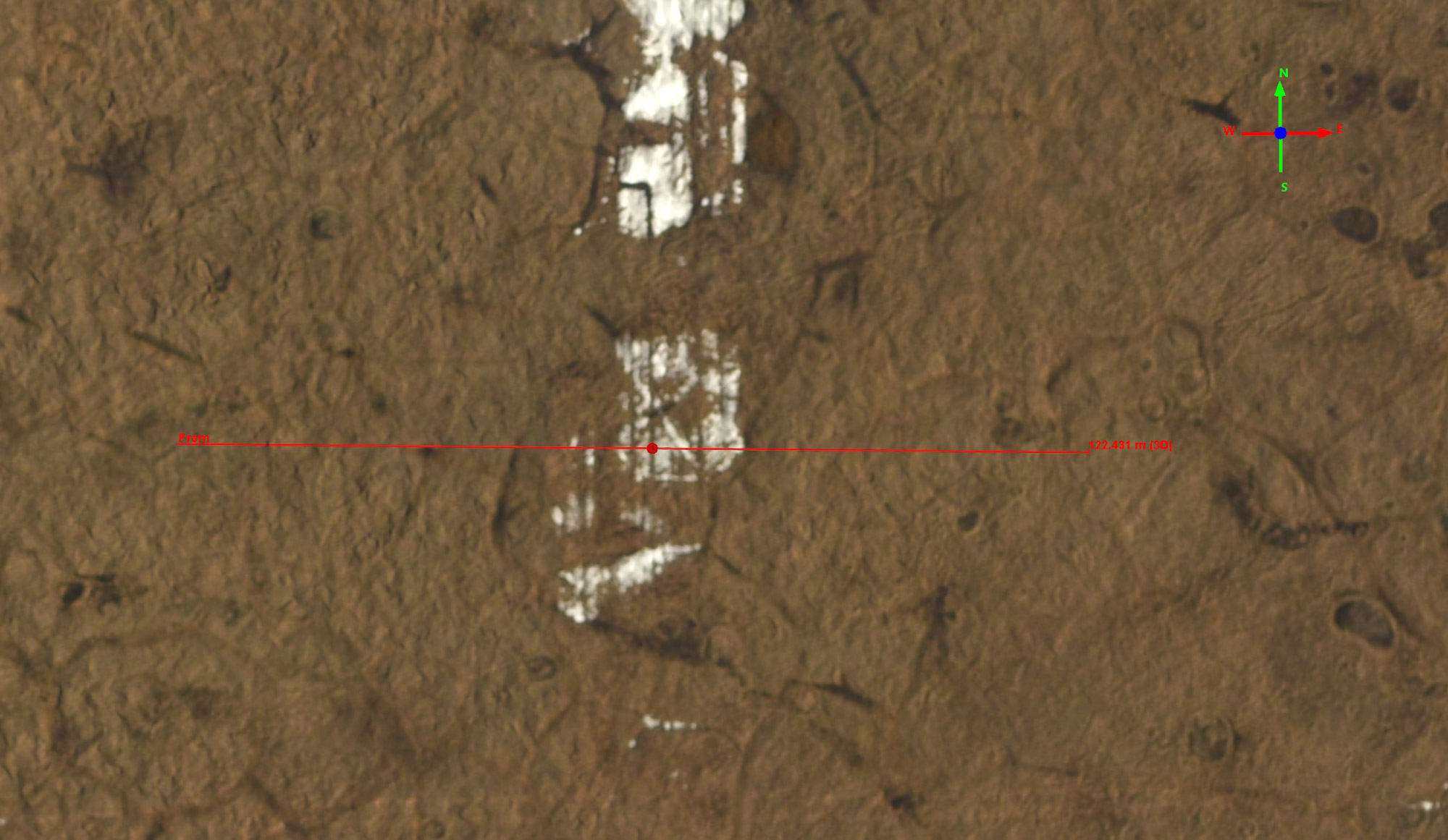
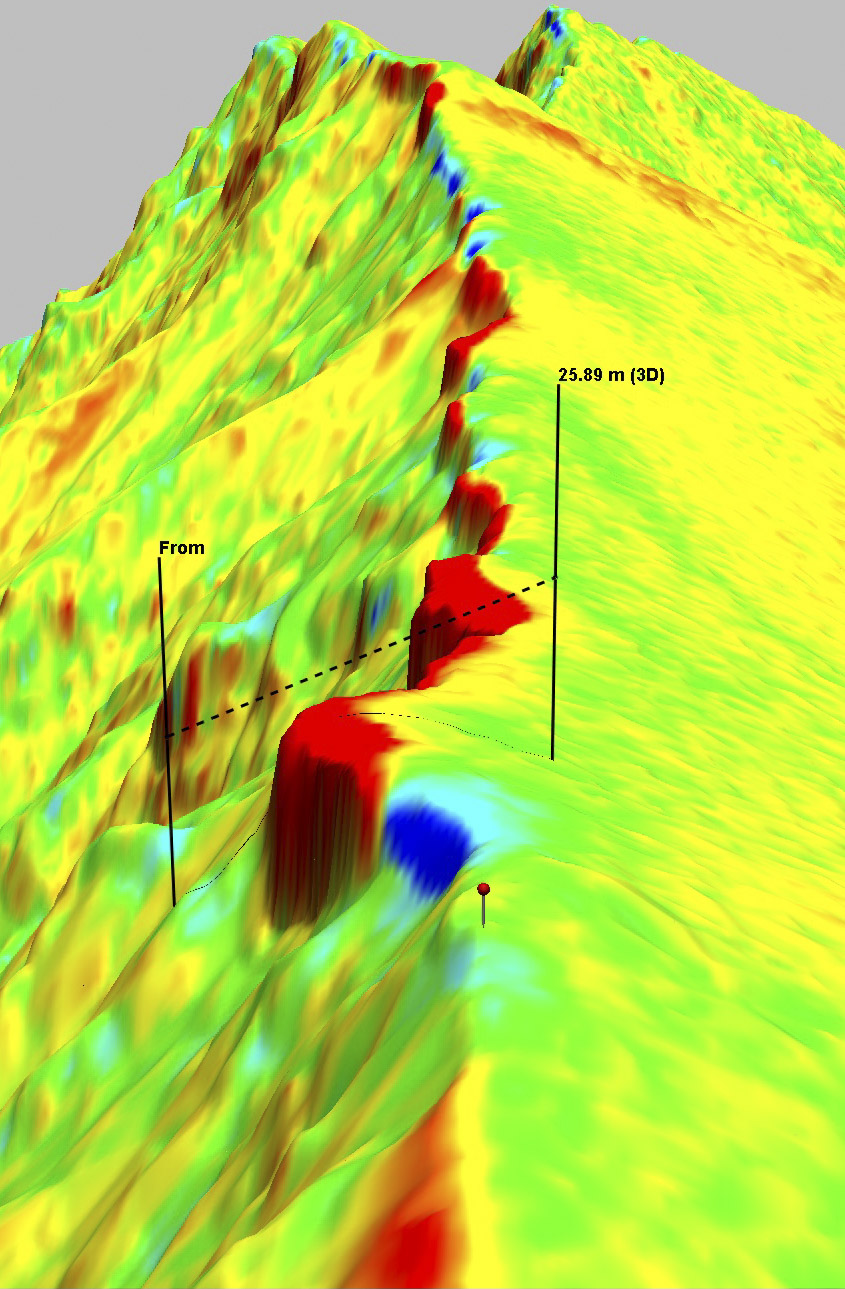
Here is a closeup detail of one of those tracks, with a cross-profile shown in red with elevation data extracted into the plot below.
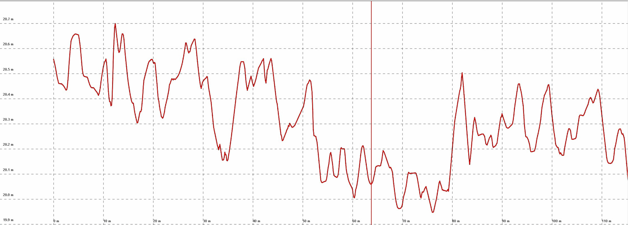
Here you can see the impact of this trail on the terrain as measured by fodar. The trail is about 30 meters wide and 25 cm deep, and we can distinguish individual ruts (red dot above, vertical red line here). Measurements like these are the first step in developing new methods that leave no impacts.
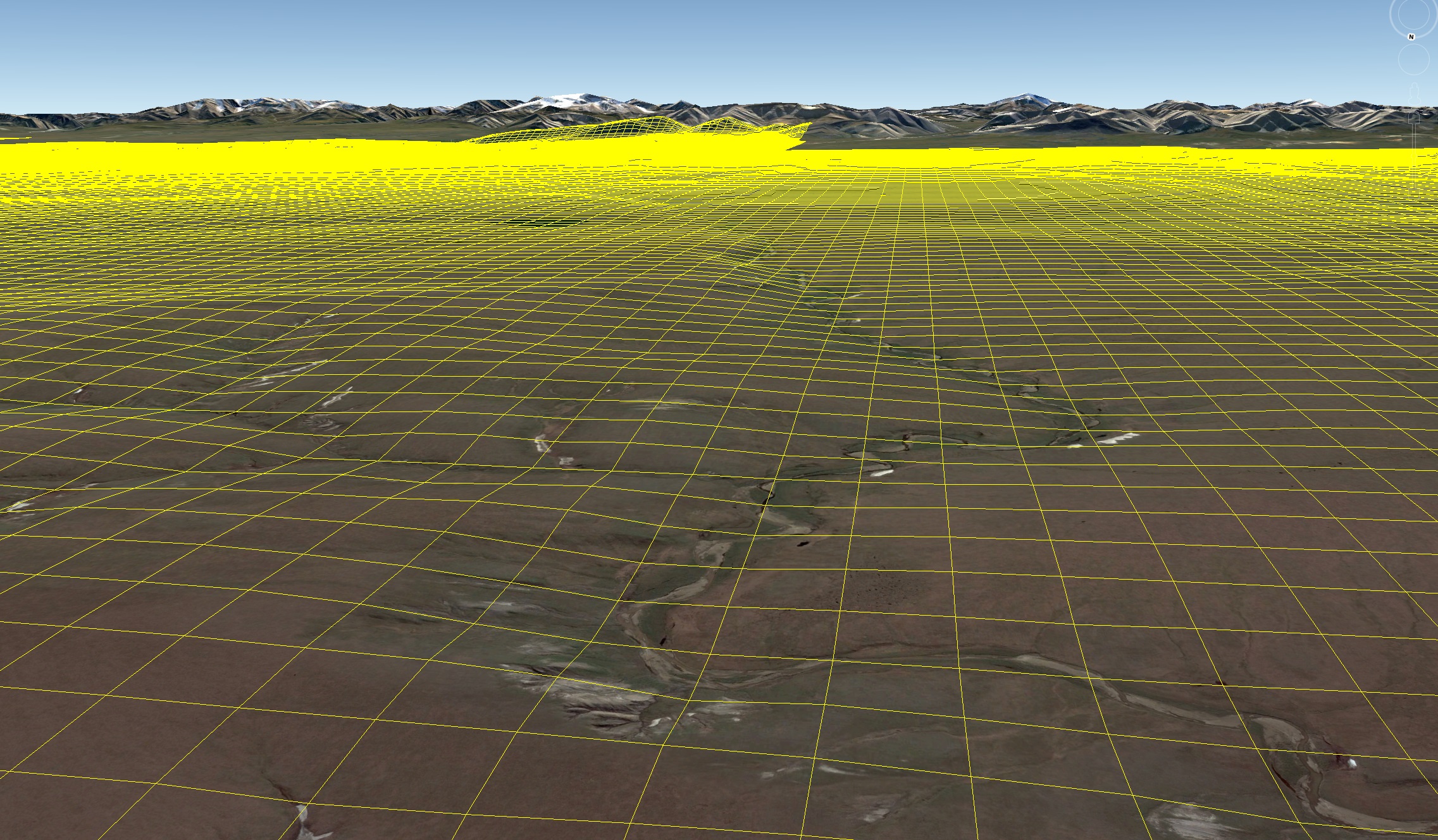
This is what a 200 m x 200 m grid looks like superimposed over the terrain. This grid adds up to about 38,000 miles of trail, covering about 150,000 acres, about 10% of the entire 1002 Area. This work will be conducting by dozens of large vehicles transporting a four star hotel for 300 people driving in the dark of winter under pressure to complete the work and be paid — what could go wrong?
When will it be available?
I hope to make the map freely available to the public to support all of the uses above, and more. I have not yet started processing the data, but plan to do so in December and finish by late winter.
I acquired these data without funding and my costs were large. I do not plan to fix a price until I have completed processing. To calibrate expectations, however, in 2008 I commercially purchased lidar data of just the glaciated portion of my 2018 acquisitions (about 1/4 the total area, see flight line figure at the top of this blog) and paid $400,000 USD. My 2018 data of the 1002 Area cover an about 3 times larger at over 500 times higher resolution (3 m GSD vs 12.5 cm GSD), and as I demonstrated here are much more accurate than that lidar.
If you have an interest in purchasing these data in whole or in part, or pooling resources with other interested parties, please contact me.
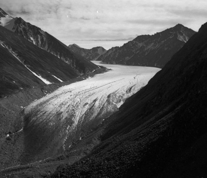
Neither McCall Glacier nor I are likely to be around in 75 years, but I’ve just ensured it’s topography will be forever remembered just like this.