Latest View of 2018 Seismic Exploration Impacts near the 1002 Area
As of July 26, not only are the winter 2018 seismic tracks still visible at Pt Thompson, the depressions they left behind are still measurable topographically with fodar. I believe that it is possible to do seismic surveys in the 1002 Area without leaving any trace, but not using current methods. We can do better.
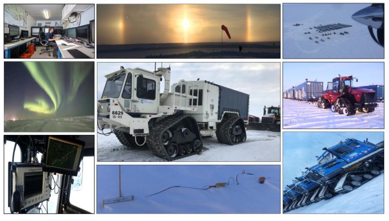
I think seismic data is cool. I think 3D seismic data is even cooler. I have a PhD in Geophysics from UAF and my thesis was on developing new methods for seismic exploration, and I’ve used these methods throughout the frozen landscapes of Alaska, Siberia and Antarctica. I just spent a few weeks in Kavik, where a bunch of USGS and DNR geologists were studying the rocks in the 1002 Area to better understand the oil-related geology, so I had the opportunity to see some of the latest in 3D seismic viewing technology. It’s like a full body scan of a human — you can fly through the subsurface of the State in any direction and trace folds, faults, and layers, with well logs geolocated within it. What a powerful tool for understanding the formation and ongoing deformation of this unique area of the Arctic! I would love to see that for the 1002 Area.
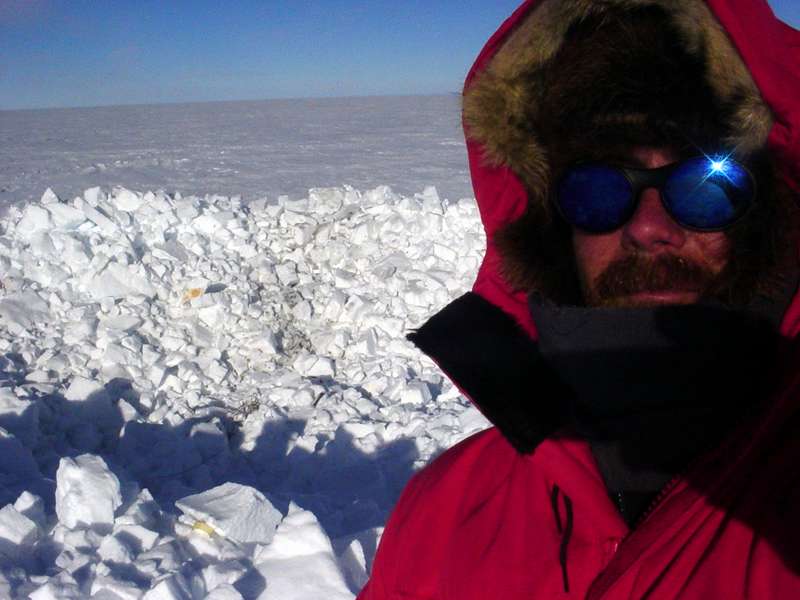
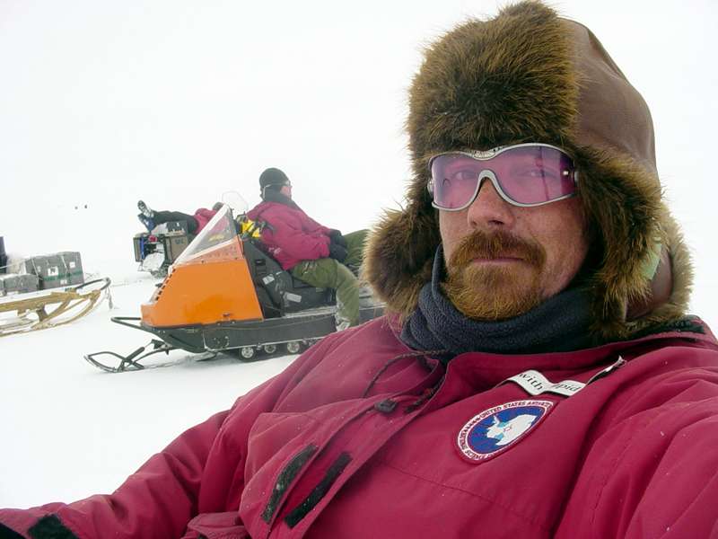
I have a lot of experience making loud noises in cold, snowy places, in this case Antarctica.
Unfortunately, seismic exploration has a justifiably bad environmental reputation in Alaska. The seismic lines from the 1960s through 1980s stick out like sore thumbs here on the tundra, to such a degree that they are used by pilots like me for navigation. Fortunately, those methods are no longer used here; but at that time, those permitting and using those methods thought the destruction was worth the benefits because they were using the best methods of the time. Unfortunately, this is always the case — people can rationalize anything, especially where money or peer-pressure are involved. So as much as I would like to see 3D seismic done in the 1002 Area, I am adamantly against using the methods used earlier this year just outside the Refuge boundary which leave what appear to be permanent scars on the landscape, as I show in this blog. I’ve spent the past 15 years out there as a physical scientist trying to understand this dynamic landscape and I simply do not want to see a checkerboard placed over it due to laziness and greed after 58 years of hard-fought protection. We can do better.
Once upon a time, someone thought this was a good idea.
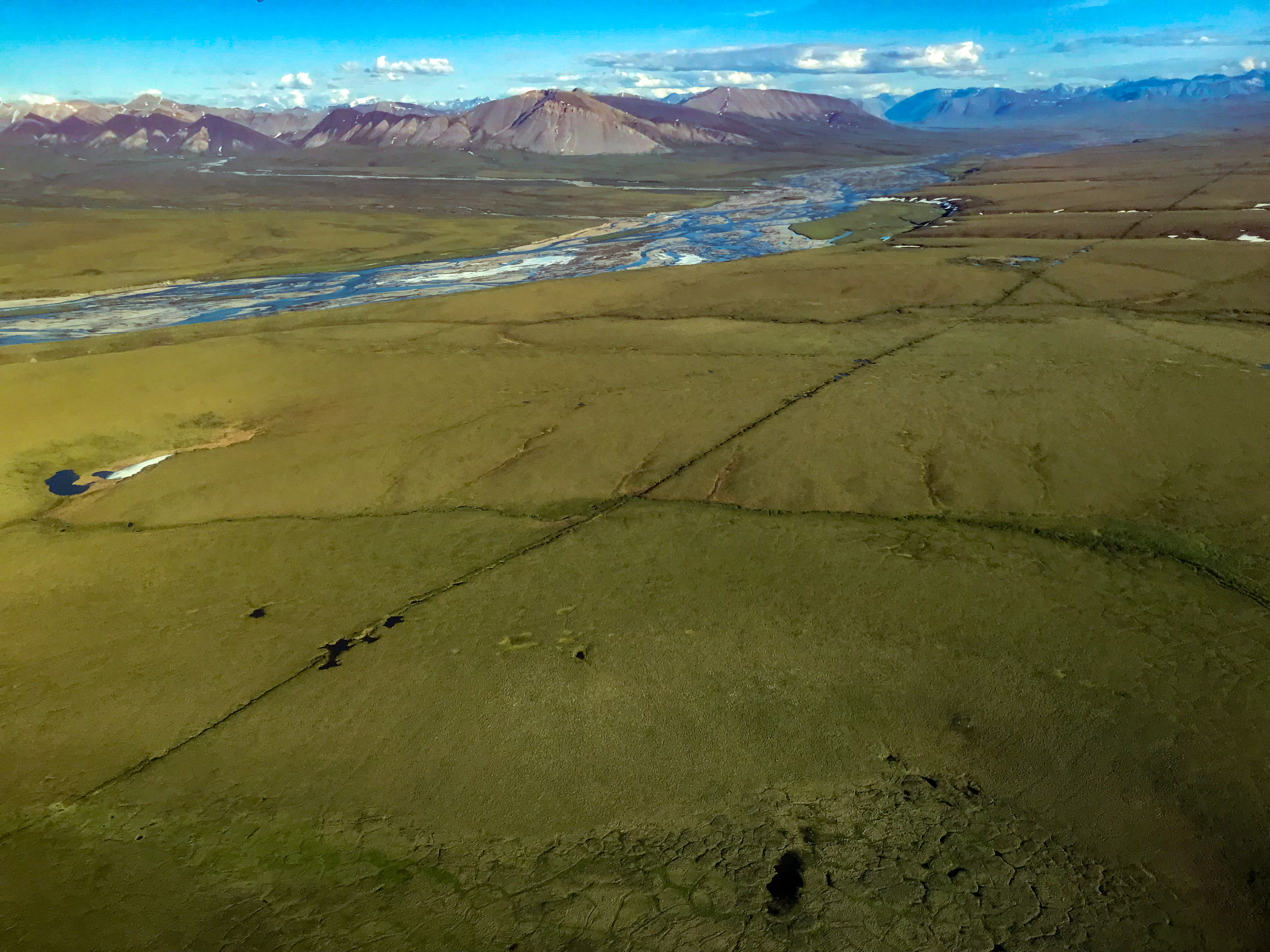
That river is the western boundary of the 1002 Area. The old seismic tracks outside the Refuge are so prominent they are used for navigation by pilots. These scars, many over 50 years old, may never heal; on the contrary many continue to get worse as the ice beneath them continues to melt.
While the seismic methods that created this line are no longer used, the point is that this was the best method of its day. Just because we are doing better now doesn’t mean we are doing good enough for work within the Refuge.
Here’s what Dan Sullivan, one of our State’s Senators, recently had to say:
“I oversaw Alaska’s environmental standards as the state’s commissioner of the Department of Natural Resources, and I can say with certainty that Alaska has the highest environmental standards regarding responsible Arctic resource development in the world. Our state has a 50-year record of responsible resource development and no “impact exploration,” meaning that we mandate the best available technology and require the protection of our incredible species, such as polar bears and caribou. On the North Slope of Alaska, for example, we allow for exploration activities only during the winter months. Companies are required to build ice roads across the tundra and ice pads where they put their equipment and drill rigs. They must also leave before the end of the winter. The ice pads and roads melt, leaving zero impact on the tundra. The only thing left is a small, capped well.”
If you parse his statement, you see there is no mandate for “no impact” but rather for “best available technology”. The seismic work of the 1960s-1980s used best available technology and those scars seen above continue to deepen over time, not heal, in the fragile arctic tundra. If he truly believes modern seismic methods leave “zero impact on the tundra”, then it should be no issue at all for him to propose the following law: “Oil companies can do as much 3D seismic within the 1002 Area as they like using any methods they like, but no gravel infrastructure can be placed or drilling operations commenced until all traces or impacts of that seismic exploration are gone.” This is what’s called putting your money where your mouth is — if there are truly no measurable impacts of seismic exploration, then drilling can start the next summer. But if new seismic exploration creates the same scars as it did earlier this year, then it may be decades before drilling can start.
My point is… that while today’s methods are much much better than yesterday’s, they are still not good enough for use in the Arctic National Wildlife Refuge tomorrow. If what he said was true — that seismic exploration leaves no impact — I would entirely agree with him, but that’s simply not the case, as my recent measurements reveal. I first noticed these tracks from the 2018 seismic surveys at Pt Thompson about a month ago, and described what I saw here. At the end of my trip to map the 1002 Area last week, I wanted to see how things had changed during the peak of summer at Pt Thompson.
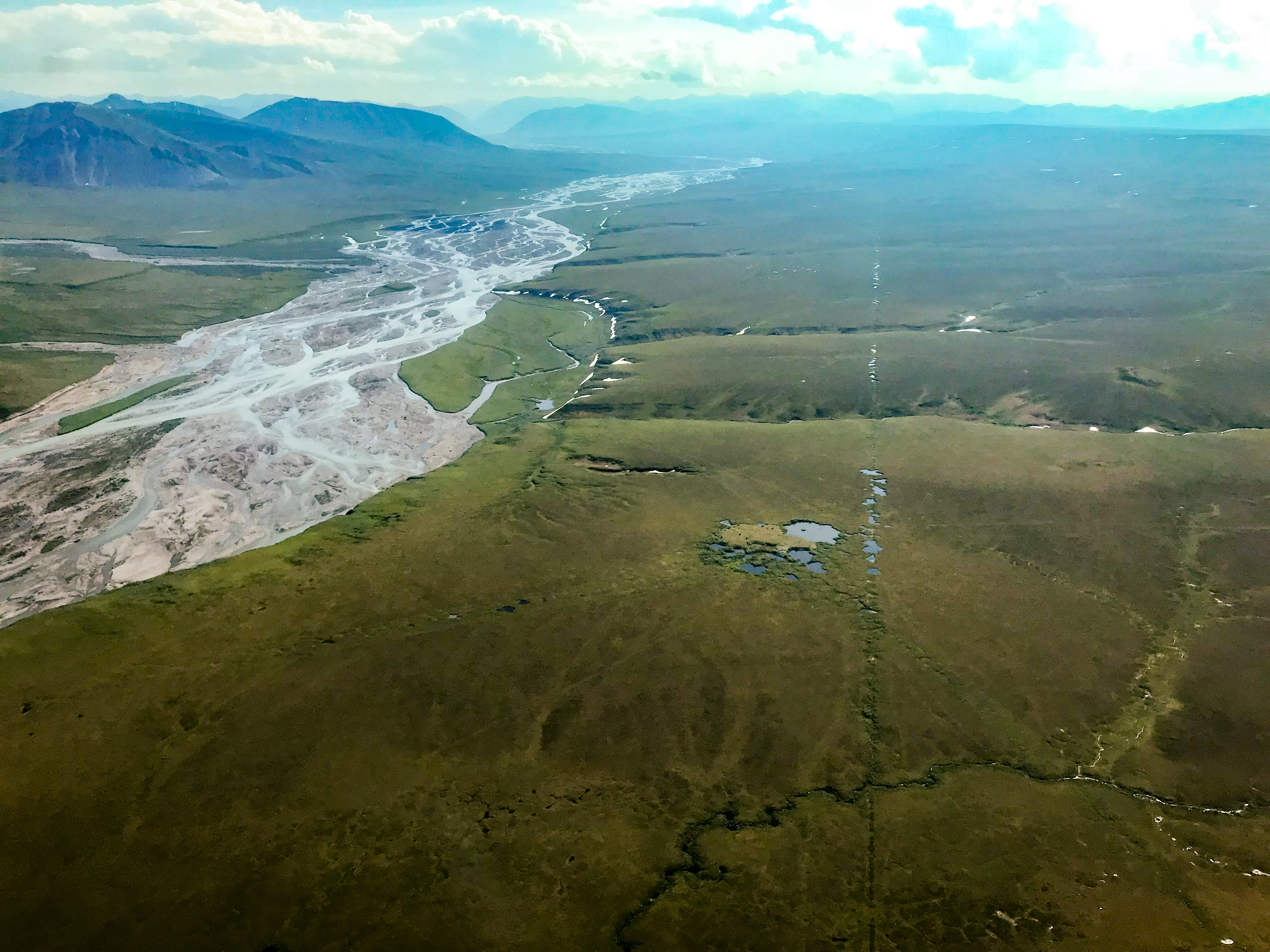
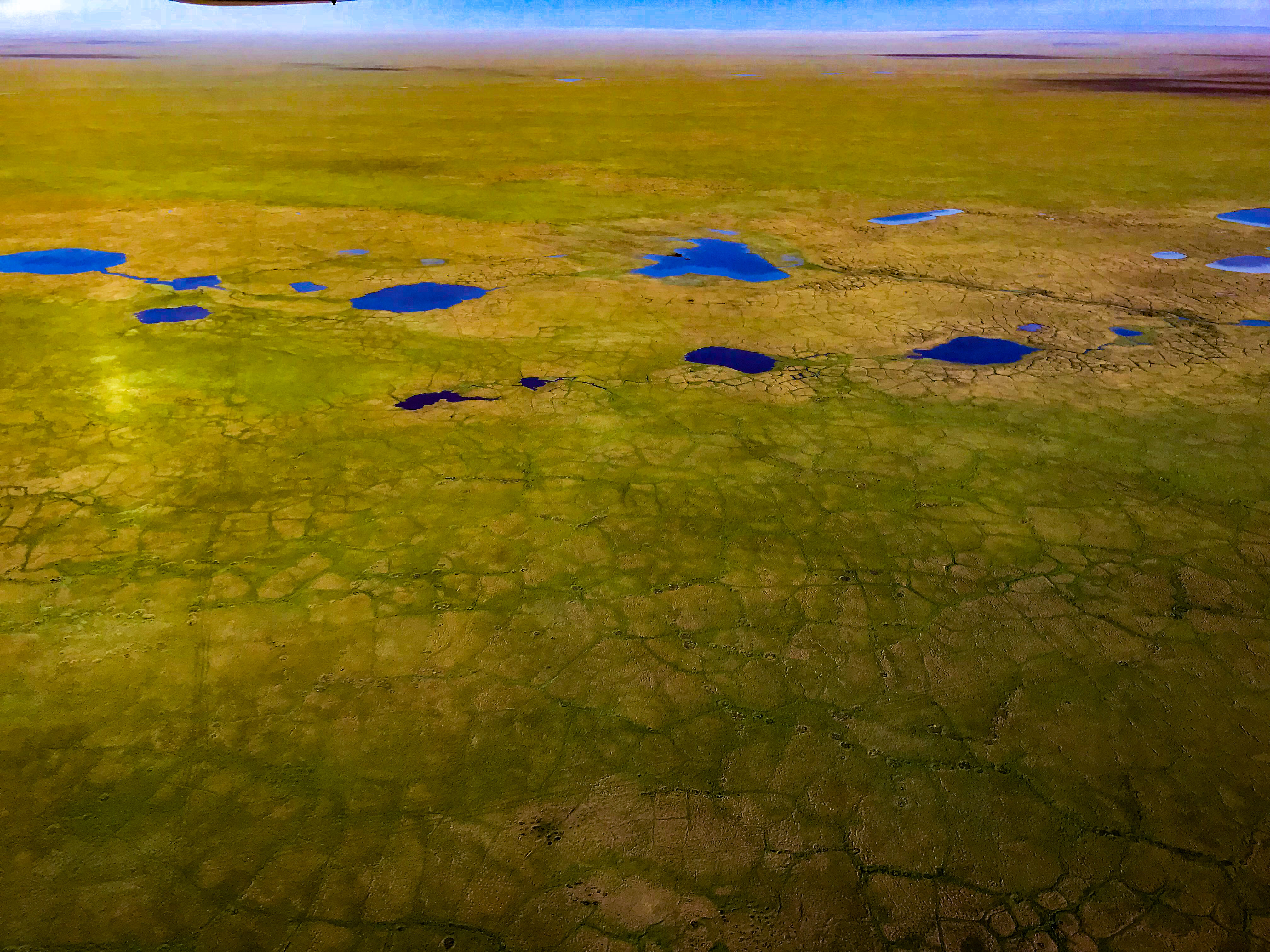
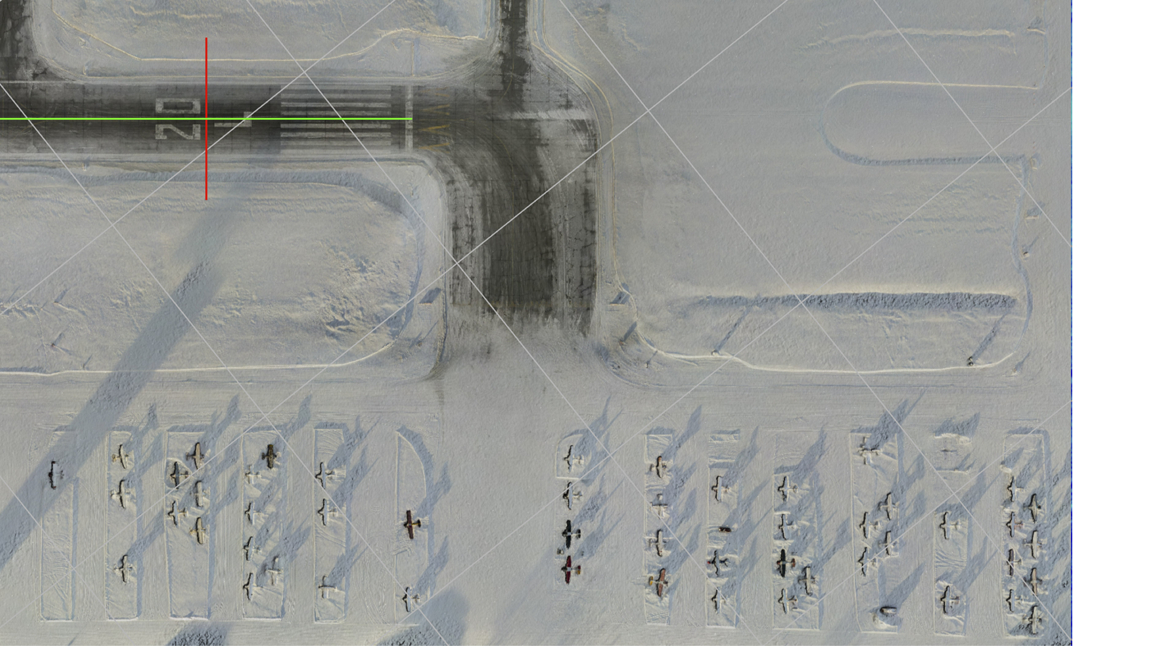
 The 2018 Pt Thompson seismic lines are still clearly visible in late July 2018, even with crappy iPhone photos through plexiglass. The tracks are deep enough to cast shadows in the low angle sun.
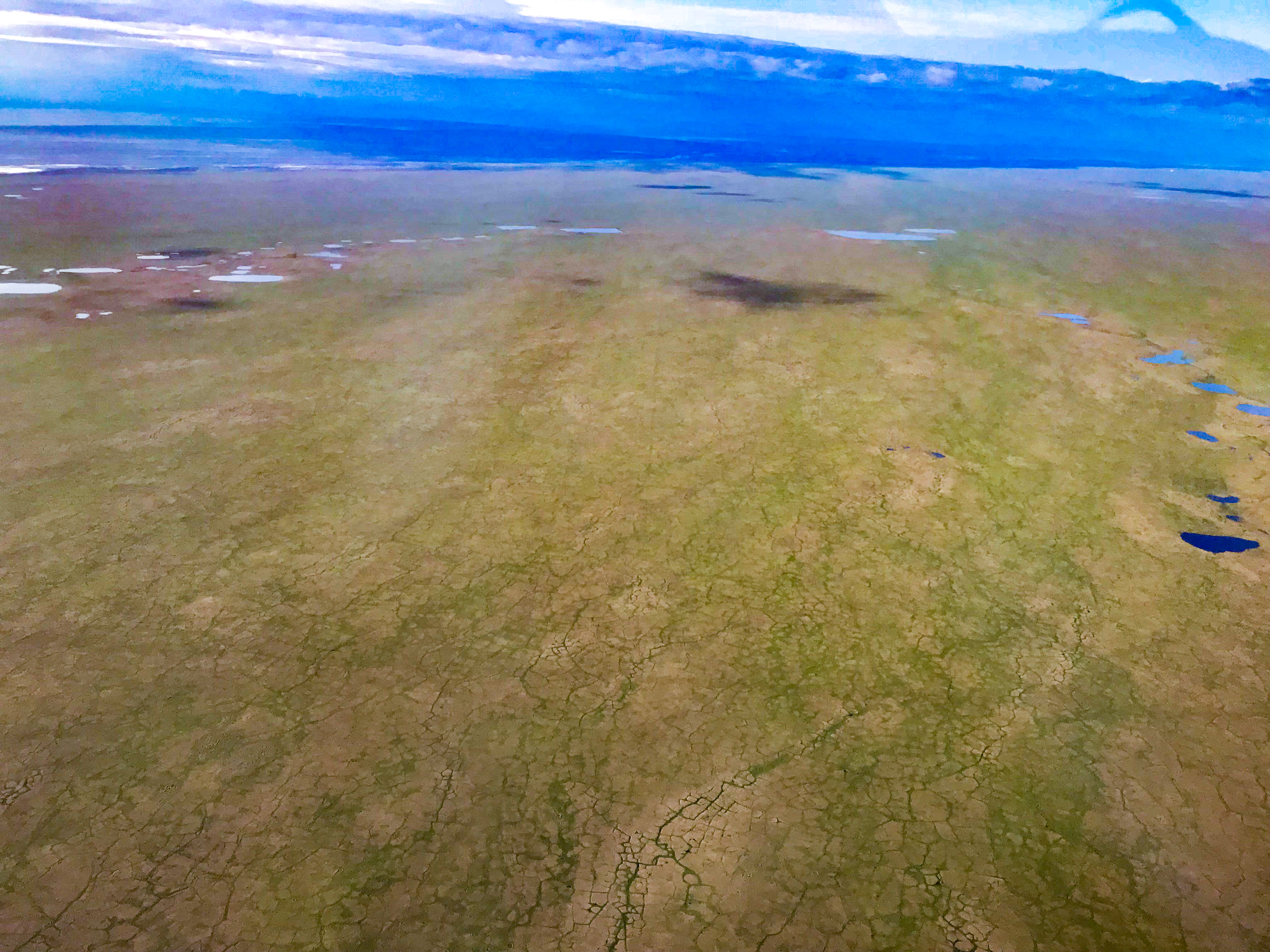
 In the plane, these lines were pronounced enough that I used them to navigate by for mapping, but there were so many I got confused as to which ones to follow next when I made U-turns.
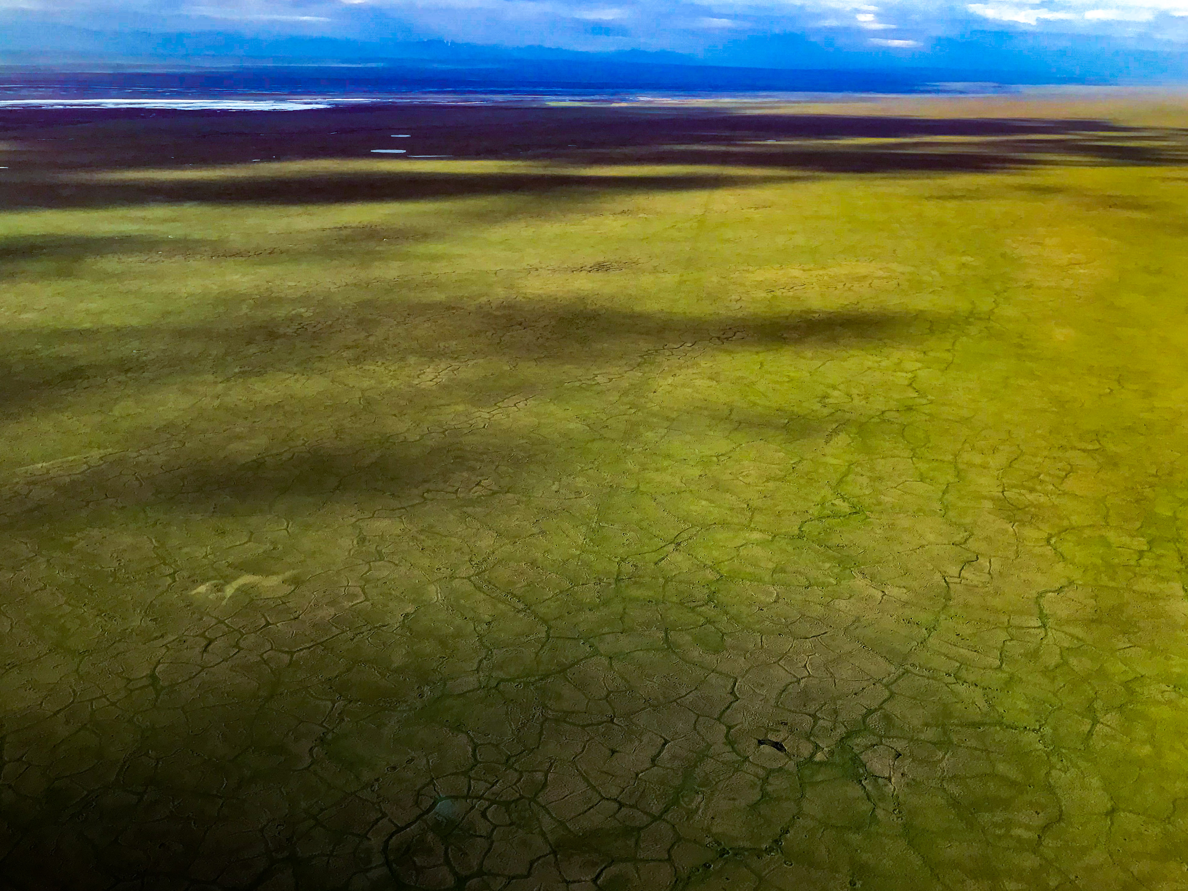
Start in the lower-left corner, and you can see the checkerboard. On the one hand, I’m tempted to bring a better camera next time, on the other hand… I’d just rather there wasn’t a next time.
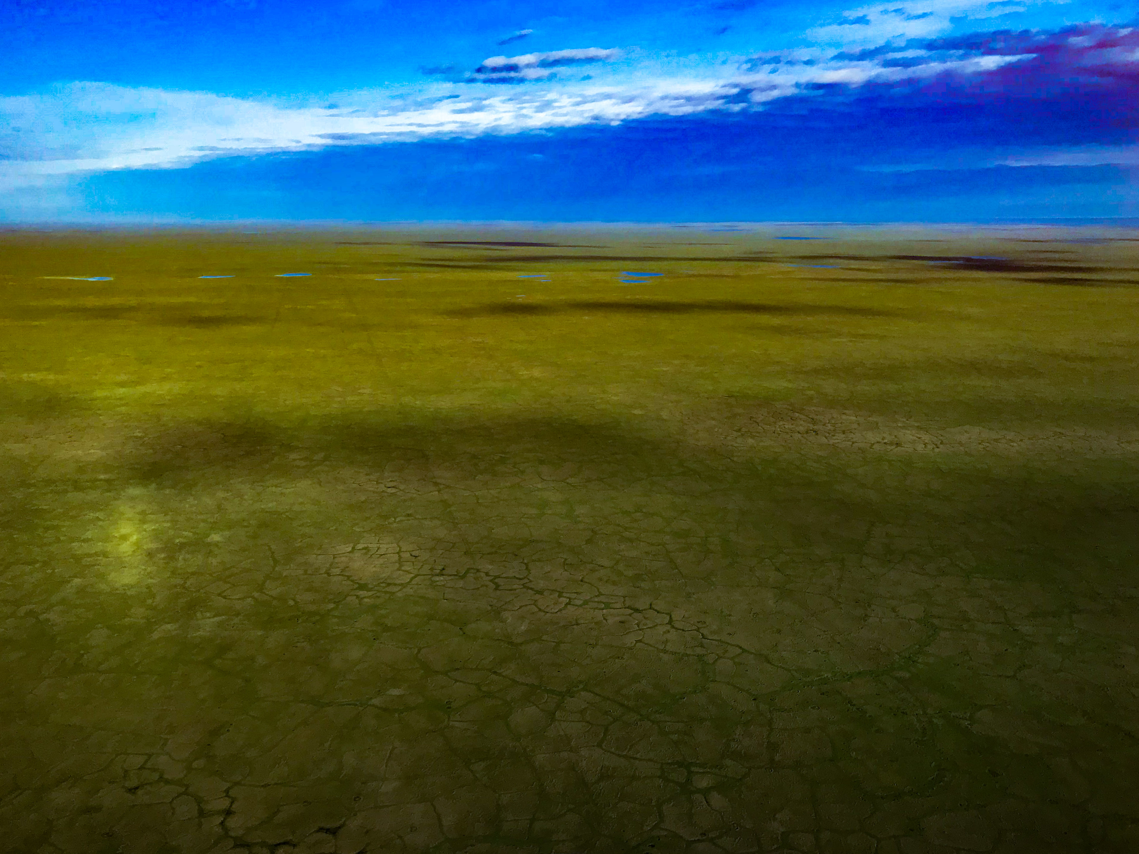
 The lines are faint, but visible. Will they ever disappear completely given the change in vegetation they cause? A better question is…. how can we prevent these tracks from forming in the first place?
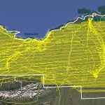
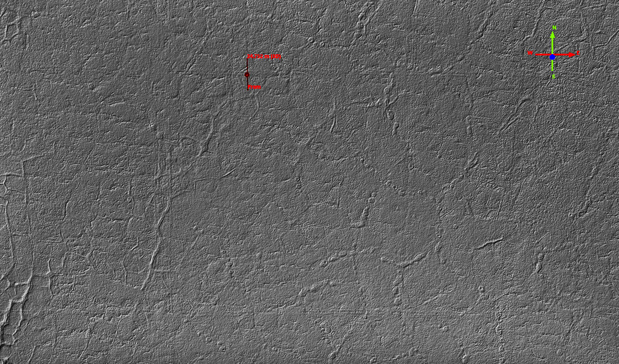
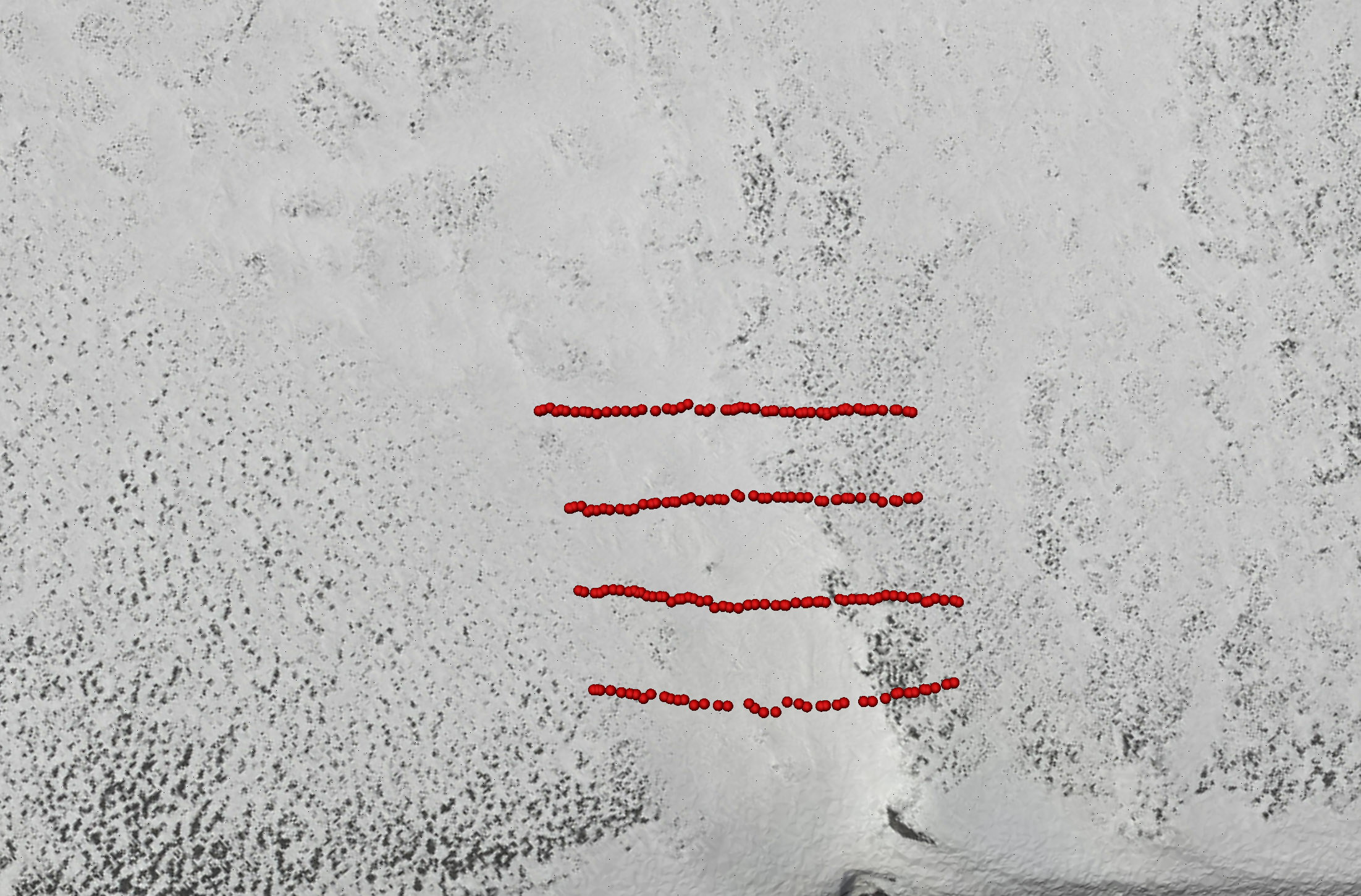
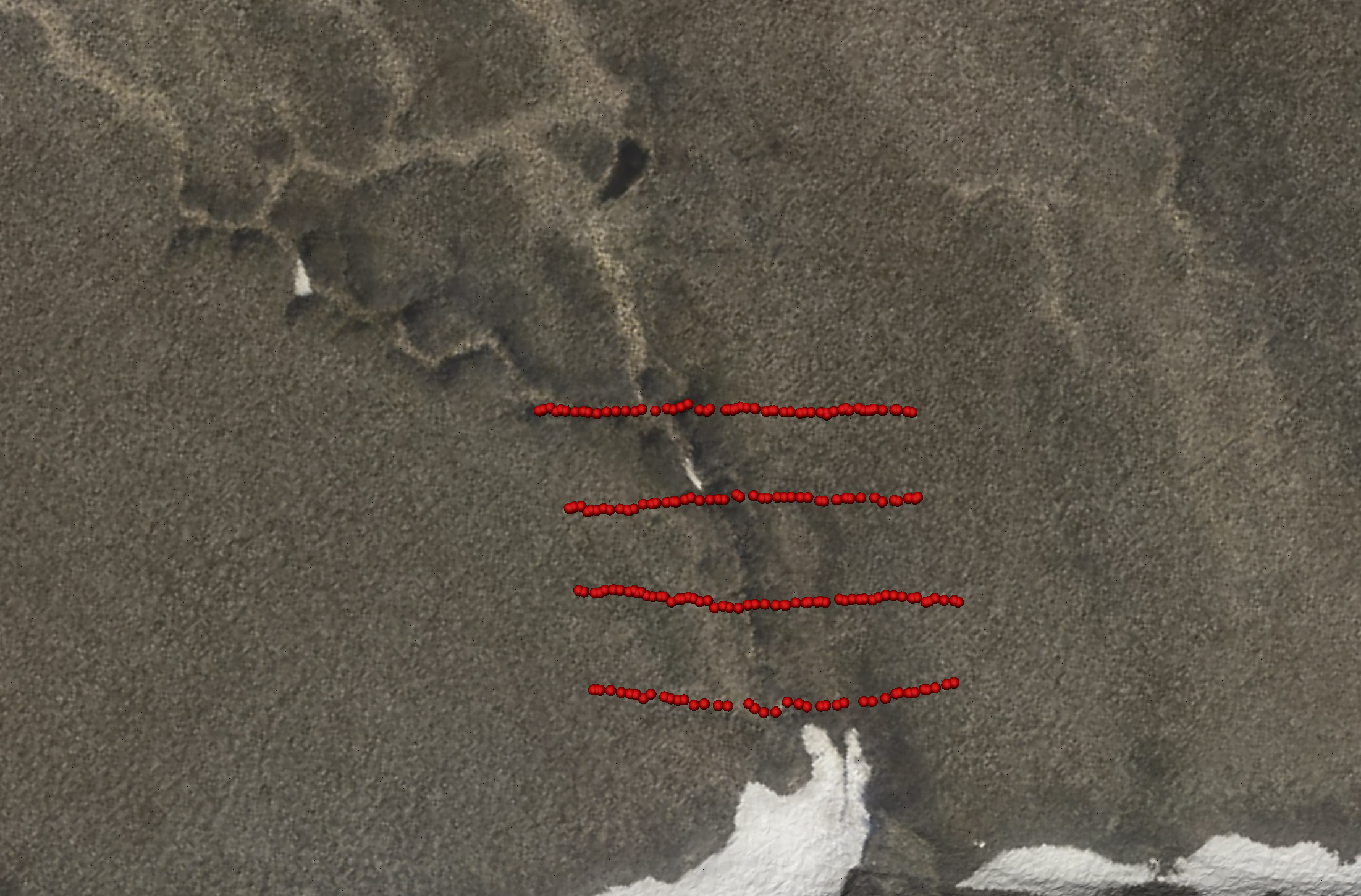
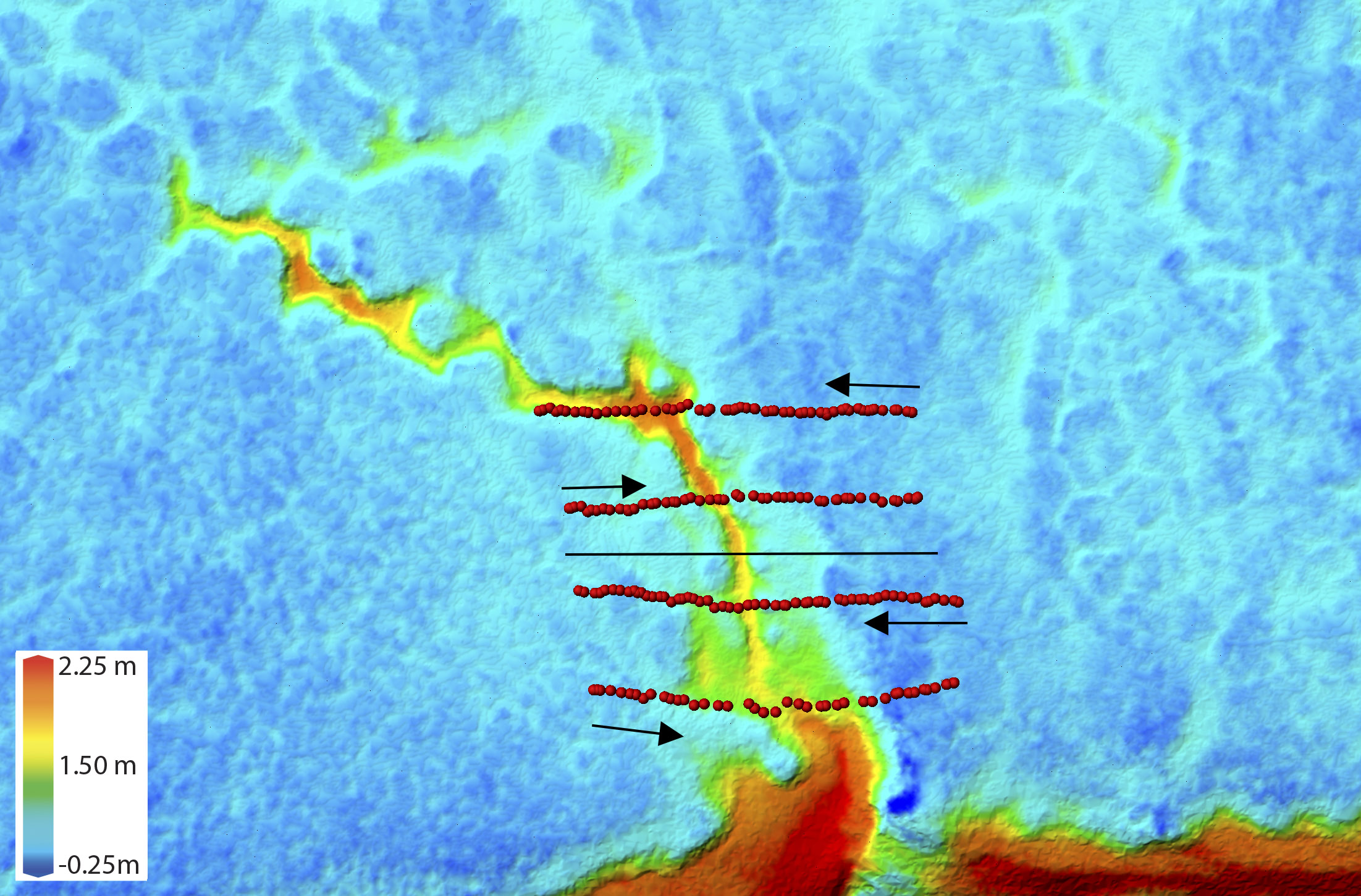
In addition to taking a few snapshots like those above, I mapped the lines topographically using my system. I have to admit that this is, by far, the worst map I’ve ever made; to my credit though, it is still the best map ever made of this area and still quite useful for the purpose. I’m not sure how I screwed things up, but it certainly had to do with planning this mission in my head as I flew over it, about 7AM, on my way to Fairbanks, trying to hurry to get over the mountains before the weather came down after finishing a month long mapping effort in the 1002 Area. In any case, an important plot point here is that I was using the seismic lines themselves to navigate my flight lines. That is, even at 125 mph I was able to clearly follow the lines left by the 2018 seismic work for my mapping. I just followed the wrong lines apparently and spaced my flight lines too far apart to make a pretty map…
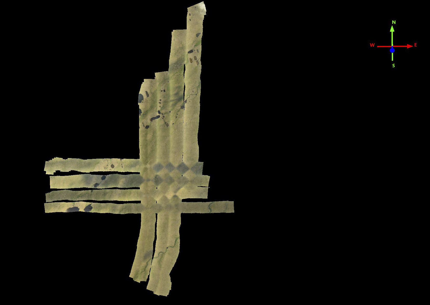 This is by far the worst map I’ve made in 8 years, but still good enough for the analysis I show below. Not sure how I screwed up the line spacing, but I didn’t preplan this mission, it was just on a whim on my way home, and I was using the 2018 seismic lines themselves to navigate by and I somehow forgot how far apart they were or was skipping too many of them. In any case, an important note here is that the tracks were so visible on the ground that I could use them to navigate an airplane flying 125 mph to make these perpendicular flight lines. The little diamond shapes at the intersection of the lines is caused by the change in cloud cover in the time between doing the east-west and north-south lines and the software trying to blend that together.
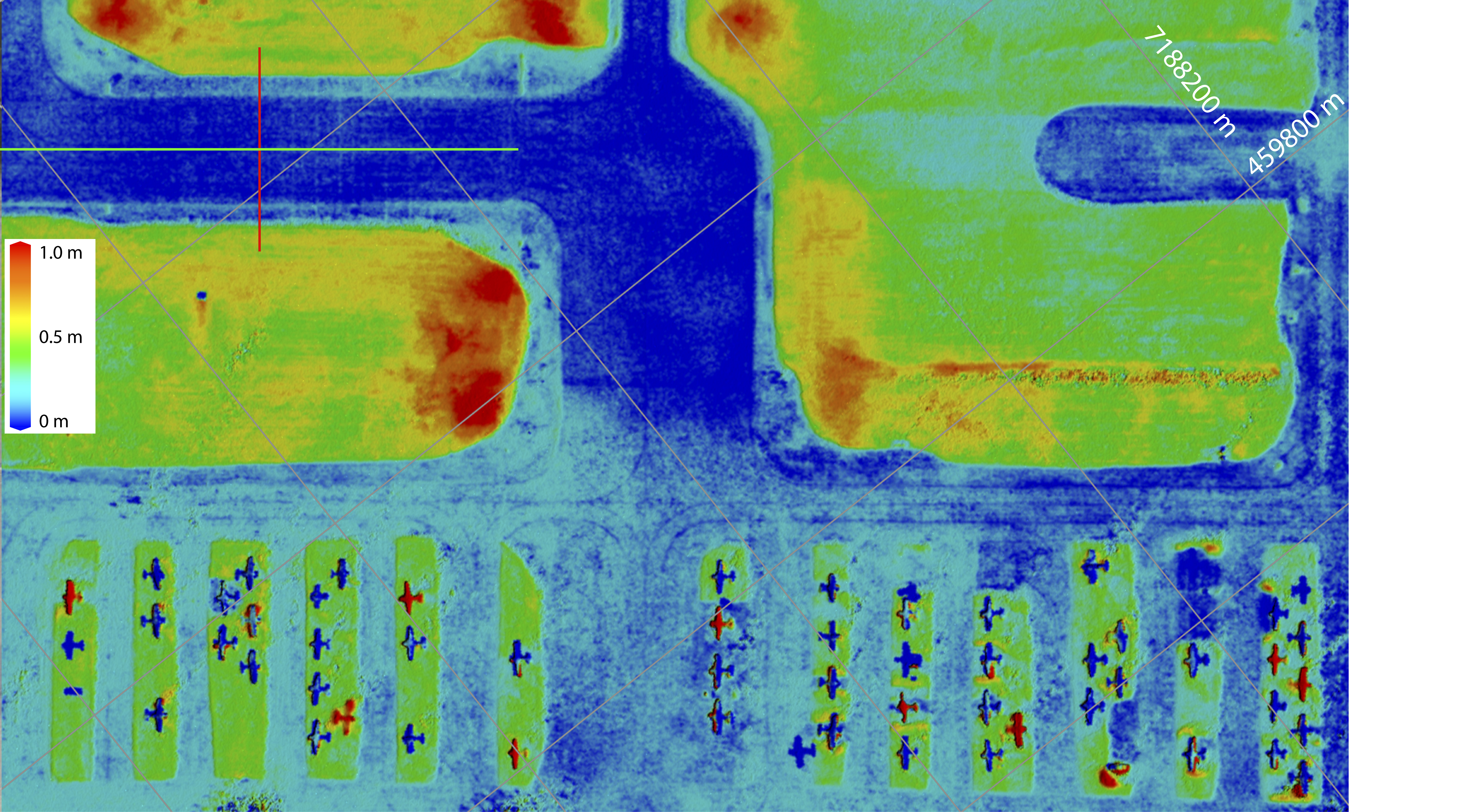
Here is a video of fodar data collected on 26 July 2018 flying over about 1.5 miles of seismic trail from the 2018 work near Pt Thompson, seen as a bunch of parallel lines near the center of the screen. The video pauses where tracks cross perpendicular the main one running through the center of the screen, about every 200 m. I didn’t count them, but there were probably several dozen trails out there, each many miles long, that looked just like this one, so I’m not cherry picking the worst by any means. These larger ones like this one with multiple sets of tracks run north-south (the video is rotated with north to the right), the ones going east-west were usually much smaller often with only one set of tracks visible. So there is no doubt that the 2018 seismic work created an impact, the question is whether you consider it significant? In other words, is it ok with you if the 1002 Area gets covered by 20,000 miles of tracks like this?
This is the same video as the last one, this time with topography, showing that the tracks you saw visually also have a topographic impact. What you are looking at here is a shaded relief image of the topographic data, so fake sunshine creates shadows that highlight the relief.
This video circles around one cell of the 200 m x 200 m checkerboard at Pt Thompson.
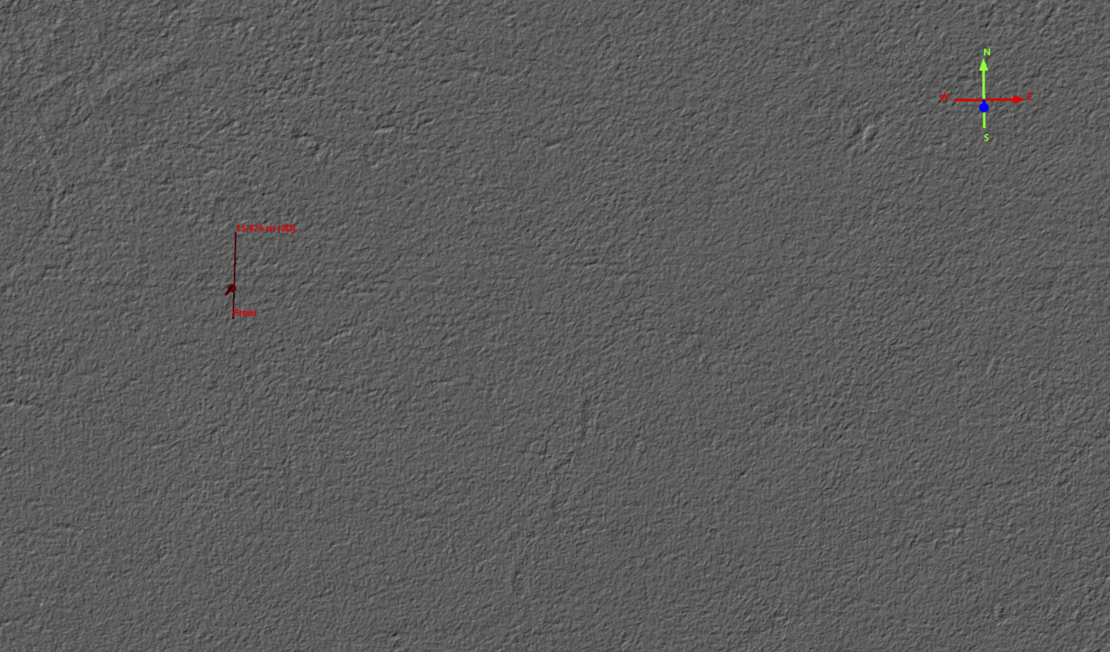
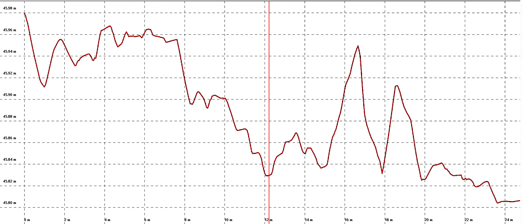
 This plot corresponds to the red line in the previous image, showing the topography under that line. The vertical red line here corresponds to the pushpin in the previous image that is in one of the tire tracks. The horizontal grid lines are only 1 cm apart. Depending on what you reference to, these tire tracks are 3-6 cm deep, or about 2-3 inches. The other track is about 2 meters to the right, so this was a big vehicle or sled.
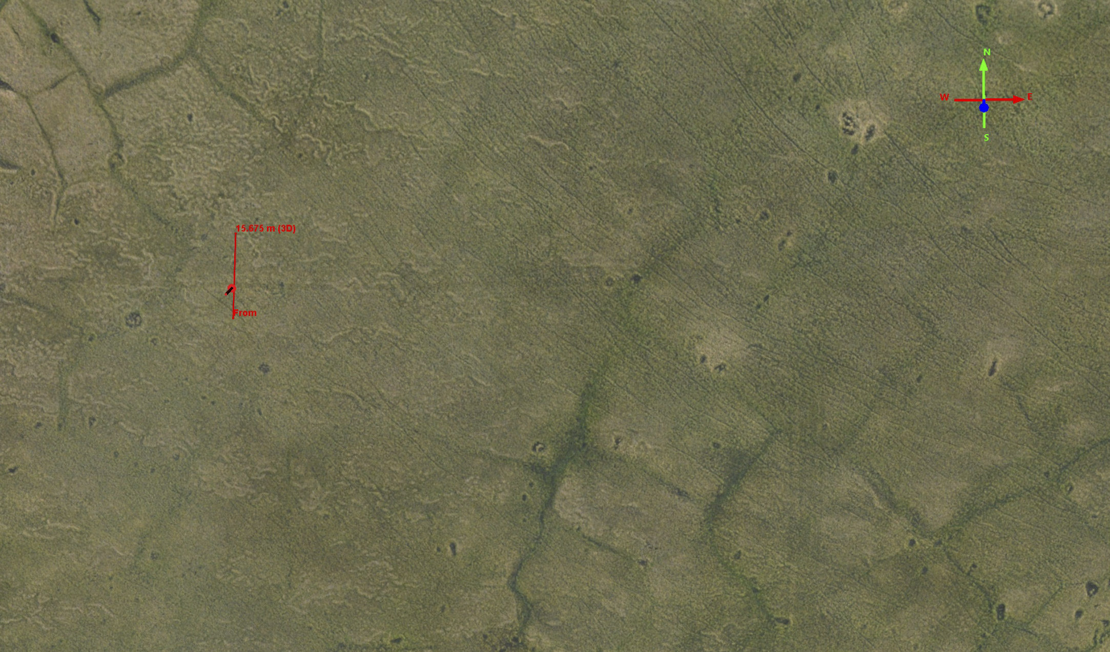
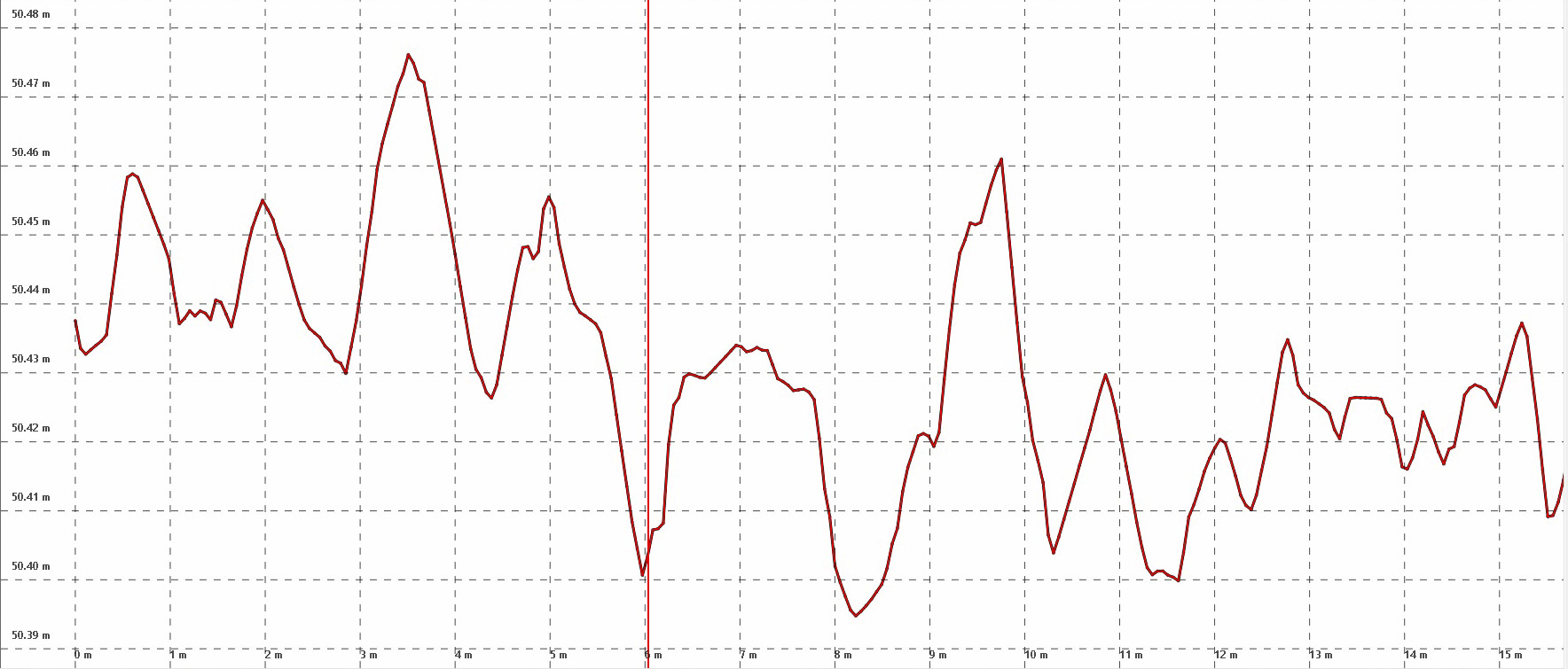
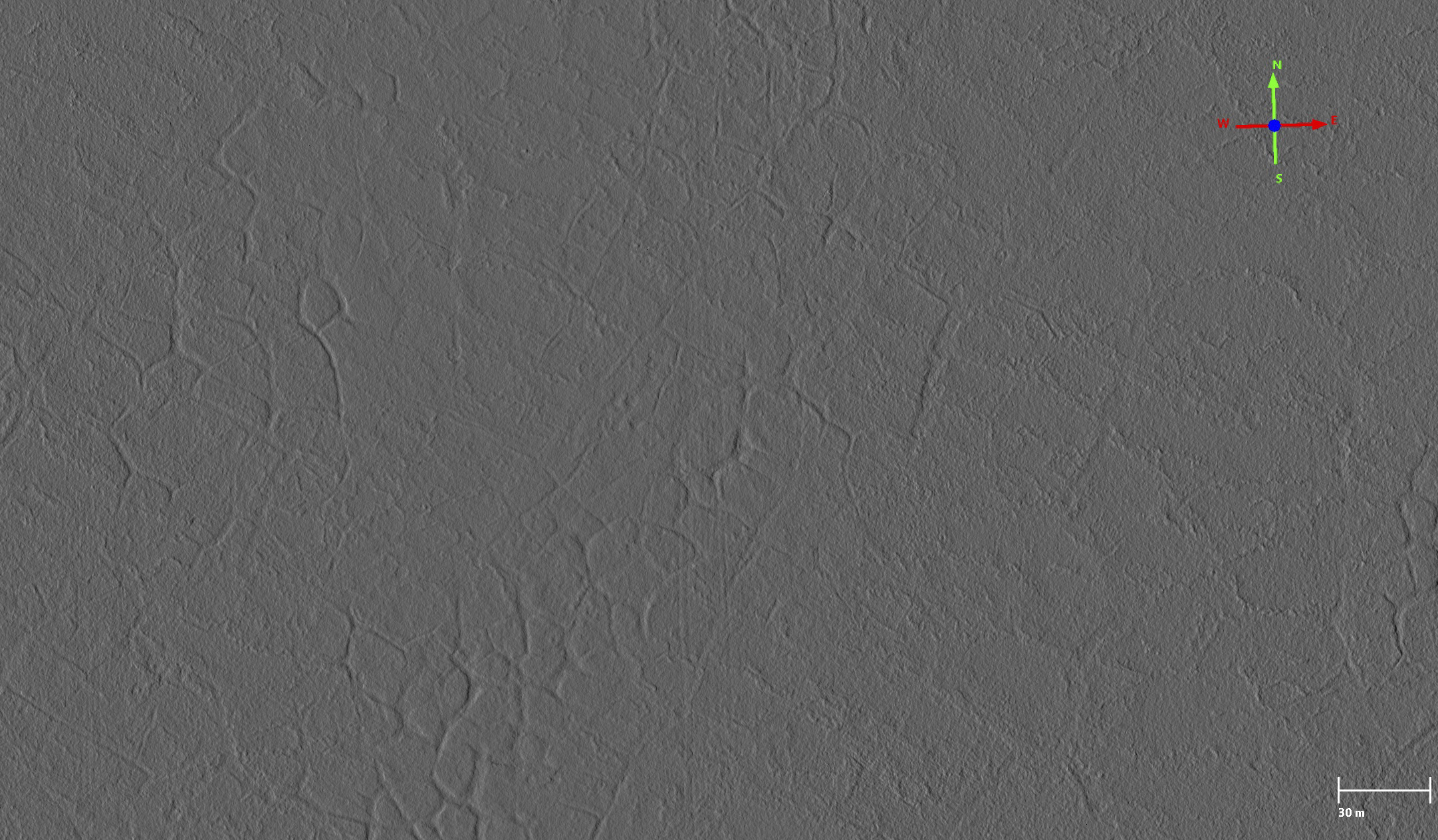
Here is a typical track along the grid lines. The red line and marker correspond to the data below. The important point with this image is not how deep it is but that you can clearly see the tracks in the topography, and that these correspond with the grid that you can see visually in the previous photos.
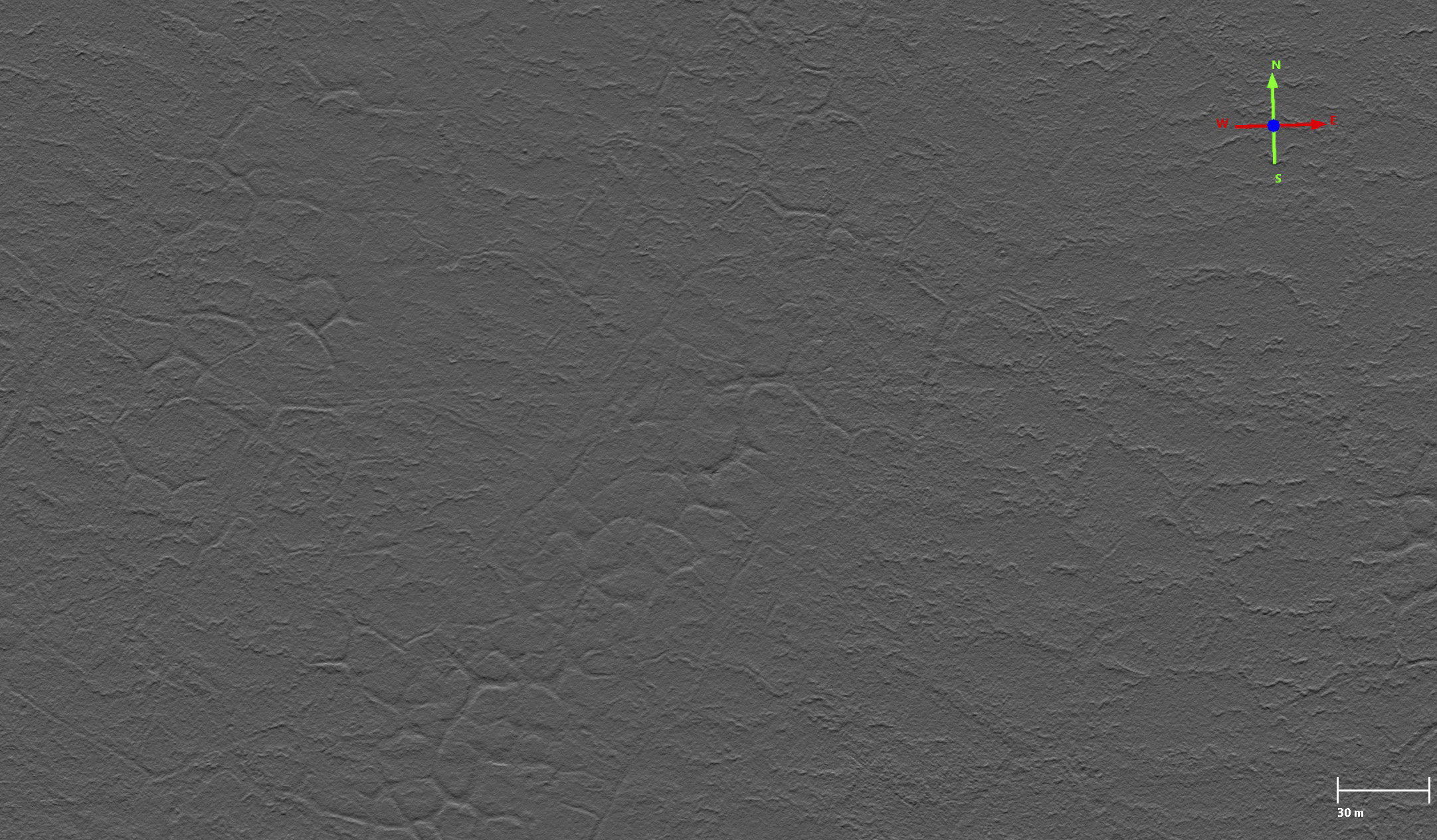
Here that tire track is shown to be about 5 cm deep (about 2″). This is typical of the few dozen spot checks I made. The track itself seems to be about 60 cm wide, and the next track about 2 m apart, so that’s a big vehicle (or perhaps a big sled).
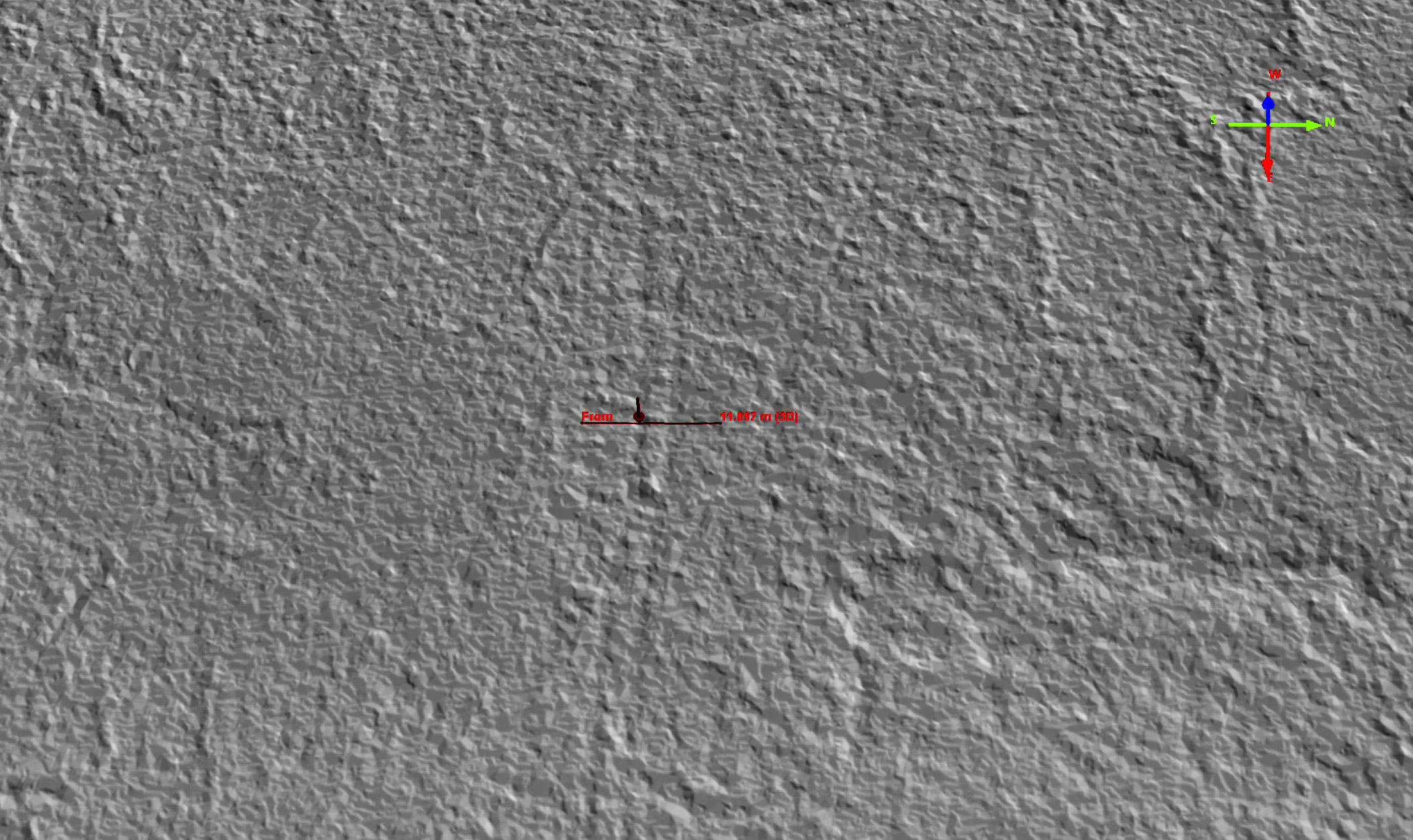
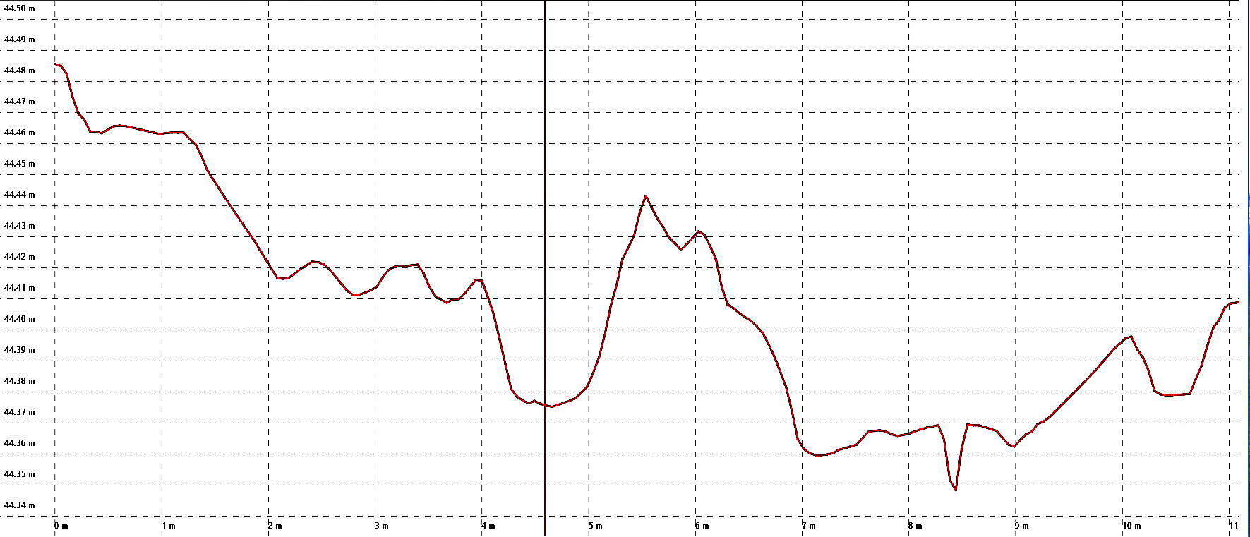
Here you can see a tic-tac-toe pattern of tracks if you look closely. The lines that run north-south seem to have a lot more traffic on them than those that run east-west. I’ve put a transect across one of the east-west lines, as it’s easier to find single-vehicle tracks and measure individual tire tracks that way, like I show below.
Here it seems the tire track is about 5 cm deep (about 2″), and this is typical. The two tracks are again separated by about 2 m, indicating a large vehicle or sled caused them.
Before discussing the implications, I want to highlight two remarkable technological achievements seen in the analysis above. First, I’m able to measure tire tracks only 2″-4″ deep in Arctic tundra using a $3000 camera and some brain power. Second, the tire tracks are only 2″-4″ deep, remarkable considering how many hundreds of tons of people and gear were dragging across that landscape, such that there is almost no comparison between the impacts of the 1960’s seismic and today’s — it really is remarkable how far we have come. But it’s simply not good enough, in my opinion, for use in the Refuge. The Refuge was set aside and zoned to be kept pristine. While it’s true that when it was expanded in 1980 it was also zoned for oil extraction, but those oil-related activities still must be held to a higher standard than elsewhere. Seismically mapping the 1002 Area using 2018 methods would be a visual and potentially ecological disaster, permanently scarring the Refuge and threatening all future drilling here due to the public outrage that would undoubtedly ensure. We can do better.
Unfortunately, there is little time for doing better. Applications for permits have already been submitted to do a lot of seismic this winter in the 1002 Area, and the BLM seems to be rubber stamping it without a serious environmental review despite decades of obvious impacts. The 1002 Area is simply much different than NPRA — most of it is not really a coastal plain, it is uplands that fall directly off into the ocean, with rock outcrops and ravines a few hundred meters from the beach. The area is actively being deformed tectonically, so there is little truly flat or level area. The rivers here are not shaping the land, the land is shaping the rivers — the folds and uplifts from below are dictating their course. There is a reason the mountains come so close to the ocean here — they are actively being pushed there from the Gulf of Alaska. The Sadlerochit mountains are only 20 miles from the Arctic Ocean — 20 miles! In that 20 miles there is little that can be called flat due to the same geologic forces that created the mountains. To the east, each of the watersheds are unique. Many are shaped by a series of perched wetlands, where the perches are only decimeters apart vertically, about the same initial depth of the tracks left behind by the 2018 Pt Thompson seismic work I found in my first maps. Thus the bulk of the 1002 Area has a much stronger hydraulic gradient, in which small disturbances will have a more dynamic impact than in the much flatter NPRA. Of the few lakes out there, I don’t recall seeing any that were not already connected to some lower lake, and the evidence of lakes changing shape and size over time is abundant. Same with overland flow — water tracks, beaded streams, linked ice wedges — these features are persistent everywhere. The point is that micro-topography is the dominant control on the surficial hydrology of probably 90% or more of this landscape — that is, the land in between the rivers which drain the mountain watersheds. If you do not understand that microtopography (in this case, topography on the scale of an ice wedge, or centimeter or decimeter) then you have no way to predict the impacts that a 20,000 mile network of 20 cm deep grid lines will cause. While I do have a fair amount of experience in permafrost hydrology and ecology, I wouldn’t say its my specialty, but regardless I know enough to know that without a map like mine being studied intensively for at least a year we are just being reckless in terms of permitting seismic work in this region. And I don’t say that to slow things down on principle but to emphasize that the comprehensive study required takes time and has not been done and apparently if the BLM has it’s way it will not be done — unless we somehow change the current dynamics to allow the necessary studies to occur. It took millenia for that landscape to form, but it will only take one winter for it to get fucked up permanently.
 This is the cover photo from SAExploration’s permit application to do 3D seismic in the Arctic National Wildlife Refuge starting in a few months. They propose to have 300 people and their living quarters towed around by some 30 vehicles. Is it conceivable that so many vehicles towing an enormous hotel in the dark of winter won’t leave an impact? Conspicuously missing from this plan is any mention of leaving scars behind or how such damage would be detected or mitigated.
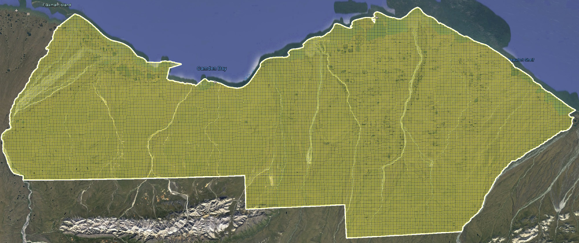 Here is what a 400 m x 400 m grid looks like superimposed over the 1002 Area. I calculated that it affects over 5% of the total area of the 1002 Area, or roughly 300 km2 (75,000 acres). That’s way more than the 2000 acre limit of impact required by law. And that’s only half as dense as proposed by SAExploration…
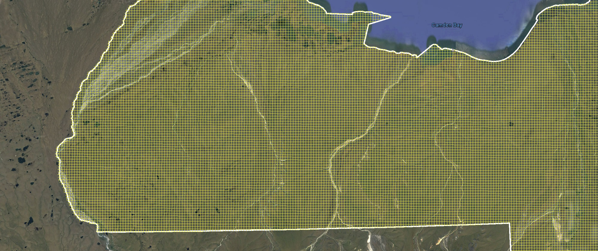
Here’s what it looks like more close up. Do you really want to see such a grid etched into the tundra? We can do better.
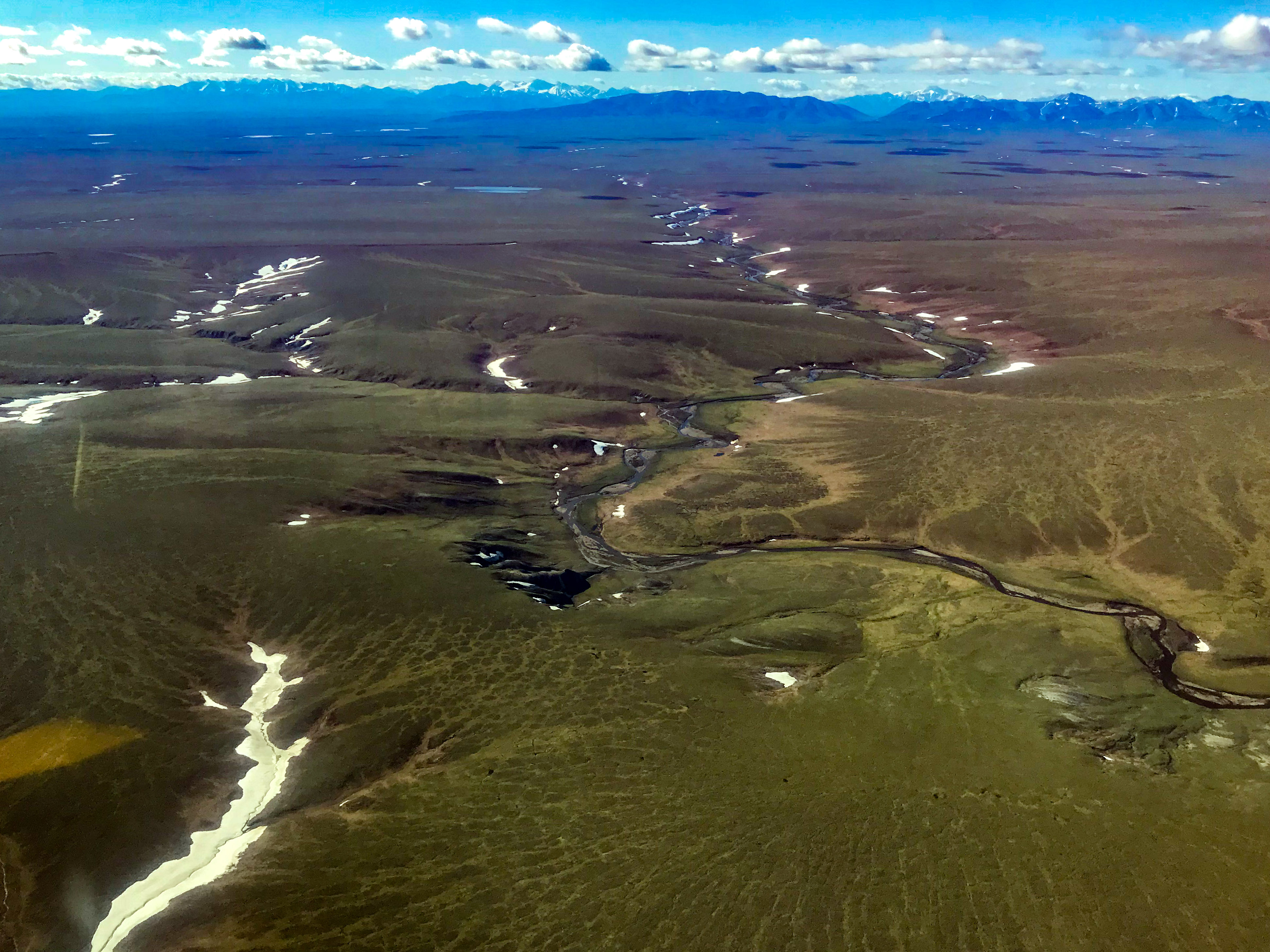
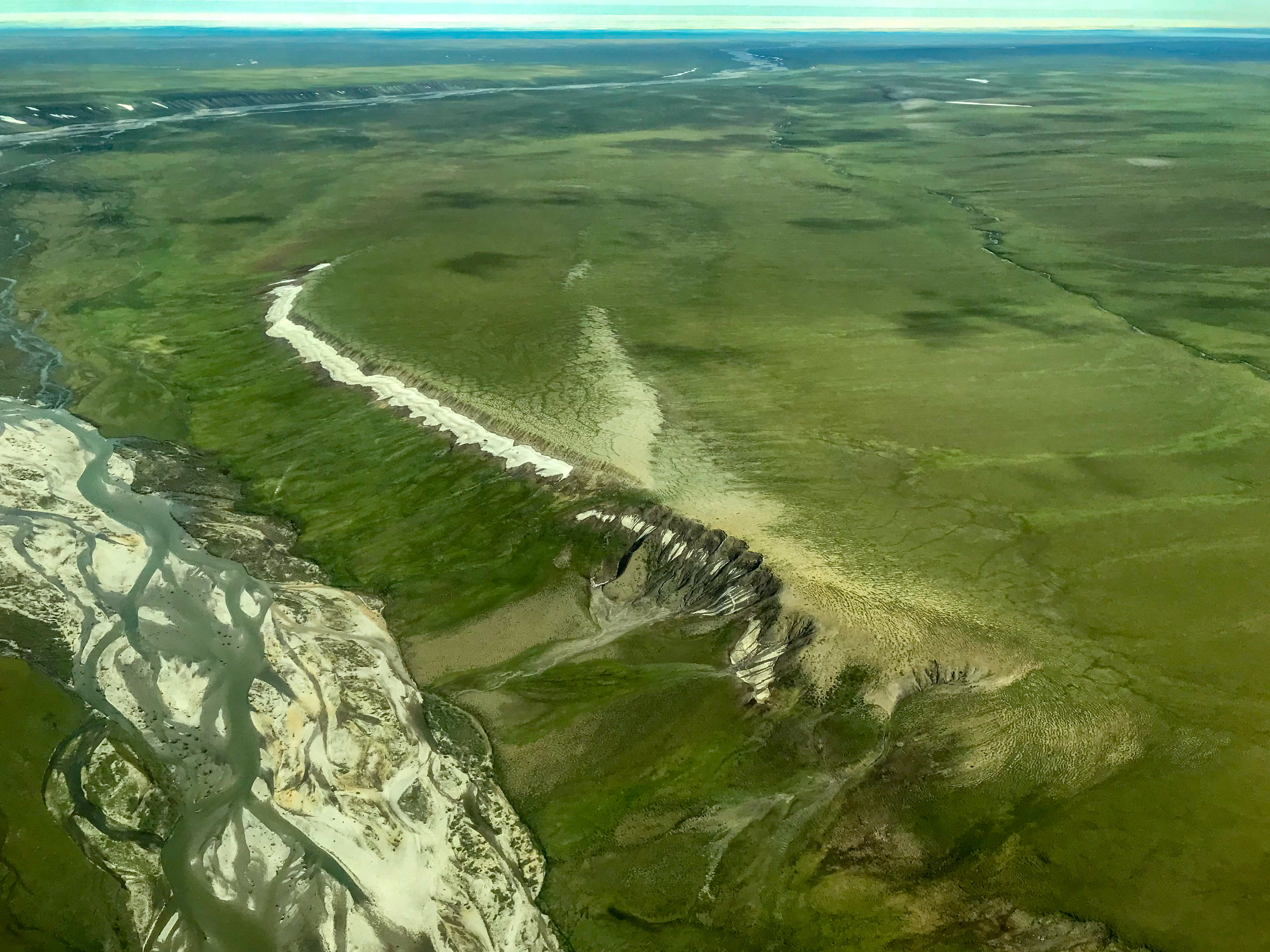
This is what much of the 1002 Area looks like. Would you call this a coastal plain? I wouldn’t. Don’t even try to tell me you can drag a 150 person man-camp across that without getting stuck a dozen times…
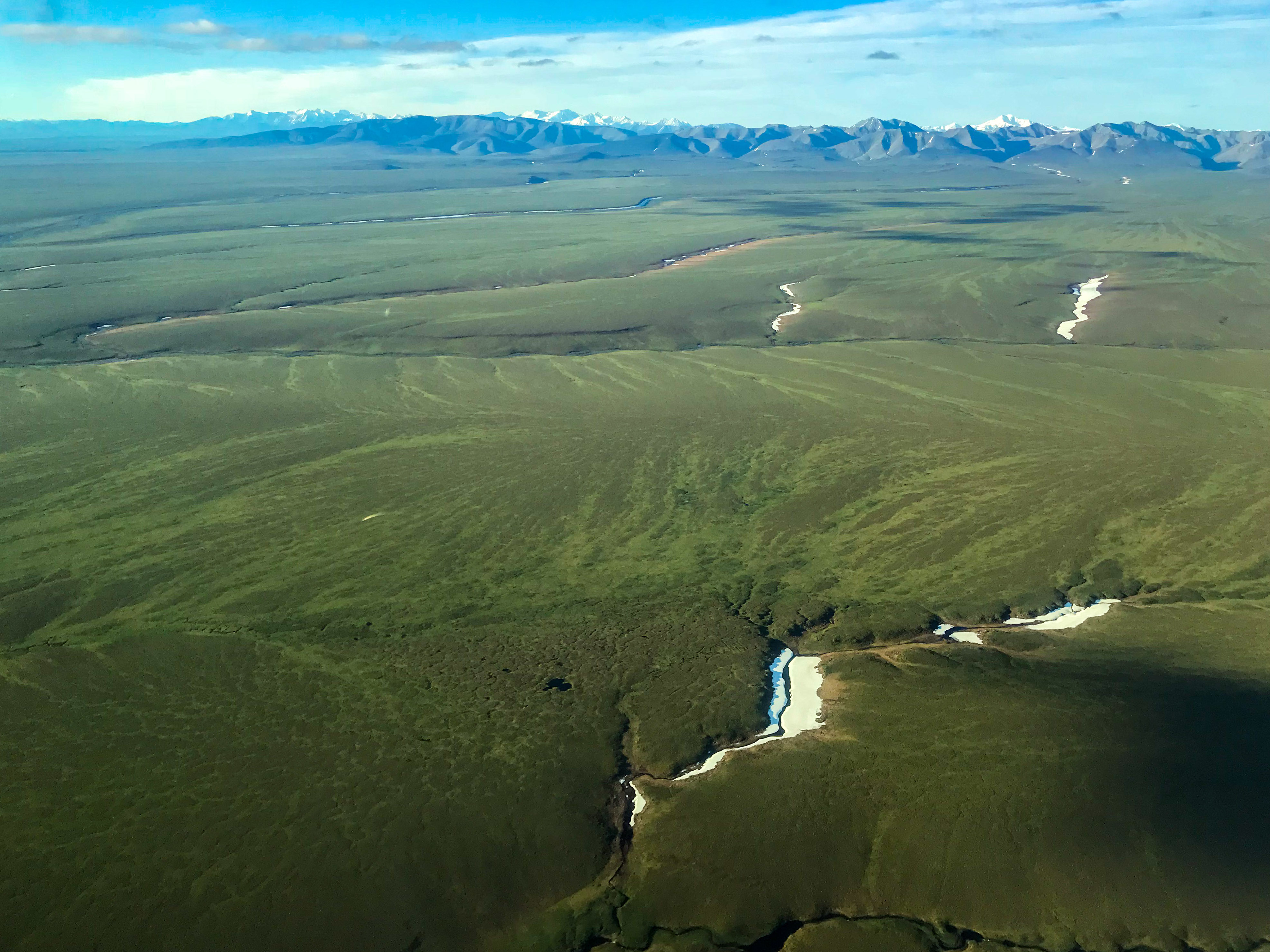
There are no large lakes here because it’s NOT flat. This is not NPR-A!
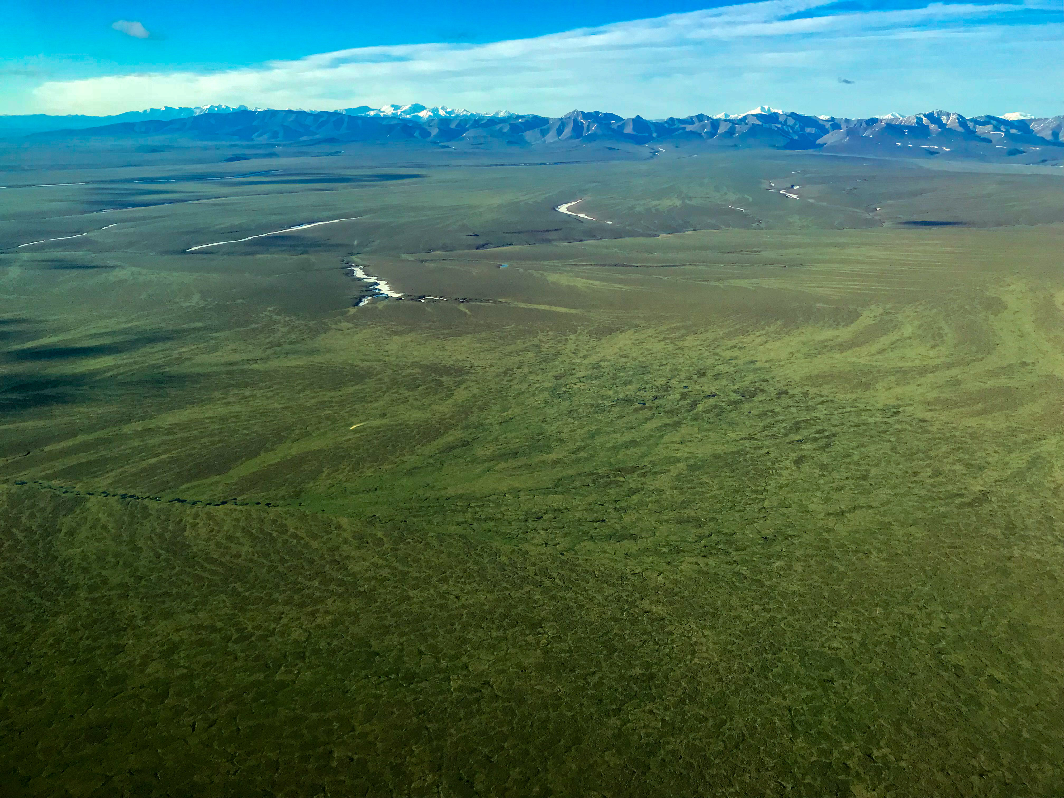
The geology here is super cool. I look forward to learning a lot more about it.
Putting miles of linear tire tracks over this terrain would likely be a hydrologic disaster.
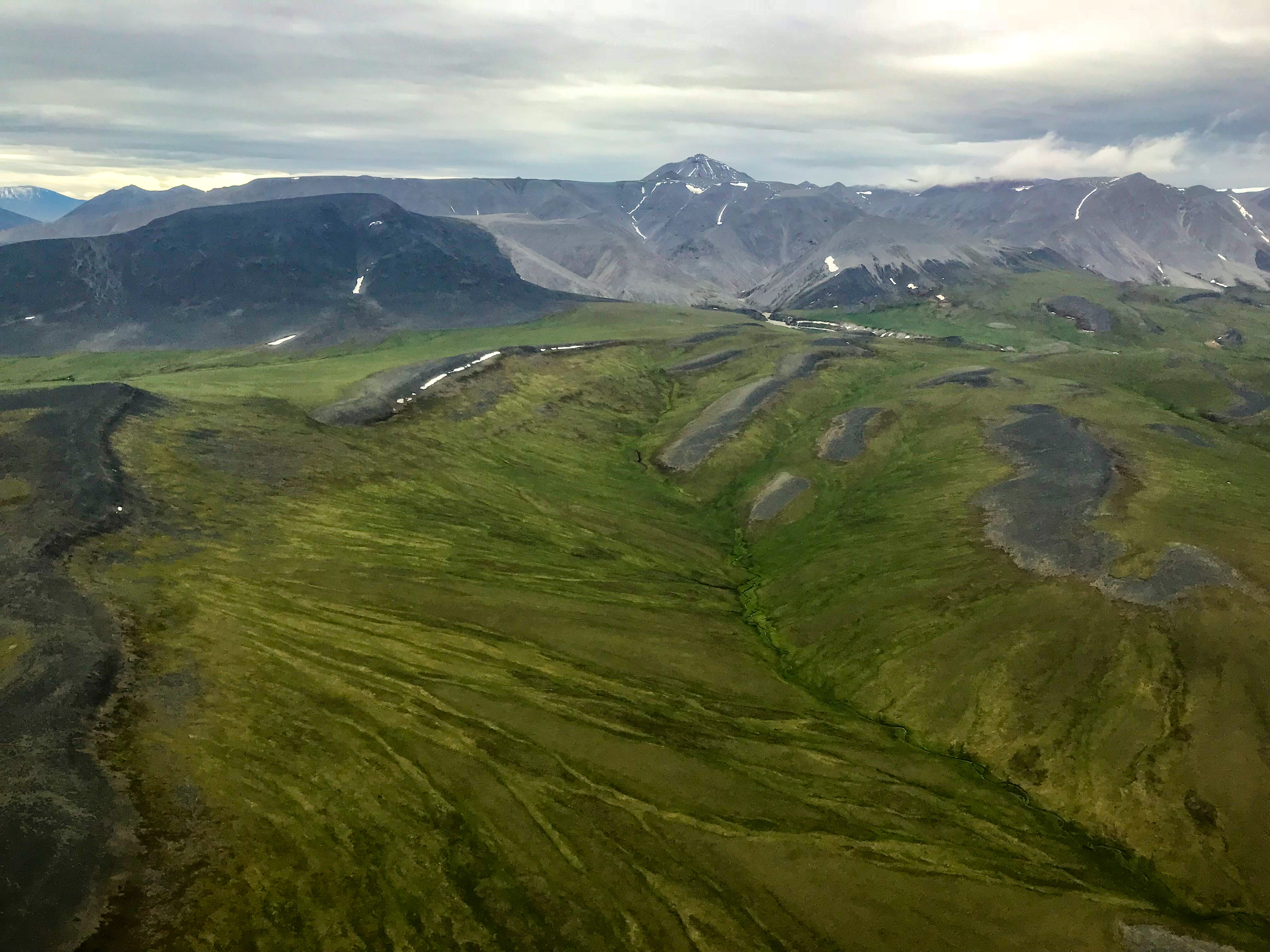
Here the geology shapes the rivers, not the other way around.
Apparently official federal government policy at this point is to call the 1002 Area a coastal plain, because, as I’ve been told by those required to call it that, it sounds like a wasteland just waiting around to be drilled. Hardly, it’s a geological and ecological wonderland.
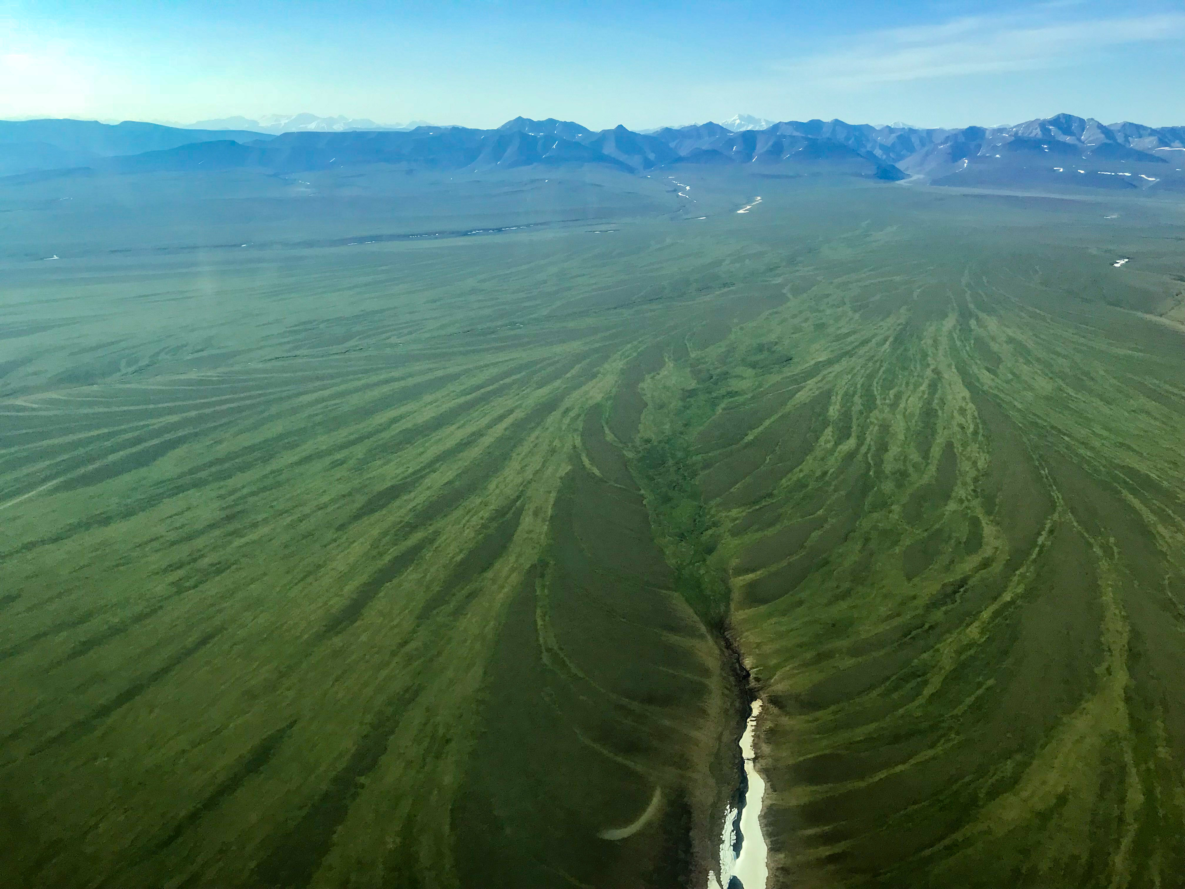
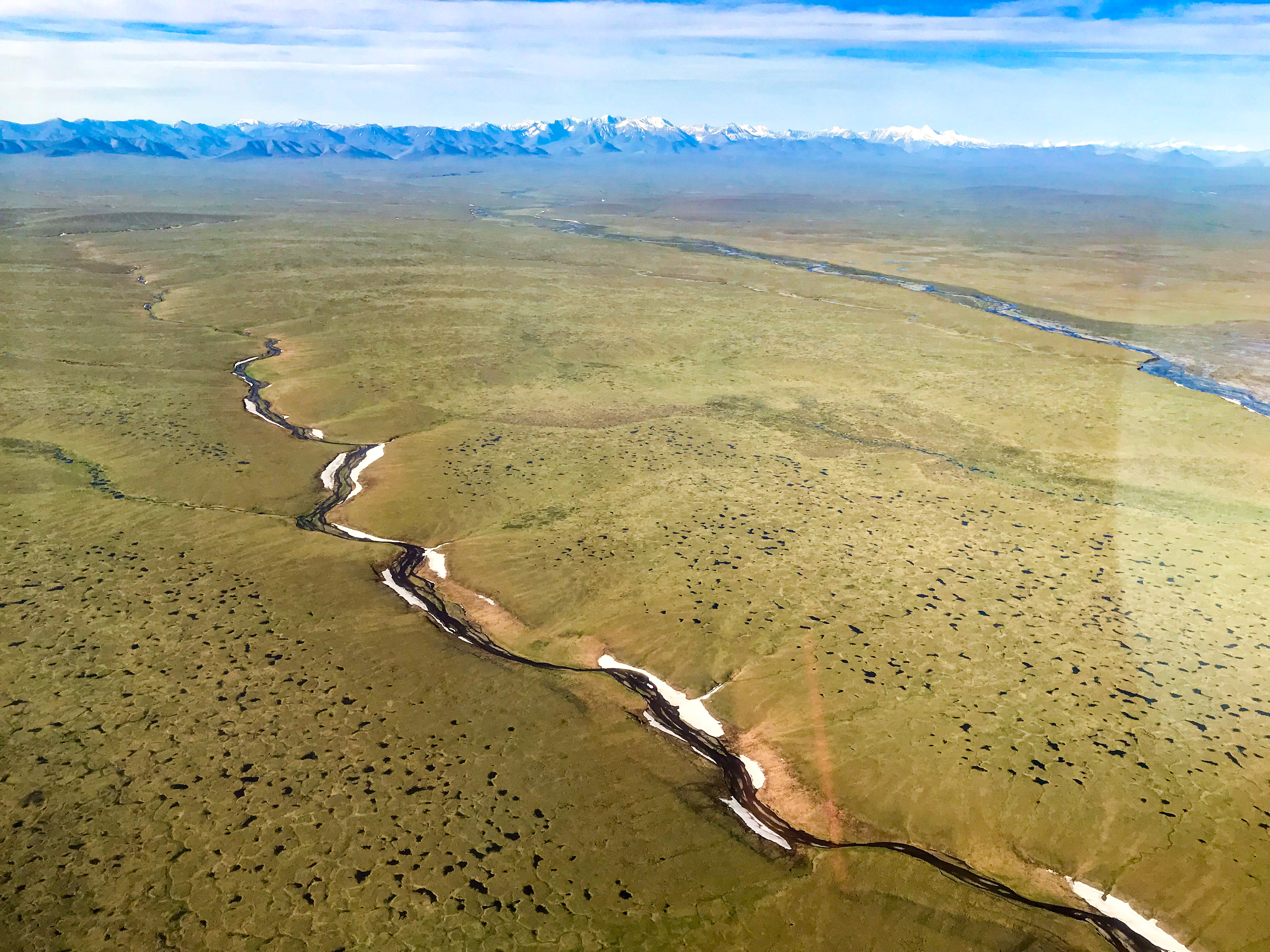
Permafrost hydrology in action — water tracks coalescing into a river channel.
This is just east of the Jago River on a smoky day — here you can actually see the folds of the soft geologic layer rumpled by the same forces that created the mountains in the distance. Again, not a coastal plain.
The 1002 has so much to offer scientists and visitors — laying a seismic checkerboard over this would be a disgrace to our country.
You can read the current seismic application here. It seems fine in general, and I don’t doubt the people that wrote it were sincere. But it is all boilerplate, it basically just asking to be turned loose out here given a few guidelines, and that simply is not appropriate for the Arctic National Wildlife Refuge. From a scientific perspective, what needs to occur is develop a comprehensive plan where each line is pre-determined and approved individually, where every vehicle or boot on the ground is justified as necessary, and where every action is vetted in advance. It’s no different than the Minimal Tool process used currently by the Refuge staff for permits, which somehow the oil industry managed to get a free pass on by having BLM do their permits. Reading between the lines, so to speak, of the application you can see there that they are not volunteering to do anything more than is required by law or regulation. Why would we expect them to? They are a for-profit company with shareholders expecting to see a profit — volunteering to hold themselves to a higher standard eats into those profits and gives their less scrupulous competition a competitive edge. So even if those responsible for this application wanted to do more, they really can’t — unless we change the relevant laws and regulations and we hold our government accountable to enforcing these and the existing ones. Conspicuously missing from this application, for example, is any mention of measuring the impacts of all those tire tracks on the tundra or what they will do if they find such impacts, probably because there is no regulatory requirement for doing so. If no one actually attempts to measure these impacts, is it any wonder our Senators and other politicians believe that there are none?
What’s needed before any regulations or laws are changed is a comprehensive, unbiased review by the leading scientists of this type of terrain — physical scientists, botanists, permafrost hydrologists, permafrost scientists, ecologists, geologists, climate scientists, biologists, and the like — to define what we know, what we know we don’t know, and what we need to know before we can allow seismic exploration and drilling to occur here. I’m not saying seismic or drilling can’t be done responsibly, but that it should be done rationally and responsibly, and that requires substantial input from the dozens of scientists working in Arctic Alaska that either understand or have the capability to understand the impacts of doing things irresponsibly. It also requires input from all stakeholders, so that scientists understand the engineering needs and vice versa. So if anything is going to get fast tracked, it should be this study process, not the actual seismic or drilling. Anything less than such a full and complete scientific review is simply shameful, and something our children and grandchildren should rightfully give us grief for not doing. Just as a simple and basic example, I’m not aware of any comprehensive study of the relationship between snow depth and tire track ruts from previous seismic work, such that we can track this over the decades to improve methods. And one simple manipulation that’s never been done is to determine how deep of a tire track will cause a change in vegetation, as a function of slope and substrate, such that the tire track will leave a visible scar even if the topography heals. Or what is the long-term impact of draining a perched wetland on vegetation communities and the animal communities that eat or use them? Etc. And if nothing else, what is the impact to our national psyche when we defile our last great Arctic wilderness with a checkerboard tattoo as far as the eye can see?
In terms of changing the law or regulation, I was really only half joking about the one I proposed earlier — that drilling operations are not allowed to start until all impacts of seismic work disappear. If there are truly no impacts using current methods, then drilling could start the next year. If there are impacts, drilling may be delayed for decades. I predict that such a put-your-money-where-your-mouth is law would lead to sweeping changes in the way 3D seismic operations are done and would eliminate the need for outsiders like me to have to propose such changes as well as eliminate the need for prescribing methodology by law — do whatever you want, but you are responsible for the “zero impact” that Senator Sullivan guarantees us. Given that’s not likely right away, I felt compelled to offer a few suggestions…
One way we can improve current methods is by using fodar maps of snow depth. I have demonstrated in previous work that I can measure snow depth within the Arctic Refuge better than can be done with a guy on the ground using a probe, but covering enormous areas at high resolution. Current guidelines call for having a minimum of 20 cm snow depth, but there is little guidance as to how densely to make such measurement and essentially no oversight in it. And clearly from the 2018 Pt Thompson work seen here, 20 cm is not enough.
Using fodar to map snow depth we can:
- Improve standards scientifically. By mapping snow depth before seismic work starts and mapping the tundra after snow melts, we can determine a relationship between snow depth and tundra damage. Current guidelines mandate 20 cm of snow depth, but clearly from the 2018 Pt Thomspon work whatever methods were used were inadequate to prevent measurable impacts over nearly 100% of the routes used. Using fodar to determine snow depth and a series of vehcile-load experiments (outside the Refuge) we can develop methods to determine what snow depth is required to prevent damage. Using a different method I am developing using insar, we can also map the depth of freeze of the ground from the air and perform the same set of experiments.
- Improve operations. By mapping snow depth with fodar immediately before an actual seismic campaign, we can plot routes with adequate snow coverage, where ‘adequate’ is based on the experiments I just described. These routes will likely not be linear, especially when ecologically sensitive areas are taken into account, but modern seismic does not require linear grid lines it’s just easier and more efficient for both acquisitions and processing, and in some years there may not be adequate snow coverage, but that’s life. We can then validate that those methods were adequate afterwards by mapping the tundra, and revising methods as needed.
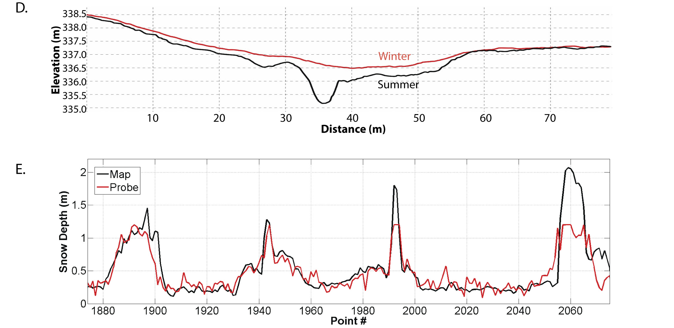 The first plot above compares winter to summer topography — the space in between is the depth of snow. The second is the point measurements from the red dots in the previous image, strung out into a single transect, such that each peak shown here is another gully-crossing. Statistically the fodar measurements are identical to the probe measurements, but because the probe was only 1.4 meters long it could not reach into the bottom of the gully. The result of our work revealed that not only was fodar better than ground measurements, but that it could cover enormous areas for a fraction of the price of field teams. You can learn more here.
 Here is a fun study from that same paper, this time in Minto Flats near Fairbanks. The colored dots on the image are geolocated probe measurements made by three of us, each wearing different footwear (boots, snow shoes, or skis). The fodar map was made after the probe measurement, thus our footprints became part of the topography. You can see this in Transect B (the arrows in the plot indicate footprint crossings) and Transect C (where the three of us met up wearing different footwear). The plot D compares probe measurements to fodar along the part of the transect shown in A with red dots; the two measurements are basically identical, the differences come from vegetation measured in summer that gets compressed in winter.
While this approach would be a big improvement over current methods, all that we are really doing is tinkering with the methods of the 1960s — that is, finding better ways to drag man-camps over the tundra. It seems to me that if we truly want to eliminate impacts in the 1002 Area we need to think outside the 1960’s box. That is, the only real way to guarantee there will be no tracks left behind by these vehicles is to eliminate the vehicles themselves. Modern technology offers us many new approaches to avoid the damage that draggable man-camps inevitably will cause. These suggestions may or may not be cheaper or better seismically, but that’s not the point — the point is to get enough data to do the job while leaving no impacts — to act as if drilling would be delayed until the impacts disappeared. I know I’m going to get beat up for proposing these ideas, but if the oil companies have better ideas to do the same, more power to them. But if they are going to sit back on their heels and only do the minimum required by law, then they’ve got no right to complain when others step in to up the requirements of law, including the law I proposed earlier. Here’s just a simple overview of idea of how things could be done differently to get a discussion going:
- Eliminate the mobile man camps. The vast majority of the weight being hauled by the tracked vehicles potentially causing the damage are to move people and provide them hot showers and warm beds. The bulk of these workers are doing grunt work — relocating geophones — or just dealing with running a mobile hotel itself. I understand they would like a warm dry place to eat, sleep and download porn at night, but I really don’t empathize as over the past 15 years I’ve literally spent over a thousand nights of my life sleeping in a cold tent without internet porn in the Arctic Refuge, and I know there are hundreds, if not thousands, of intelligent, capable, trainable professionals who would volunteer for the opportunity to protect the Refuge from damage by camping in mountain tents, transporting themselves on skis, and eating dehi for dinner. Eliminating the tracked man-camp within the 1002 Area is likely the biggest thing we can do eliminate the potential for damage to the 1002 Area. Do what you want elsewhere, but here we can do better.
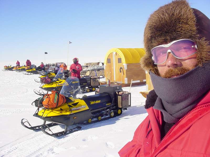
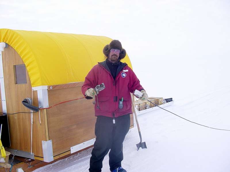
In Antarctica, we traveled several thousand kilometers on snow machine, mapping the bed of the ice sheet seismically.
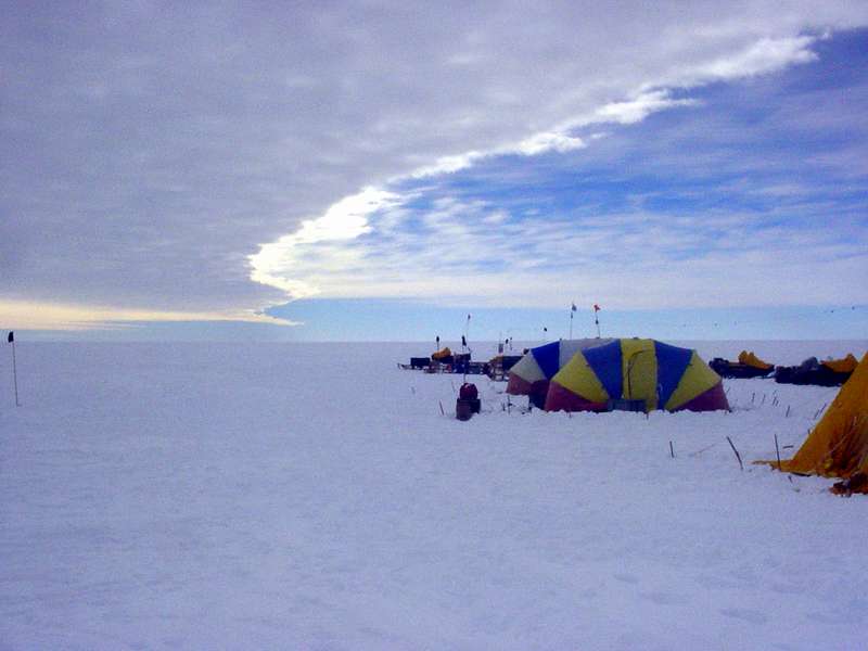
We didn’t need to haul a hotel around with us, we slept in tents. 3D seismic guys on the slope can’t do the same? Really?
Most of seismic work consists of brief moments of frantic work in between long stretches of sitting around doing nothing. Nearly anyone can be trained for this job…
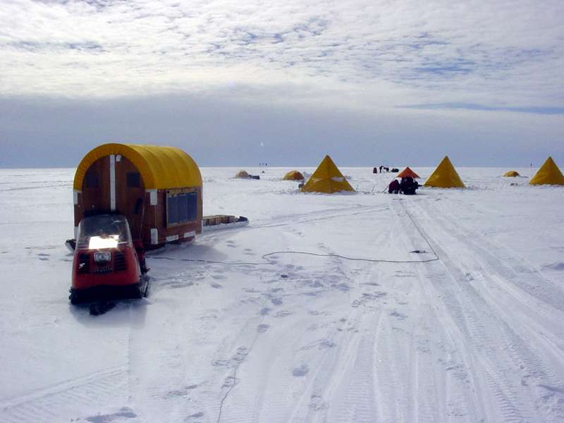
Our seismic hut is being pulled by an ancient Alpine. Why is it that the oil fields need a cat train full of Tuckers to pull their’s? There’s two ways to approach this problem: 1) how much equipment can we haul with a snow machine? and 2) how big a rig is it going to take to haul a cozy heated office complete with desk chairs? Yes, leaving no trace in the 1002 will be a big pain and slow down productivity, but that should be the price of playing poker here.
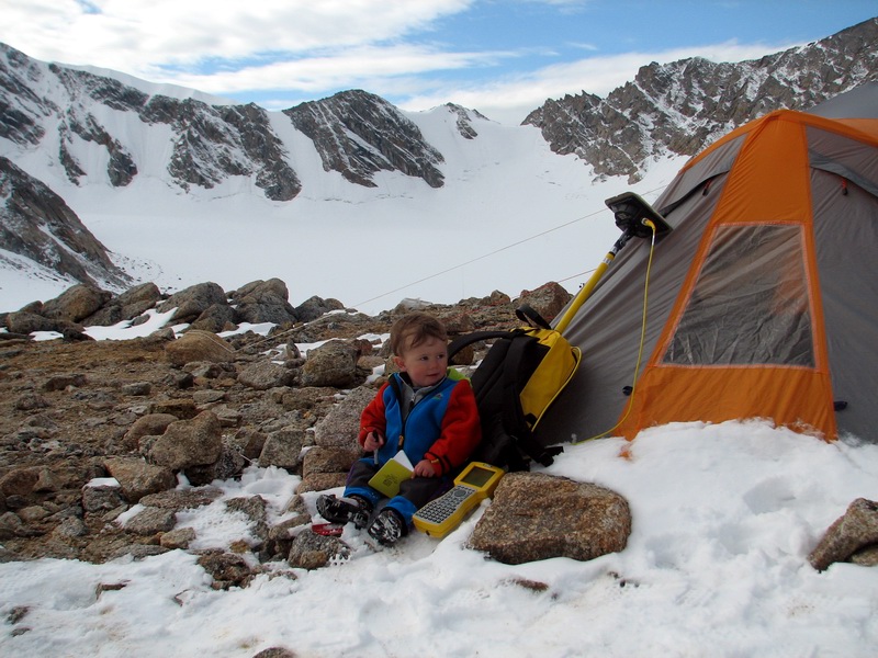
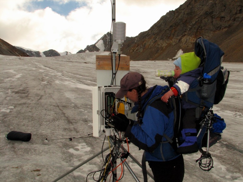
My son Turner had his first 7 birthdays in a tent on a glacier in the Arctic Refuge.
I don’t recall him complaining once about it in all those years. If these seismic guys are so delicate that they can’t do their work without solid, heated shelters complete with internet and hot showers, maybe we should find new seismic guys…
- Place all permanent camps on lakes or sea ice. Permanent camps will be needed for large jobs like this, whether in solid-walled buildings or tents. Impacts to frozen lake surfaces disappear completely, so placing those camps on lakes eliminates potential damage to the tundra. Sling all solid buildings needed onto them using helicopter and put all centralized activities onto lakes. When the lakes melt in summer, all impacts disappear forever, short of trash sinking to the bottom.
- Change the seismic shot-receiver ratio. Seismic works by making loud noises and listening for their reflections off layers in the subsurface. Usually these receivers are deployed in strings related to the source sounds, then redeployed for the next set of sounds. This means a lot of driving and thus a lot more potential impact. By investing in a lot more receivers and leaving them in place for the entire survey, each source sound gets recorded by all receivers, resulting in more bang for the buck, so to speak. Using seismographs timed by GPS and powered by battery can record continuously or be triggered to start recording via telemetry would reduce the potential of driving damage considerably and eliminate seismic shacks and local staffing at the receivers. The SAEploration application already mentions things along these lines, I’m just suggesting going all-in.
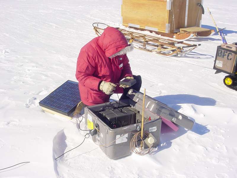
Fifteen years ago the stand-alone geophone-seismometers powered by solar and timed by GPS we used in Antarctica were home-made. Now it’s something you can buy from a store. We should buy tons of them for the 1002.
With stand-alone units, you never have to worry about your cable being too short…
- Only drive over fresh snow, don’t make sharp turns, and use a helicopter to get vehicles unstuck. If vehicles are used, allow them to only drive over fresh snow. A lot of the damage I’ve seen in my data appears to be caused by repeated use of the same track. When driving over fresh snow, the snow acts as a cushion to distribute the weight of the vehicle further. However, once its crushed and sintered it acts like a wedge being driven into the tundra when more weight is added. And any time you are driving a heavy tracked vehicle over snow you risk getting stuck, and getting unstuck is where major damage can occur, as you then have multiple vehicles pulling hard and excavating what little snow exists. Current guidelines mandate only 20 cm of snow — 8 inches! You can’t get a simple snow machine unstuck here without boring down to tundra. The deepest ruts I’ve seen are where vehicles are making sharp turns, presumbly because the edges of the track are able to dig in because they don’t remain level with the ground. Perhaps specifying a minimum turn radius, or helicopter-slung 180s, would eliminate this potential.
- Change seismic source methods. Vibroseis requires a fleet of heavy tracked vehicles, and those vehicles are where all of the potential for damage exists. If the mobile man-camps where eliminated, I could envision the vibroseis leaving no trace, though it would still be tricky. A fodar map of snow depth made immediately before driving commenced could be used to plot routes for the vibroseis vehicles. It won’t be straight route, so it wont be as easy to process, but it will still be processable. These routes would also be selected with particularly fragile and vulnerable areas in mind. However, it seems to me that a better plan is to use explosives. Small drill rigs to place the explosives slung by helicopter would eliminate the majority of overland travel for the seismic sources. Shots placed in gravel bars and lake bottoms would either leave no trace inherently or those traces would be mitigatable by river action or rakes in summer. Again, shot placement would not necessarily be linear, but our priority here is to create sufficient data to do the job without creating any impact, and non-linear placement of shots satisfies that requirement, seems to me.
So I am of course not the right guy to be proposing how to actually run a 3D seismic campaign, my point here is to try to break us out of the 1960s mindset and remind ourselves that we are Alaskans, not Texans. We have the know-how and grit to do things the right way in the Arctic, we just need to apply it. The bottom line is simply this: Regardless of any new regulations or any new ideas on technical approach, if the first oil-related activity that occurs out here is permanently scarring the landscape with a 200 m x 200 m checkerboard, the justifiable public outrage could well overturn the 2017 law that allows drilling out here, in which case everyone loses. We can do better.
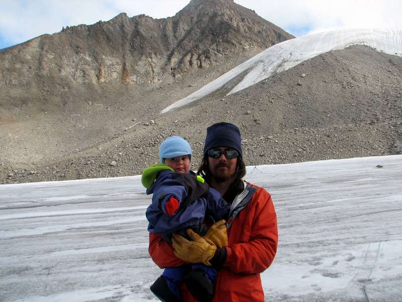
“I don’t know Turner, are oil field workers as tough as you are? I guess we’ll find out.”