The importance of measuring snow and ice in the 1002 Area of the Arctic NWR
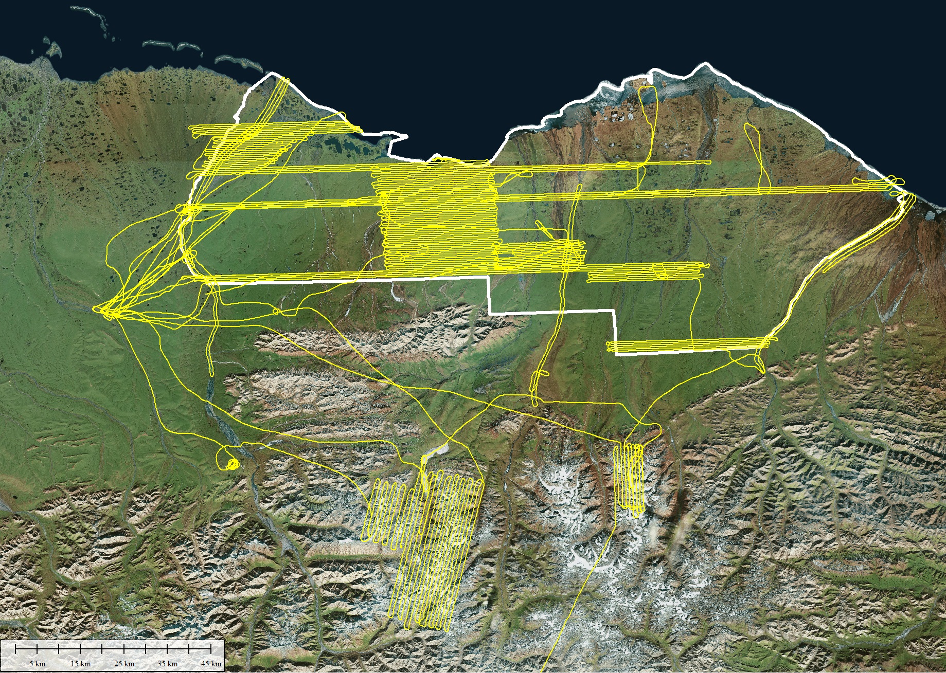
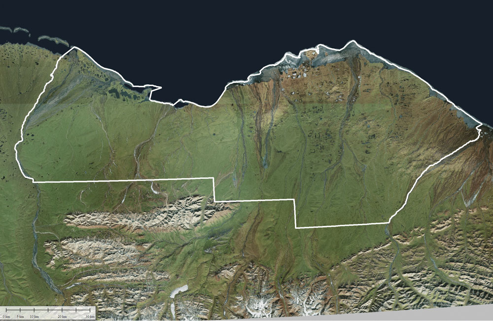
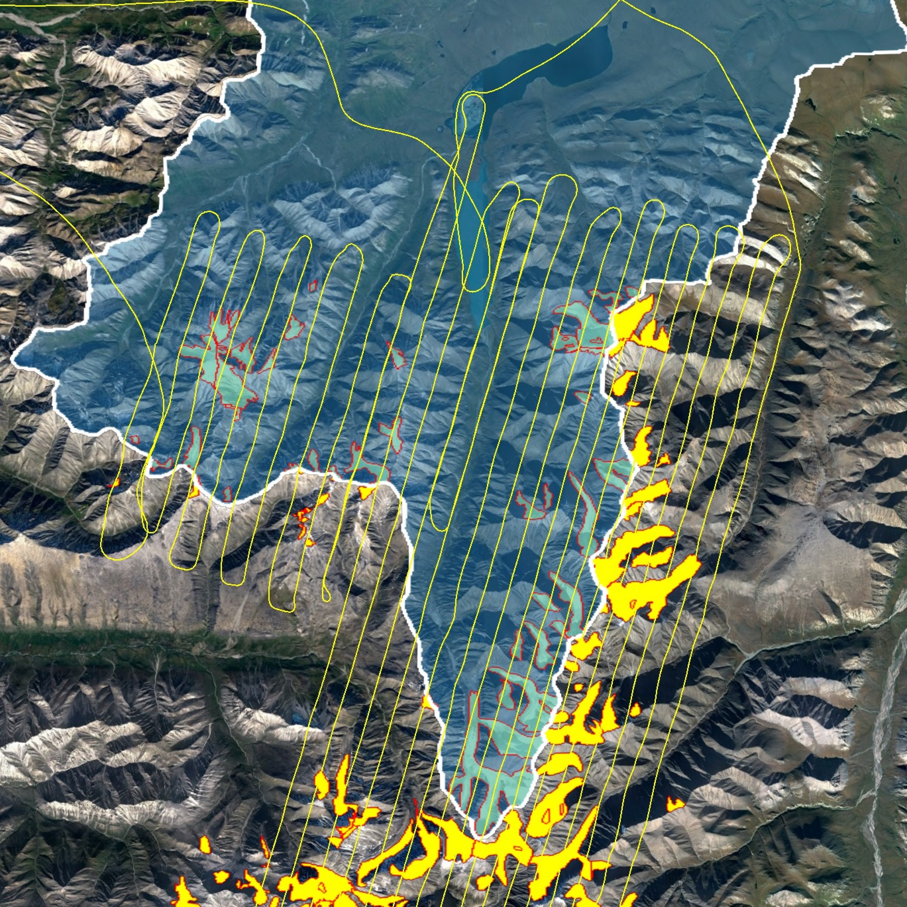
I just returned from a few weeks of using fodar to map the snow depth of over 1/3 of the 1002 Area of the Arctic National Wildlife Refuge at 12.5 cm resolution, as well as about 700 square kilometers of mountain snow pack draining into it at 25 cm. This is the most comprehensive mapping of snow depth made by far within the Arctic NWR, and perhaps anywhere in the Arctic. The measurements were distributed throughout the 1002 Area based on ecological zones and other factors and will allow us to better understand the dynamics of winter ecology here as well as any disturbances to it. This blog describes some of those dynamics, the measurements, and the importance of both.
What did I do?
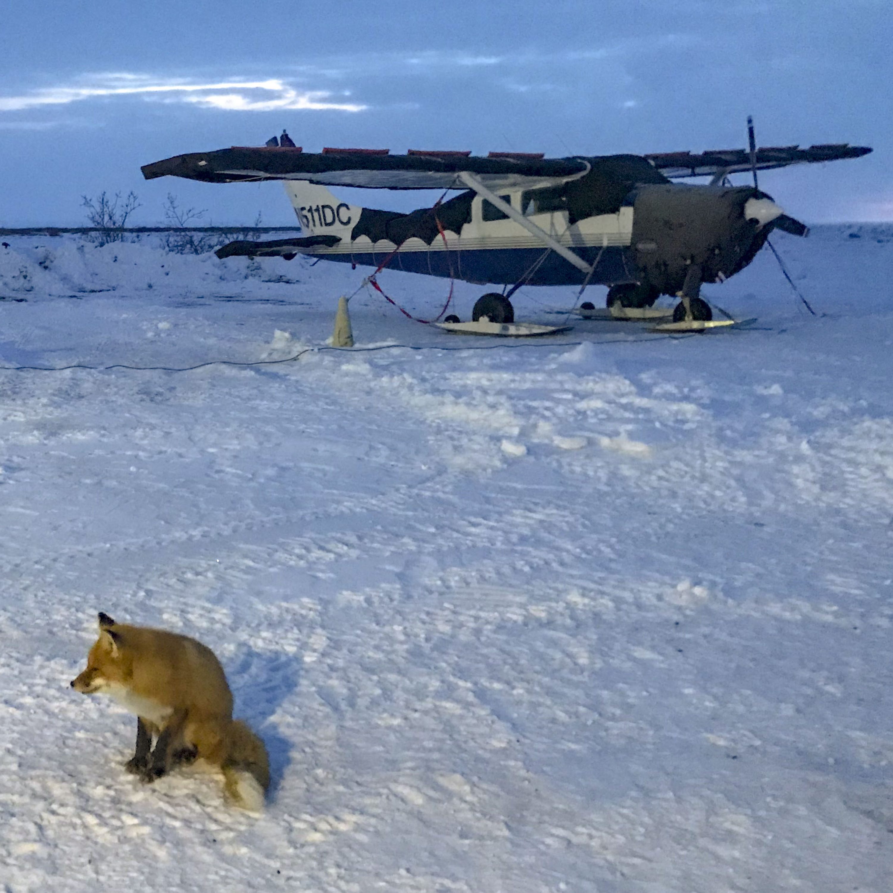
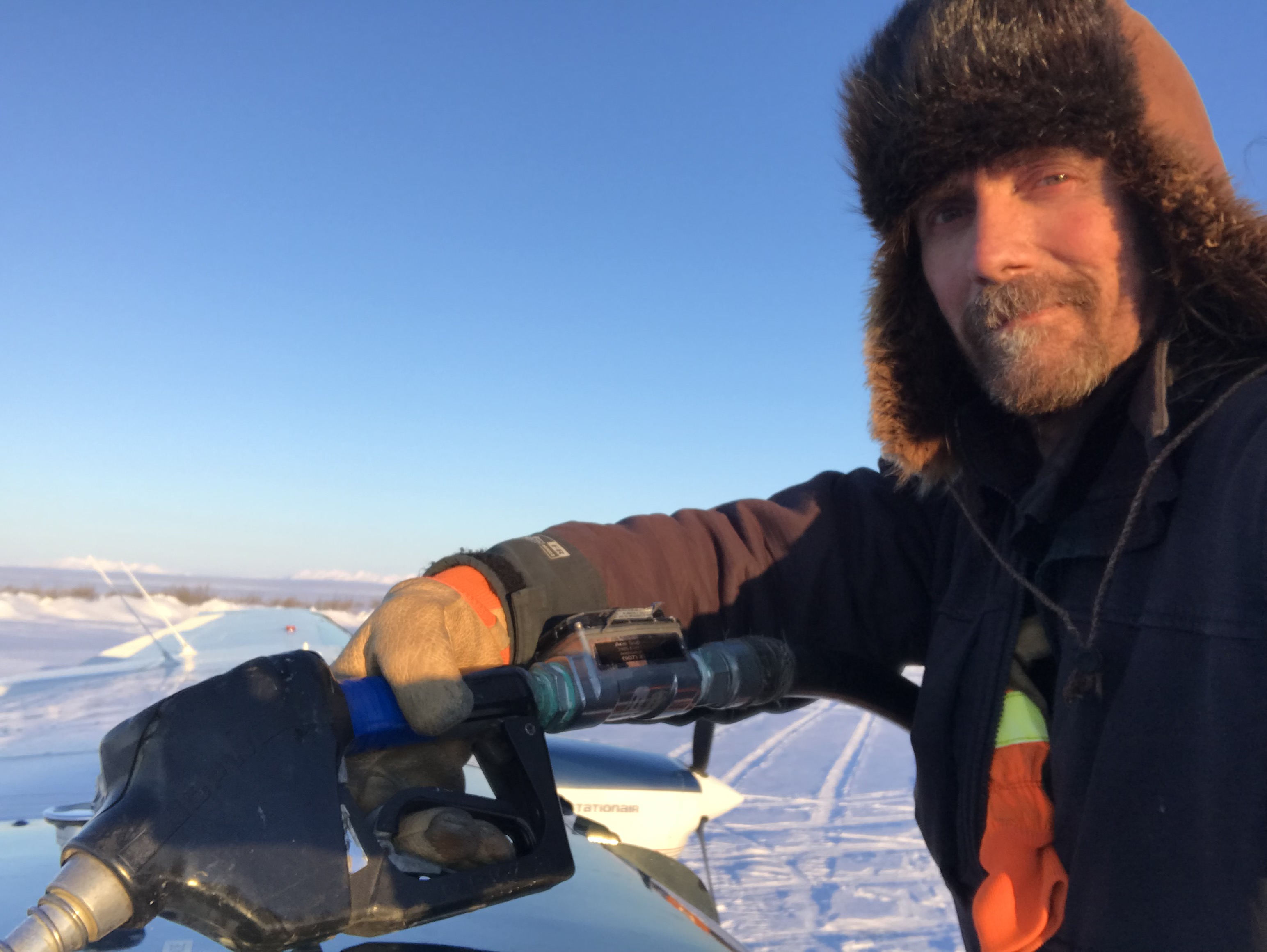
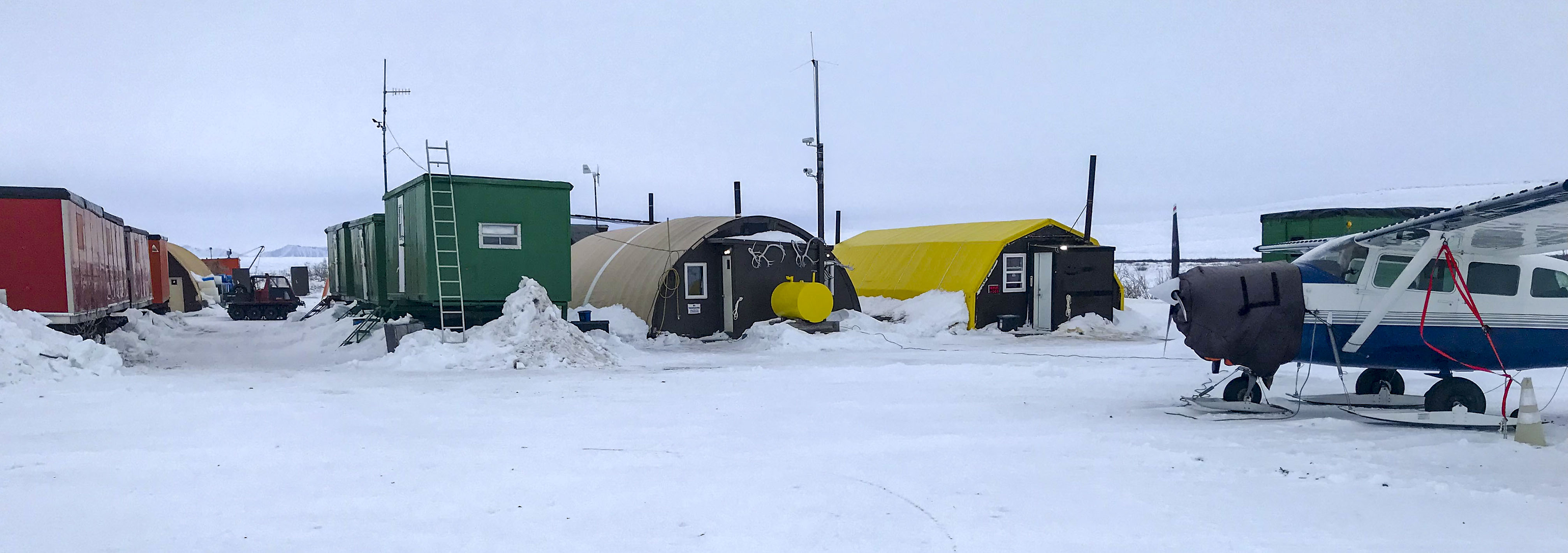
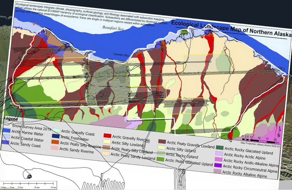
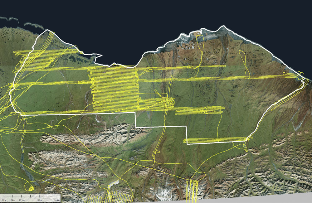
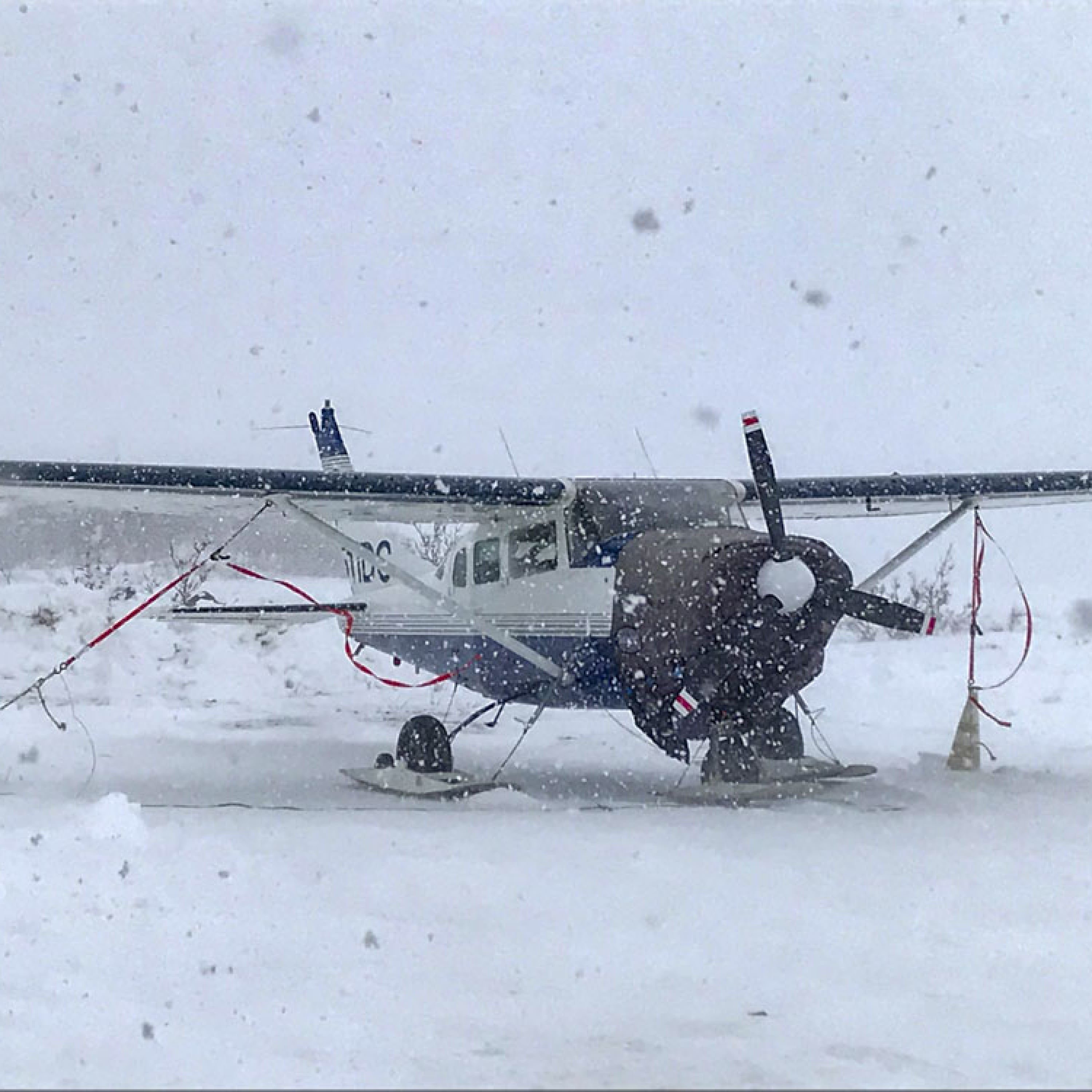
Between 27 March and 11 April 2019, I mapped a little over a third of the 1002 Area as well as large areas in the mountainous region that drains into it to determine snow thickness. I planned all of the missions, funded them myself, spent two weeks camped in a metal box on the tundra where nightime temperatures averaged about -15F, flew all of the missions myself using my Cessna 206, and will begin processing the data shortly. The technique I used is fodar, a photogrammetric technique that I have been developing and using since 2010; you can learn more about fodar on this website, but this recent blog gives a good summary of its history, its capabilities, and a variety of validation studies.
Plus no crowds in winter!
I’ve only just returned and have not fully processed any of these data, so it is impossible to give exact numbers, but roughly speaking:
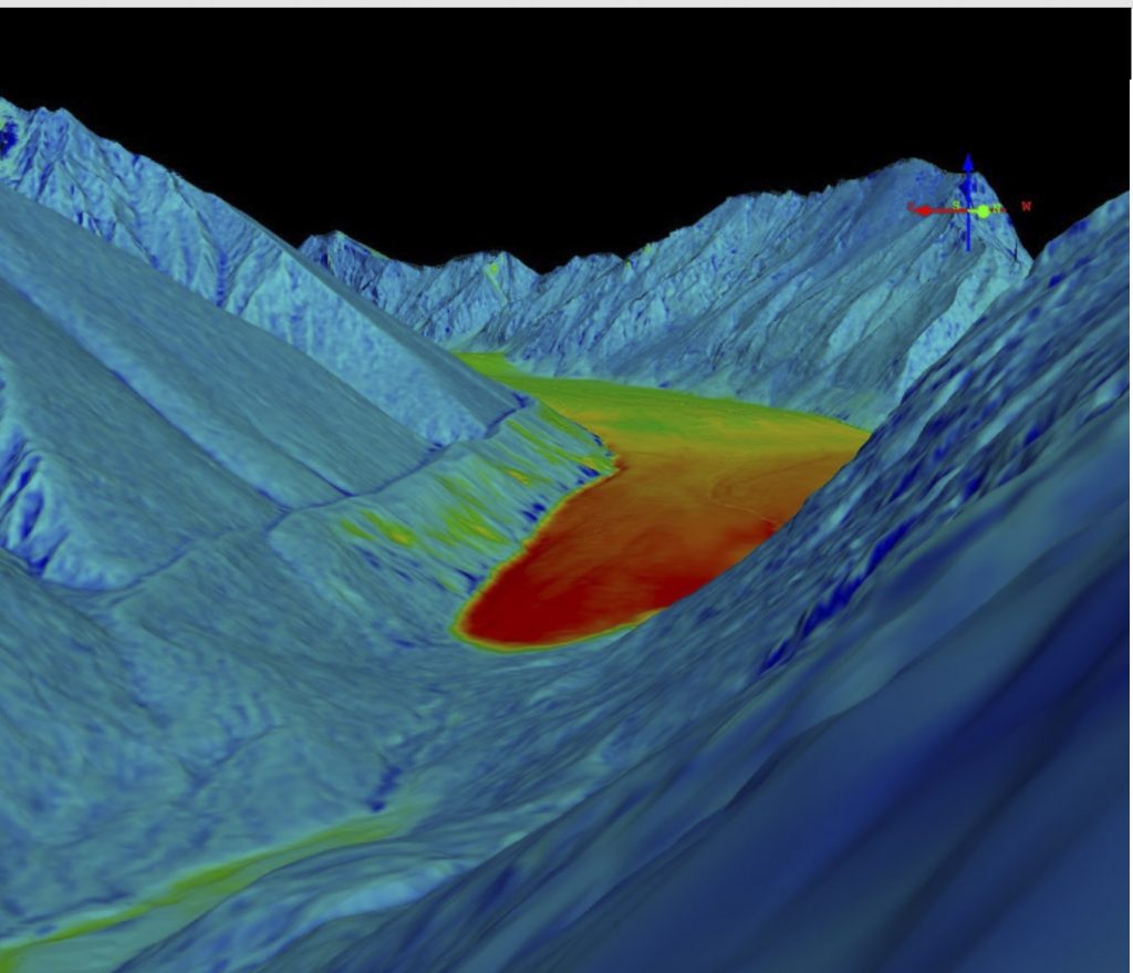
- I mapped about 2300 km2 of the 1002 Area at 12.5 cm resolution; I anticipate the accuracy of the snow thickness measurements made using these to be on the order of centimeters, as my previous work here has shown, exclusive of the confounding effects of shrub compression by snow.
- About 10% of that area I mapped 2-3 times to study temporal changes due to snow fall during my time there or to validate the data through repeat measurements
- I mapped about 140 km2 of rivers, including the Hulahula, Canning, and Aichillik, at 25 cm to compare to understand aufeis dynamics, identify polar bear denning habitat, and measure geomorphological change compared to previous measurements I’ve made there
- I mapped about 750 km2 of mountains just south of the 1002 Area, about 10% of this twice to assess short-term change. This area includes about 40-50 glaciers and mountain snow pack in some of all of the major rivers draining through the 1002 Area. It also includes the entire Lake Peters watershed, in which I have mapped snow cover annually since 2015.
- I mapped about 20 km2 of area in the Pt Thomson area to determine snow depth where overland seismic exploration occurred last year.
How does fodar map snow depth?
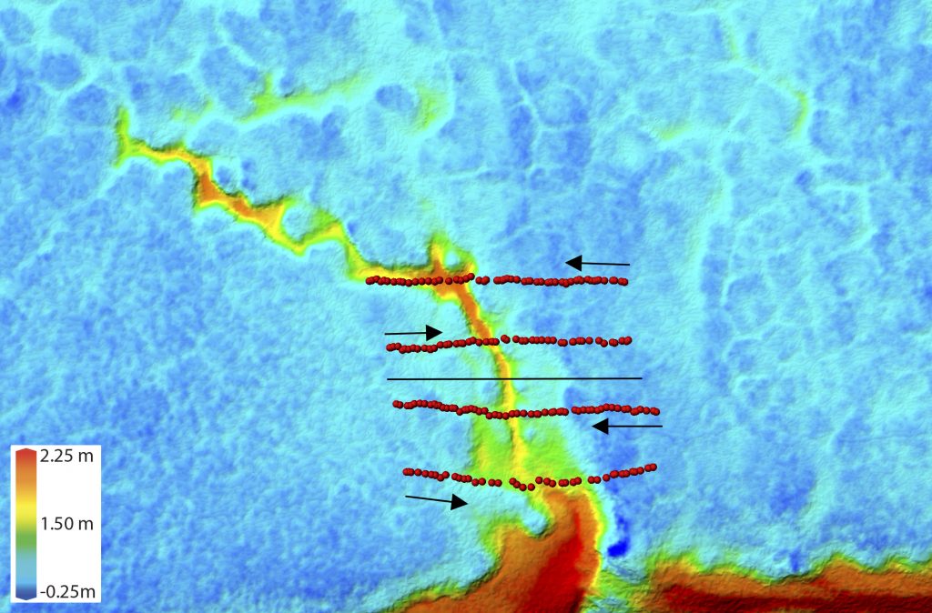
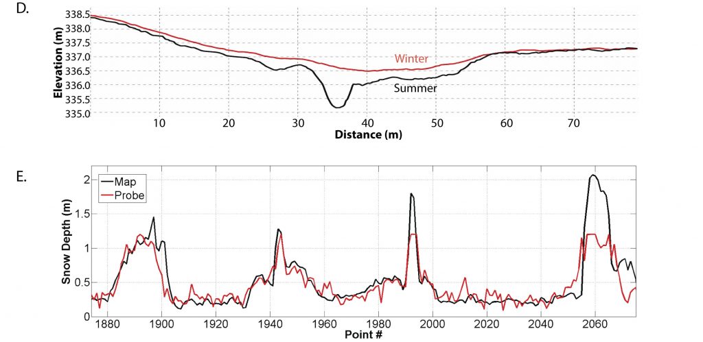
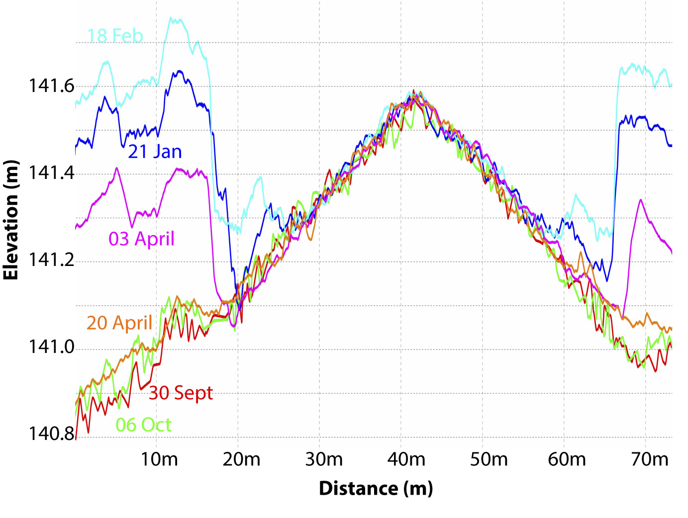
How do I map snow depth using fodar? The technique is fully described here, but in short it is simply a matter of subtracting summer topography from winter topography. As long as there are no shrubs getting smushed by the snow pack, the bulk of the difference between these two topographic maps is the seasonal snow cover. On this arctic tundra, there are few shrubs and the moss cover itself experiences little if any compression due to the thin snow cover. Indeed, across much of this area I could see the tops of tussoks, meaning that the snow was so thin the vegetation itself was not even covered and we don’t need a fancy technique like this as a simple photograph will do. In any case, I mapped the entire 1002 Area last summer so that I could measure snow depth in near real time this winter in case overland seismic work was approved this winter (which it was not) and I present some preliminary validations of that work here.
Why should we study snow and ice in the 1002 Area?
The Arctic NWR spends most of the year under a blanket of snow, so it’s no surprise that snow and ice play an important role in the ecology there. Less obvious though is the role that retreating glaciers play in bird and fish ecology or the role that plate tectonics plays in controlling snow thickness or attracting polar bears. Snow is also used by industry as a layer of protection to prevent their heavy trucks from creating permanent ruts in the fragile permafrost terrain — for the first time in 35 years industry has the opportunity to drive such vehicles here and is planning to do so next winter, yet all of the evidence we have on snow cover so far indicates that snow cover here is not sufficient to support their goals. Melting snow and ice also provide most of the liquid water in the area, also critical for ecological and industrial needs. So one way or another, snow and ice are central to every aspect of ecology and land use in the 1002 Area.
During various glacial cycles over the past 1.5 million years, glaciers here extended far out of the mountains onto the hilly topography in view of the Arctic Ocean, but they reached their maximum position for the past few thousand years sometime in the late 1800s. Since then they have been retreating steadily as evidenced by repeat photography since 1907 and our formal glacial research in the area since 1957. Alpine glaciers like these retreat when accumulation of snow in winter does not balance the ice melt in summer – it works much like your bank account, spend more than you make and you have to draw from savings to make up the difference. But at some point your savings runs out and your glacier disappears completely.
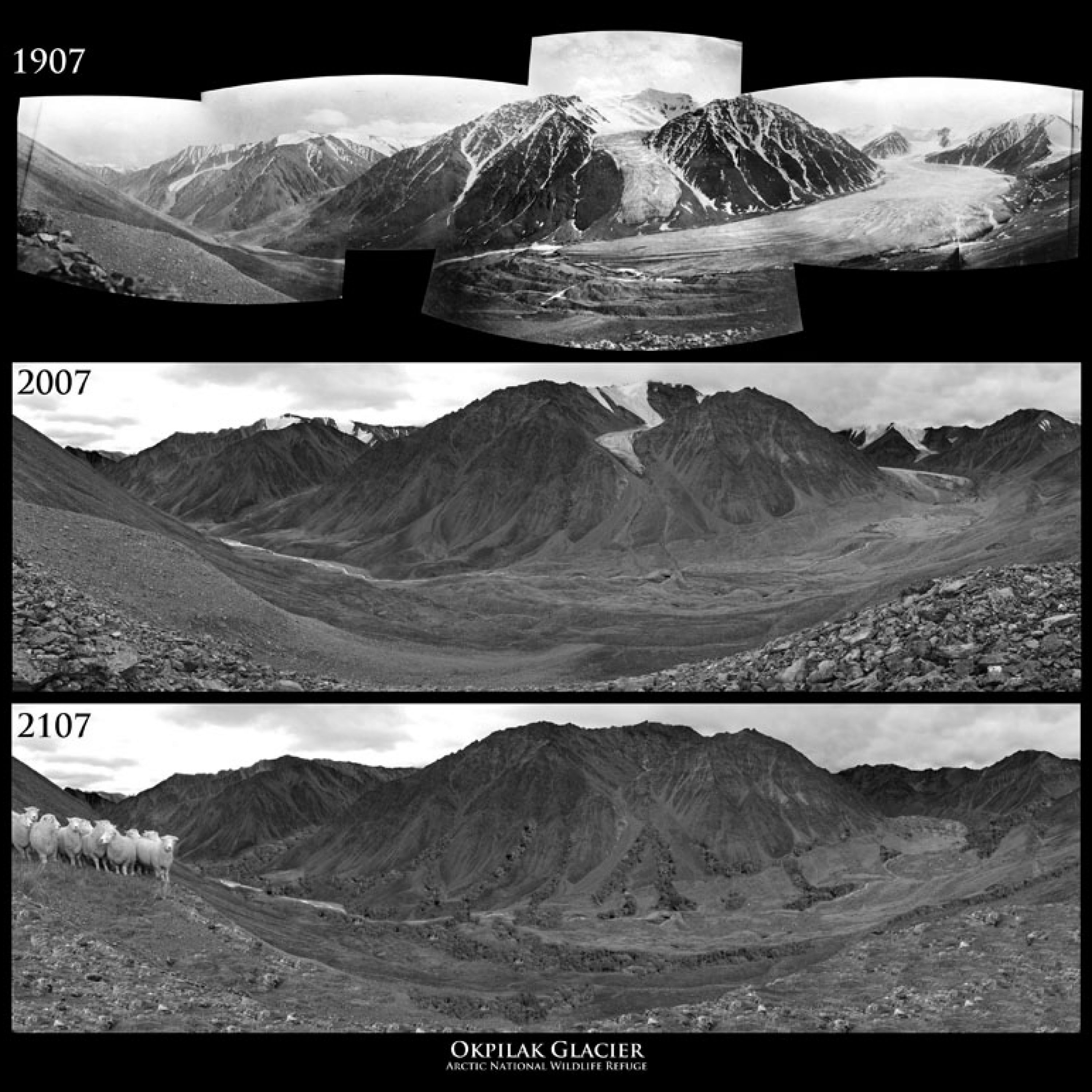
How do glacier fluctations exert controls birds and fish ecology here? The glaciers discharge not only melt water but also sediments ground up at the base of the glaciers. This meltwater and sediment flows through the rivers to the Arctic Ocean, where it forms the largest deltas on the Alaskan Arctic Ocean coast. These deltas are home to tens of thousands of migratory birds which preferentially come to these freshwater deltas because they are not only large but host a stable, abundant, freshwater inverterbrate ecosystem (that is, lots of tasty food!), features lacking in the salty, marine deltas to the west. But the deltas are being constantly eroded by the ocean, so they too behave like your bank account – if the glacial sediment supply is less than the ocean erosion, the deltas will have to spend from savings and shrink. Thus as the glaciers continue to disappear, so will the deltas, and presumably so will the birds. Similarly, the Dolly Varden fish that return from the sea each year here do so only on the Hulahula River. Why? Among several reasons this small river is kept open by glacier meltwater during summer, unlike many of the larger rivers to the west which dry up in summer as they are only kept open by the limited summer rainfall in their catchments. So for the past 150 years, these small glacial rivers have been getting larger because it is not only the annual precipitation that flow through them but also increasing amounts of glacial meltwater from storage. But at some point as the glaciers dwindle away, the rivers will get smaller and eventually mimic the dynamics of today’s non-glacial rivers, decreasing the chances of anadromous fish runs from continuing. Of course these birds and fish are staples of a subsistence diet for locals in the area, so their ability to forage in this way is also threatened by the loss of glaciers. You can learn more about the glacier-ecosystem dynamics in a paper we wrote in 2011, but the general idea is that glaciers exert a primary control on ecology in the 1002 Area and their loss will impact that ecology.
How does plate tectonics control snow depth here? The eastern Brooks Range is the most tectonically active part of northern Alaska and even a quick look at a map will reveal that the mountains here have been pushed quite close to the coast, buckling and rumpling the 20-40 miles of the 1002 Area in between them. The dominant winds here flow east or west, as high and low pressures vie for dominance. To the east and west, there is plenty of room for these winds to spread out over the large flat ground, but the eastern Brooks Range gets in the way and funnels these winds over the narrow strip of land between them and Arctic Ocean — the lumpy 1002 Area. This lumpiness combined with the channelized wind leads to increased wind scour, such that much of this area is snow free even at the end of winter when the snow pack should be at its maximum. On top of this, because the mountains are so far north here it means winds from the south can more easily find their way to the 1002 Area as well – I have watched these warm, strong winds many times in my 16 years out here, they can blow over 100 mph due north in the mountains, scouring winter snow packs down to bare ice or ground in only a few hours, leaving entire valleys like the Hulahula River bare of snow at any time during winter.
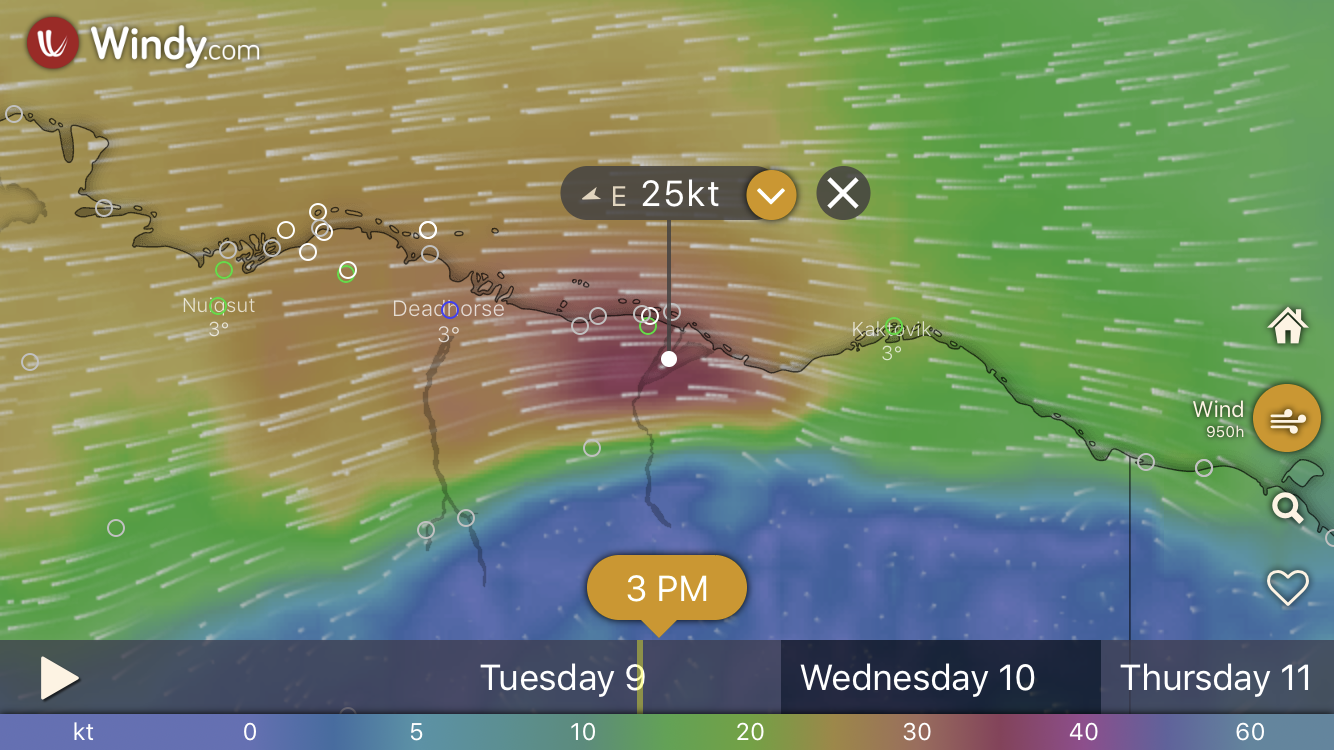
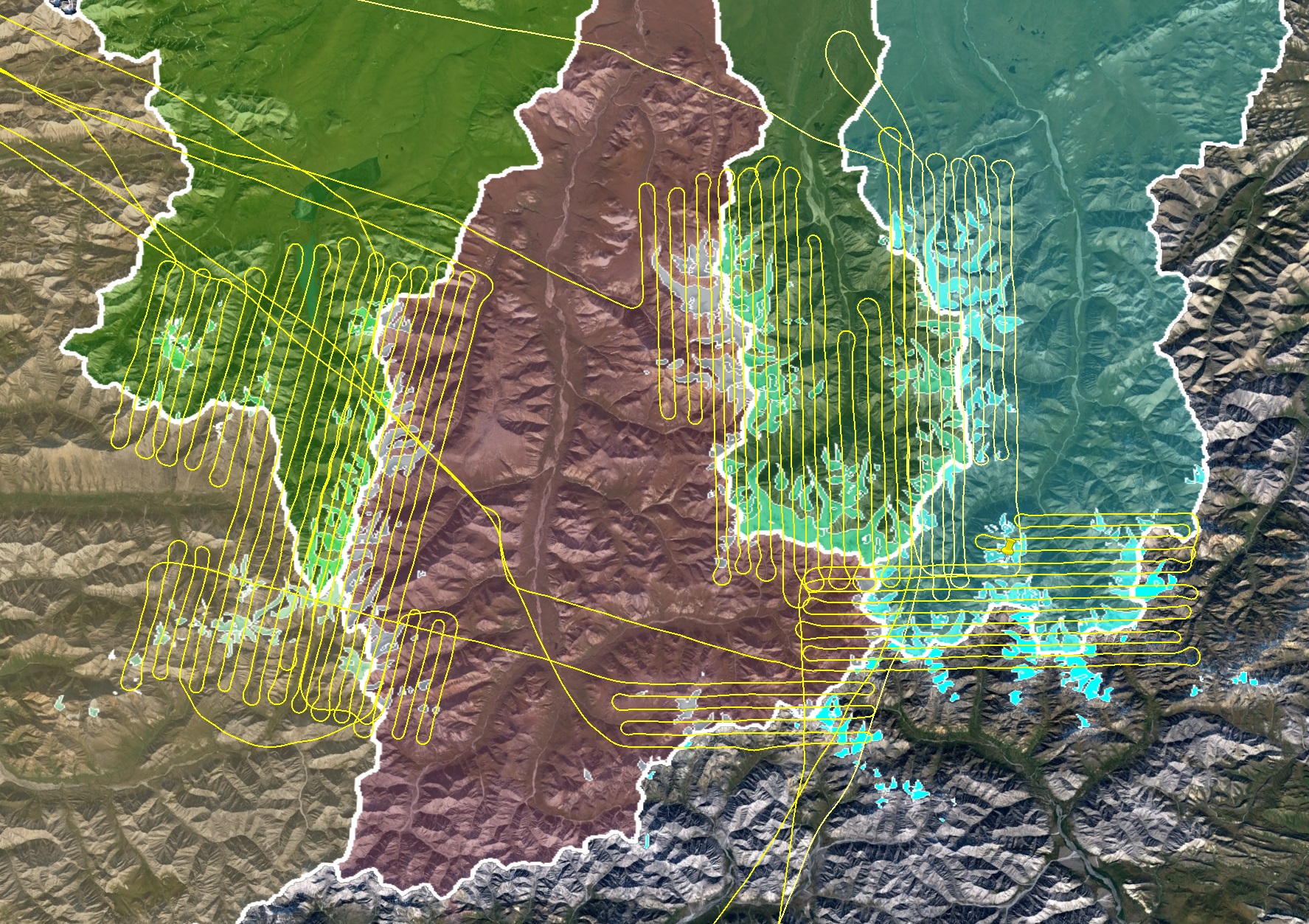
I took this screenshot on my phone while I was out there, as it demonstrates the funneling affect the mountains have on surface winds in the 1002 Area, as seen here (the pushpin is over the Canning River). The Camden Bay area gets hit hardest whether winds come from the east or west because they have to pass over it.
In our first expedition to McCall Glacier in 2003, we got caught in 100 mph winds from the south while traveling on the glacier back to camp. The winds were warm and posed no threats of frostbite, but were strong enough to lift us up and toss us onto the ground. If you watch closely you can see the snow being deposited and scoured on Kristin’s skis ahead of me several times, and to the upper left of the other skiers you can see that the late-winter snow pack has already been scoured down to bare ice (dark grey color); by the end of the storm this whole region of the glacier was completely scoured. These winds occur several times per year here and can scour the major north-south valleys like the Hulahula River down to bare ground at any time of winter. They occur, in part, because this is the closest connection between the inland continental air masses and the ocean air passes, due to how plate tectonics has pushed the eastern Brooks Range so far north here. Note too that this is digital video from 2003 when 1 megapixel images were the rage, problematic enough back then without trying to use it in a blizzard while skiing with a backpack filled with science gear!
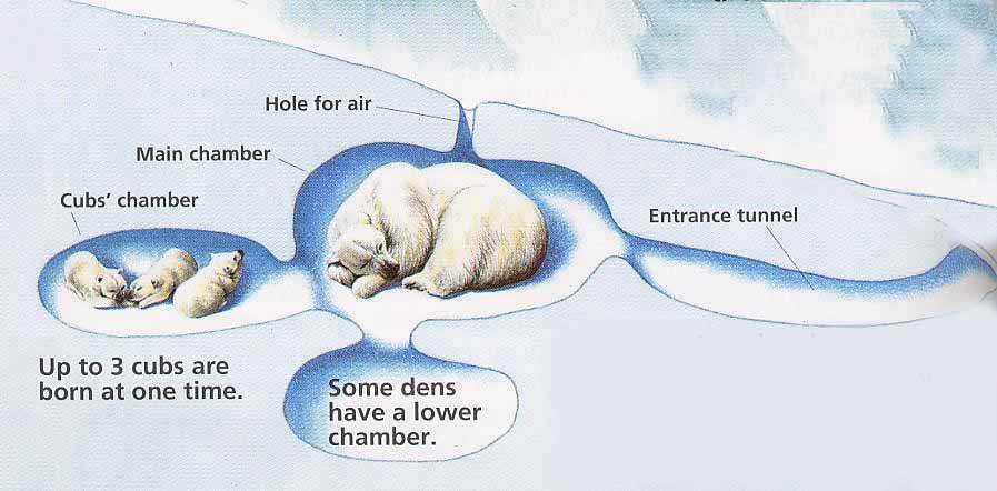
Over the millenia, polar bears have become wise to how special the snow is within the 1002 Area as well, with about 1/4 of the entire southern Beaufort Sea population of polar bears denning within this tiny part of their range. As you saw in the fodar examples above, the conspiracy between lumpy topography and strong winds instigated by plate tectonics creates a stable habitat for their winter dens — snow drifts. The drifts are formed where the wind slows down, which is on the lee side of obstructions or ditches or cut banks and the 1002 Area has a higher concentration of these than any other coastal location in the US Arctic. You can learn a lot more about the dynamics of polar bear denning in this paper, but in short they need suitable snow thickness for denning and they find it reliably in the 1002 Area. One of the major concerns for the proposed overland seismic work described below is that these dens are hard to find, even experts have only a 50% success rate, so with a grid of 200 m by 200 m with trails each 10-30 m wide, it is virtually guarranteed that the trucks will run over one or more of these dens or disturb them enough to affect cub mortality, and these guys have already lost half their population likely due to lower cub mortality since the 1980s. You can read the details of these concerns from one of the world’s leading polar bear experts here.
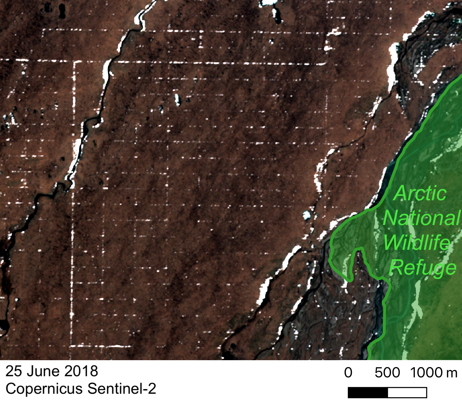
In December 2018, a federal law was passed to allow oil development within this formerly protected area, and this is largely what prompted me to map summer and winter topography here over the past year out of my own pocket — the necessary scientific studies needed to develop this area responsibly had not been done and no one seemed that interested in funding them before granting massive unfettered industrial access to this terrain. Indeed, the BLM, who had been placed in charge of managing this development effort, stated that there would be no significant impacts caused by the seismic work here so they waived the process of an Environmental Impact Statement to evaluate the impacts of driving dozens of heavy vehicles including a hotel for 300 people over a 200 m by 200 m grid network totaling over 40,000 miles of trail over this new terrain — terrain which still has not recovered from the last time such work was allowed (on a much more limited basis) in 1984-85. Many of us scientists have tried to educate the powers-that-be about the dangers of moving forward on such a large scale without the necessary scientific background studies guiding the process responsibly, including our paper on the physical impacts and Dr. Steve Amstrup’s on the polar bear impacts. I was able to see and measure the impacts of 2018 seismic work adjacent to the refuge not only immediately afterwards but I could also see every single lines visually from the air even after the end of summer, and shared these observations in detail in my blogs so that anyone interested could see what I saw (for example, see the late-summer images in the last section of this blog). Maybe these contributions did some good, or maybe it was just the government shut down in winter, but for whatever reasons the seismic work was not approved as planned for this winter, though it is still on the table for next winter and thus still a major concern for scientists as there is still no coordinated scientific effort to evaluate the potential impacts of this work, a process that will take several years anyway to accumulate the necessary information on the inter-annual variability of snow cover among many other environmental and ecological variables. Of all of the environmental studies that need to be done for responsible development, snow cover distribution is arguably the most important, as we already know that much of this area never meets the minimums allowed by the State for overland travel further west. As an example for polar bears, consider that in high snow years (good for seismic) the range of suitable polar bear denning habitat is much larger (bad for seismic), and in low snow years polar bear dens are more isolated and thus easier to identify (good for seismic) but the surrounding tundra is likely to be even more free of snow than normal (bad for seismic). One way or another, this method of seismic using thumper trucks is all wrapped around snow cover. But this method is not the only way to conduct this work, as I describe towards the end of this blog.
The important take home messages here are that 1) snow and ice play an important role in the ecology here, 2) snow and ice distribution here is different than the rest of the US Arctic, and 3) snow distribution in the 1002 Area is poorly studied but we already know much of it is perennially too thin to support the proposed seismic methods. Other than my own long-term glacier studies in the mountains to the south and a few ad hoc snow measurements that I and others have made over the years within the 1002 Area, there are no long term measurements suitable for understanding the distribution and temporal variability of snow within the 1002 Area. Thus given the scientific need and uncertainty, this winter I attempted the most ambitious measurement of snow depth by far — mapping snow depth of over 2000 km2 (about 1/3) of the 1002 Area at about 5″ resolution. Next I address how we can put these data to good use and outline some plans for the future.
What are the next steps?
Obviously the dynamics of snow and ice in the Arctic NWR have been on my mind for a while, and I’m hoping by now that I’ve demonstrated both that we still have a lot to learn about this place and that we have new tools now which we can use to educate ourselves. Here are a few key questions that I think need to be addressed before any further discussions of responsible oil development in the 1002 Area can occur, along with my hopes and dreams for answering them today and in the future. There are of course many more questions that should be addressed, these are just a few on my mind that I think I can contribute to in a meaningful way in the short term.
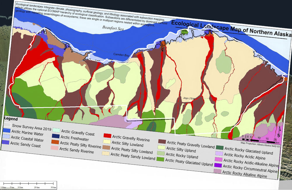
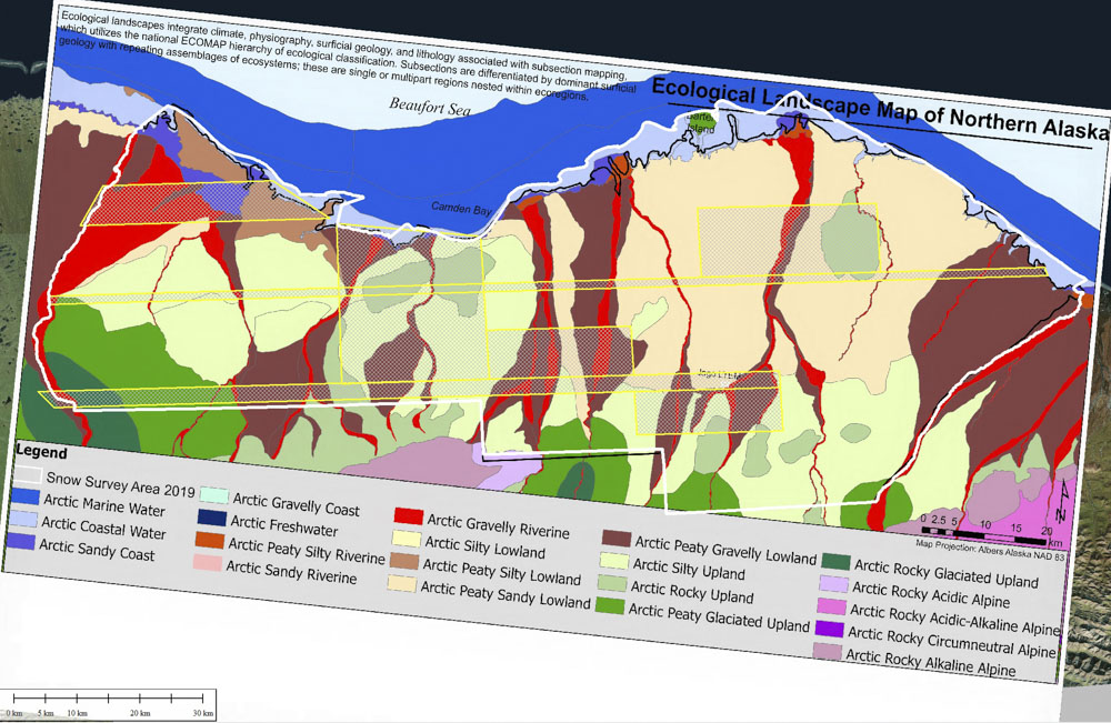
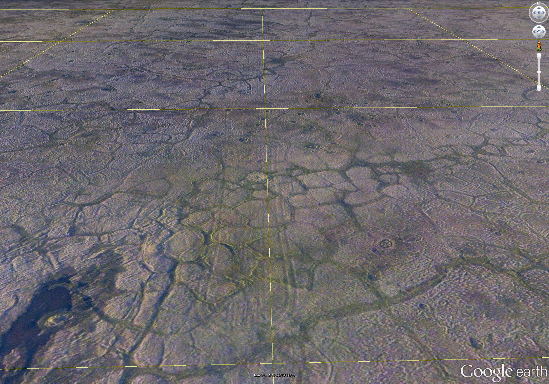
- What is the shape of the 1002 Area at resolution of ice wedges and tussoks, which of the ecological landscape units are most sensitive to small topographic disturbances on the centimeter scale, and what is it’s snow cover?
- Today: I’ve acquired the entire 6000 km2 of the 1002 Area last summer at 12.5 cm resolution and about a third of it this winter while still covered with snow. My goal is to process these data over the next few months and publicly release them all on the next 10/02 Day, though in the meantime I hope to share what I have ready with those that need it most.
- Future: While I acquired these data out of pocket, it is my hope not to release them that way. A coalition of end-users (including NGOs, private, government, and industry) is forming to purchase these data for public release, covering my costs for acquisition, processing, and analysis, as well as keeping me afloat and available to do more work like this out-of-pocket when the situation calls for it. The sooner that comes together, the more time I can devote to data processing and analysis, rather than trying to make a living in ways which unavoidably detract from those goals. If you are interested in joining this coalition, please contact me.
- Where can the minimum standards for snow cover for non-destructive overland travel reliably be met within the 1002 Area?
- Today: With my summer and winter maps in hand, we can now answer this question for about 1/3 of the 1002 Area for 2019, which is a great start. My informal observations over the years suggest to me that patterns of snow distribution are fairly stable year to year, but this remains to be tested.
- Future: We need annual maps of late-winter snow cover of the entire 1002 Area for at least 3 years. Some field measurements of density, hardness, and load bearing strength should accompany these maps.
- Are the minimum standards for snow cover for non-destructive overland travel sufficient in the 1002 Area?
- Today: I have in hand maps I made in June, July, and August of the Pt Thomson seismic exploration work done in February 2018 using the same methods proposed in the Arctic NWR. I have only done preliminary analyses of these, so there is more left to do. This area is not particularly representative of the 1002 Area, but it’s a start.
- Future: This summer we can map the Pt Thomson seismic area again throughout the snow-free season, as well as expand to other recent seismic areas, to begin systematic studies of impacts of actual seismic exploration on arctic permafrost using modern means as a function of ecological landscape units, something which surprisingly seems to have never been done before given the volume of claims that these methods have no impacts.
- Where are polar bear dens most likely within the 1002 Area?
- Today: With this winter’s snow depth map, especially the large block in the Camden Bay area, we will be able to make the most detailed map of suitable denning sites ever made using real snow data and perhaps even locate some of them directly from the imagery.
- Future: Though I captured much of the snow area, including many of the largest river banks, a complete map of denning probability is needed, but fortunately is something that will fall out of a project to understand the inter-annual variability of snow cover described above.
- Given likely climate trends for the next few decades, when should we expect glacier meltwater and sediment supply to peak and begin adversely affecting current ecological trends for birds and fish and how might oil development exacerbate that trend or confuse the study of it?
- Today: I have an enormous backlog of data from my 16 years studying McCall Glacier, which drains into the 1002 Area, including the most robust time-series of glacier surface elevation change over time of any arctic glacier (probably any valley glacier in the world), along with corresponding annual/seasonal mass balance data, and tons of local weather measurements. I’ve also mapped all of the glaciers here many times, so I can extrapolate our field studies to the entire eastern Brooks Range to understand how these dynamics impact the 1002 Area ecology. I need six months with a clear schedule to reduce, analyze and publish these data in a series of papers, but have been struggling to find that time with all this 1002 work.
- Future: We all understand the value of baseline data in terms of detecting trends, but I’ve been collecting those baseline data out of pocket for the past 4 years and it’s taking a toll on the science. I’ve greatly simplified the research program on McCall Glacier to reduce cost and time commitment, but maintaining any program up there is almost a full time job equivalent if done well, and not without expense. I will continue to keep it going for as long as I can, but I recognize that I (and my finances) am a single point of failure in terms of the sustainability of this program and I am open to any ideas on partnership or support.
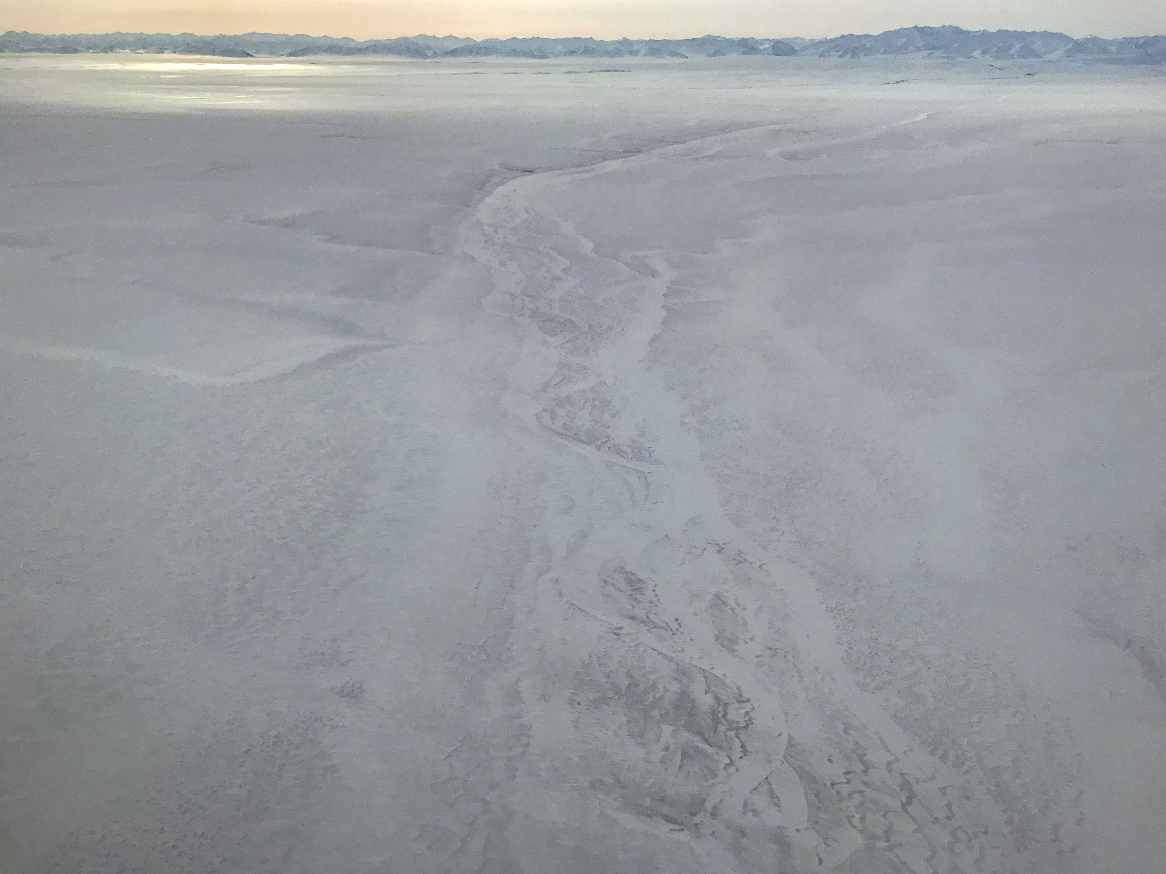
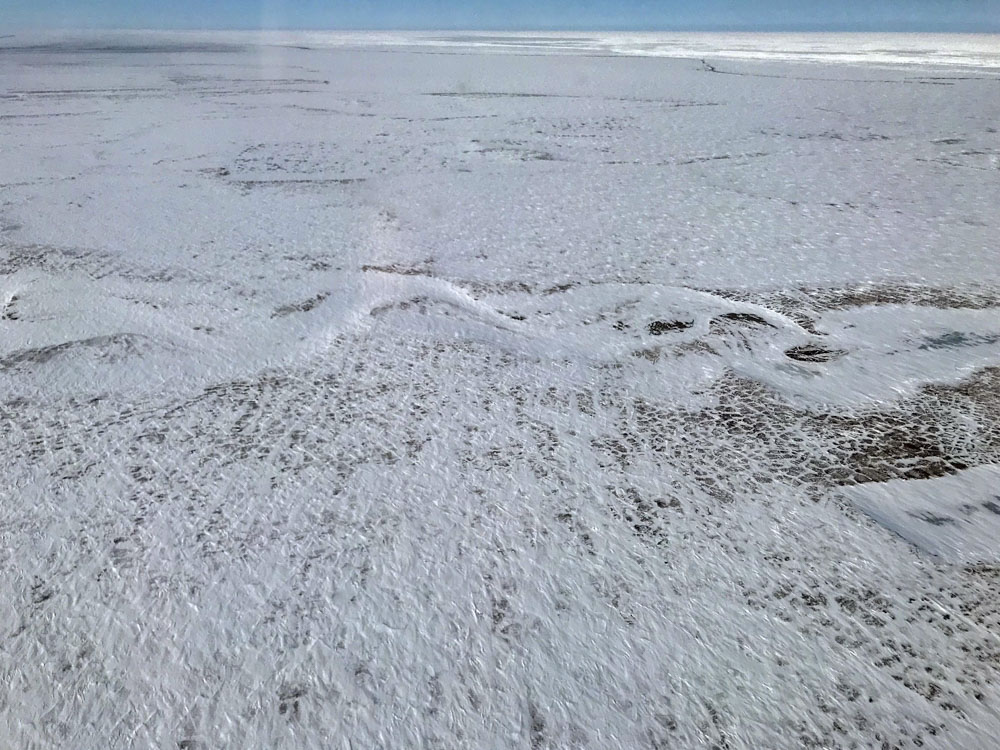
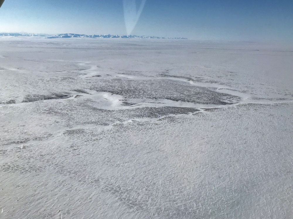
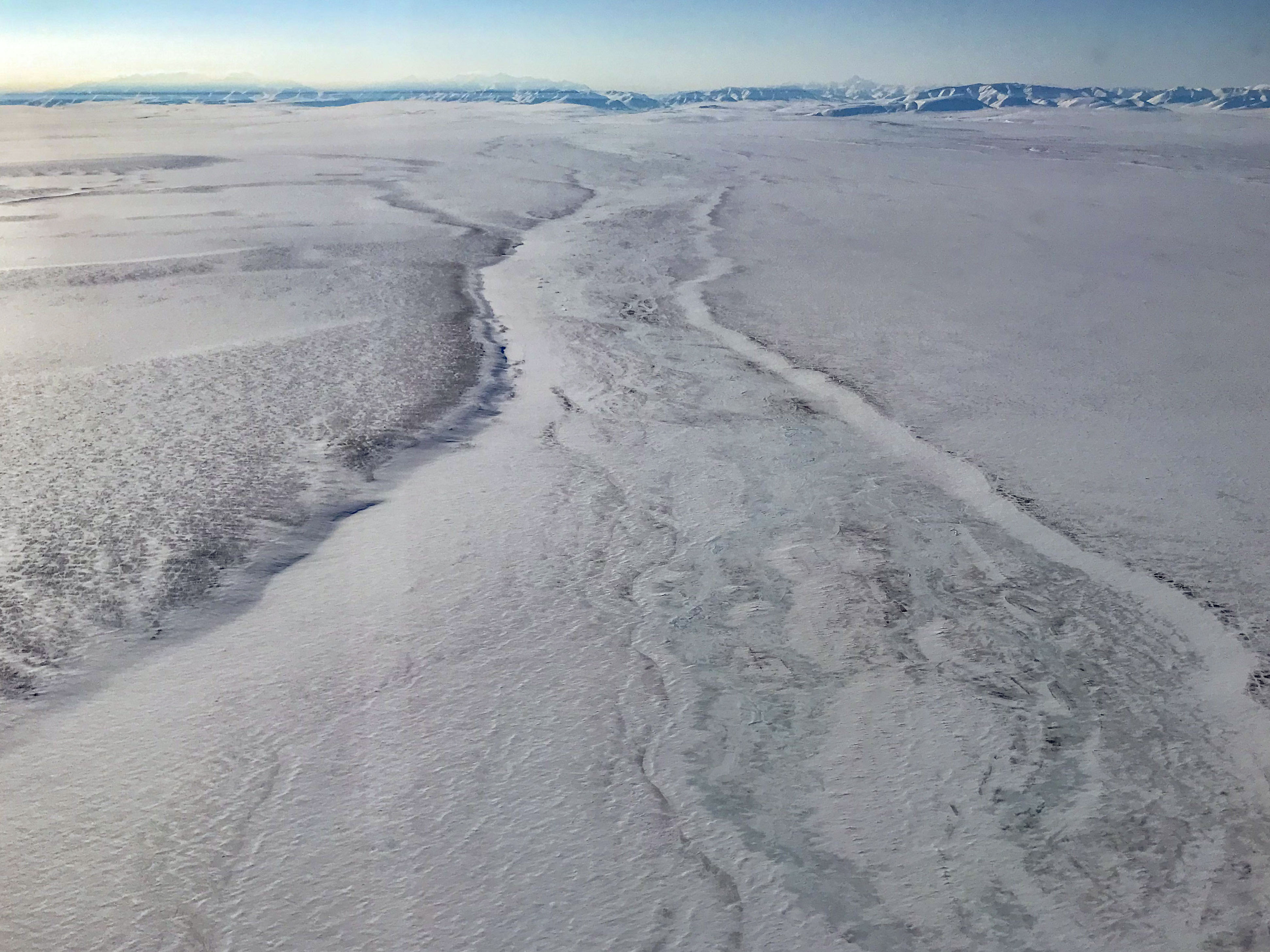
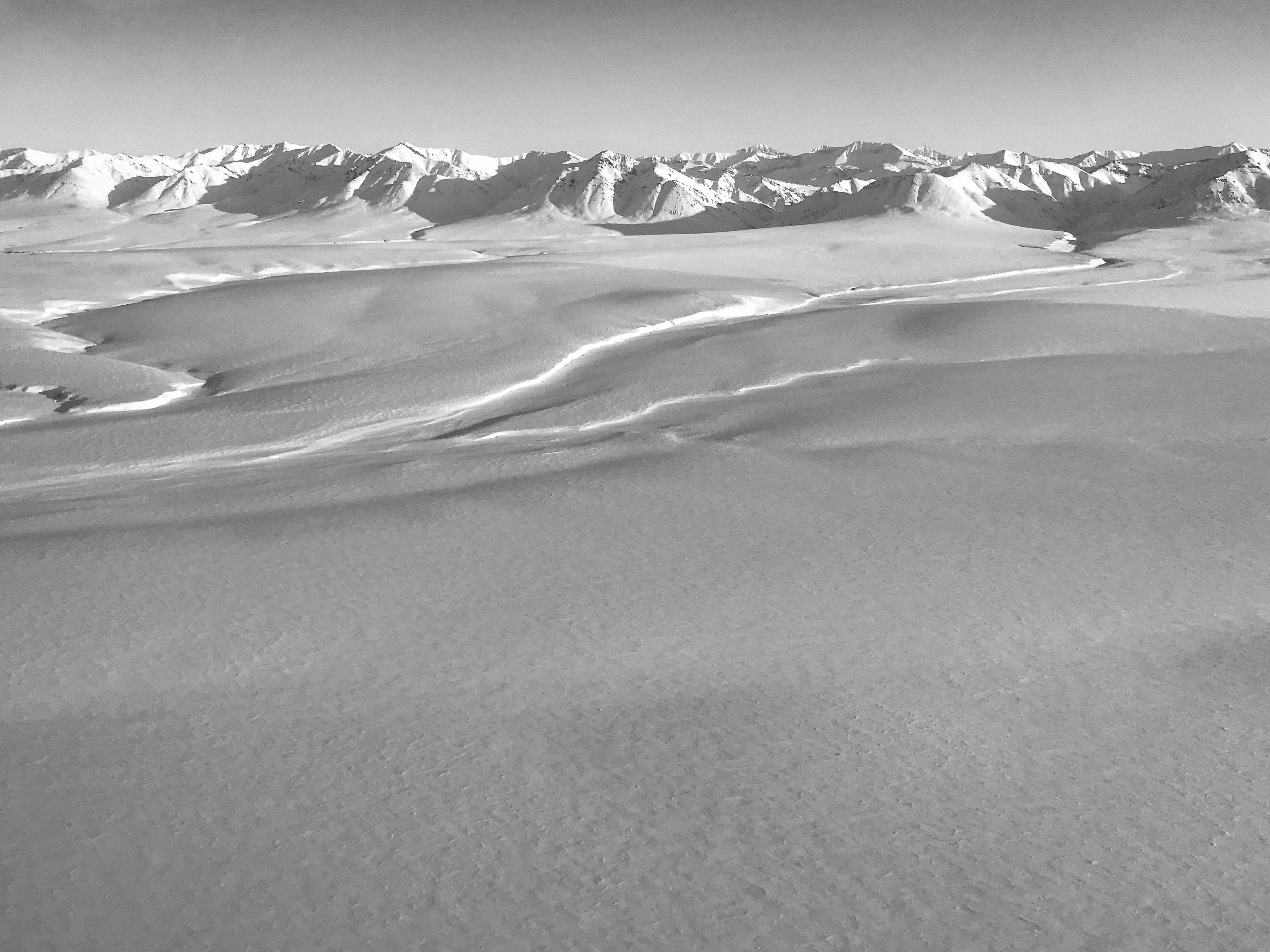
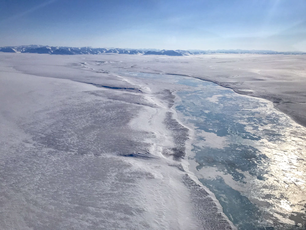
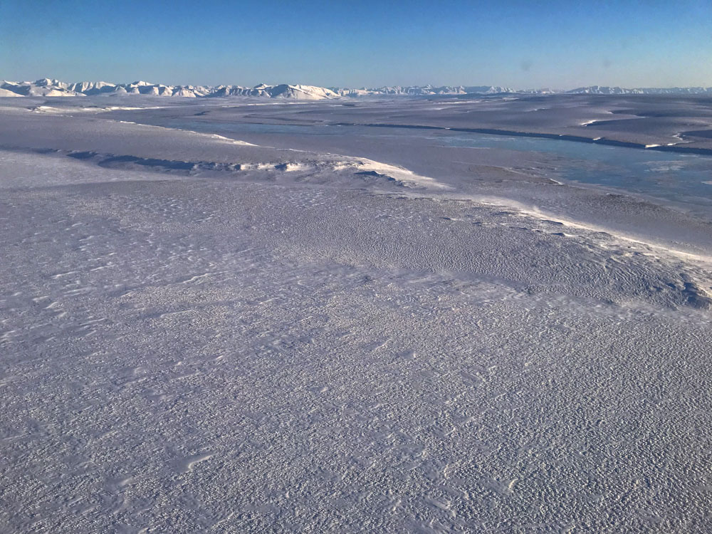
Oblique Photos
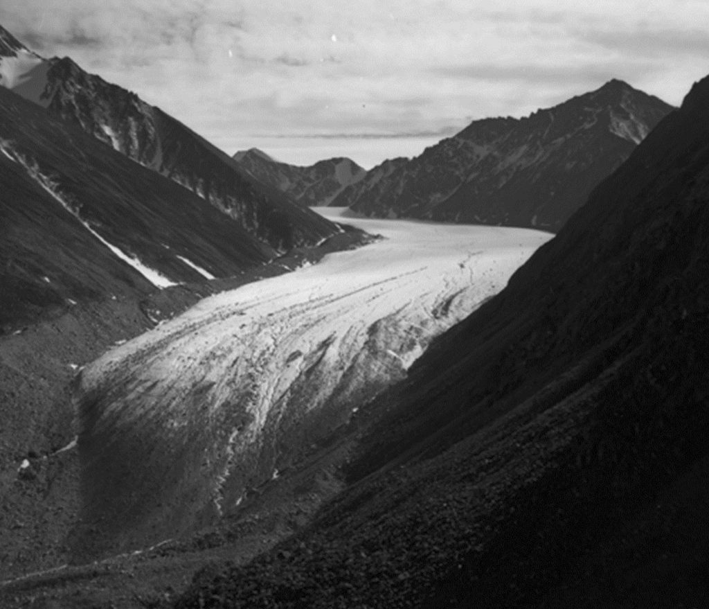
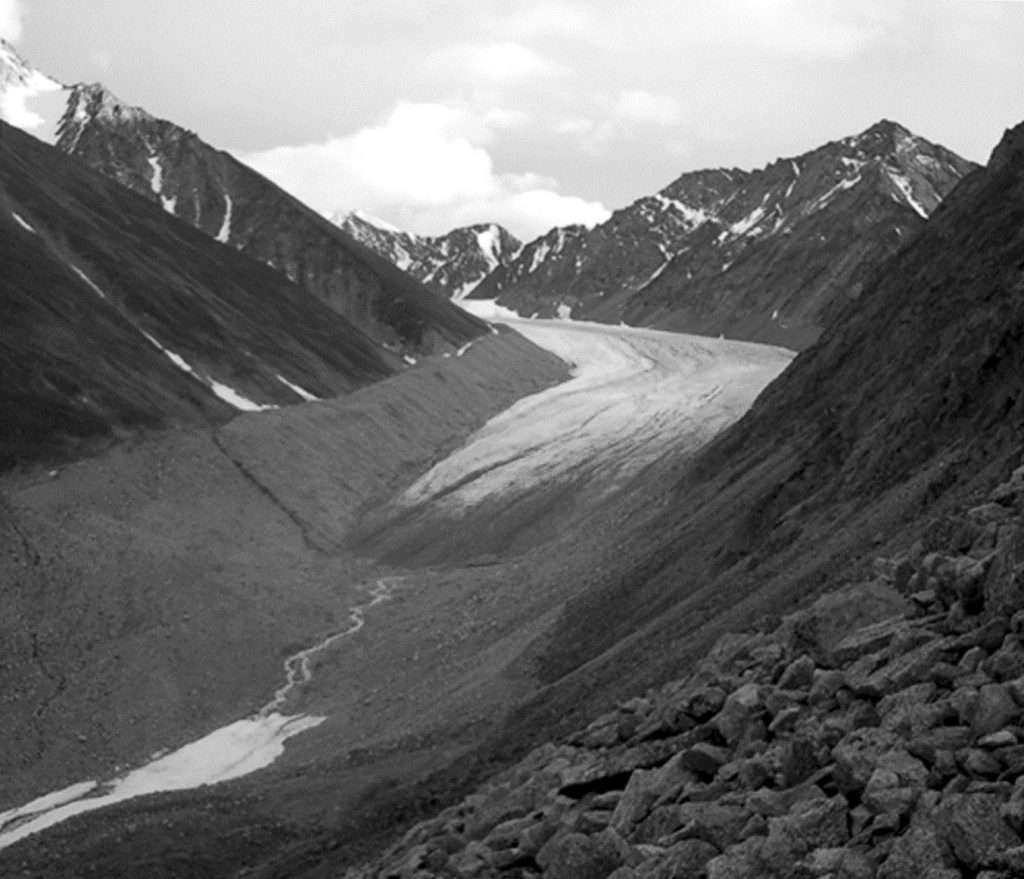
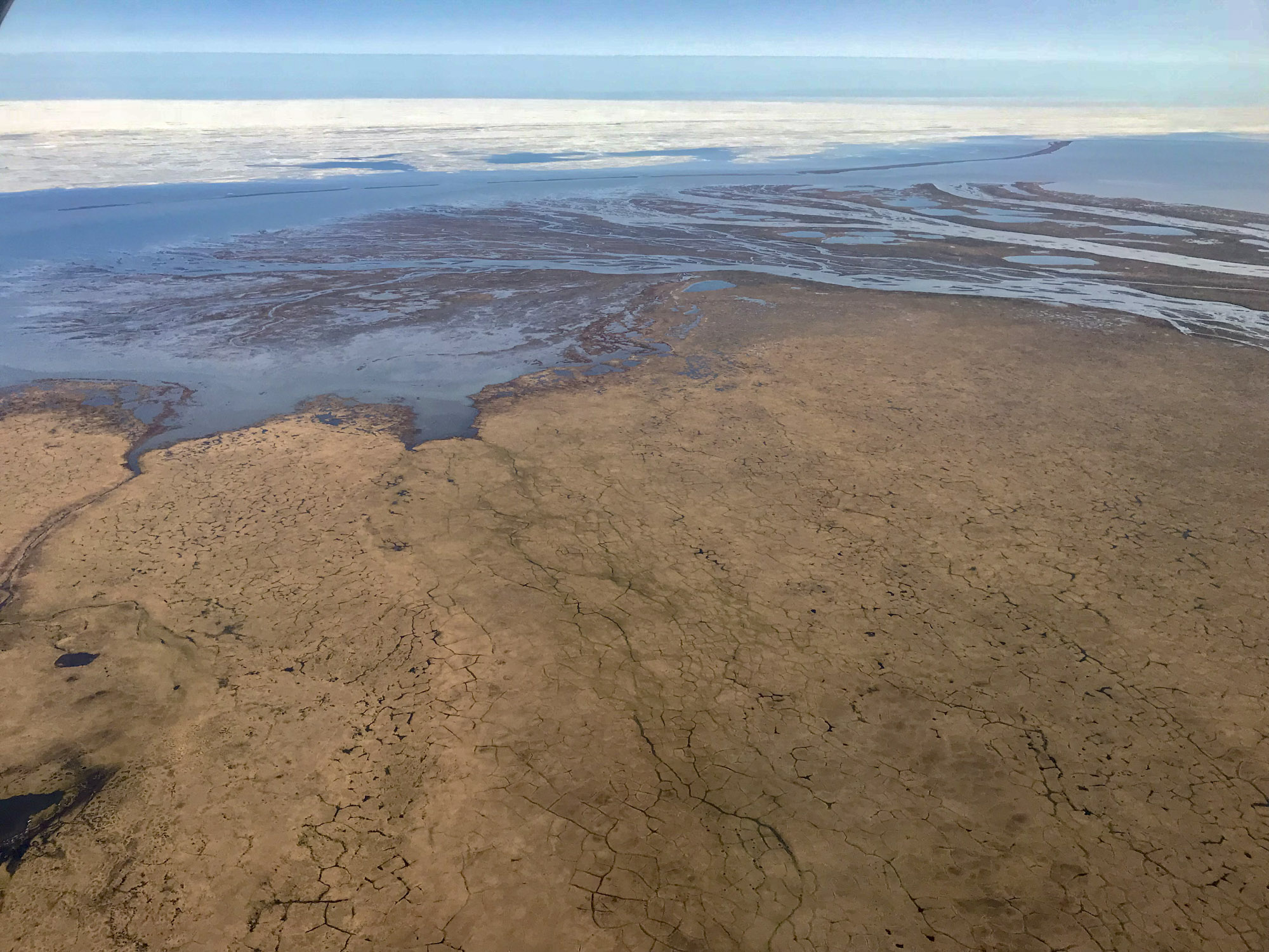
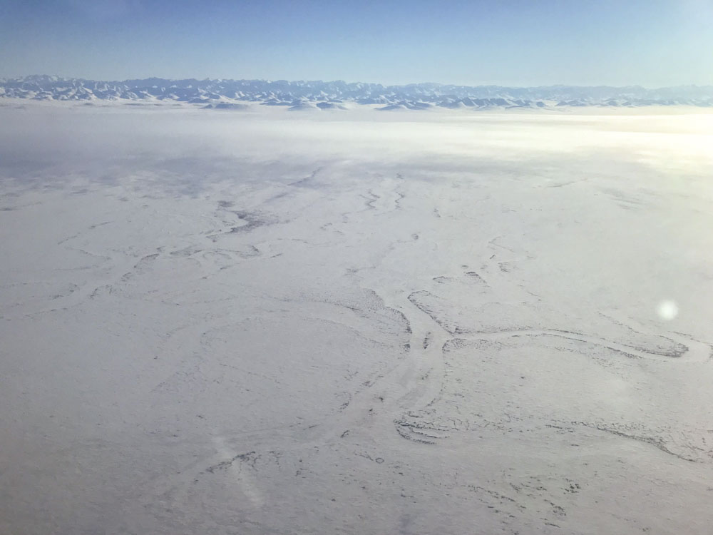
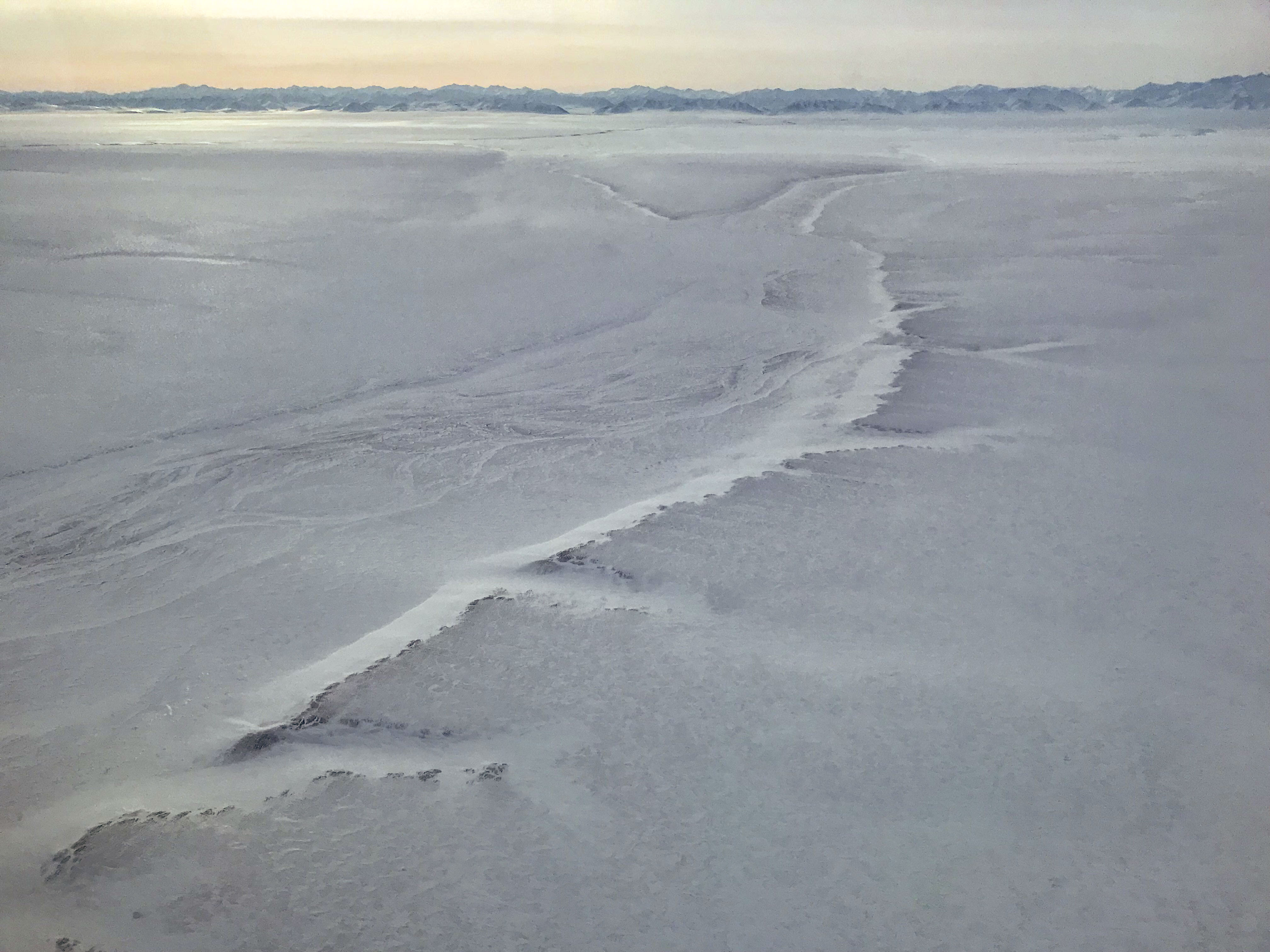
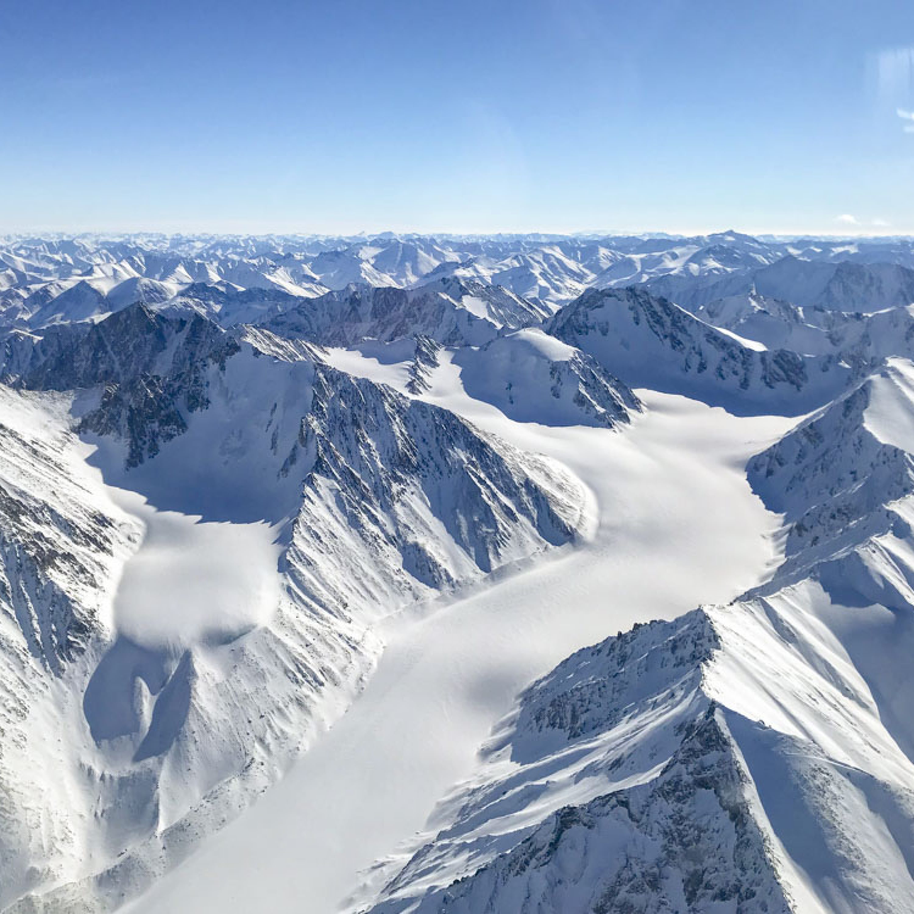
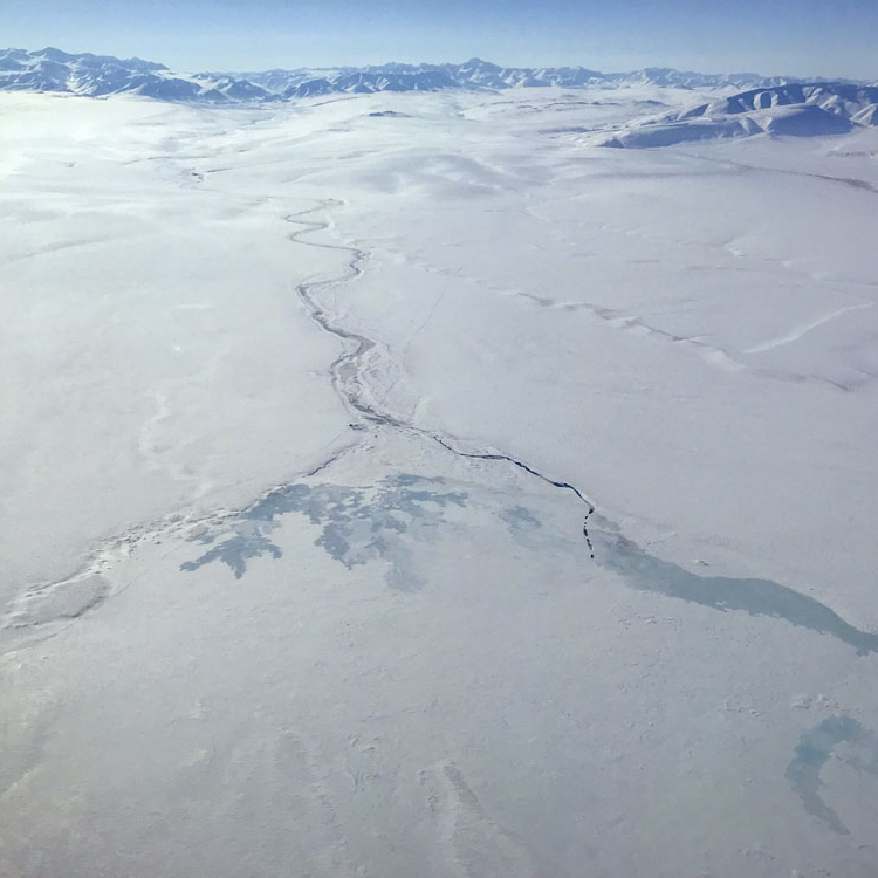
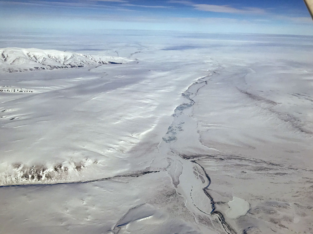
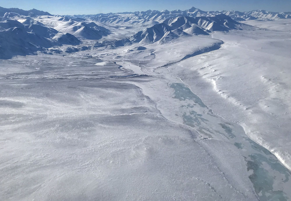
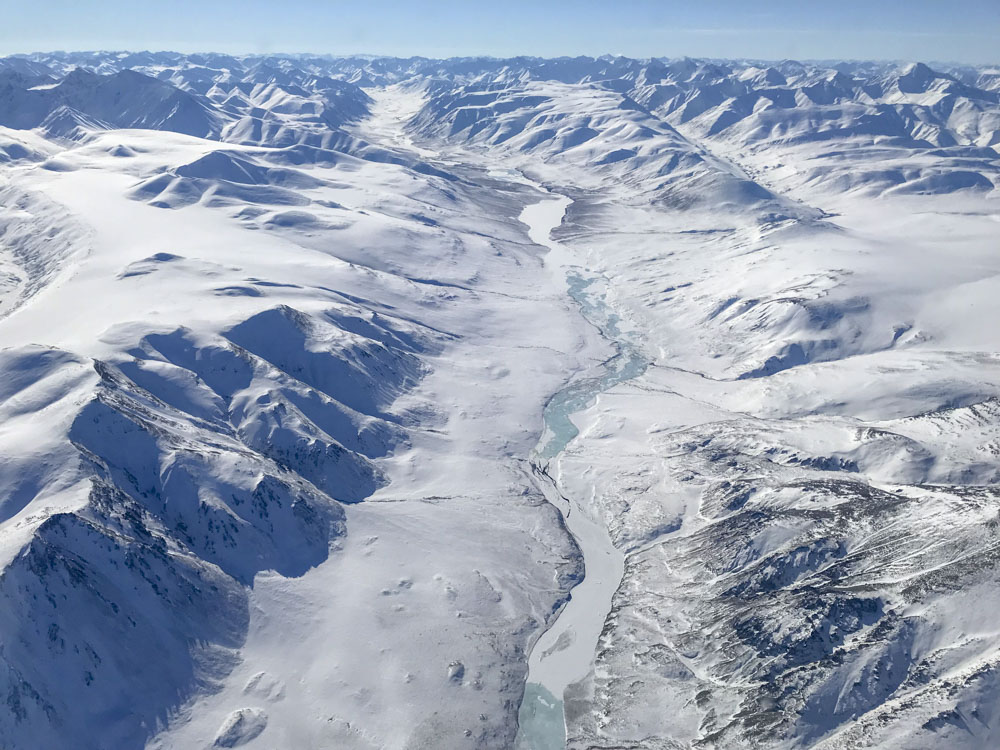
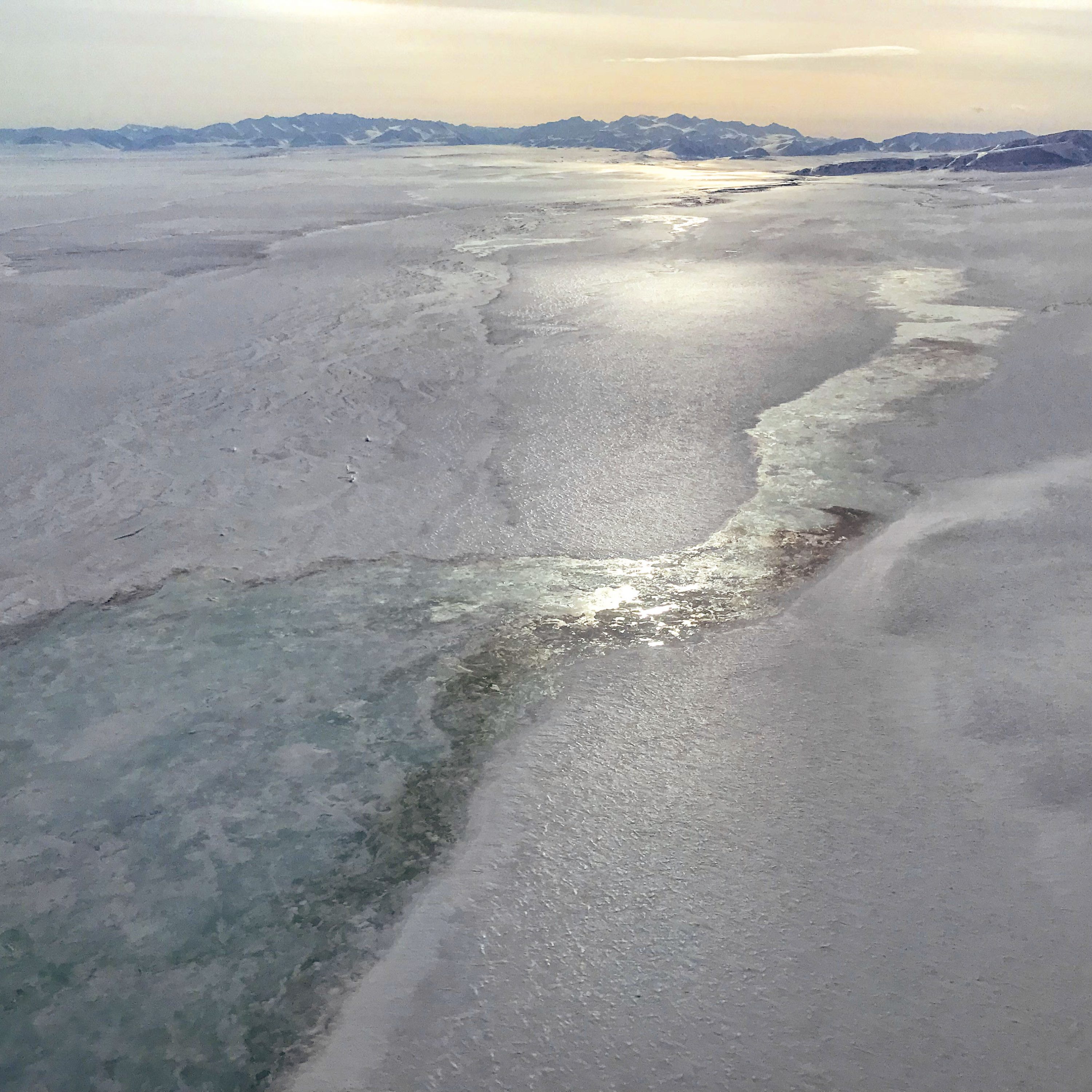
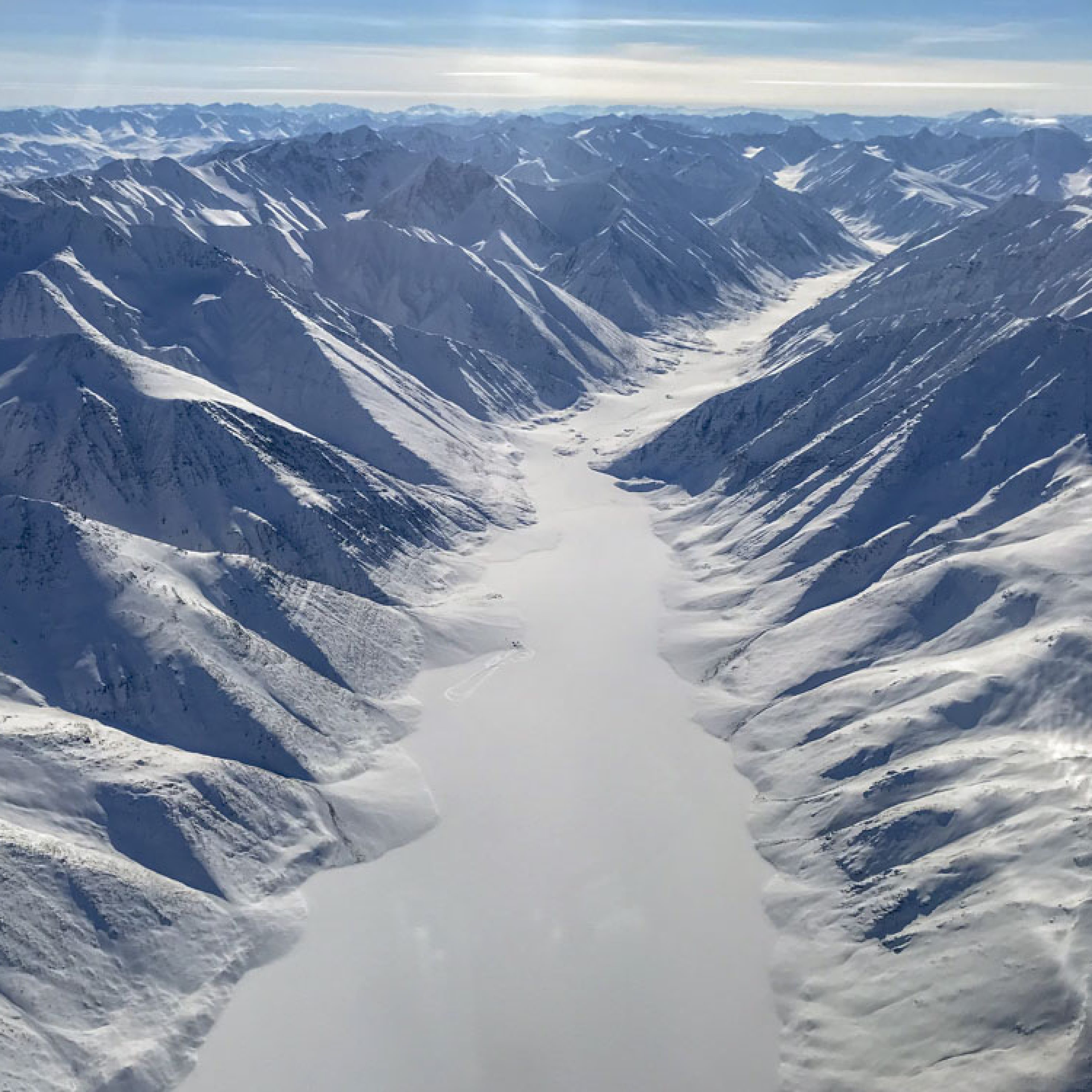
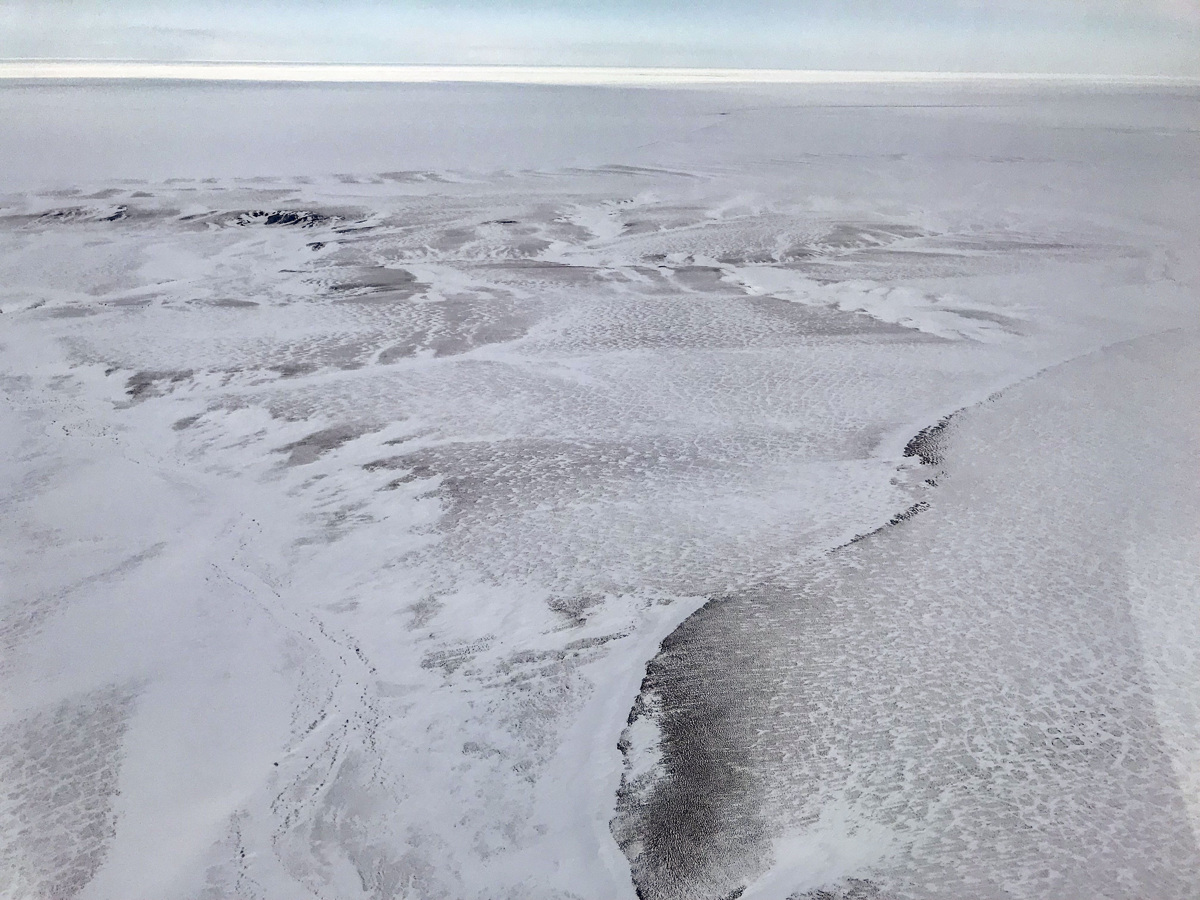
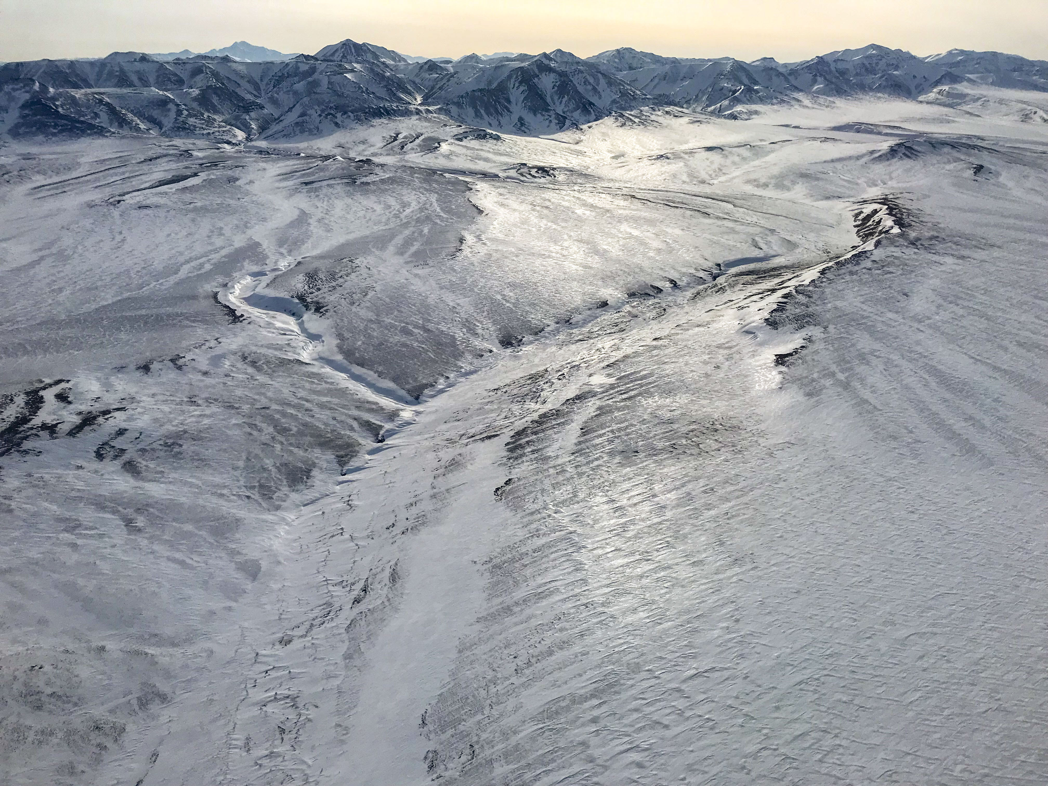
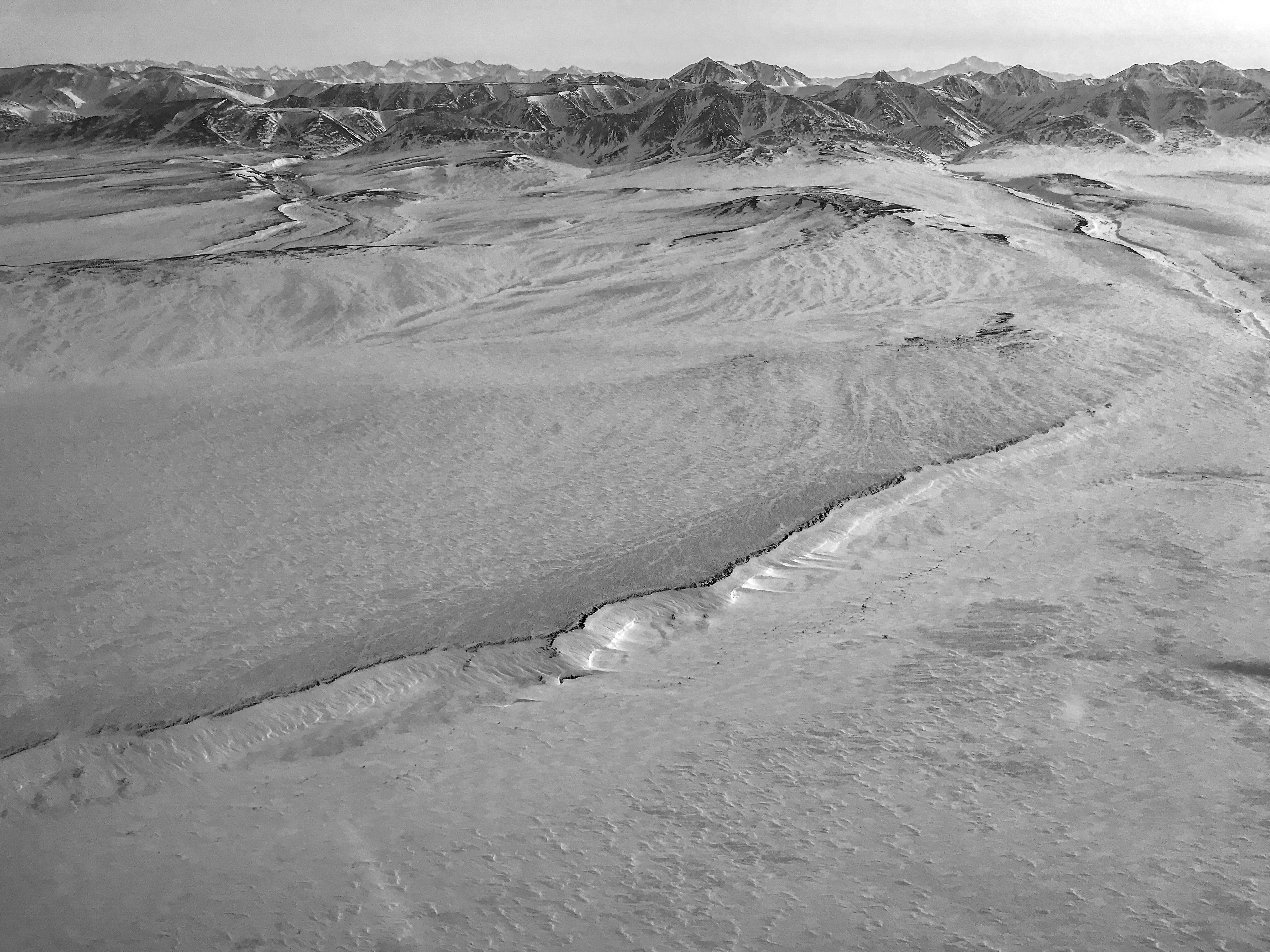
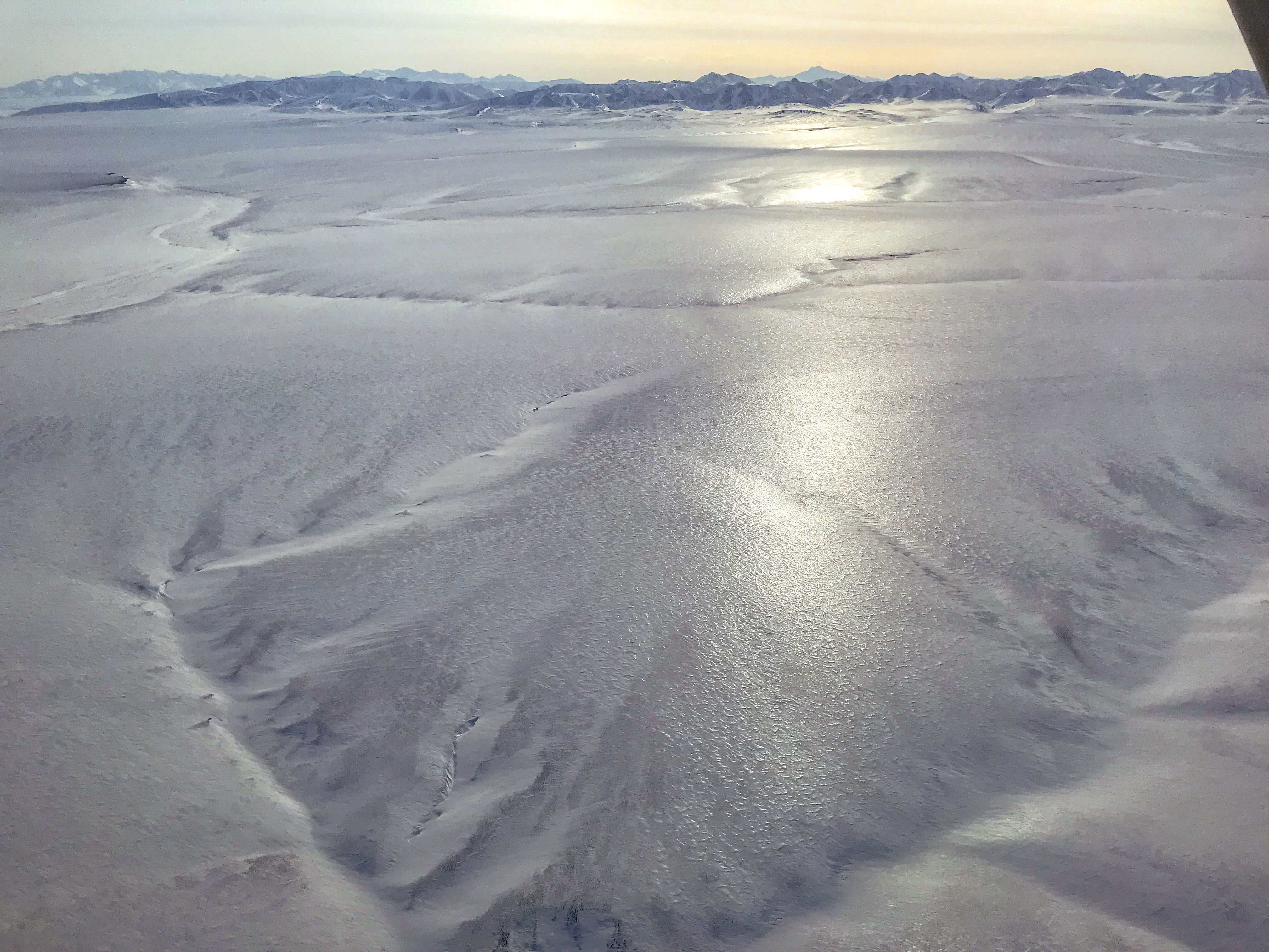
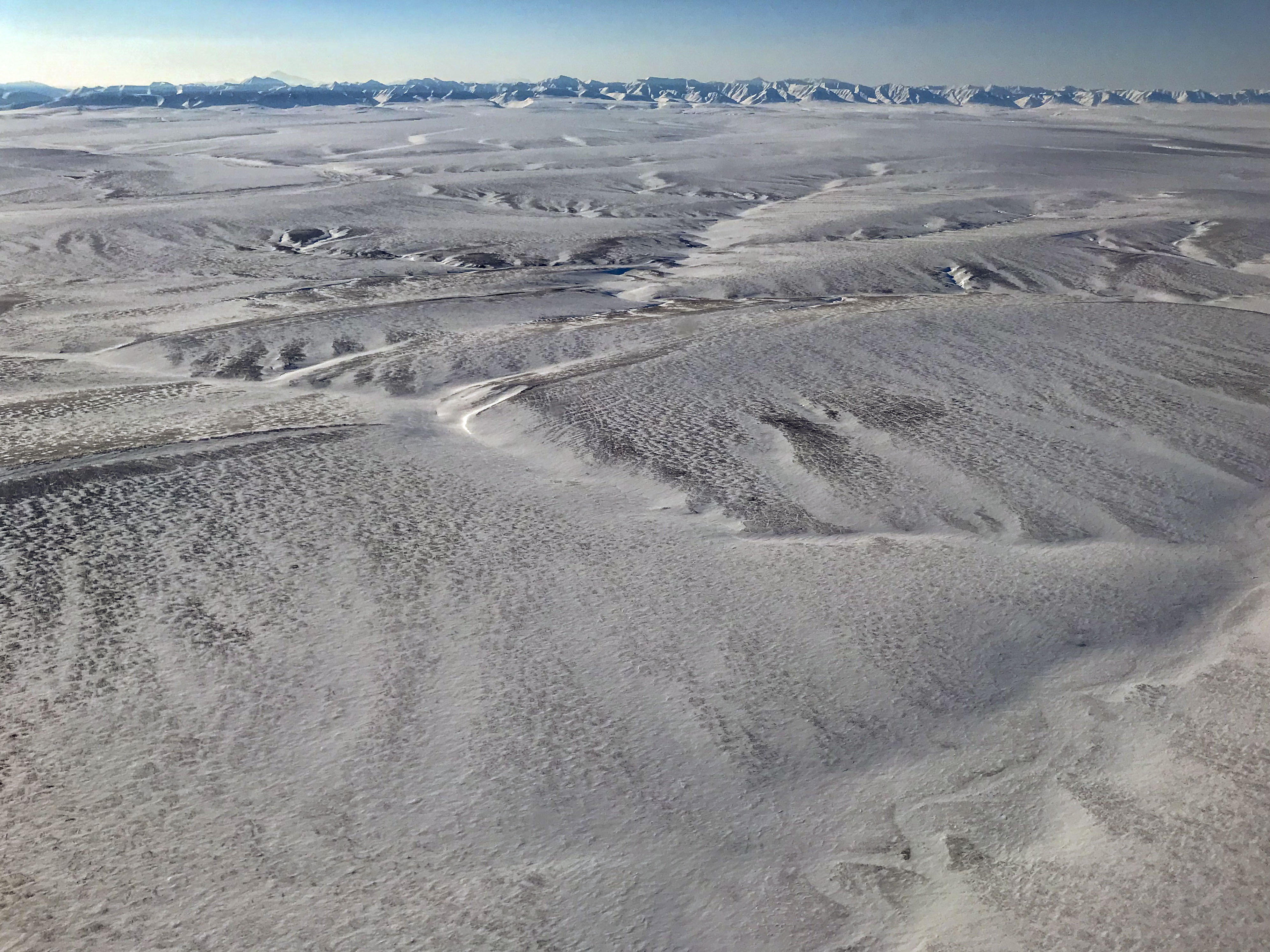
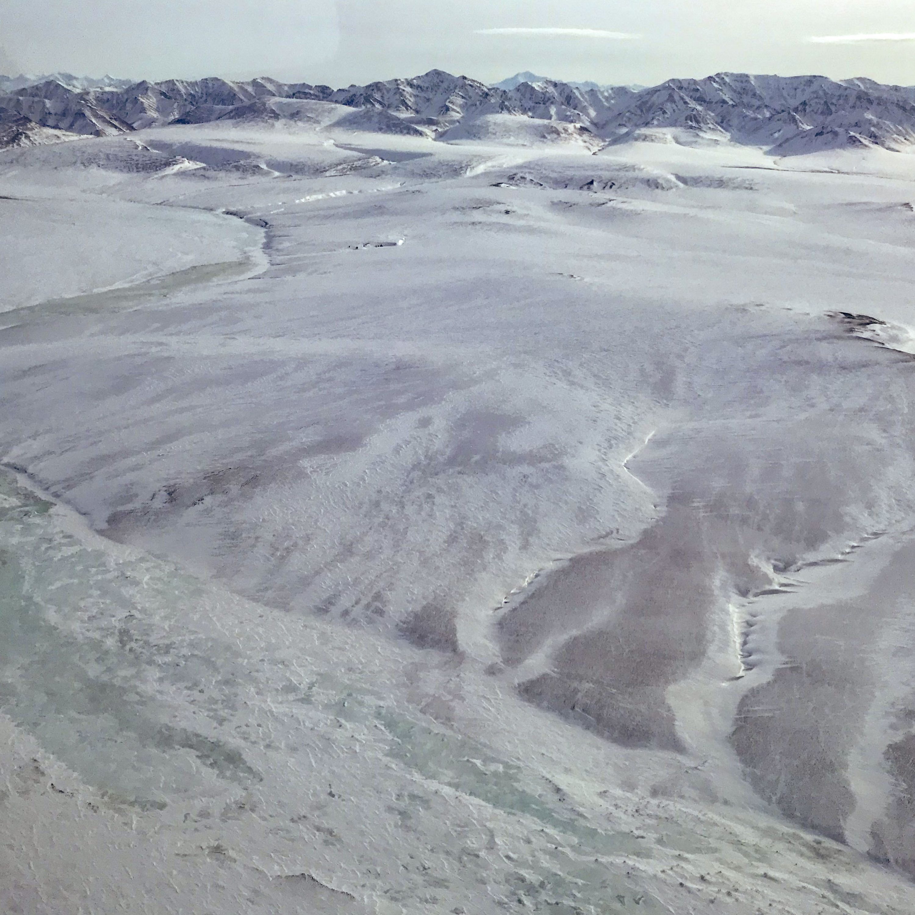
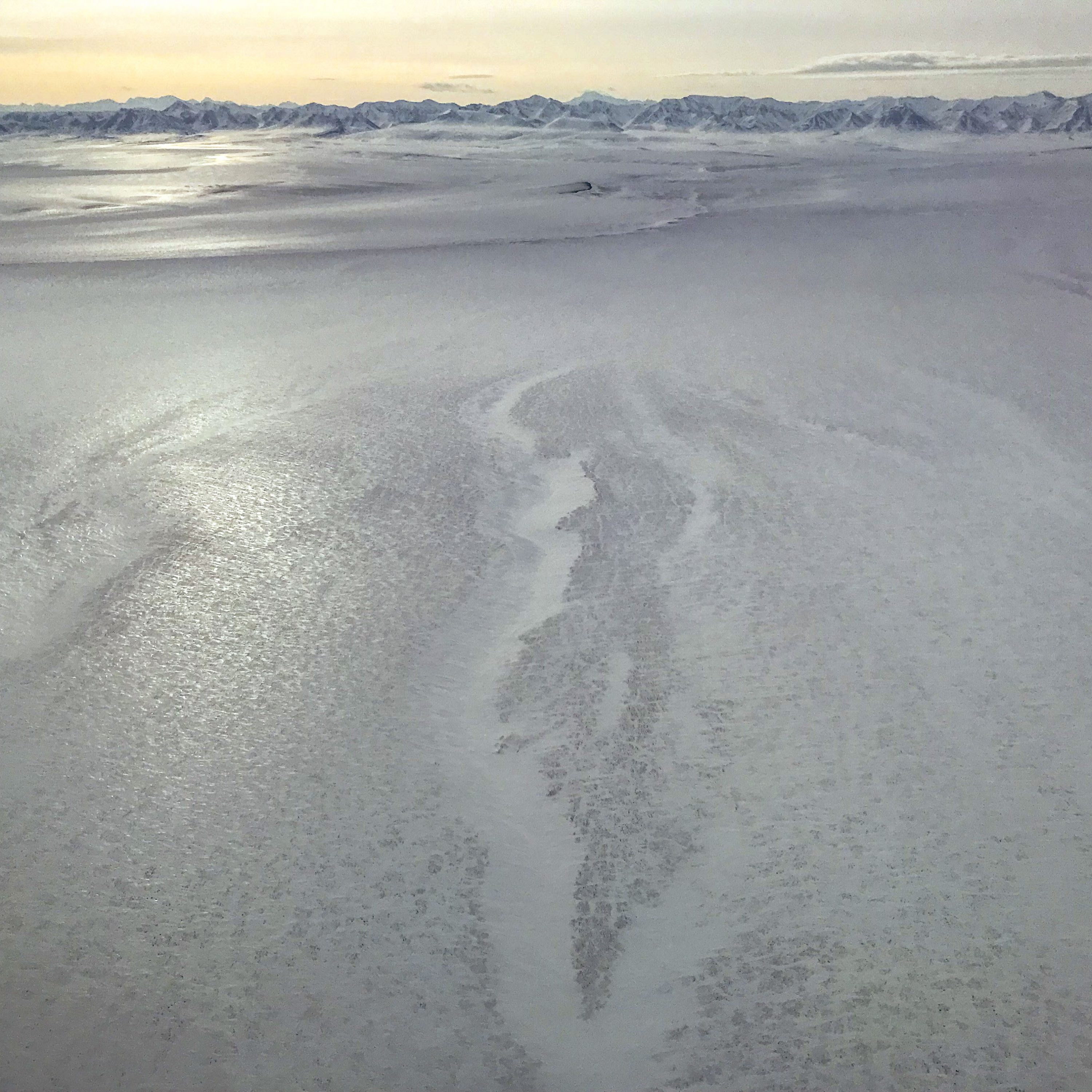
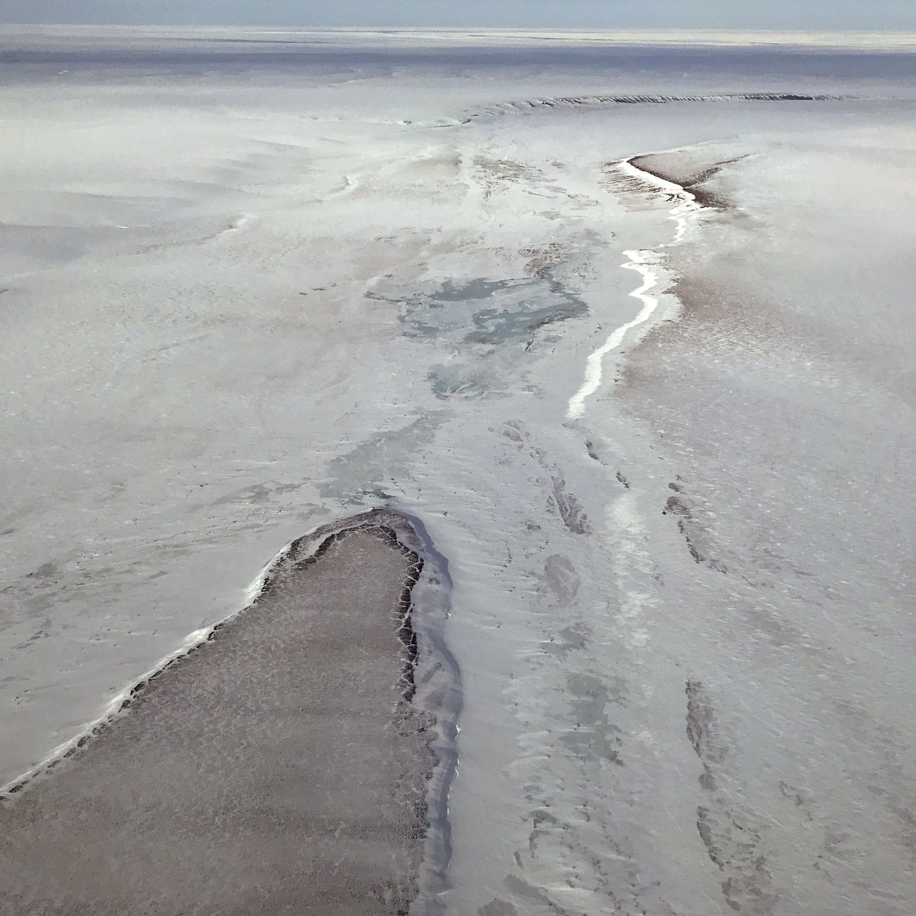
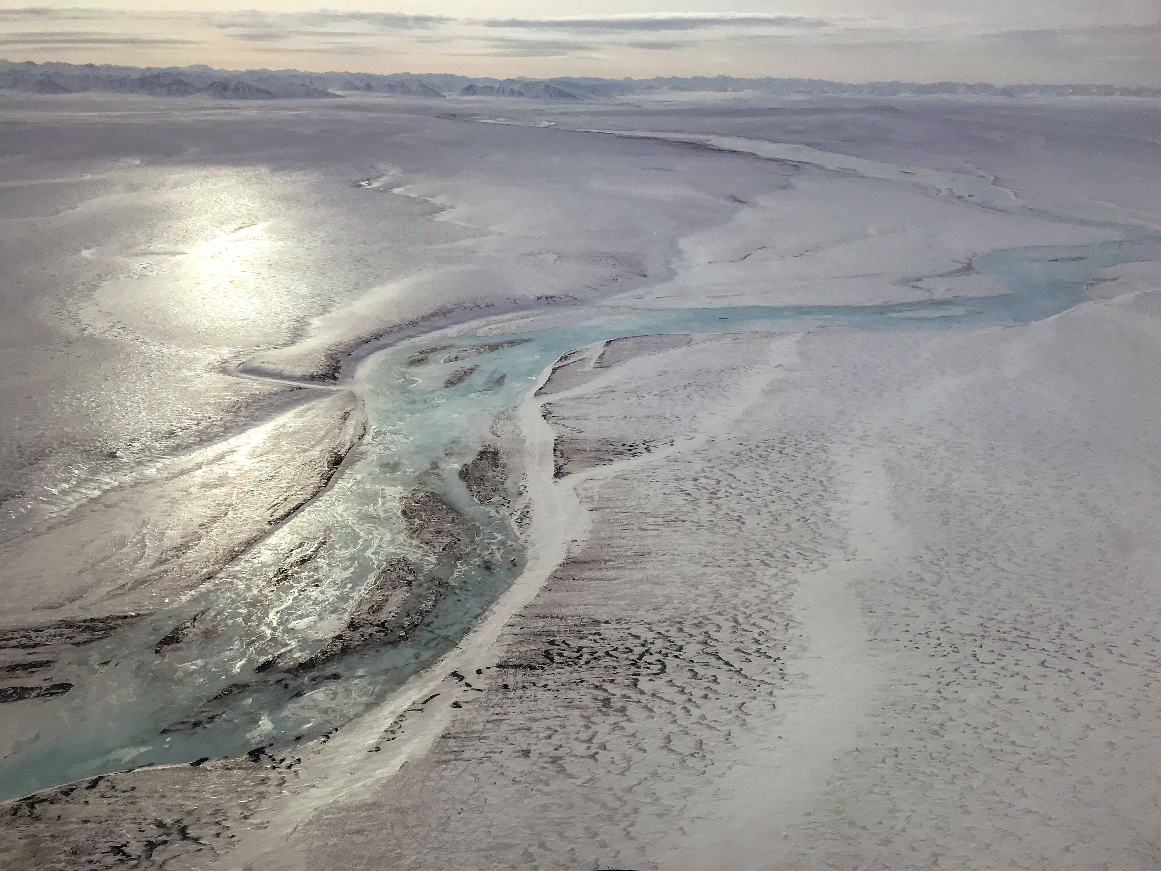
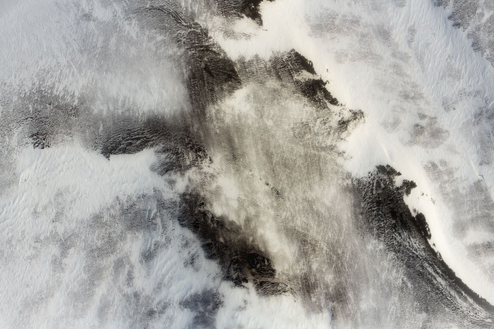
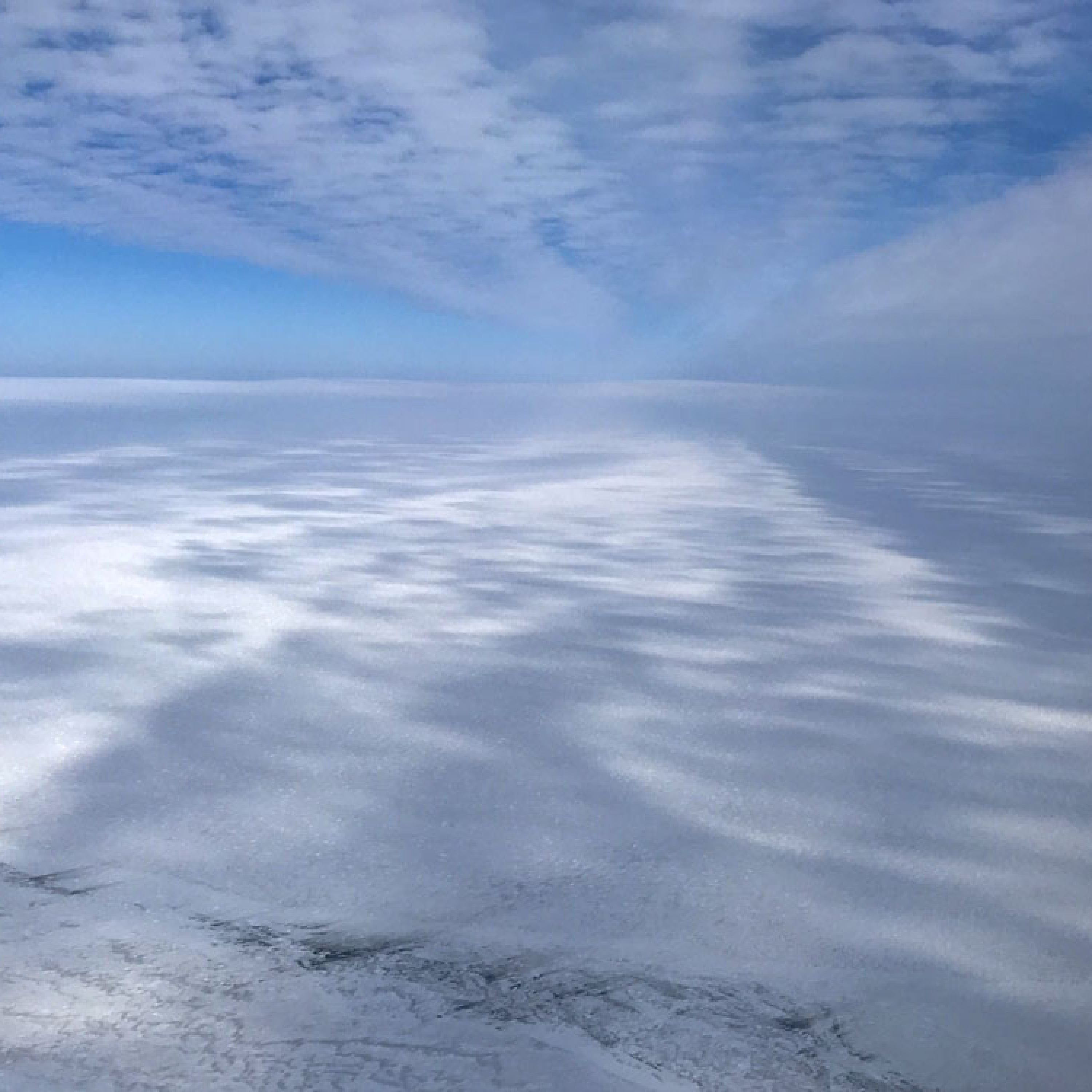
Here I share a few oblique photo taken with my phone from the airplane to give a sense of current conditions in the 1002 Area. I’ve identified where I’m pretty sure each photo was taken, but I took a lot of photos and I may have gotten a few locations wrong so use your judgement when in doubt. My general sense was that between the Canning and Sadlerochit Rivers there were tussok tops exposed everywhere you looked. Between the Hulahula and Jago Rivers the tussok tops were mostly covered, though there were some broad sections which were not. East of the Niguanak River tussok tops again predominated. The entire area was covered by intersecting drifts and dunes, even the bare ground– this does not look like a fun year to snow machine there, though I think almost anywhere you wanted to get to you could find a suitable snow-covered path. Off the cuff I’d say a third of the area I mapped had enough exposed ground that you could not lay down a 200 m x 200 m grid pattern, or more than 1-2 cells of it, but the final map will settle all uncertainties about this soon. I’ve arranged these photos going from east to west. Note that a few of these photos are capturing views outside the 1002 to show mountain snow packs.
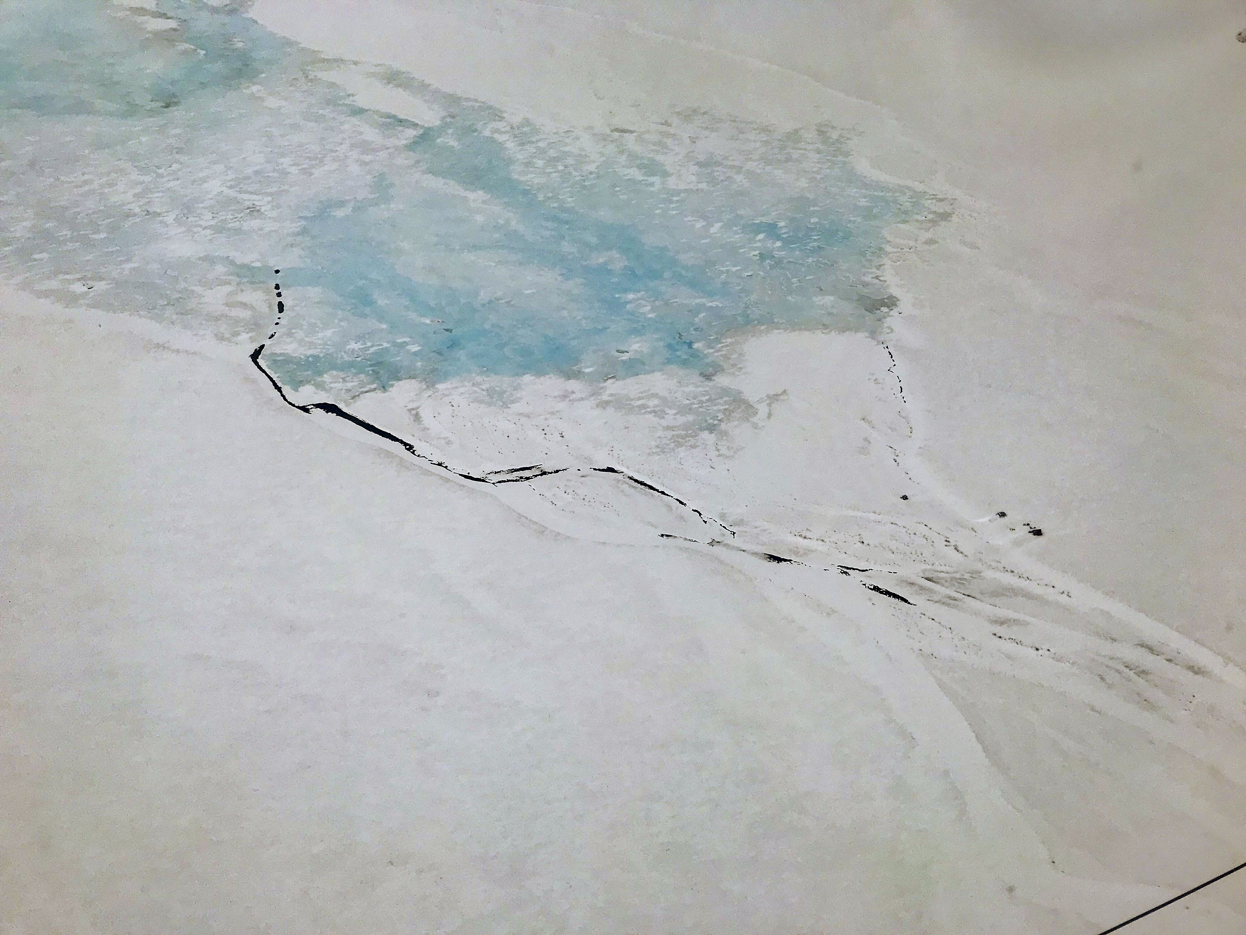
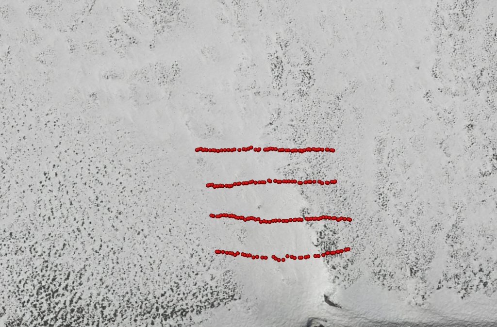
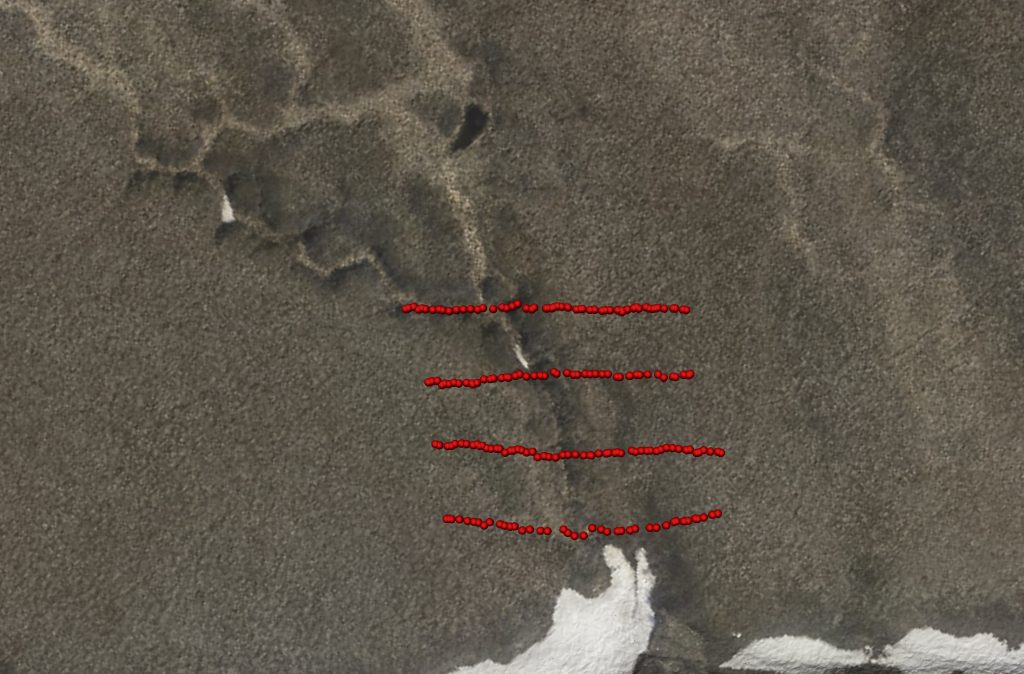
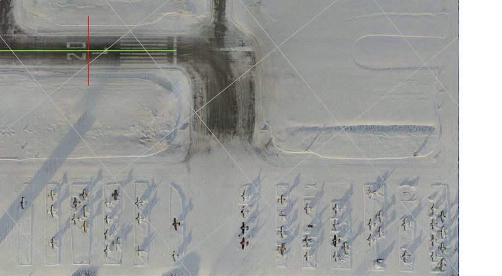
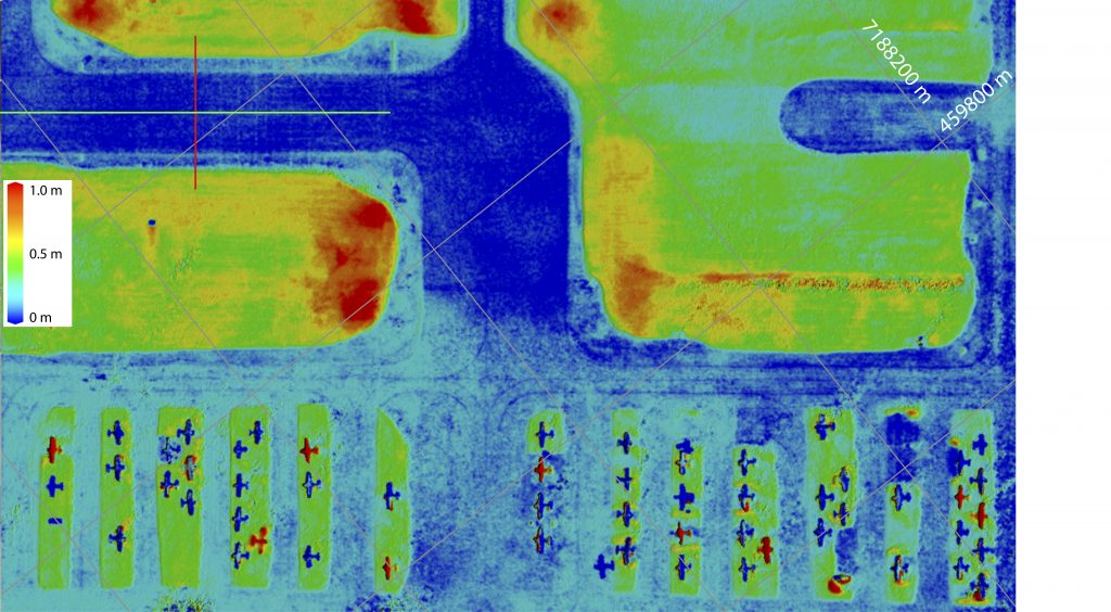
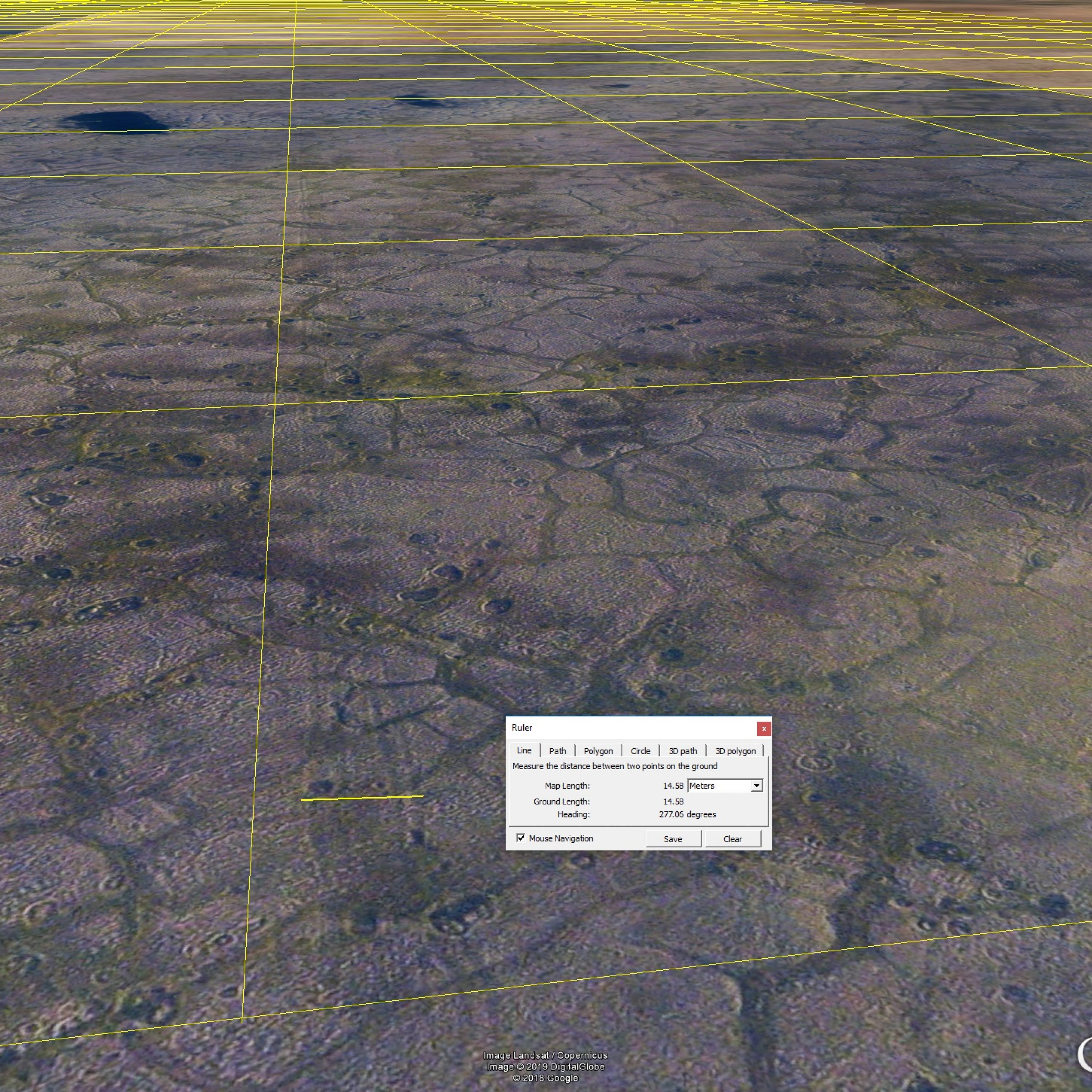
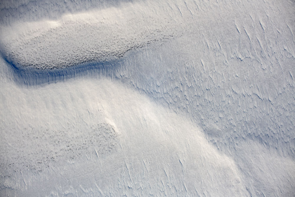
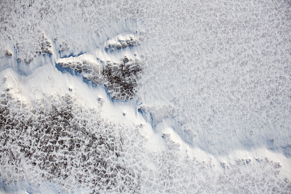
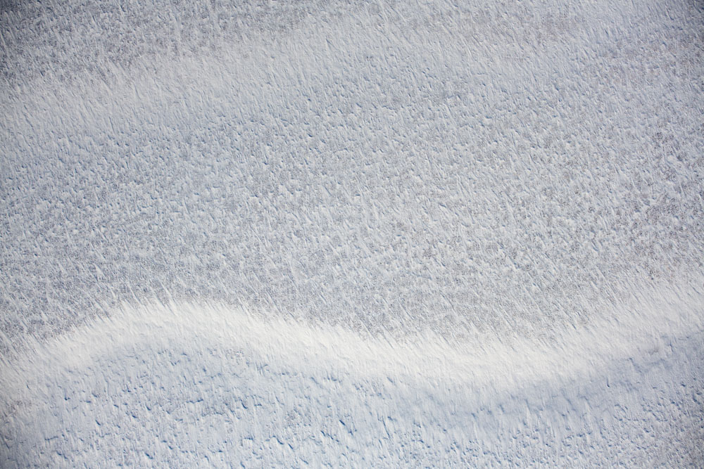
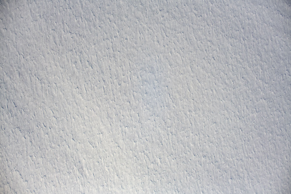
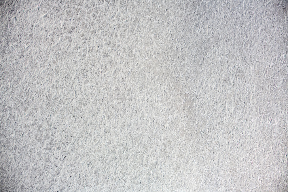
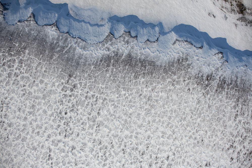
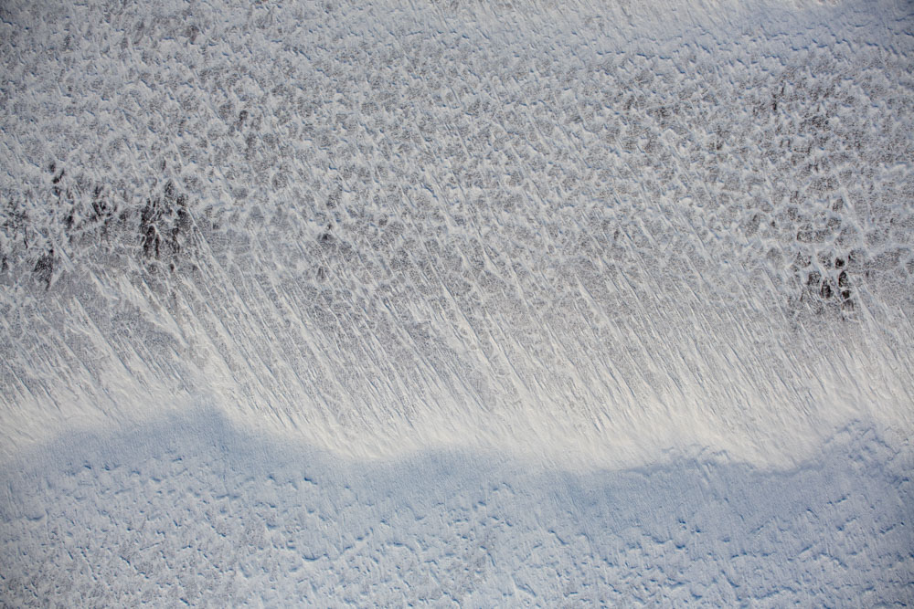
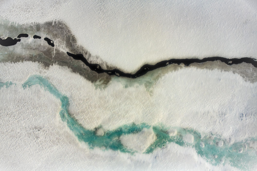
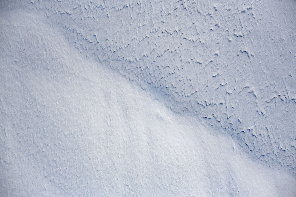
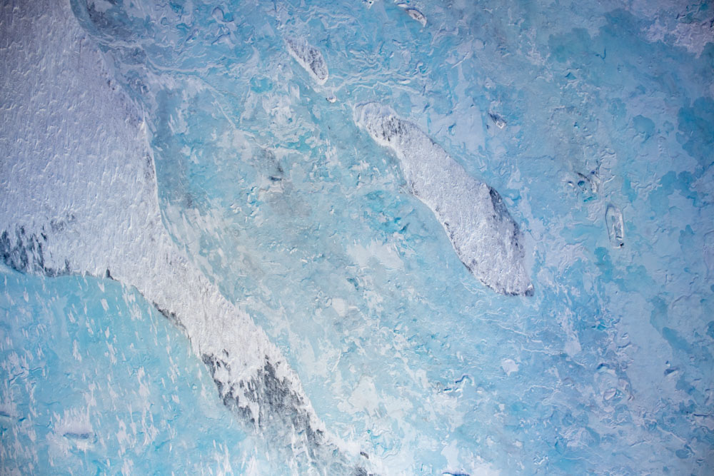
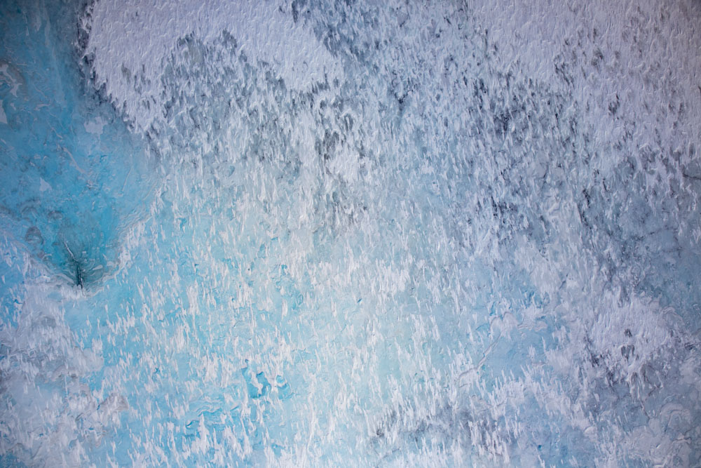
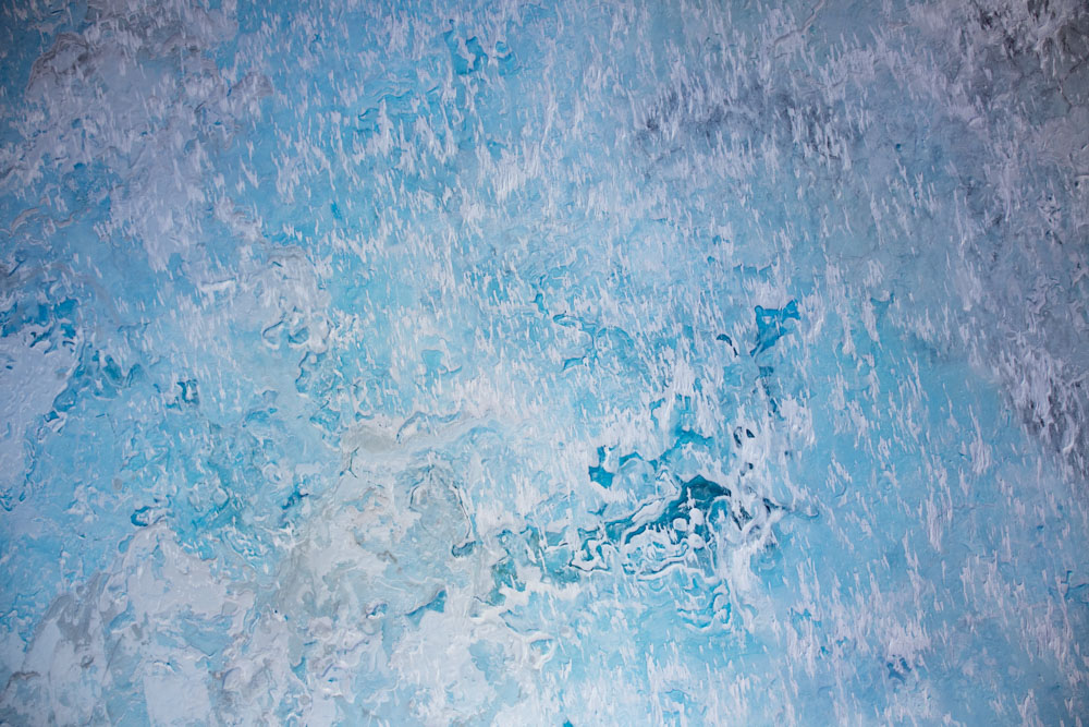
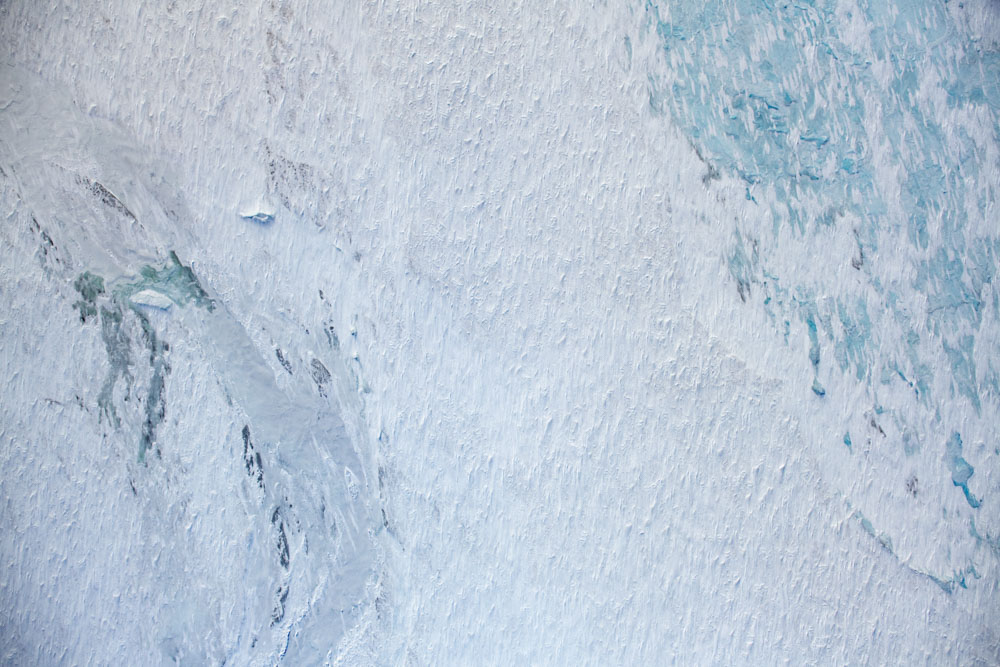
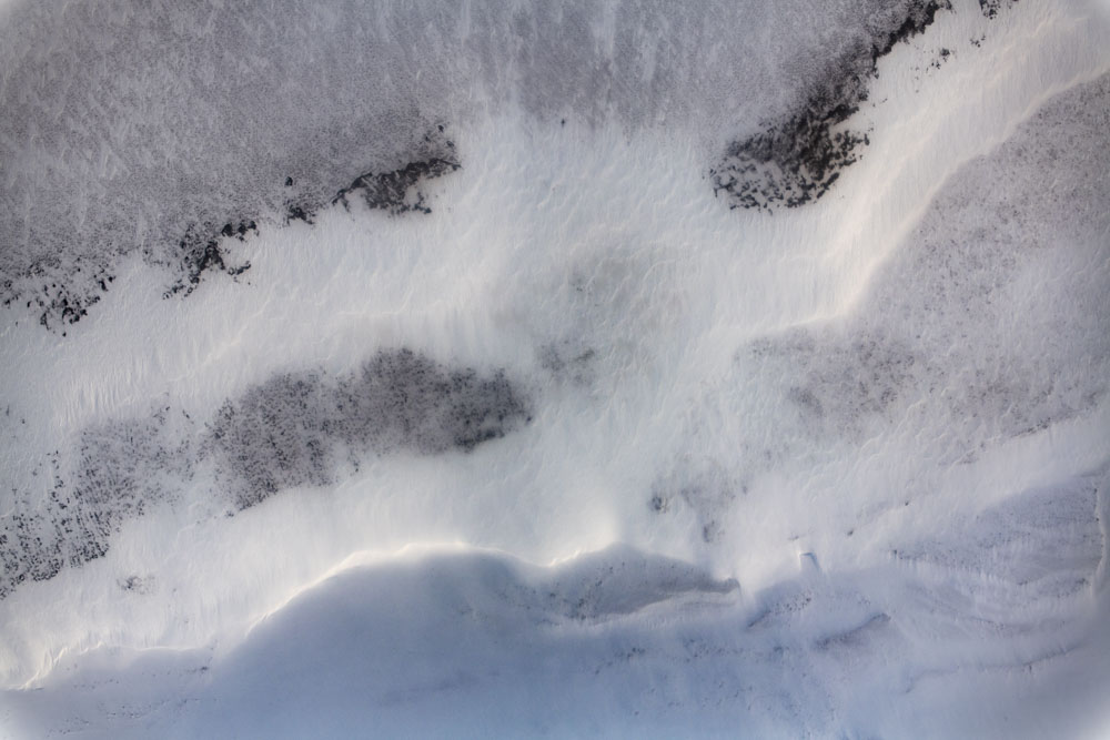
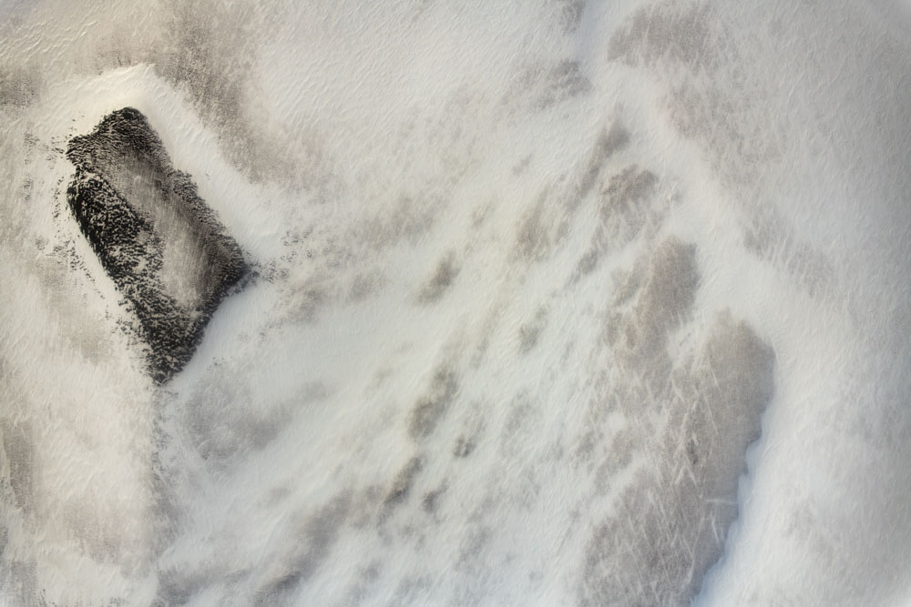
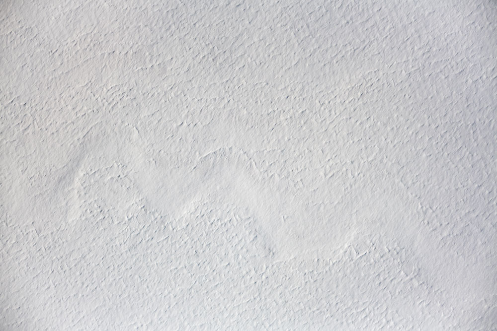
Example Vertical Photos
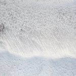
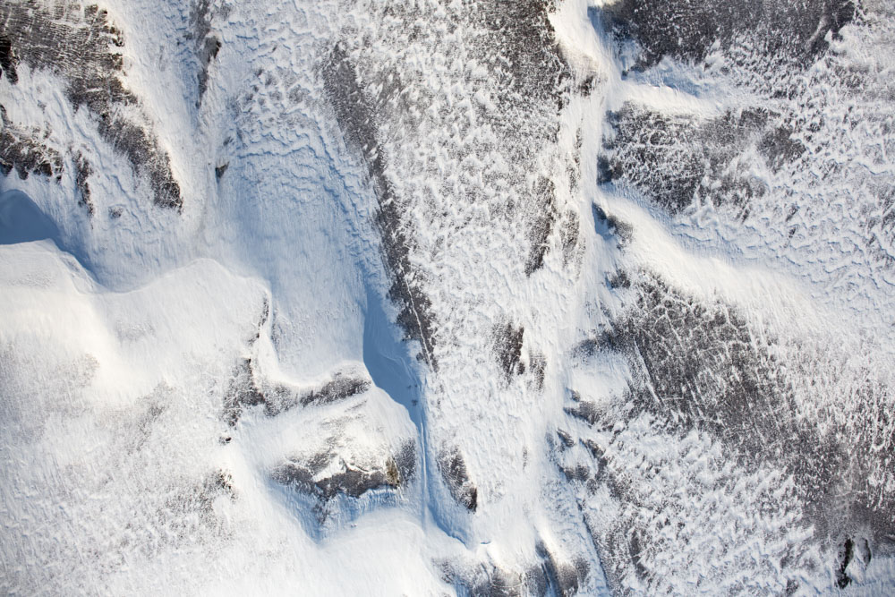
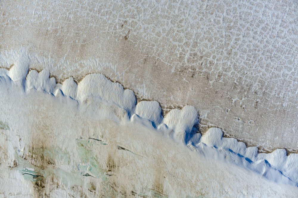
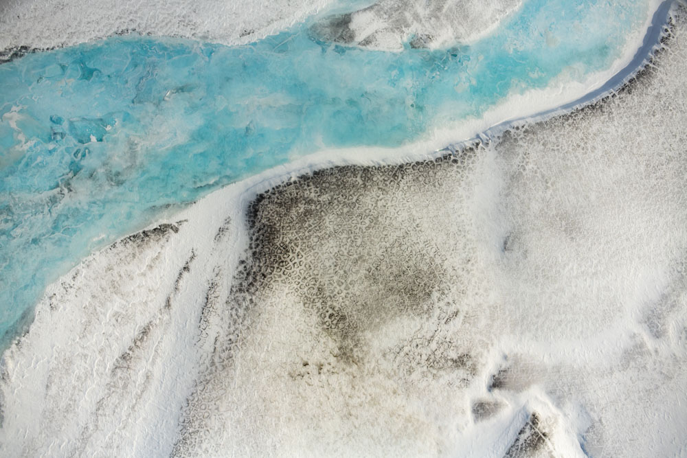
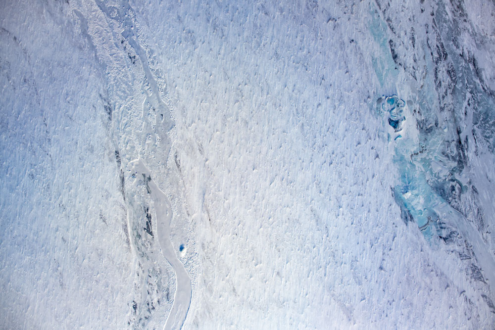
Below is a somewhat random selection of vertical mapping photos from the 1002 Area that will I use to make the winter digital elevation model and snow depth map. The purpose here is just to give some sense of detail, beauty, and snow cover — a taste of what is to come on a massive scale. These photos are roughly 1000 m by 700 m in size, though this varies as they are not orthorectified yet. In terms of seismic impacts and not driving over bare ground, consider that the proposed 200 m by 200 m grid would have 5 vertical runs and 3 horizontal runs in each of these images.
Final Thoughts
To me, an important aspect of “responsible development” is taking responsibility for understanding the impacts of what we do before we do it — there should be no doubt, development methods should be considered guilty until proven innocent. Understanding snow is vital to understanding the ecology here, yet snow cover and snow-ecology linkages here have been poorly studied to date. To take responsibility, it means not making assumptions about this snow cover that are easily tested, even if that takes a few years of watching nature do it’s thing or organizing the humans to do the watching. In this case, assuming that the snow cover in the 1002 Area is ‘similar enough’ to the snow cover in the oil fields is an assumption that is easily tested, and I believe will likely be disproven. Likewise, assuming that the ecological terrain units here have the same level of sensitivity to vehicle impacts as the oil fields to the west is also an assumption that is easily tested, and I believe will likely be disproven. Not everyone that speaks unfavorably about development plans promoted by industry is against development itself, and in my opinion polarizing the issue in that way is not responsible either as it has a tendency to blind proponents into thinking that the ‘enemy’ is spouting fake news or false science. Here, we simply need more studies of snow before we can make an intelligent, responsible decisions about these development methods or other possibly more suitable methods, as needed. In the meantime, if you are unfamiliar with snow, this book is an excellent resource for understanding Arctic snow in general.
The Miracle of Mindfulness — Thich Nhat Hanh
Come As You Are — Emily Nagoski
Conquering Shame and Dependency — Darlene Lancer
How to Talk to Yourself Like a Buddhist — Cynthia Kane
No-nonsense Buddhism — Noah Rasheta