
Which are the highest peaks in the US Arctic?
Which are the highest peaks in the US Arctic?
A glaciologist and a ski mountaineer use Fodar to settle the debate
Text by Kit DesLauriers
Photos by Andy Bardon
Since the beginning of time humans have wondered ‘What’s over there?’ and ‘How high is that?” Now that our geophysical world is largely available for viewing at our fingertips, many would argue that the age of exploration is over, yet when we take a close look at verifiable science, the truth is that there are many details still unknown. In the realm of measuring the highest mountains in the US Arctic, not only have the highest peaks been unknown, they’ve also been debated until now.
The Mystery
In 2010, I made my first journey to the Arctic National Wildlife Refuge in the north-eastern Brooks Range of Alaska in an attempt to explore the area while skiing the highest mountain in the US Arctic. During planning, I noticed a discrepancy between the two highest mountains depending upon which of the two available scales of USGS topographic maps I consulted. While both maps were made in the 1950’s, one gave the answer as Mt. Chamberlin and the other gave the answer of Mt. Isto. Because the difference between the two peaks was less than 50 feet, the question may seem inconsequential to some but for me, the first person to ski from the highest point on each of the seven continents, it increased the mystery of this remote landscape and served as the beginning of my desire to find the answer.
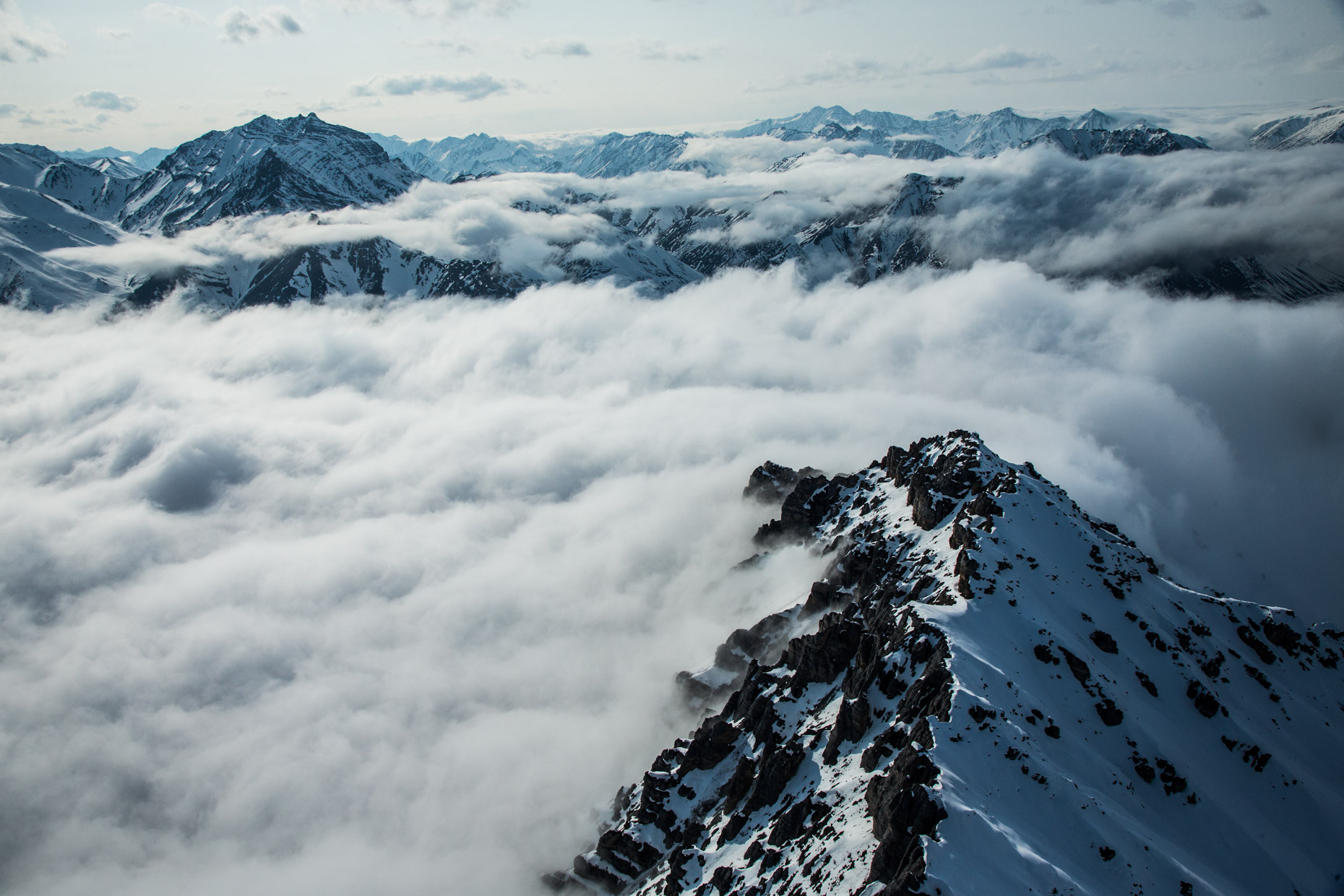
The answer to ‘Which is the tallest peak in Arctic Alaska?’ was shrouded in mystery during our first trip in 2010, but five years later the clouds parted long enough for us to resolve it.
Coincidence?
As serendipity would have it, while waiting at Coyote Air in Coldfoot, Alaska, for my spring 2010 flight into the Refuge, I met Dr. Matt Nolan (Univ. Alaska Fairbanks) who was also preparing to be flown into the same mountains, but not to ski. For seven years, Dr. Nolan had held a permit to conduct glaciology studies on the McCall Glacier and his destination was the research camp there that he used to continue the longest scientific observation history for any US Arctic Glacier (1957). Although I still wondered which was the highest mountain in the Refuge, my first questions to Dr. Nolan were more of the nature, “How is the climate changing up there? What are the driving forces? How long will the glaciers remain?”
Though I am keenly interested in the natural world, I am a layperson in the field of glaciology yet Dr. Nolan’s answers were succinct and digestible. My take away was that the increased melt is due to longer and warmer summer seasons and that with a high probability all of the glaciers in the US Arctic will be melted away in about 100 years. Within a few hours, we went on their separate paths into successful Arctic journeys, but I was intrigued by Dr. Nolan’s research and he curious about this person who seeks exploration in remote mountain ranges.
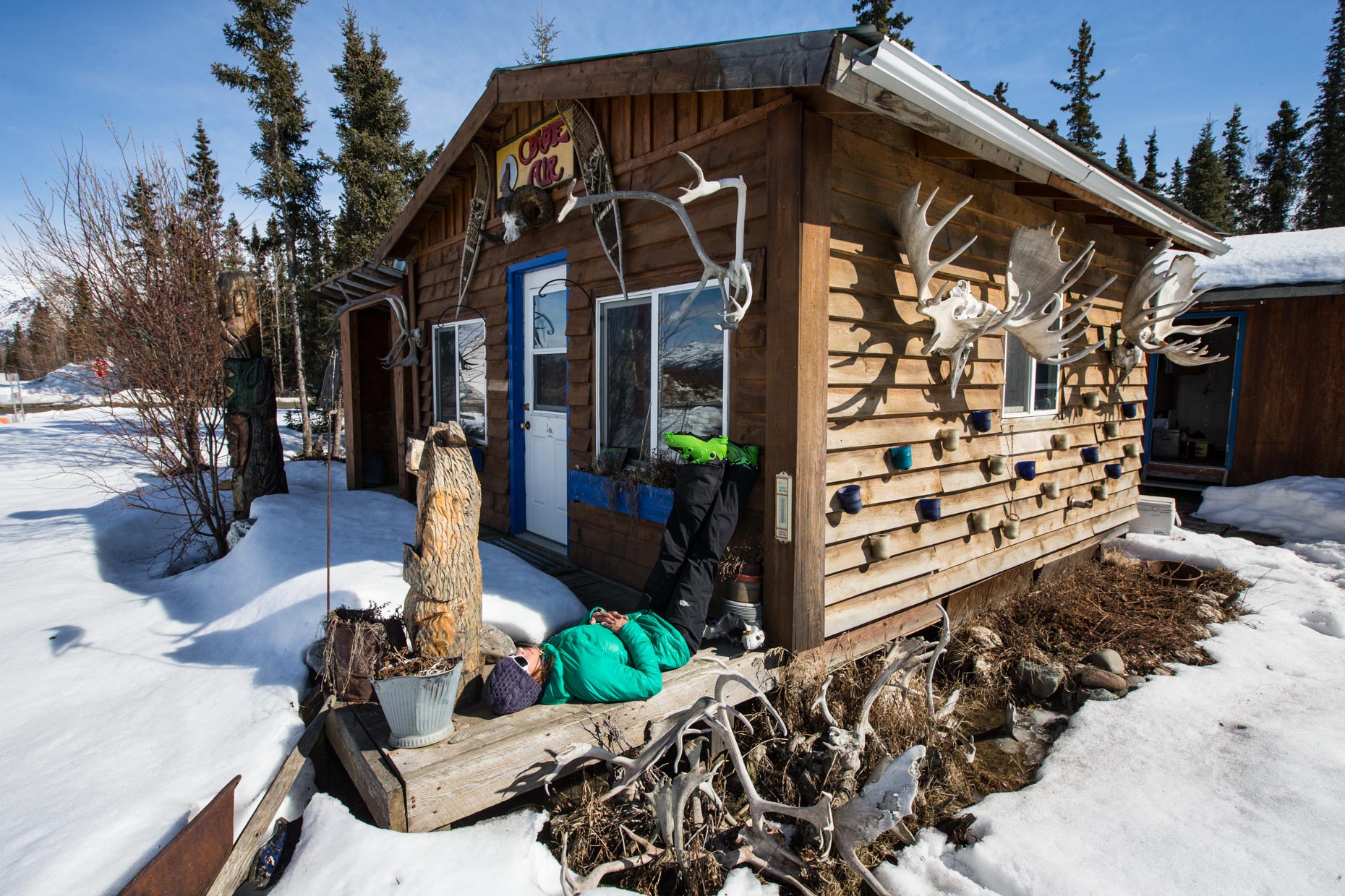
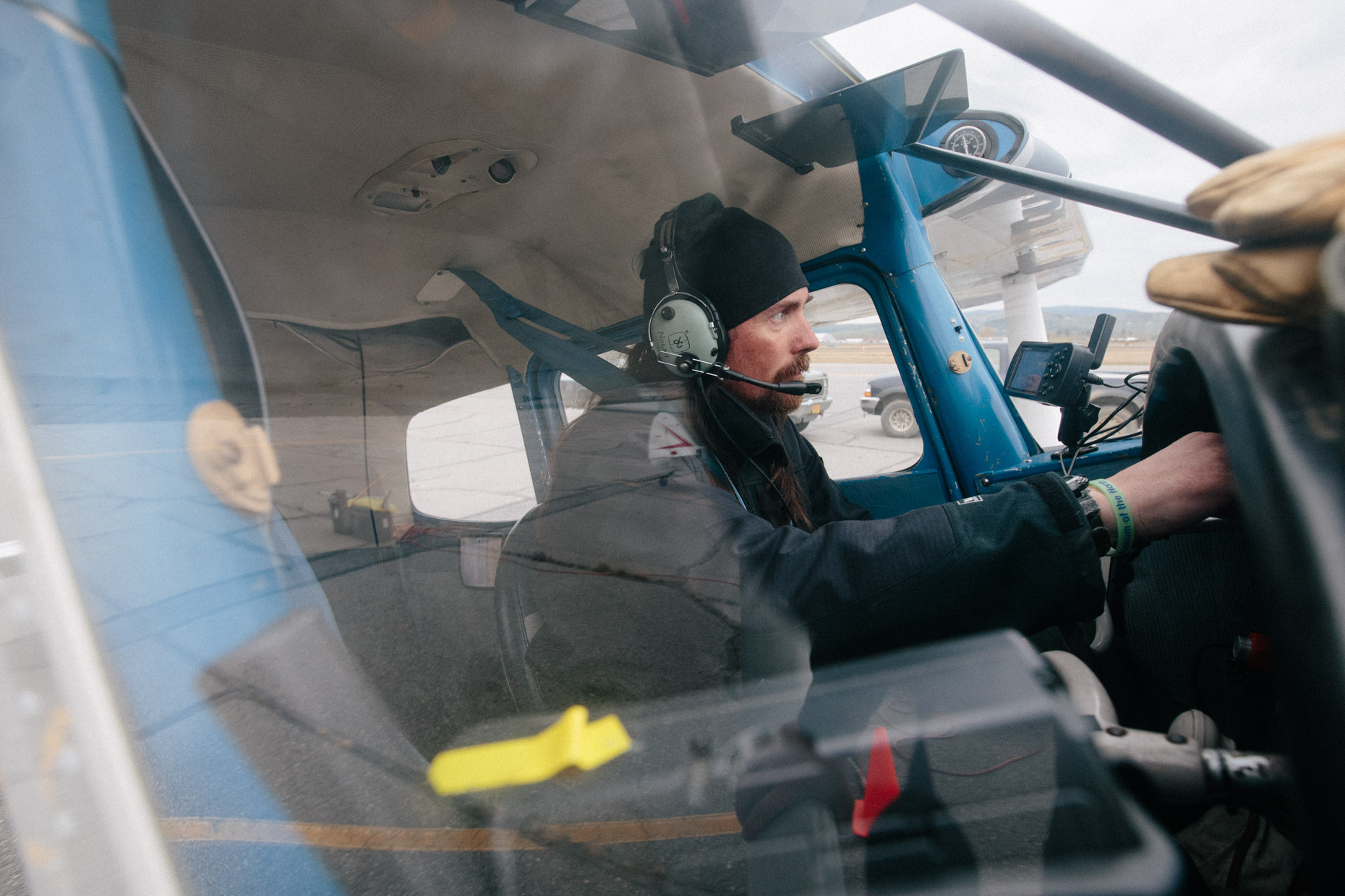
Me, waiting for 200 miles of flyable weather from Coldfoot, AK across the Continental Divide to the Arctic Refuge
First Attempt at Science
In August of 2012, at the invitation of Dr. Nolan, I returned to the Arctic Refuge in order to assist with an ice radar survey designed by Dr. Nolan to measure the amount of ice remaining on the glaciers surrounding the McCall Glacier, as part of an effort to understand how much glacier ice exists in the entire US Arctic. Dr. Nolan was still recovering from some broken ribs due to an aircraft accident earlier that summer, so my two climbing parters (Kasha Rigby and Ace Kvale) and I carried survey tools, an oscilloscope, laptop computer, radar device and antenae to outlying glaciers then walked transects along the ice while retrieving radar images from the bottom of the glacier.
We were challenged by difficult summer access to the glaciers, cumbersome equipment and inadequate scientific knowledge to discern whether the information we were gathering was complete. After conducting the survey on two glaciers, it was clear that rough summer surface conditions and troubleshooting by satellite phone were not a productive use of our limited field time. So Dr. Nolan instead used the team’s skills to do maintenance on the glacier’s weather stations as well as carry a differential GPS along surrounding mountain ridges to contribute to an ongoing mapping project of Dr. Nolan’s.
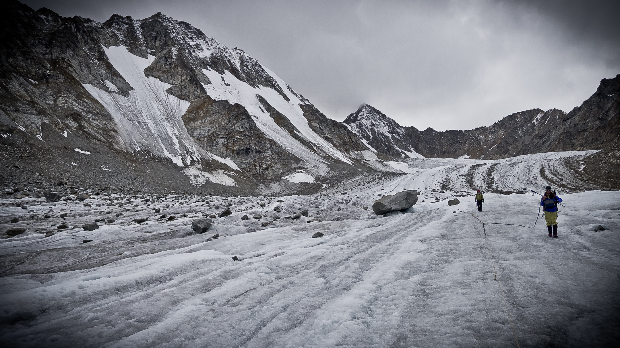
We encountered a lot of issues dragging the system over bare ice, as well as issues scrambling over loose rock trying to get to other glaciers, but our spirits were still high. (Photo: Kvale)
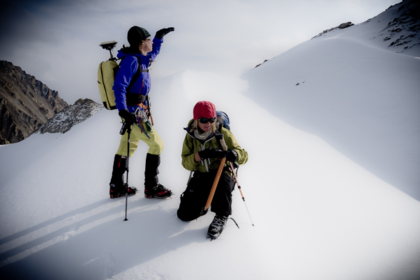
We switched over to measuring ridges and peaks with GPS, a skill that would prove fortuitous to the future. (Photo: Kvale)
Dr. Nolan’s Dream
Our difficulties of accessing these glaciers in 2012 added fuel to Dr. Nolan’s long standing dream to be able to fly himself to the glaciers he had by now spent a decade studying. So during the winter of ‘13/’14 he got his pilot’s license, bought a Cessna 170B, and began testing an aerial photogrammetry system he designed himself. If it worked, he’d be able to measure rates of glacial recession, among other things topographic like permafrost melt, coastal erosion, snow depth, and similar dynamics occurring in the Arctic that largely go unnoticed due to their remote location. Besides topographic mapping, his plan included using the plane to carry the ice radar equipment we used in 2012 on the ground plus other instrumentation.
Back in Jackson Hole, I had no idea what Dr. Nolan had been working on since our 2012 trip to McCall Glacier. Still disappointed in our ability to help answer the question of how much glacier ice remains in the US Arctic, in November 2013 I reached out to Dr. Nolan to see if he had any new methods to measure glaciers in the Arctic. He steered me toward a blog post he’d written about the process to get his pilots license and build his mapping system, which he’d already begun using to map large, remote areas at high spatial resolution, without the use of ground control that I now knew was so problematic and expensive. The hardware, which includes a Nikon D800E camera and survey-grade L1/L2 GPS in tandem with Structure-from-Motion (SfM) software, made sense even to my untrained scientific mind and prompted me to ask, “How can I help?”
“Well, all good airborne science needs some ground truthing,” Dr. Nolan told me. “You remember that differential GPS you carried on the mapping day above the McCall Glacier? You could use that on the ground, ideally on a glacier that I could fly over, and then we could compare data sets to validate the accuracy of my airborne data.”
“All good airborne science needs some ground truthing”
I didn’t hesitate to accept the challenge and began to ask the next question, “Does it matter what we measure? Because you know I like to ski, and access to glaciers in the Refuge is easier for me in the spring on skis.” Dr. Nolan answered, “As long as I can fly over it, and we incorporate glaciers plus some points that are distinct topographical features, you can measure whatever you want.” That was enough for me. I decided to climb and ski Mt. Isto and Mt. Chamberlin in a collaborative effort to answer the question “What is the highest peak in the US Arctic?” That data would hopefully provide the ground truth needed to verify Dr. Nolan’s new mapping system so that glaciers, and all things topographic, might now be measured accurately and efficiently from the air.
Ground Truth Part 1: Mt Isto
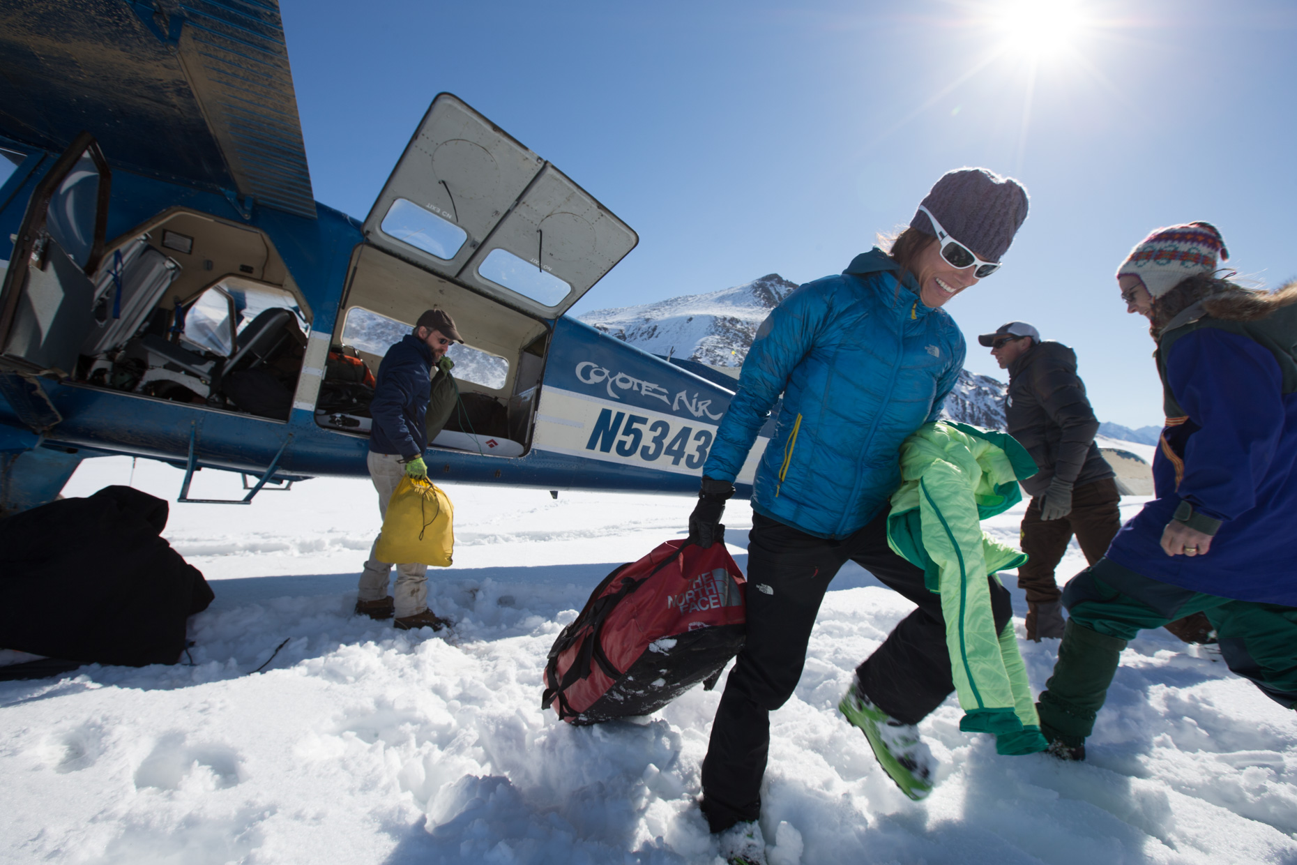
To support the new project, I applied for and received a grant from the National Geographic Expeditions Council to carry out the ground-truth ski-expedition to Mt. Isto and Mt. Chamberlin to coincide with Dr. Nolan’s mapping. The ground truth team mobilized in April 2014 and we began our journey from Fairbanks, AK to Coldfoot and then to the same landing zone on the Okpilak River which I had used during our 2010 expedition.
In addition to myself, the team included Andy Bardon, a photographer specializing in climbing and adventure documentation, Don Carpenter, an accomplished skier friend from the Tetons, and Martha Reynolds, a biologist and ecologist from Fairbanks.
Back in the Refuge, April 2014, unloading in the Okpilak Valley with the new team.
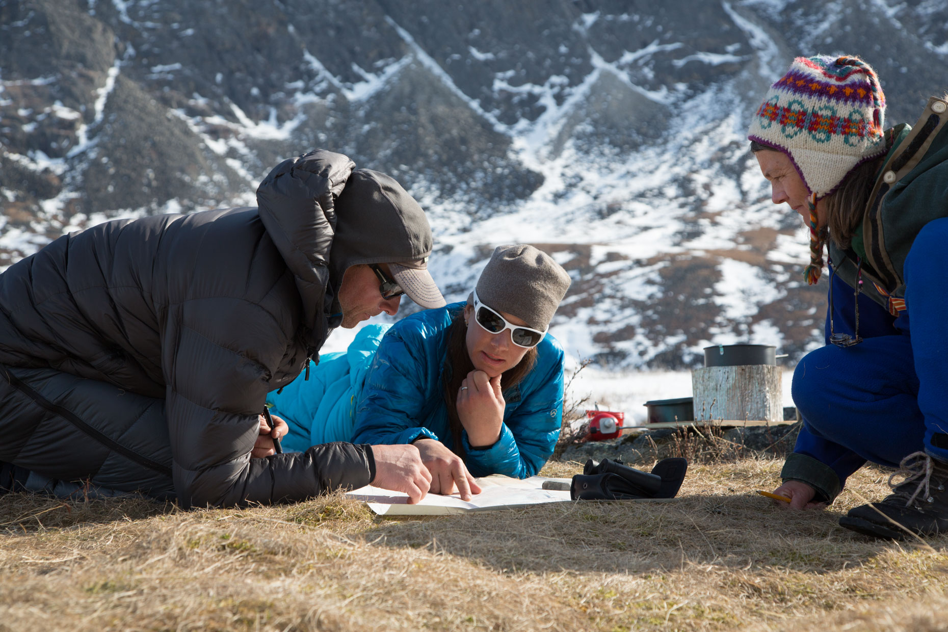
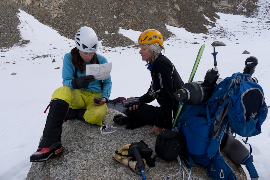
Don and I plan our climbing routes while Martha plans her ecological surveys.
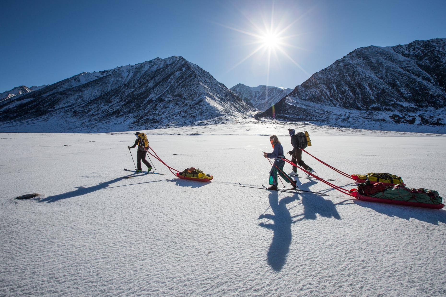
The team skied northward along the frozen Okpilak River and deeper into the heart of the glaciated high peaks. After two days of travel in beautiful weather, we made camp at the bottom of a drainage leading to Mt Isto, after having seen wolverine and tons of fresh grizzly bear tracks.
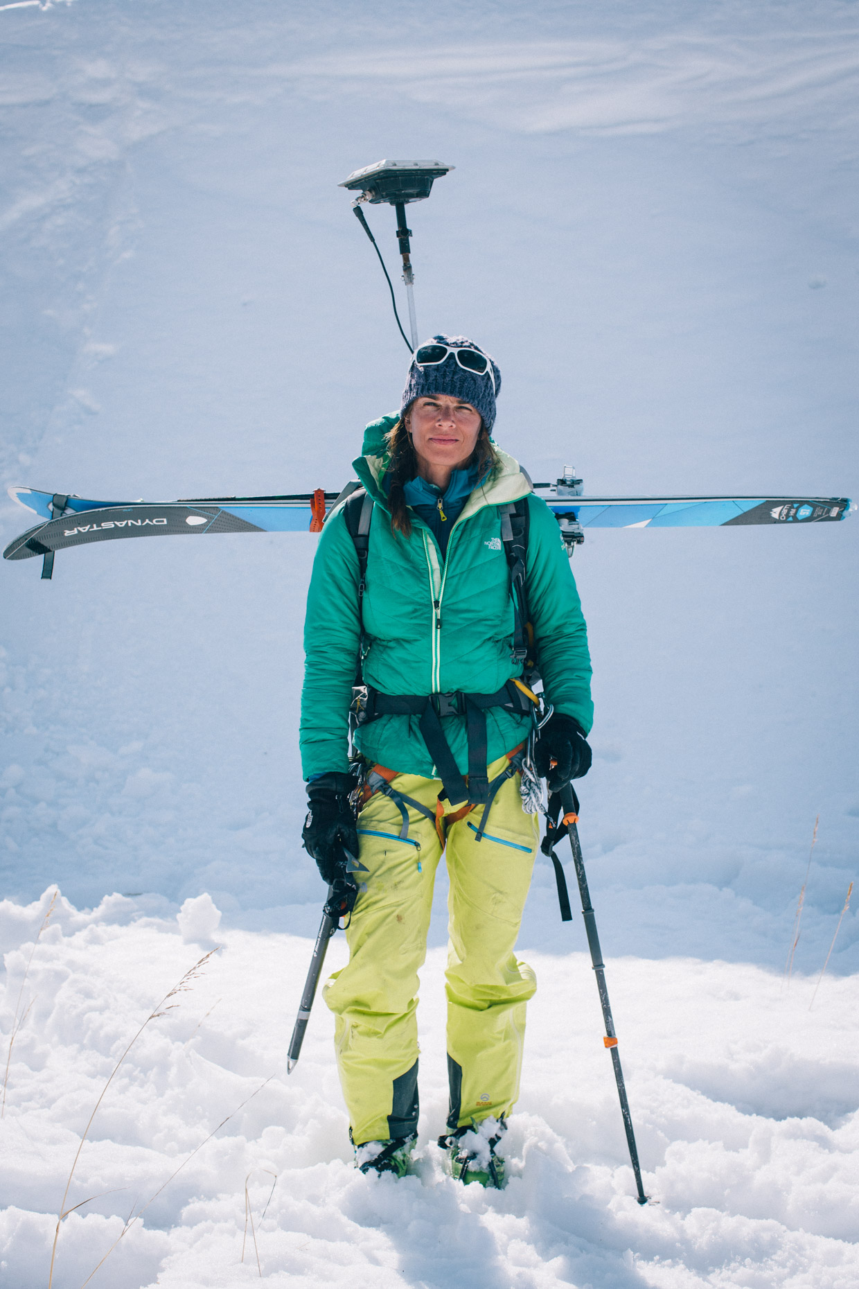
The next morning, April 27, 2014, Don, Andy, and I set off on skis toward Isto with the Trimble 5700 differential GPS inside my pack and the L1/L2 antenna mounted on a steel post bolted to my pack frame. Not a climber, Martha remained near basecamp to continue her studies of winter ecology.
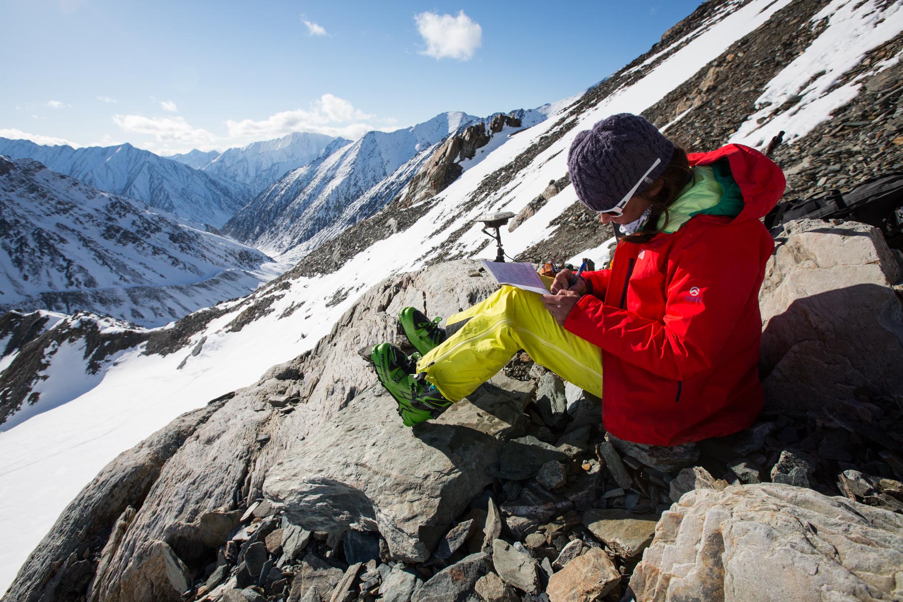
Along the way up and down Isto, I made the effort to take fifteen-minute measurements at large rock outcroppings we hoped would be visible from the air.
Not your normal climbing trip, but Don and Andy were always positive and patient as I scribbled my notes.
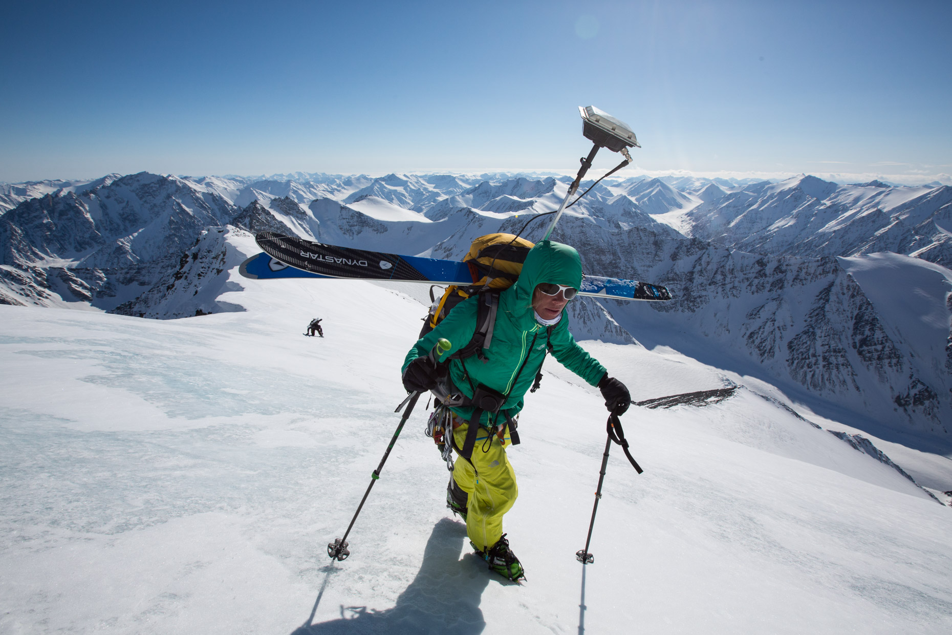
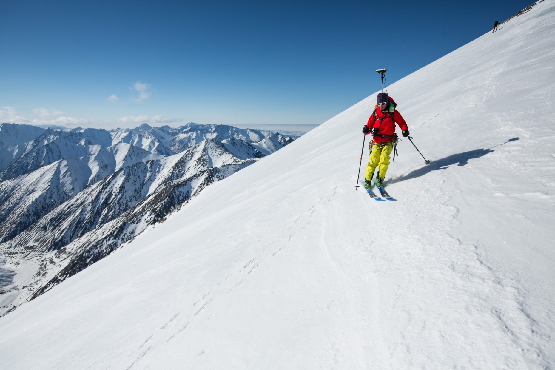
Although I had skied from the summit of Mt. Isto four years earlier, this 2014 ascent proved especially challenging due to the GPS on my back, which we named “ET”. When the terrain became steep enough that we had to switch to crampons and put skis on our packs, I was then faced with carrying my skis in an unusual horizontal arrangement so nothing would interrupt the GPS transmissions. Here, on the Isto summit ridge, we had to take great care due the overhanging cornices on our right.

After eight hours of climbing the team arrived on top of Mt. Isto. Given the summit was dangerously corniced, I decided the best method to ensure a fifteen-minute summit GPS recording, while not sacrificing safety, was simply to get as close to the summit as possible. So I used my shovel to dig down in the snow until I found ice, which I ascertained meant I wasn’t on top of an airy wind lip, and then placed the GPS, still mounted to the pack, in the snow pit while my teammates hunkered together against the cold wind just below. Though it was too chilly to celebrate, we had just acquired the data required to resolve the discrepancy in the height of Mt Isto!
 The ski down Isto held some ice on the upper section and several places on the mountain’s west face where the team moved right and left in search of less breakable wind crust and better skiing.
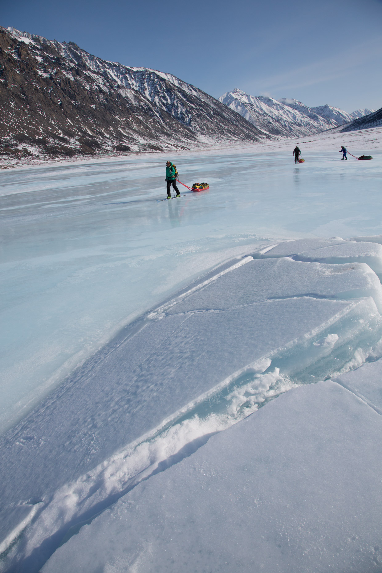 Once Isto was completed, we made the two-day ski back to our Okpilak landing zone where pilot Dirk Nickisch of Coyote Air picked us up and then flew us thirty miles to the west to make the same measurements on Mt. Chamberlin.
Ground Truth Part 2: Mt Chamberlin
With our basecamp set up less than a five minute walk from the landing zone on Peters Lake, it appeared to the ground truth team that climbing Mt. Chamberlin might be easier than Mt. Isto had been. At 6 am on May 3rd, Andy, Don and I began the ski up the Chamberlin Glacier on the north side of the mountain. I again carried the GPS system and made the same careful notations about the antenna’s elevation above snow as well as conducted several longer duration measurements with the GPS mounted on a stationary tripod.
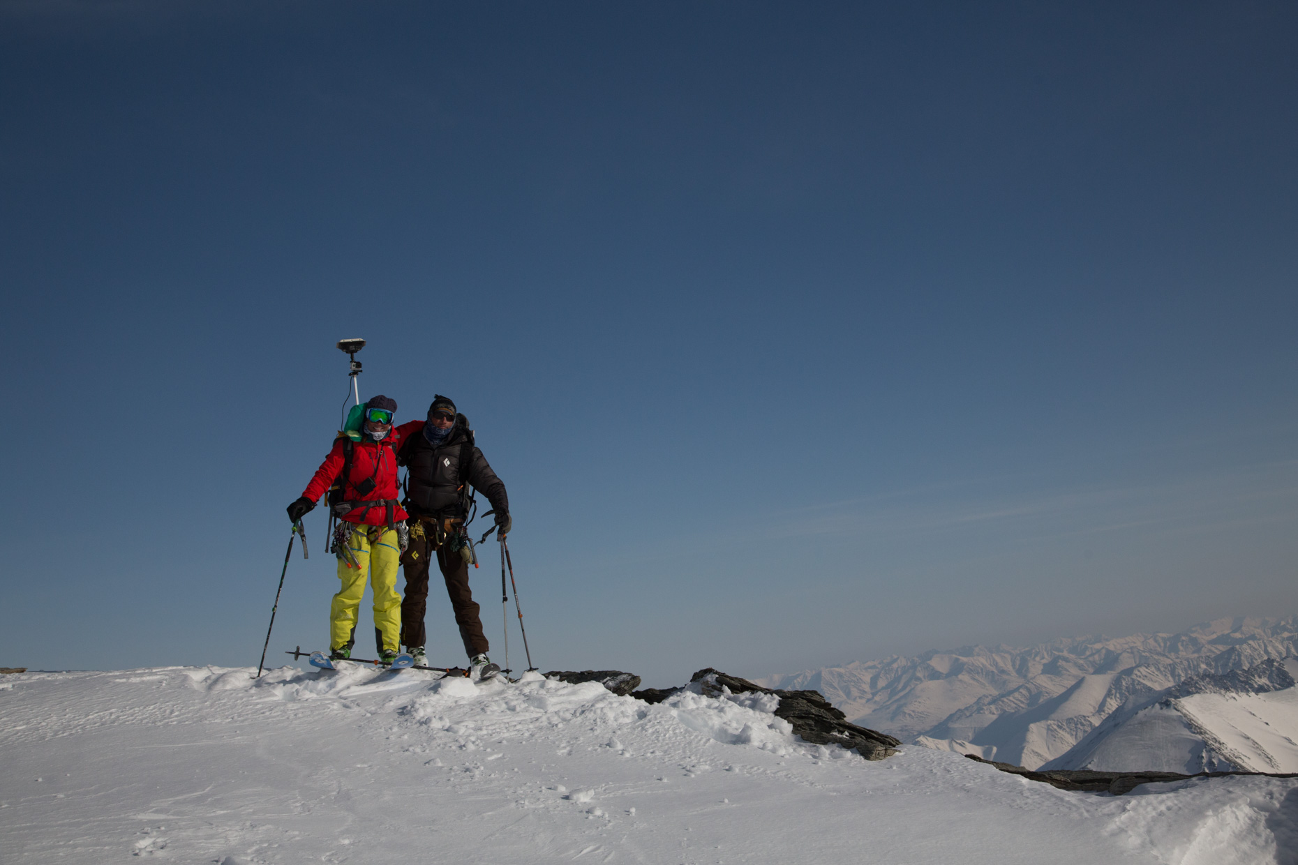
When the team reached the glacier on the north face of Mt. Chamberlin, we spent some time discussing the best climbing route since the face was comprised of steep glacial ice riddled with obvious debris. The originally intended route up the northwest ridge looked like a long lower angle ice climb – not something we could easily agree would be the best choice. Eventually, we chose to try a steep snow couloir on the west side of the north face but once in it, the couloir proved to have too much avalanche danger so we exited onto the northwest ridge and attempted Plan C by climbing through loose snow and rock to reach the upper mountain which held blue ice mixed with snow. This route was our last option and was very slow going, but it worked and we reached the summit after twelve hours of climbing!
On the summit at 6 pm, we studied the snow cornices which had built over time by prevailing winds and decided to locate the GPS on the spot that we felt represented the true summit without exposing ourselves too much to danger of falling through a cornice. This time, I connected the antenna to its tripod and, while laying on my belly, pushed it into as ideal of a location as I could manage so that we’d have an accurate fifteen-minute reading while we changed from crampons to skis.
As the reading was being finished, we held a difficult discussion as to what would be the best route down since nothing we had seen or climbed on the north aspects appeared skiable in the current conditions. We agreed to try a southwest facing couloir that began partway down the west ridge. Although no one in the team had experience on this aspect in the Arctic, before leaving Fairbanks we had been able to view the 3D maps Dr. Nolan had made only a few days earlier and thus virtually scouted this option.
As I stood on the summit of one of the tallest peaks in one of the most remote Wilderness areas in the country, my satellite phone rang… It was Dr. Nolan who was in Coldfoot checking up on us and wanting to get weather conditions, as he planned to to fly over the same peaks the next day. I let him know of our successful summit of Mt Chamberlin and our plan for skiing down.
In the Arctic’s evening light, we were able to make a complete ski descent down Mt. Chamberlin from the summit via the southwest facing couloir into Carnivore Creek. The route held everything from ice near the top to ‘perfect corn’ in the middle to rotten isothermic snow at the lower gullies, which had experienced wet avalanches during the day and were just now beginning to refreeze. Safely out of Carnivore Creek, we finished the day with the ski back to our base camp on Lake Peters where Martha had a hot meal ready for us.
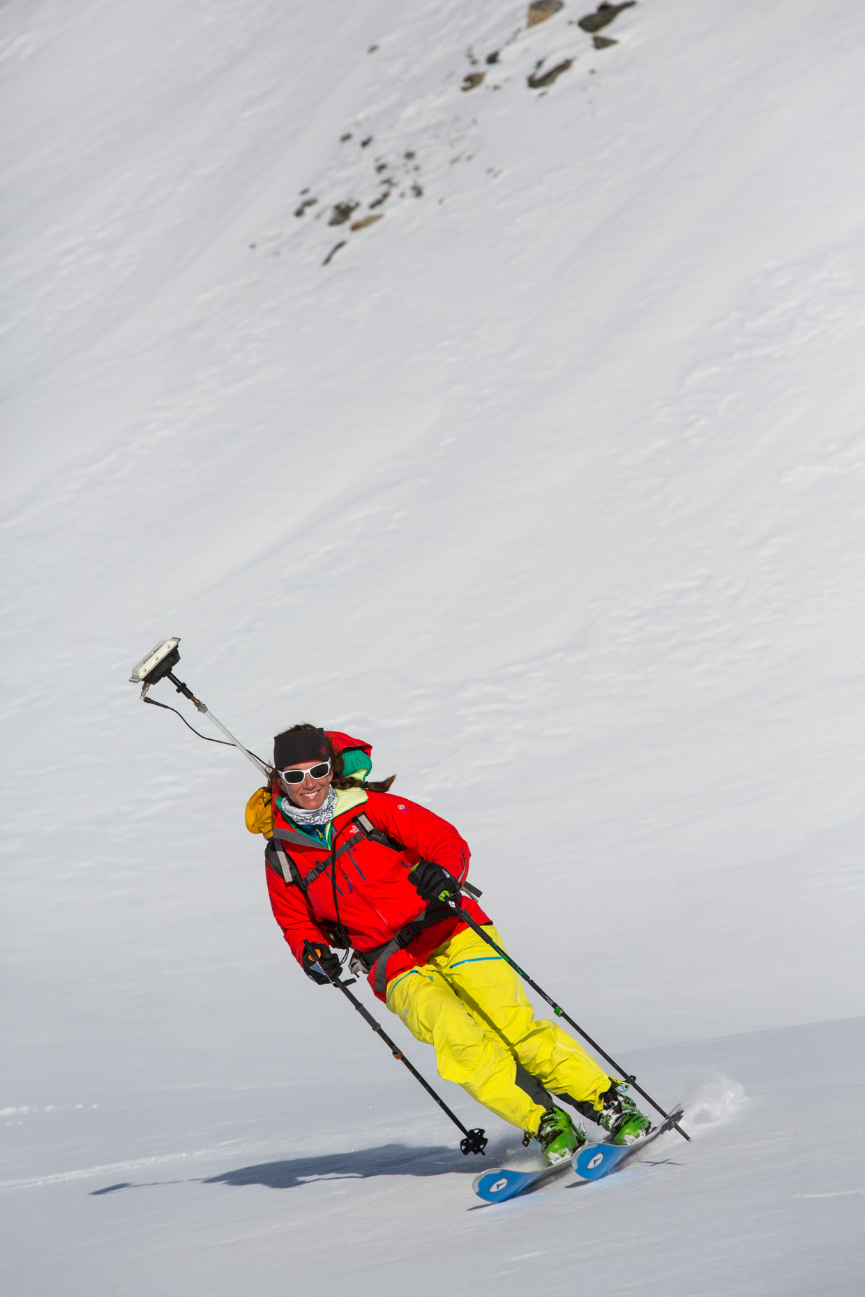
When Dr. Nolan saw this photo he just chuckled, apparently I was supposed to keep the antenna level on the ski down…
FODAR
With our part of the journey successfully finished, it was now up to Dr. Nolan to complete the airborne acquisitions and the subsequent processing and analysis. The good news was that the preliminary analysis, made minutes after our return to Fairbanks, showed that our GPS measurements had succeeded and that they were within centimeters of the maps that Dr. Nolan had already made a few days before our climbing trip began. The bad news was that it seemed we hadn’t fully settled the initial question, as there was a lot more to this story, and to science, than I initially realized.
These preliminary results had indeed showed that Mt Isto was significantly higher than Mt Chamberlin, but they also showed that Mt Chamberlin was over 100′ lower than indicated on the maps, calling into question how many other peaks may be different heights than currently published. These maps are also over 60 years old — could climate change have caused the differences? It was at this point I began to understand Dr. Nolan’s dream — with his own airplane and mapping system, he had the capability to answer questions like this on his own. For the rest of this summer, and the summer of 2015, he took any opportunity he could to make the thousand mile flight to get up to these peaks, map them, and return home in a day trip if possible. I lost count of how many flights he made, but in the end I know he mapped each of the five tallest peaks at least twice and several of them five or more times. By repeating these maps, he removed all doubt as to the accuracy of his system in steep mountain terrain because he was demonstrating that each map was identical, except for the real changes that were occurring due to storms and melt.
 Always on the lookout for good mapping weather…
By now Dr Nolan had named his technique fodar and as word of the accuracy of his technique spread, he formed a business called Fairbanks Fodar to meet the increasing demand for his maps in other applications. As I see it, Dr Nolan is about as much of a businessman as I am a scientist, as all of his profits seem to go back into the science that is his passion, but in that regard our approach is the same — to do what it takes to pursue our dreams in the Wilderness we love.
So now, just about two years after our first phone call about the topic, we know conclusively which are the tallest peaks in the US Arctic, but you can read all about that in the rigorous peer-reviewed paper that Dr Nolan submitted on the subject.
Is the age of exploration over? With the project finished, I asked Dr Nolan this question. He just smirked, “It’s only just beginning.” I’d have to agree.