
A First Look at the Nome Map
With the storm still raging, I had some time to process the Nome acquisitions from two days ago.
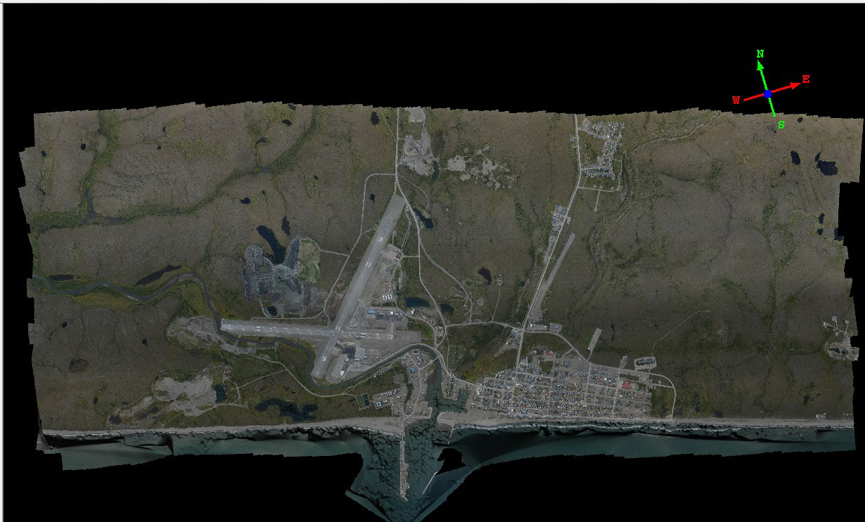
Here’s a top view of the new map. Mouse-over to see the topography created by the same images.
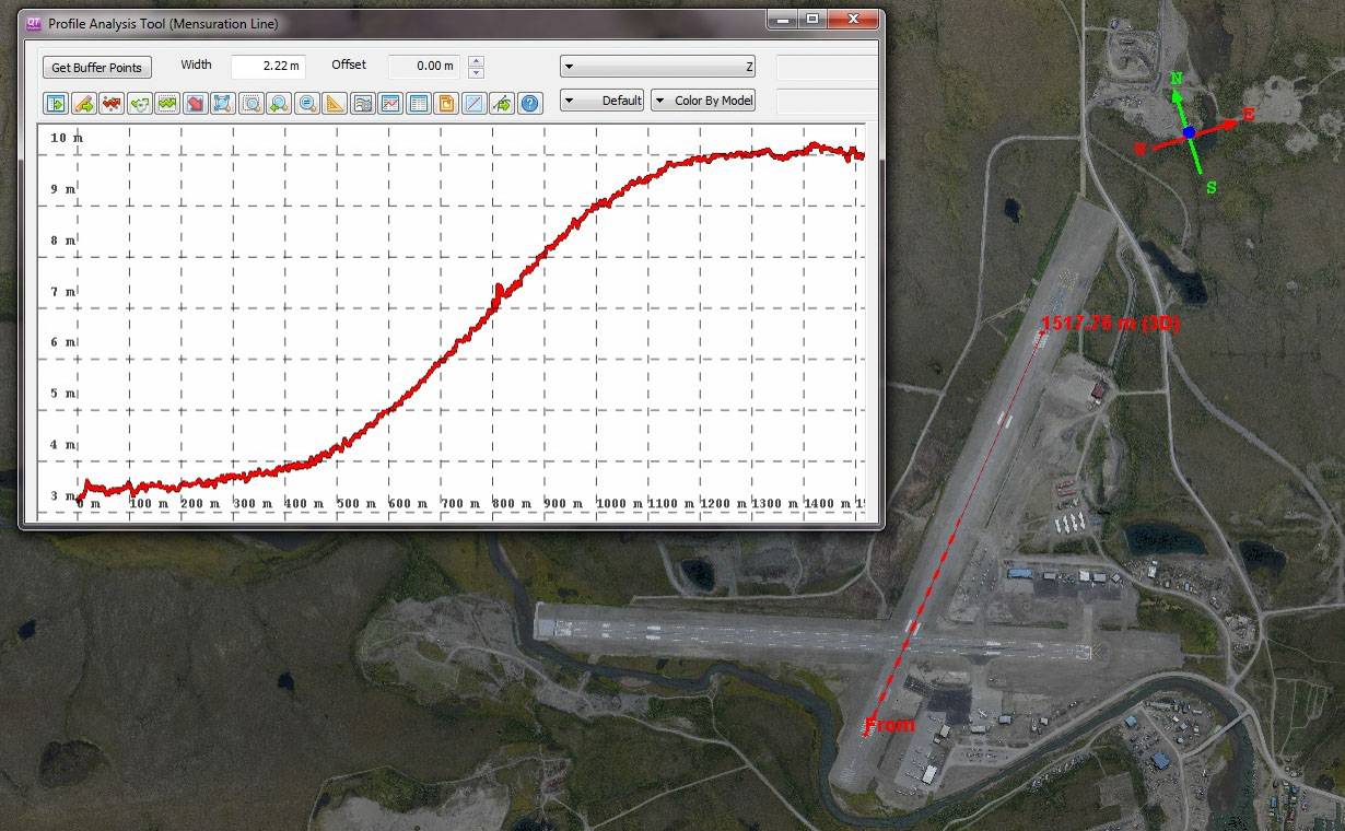
This runway seems to have quite a slope to it. The published FAA guide here lists the slope as 0.4%. I get that same value, when I measure length from threshold to threshold. But when I measure just the slopiest part of the runway, I get over 0.6%, which seems like a more realistic and useful number in terms of landing characteristics. Mouse-over to see the topography.
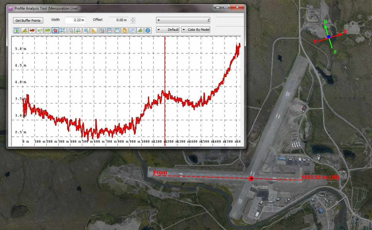
The other runway has some dippity-dos too, especially where it meets the other. I taxied on this today, and those dips really exist.
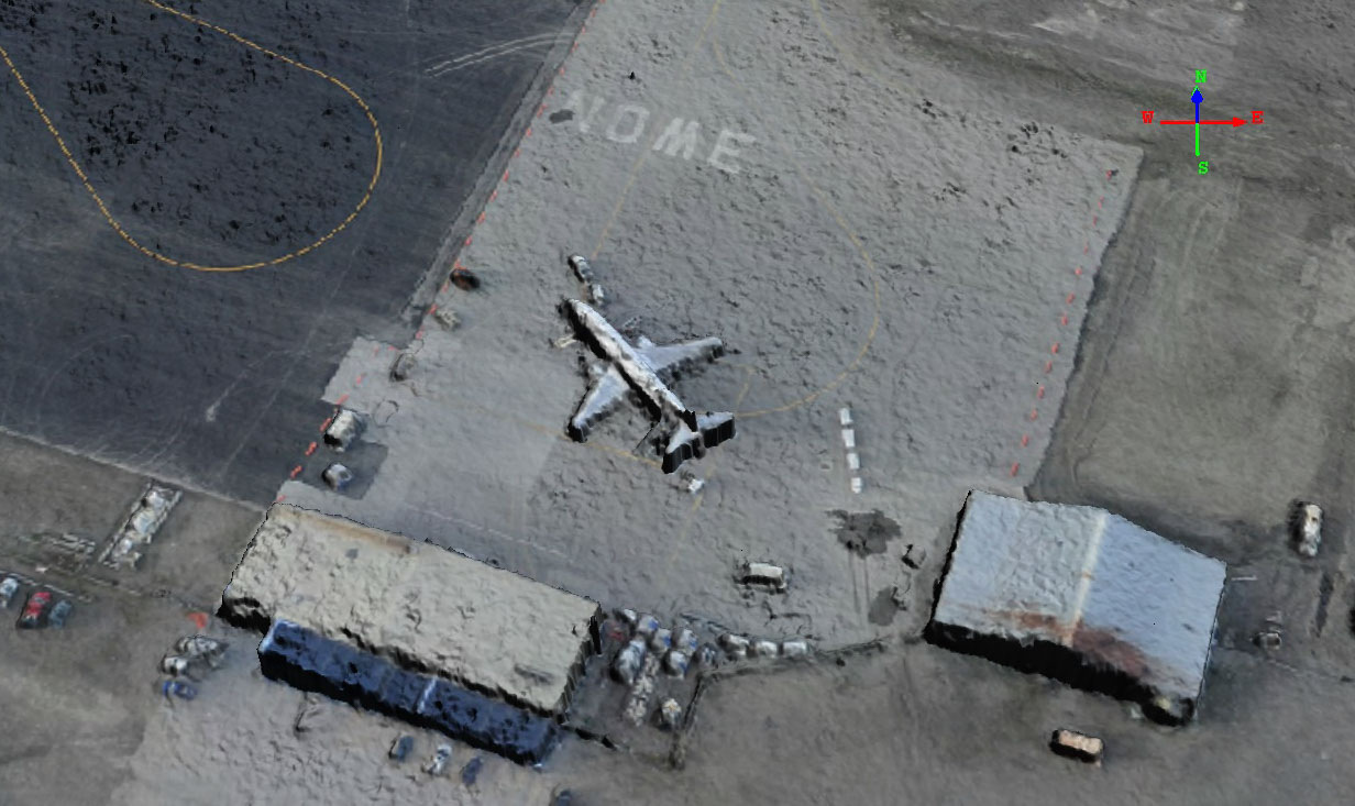
Here is the Alaska jet parked at its ramp. Mouse-over to see its topography.
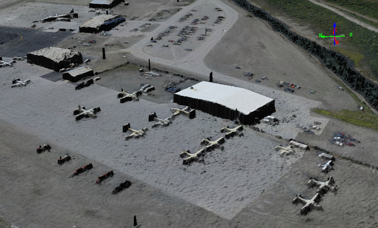
Here is the Bering Air ramp. Unfortunately for them, their ramp is actually the lowest spot in town, as I show later in the short video.
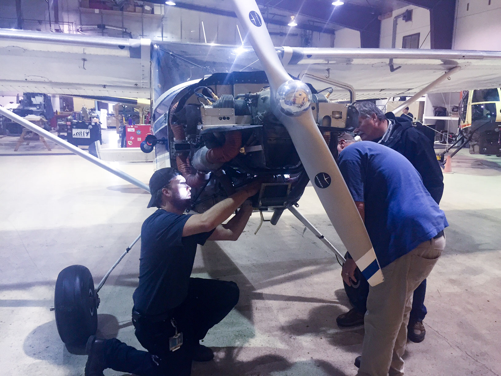 The good mechanics at Bering Air took pity on a wayward Fairbanks pilot and made sure everything was still attached properly to my engine.
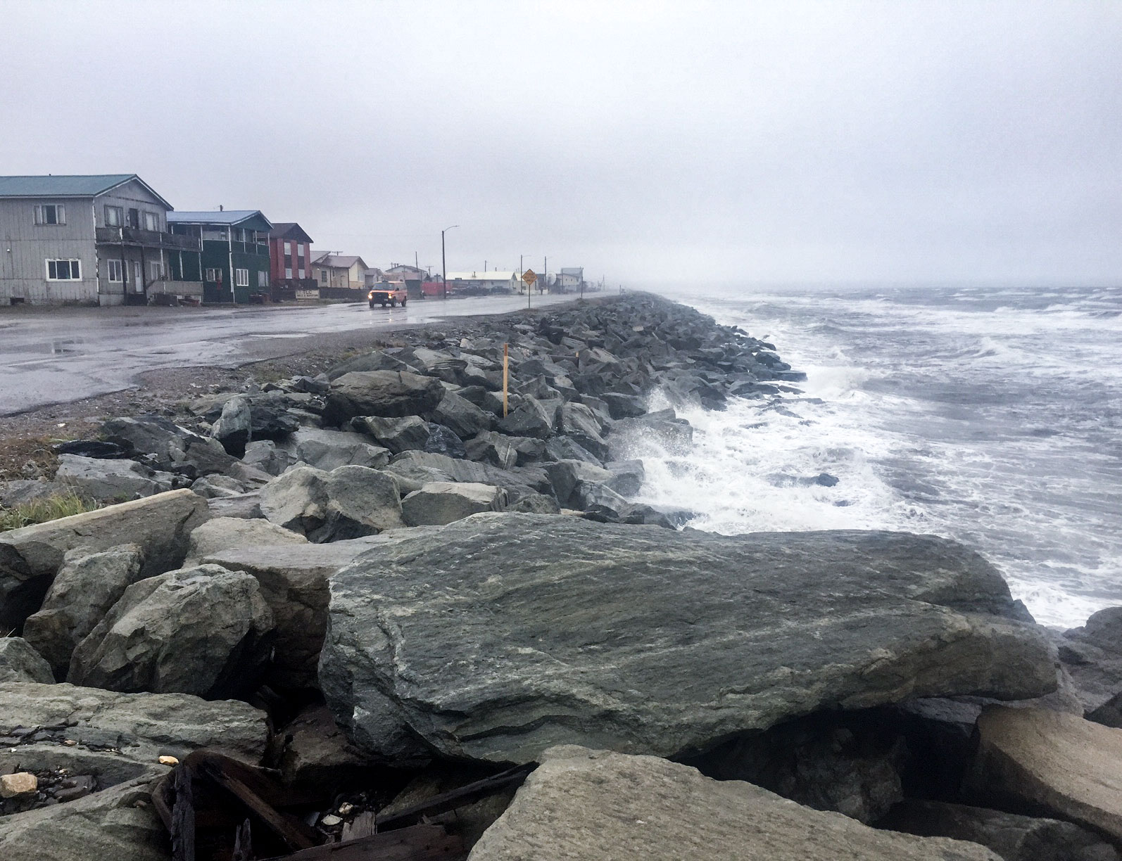
One of the reasons for all this flying around has to do with today’s storm. Here is a view of the waves today. They are not huge or threatening, but they come much higher up on the beach than normal tide levels. Mouse-over to see what they looked like before the storm hit full strength. The wind-driven waves and the low pressure air have the potential to raise water levels up and over the armored embankment here. As things go, Nome is in pretty good shape. Many of the villages along this coast are much lower.
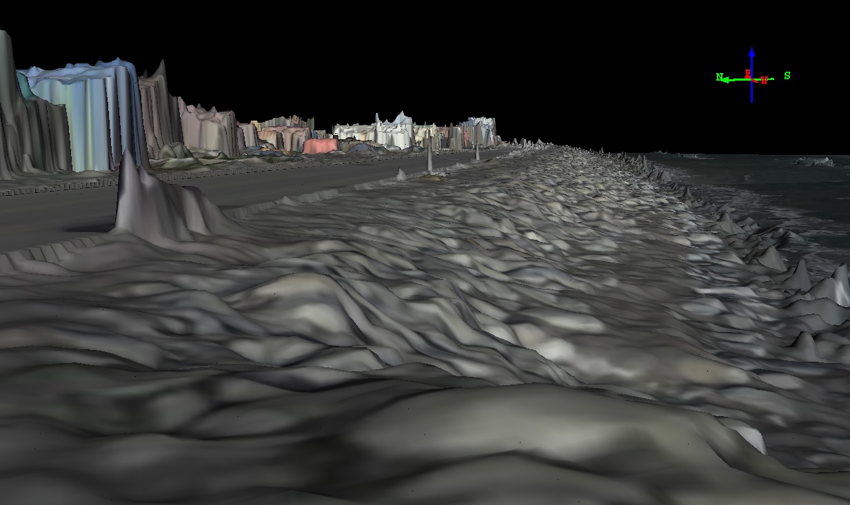 Here’s that same view created synthetically with my maps. The general idea is that by using these maps, we can predict how far inland such storm surges will travel.
The video below gives some idea of how, similar to what I did for Unalakleet. But I’m really just fooling around when I do it, once I’m done with the final processing the real experts will take over. That is, I’m not a real coastal scientist, I just play one on Youtube.
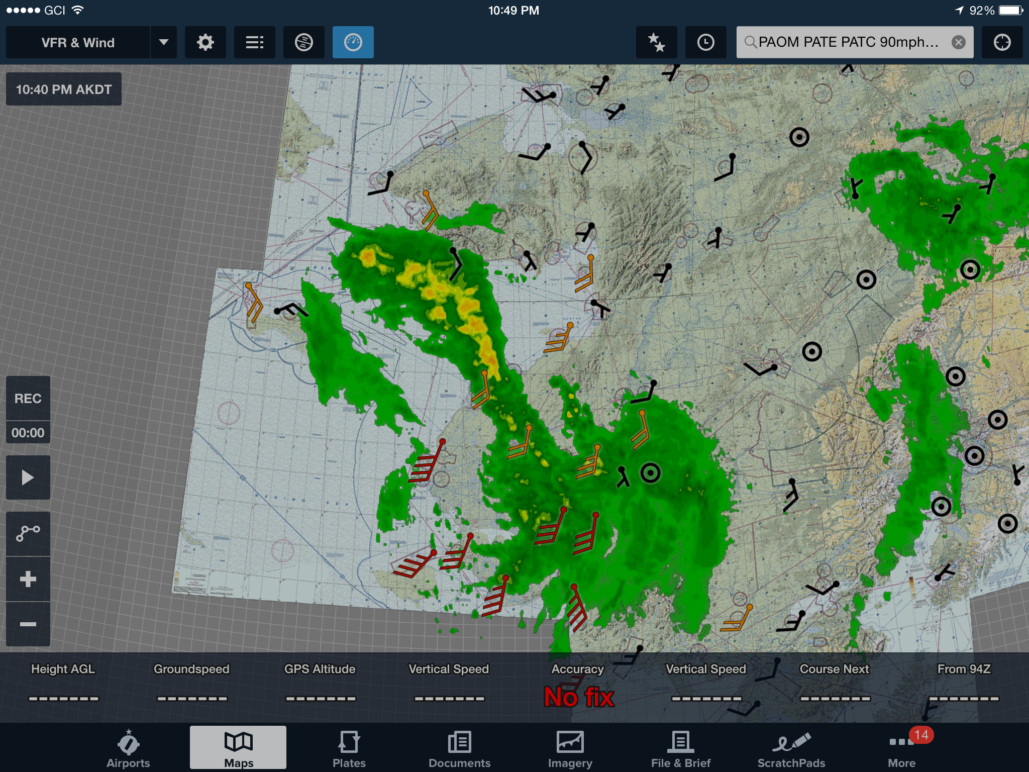
The green and yellow blobs are still coming at us, but wind speeds here have died down some. I think I made the right call leaving Bethel.
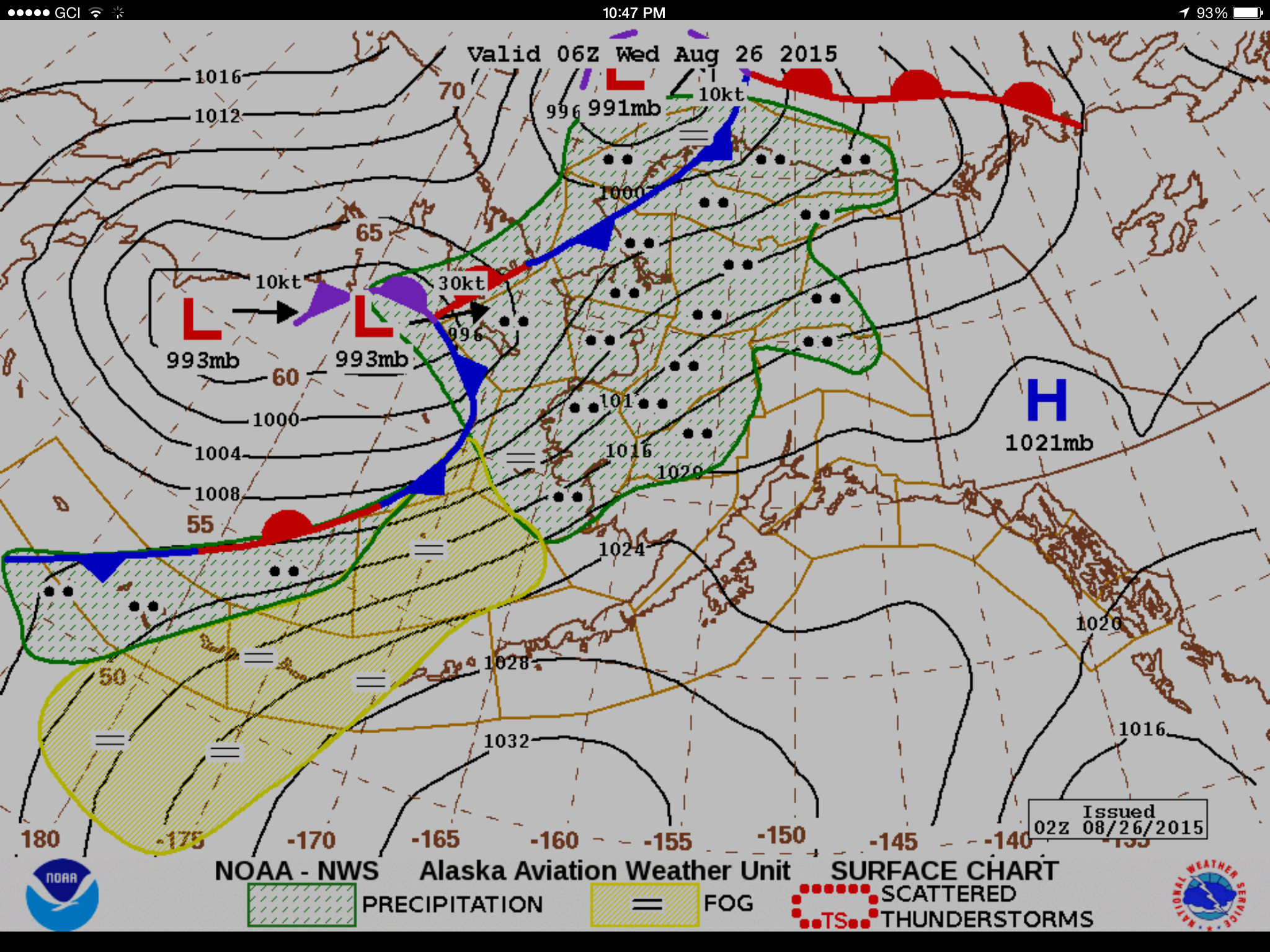
Here is the current weather. Mouse-over to see the forecast for Thursday afternoon — could be the day.