
West coast villages complete!
After 4 days of bad weather, today I mapped Chefornik, completing our goal of mapping all of the villages between Wales and Bethel on the west coast of Alaska.
After two very productive days based out of St. Mary’s, the weather turned sour. Most of the region was IFR and St Mary’s itself spent most of the time in a cloud. As the internet and cell coverage in town was on the blink most of the time, I took the opportunity to finish processing all of the airborne GPS data to date and prepping the various data sets for processing once I return. But the novelty of this has its limits and when the ceilings lifted a bit this morning I was ready to fly. Though perhaps too ready.
Bethel was calling two layers — a 20,000′ ceiling with 1/4 mile visibility due to ground fog. I gave it an hour to burn off in the sunlight before launching, but it was still a bit too early. The coast was still covered by the same ground fog 30 miles inland, with a 4000′ ceiling and mixed layers in between. I poked my nose in as far as I dared but it was too jumbled, so I loitered a bit looking at the volcanos while waiting for Bethel to open up, which it didnt. It being Sunday, it meant no fuel in St Mary’s, so I headed back to St Mary’s to save fuel in case it turned into a late night of great weather.
I was a bit too eager getting out of St Mary’s this morning and got turned around by early morning scuz. It gave me a chance to catch up on my reading while waiting to relaunch, “Mosquito: A natural history of our most persistent and deadly foe”. I thought I was heading into mosquito heaven on this trip, but I literally have not seen a single once since arriving. Not even any dead ones of my windshield.
Bethel opened up about 12:30, so I launched a little later and got about as far as the first time and found the same cloud layers. With Bethel now VFR, the Battle of Bethel had begun with dozens of planes launching and trying to play catch up for the day. I could see most of them on my Forelight traffic display, and that they were all 1500′ or more below me, which meant that they were all flying below a ceiling that was at least 500′. So I descended and found that the ground fog had indeed lifted enough to get under.
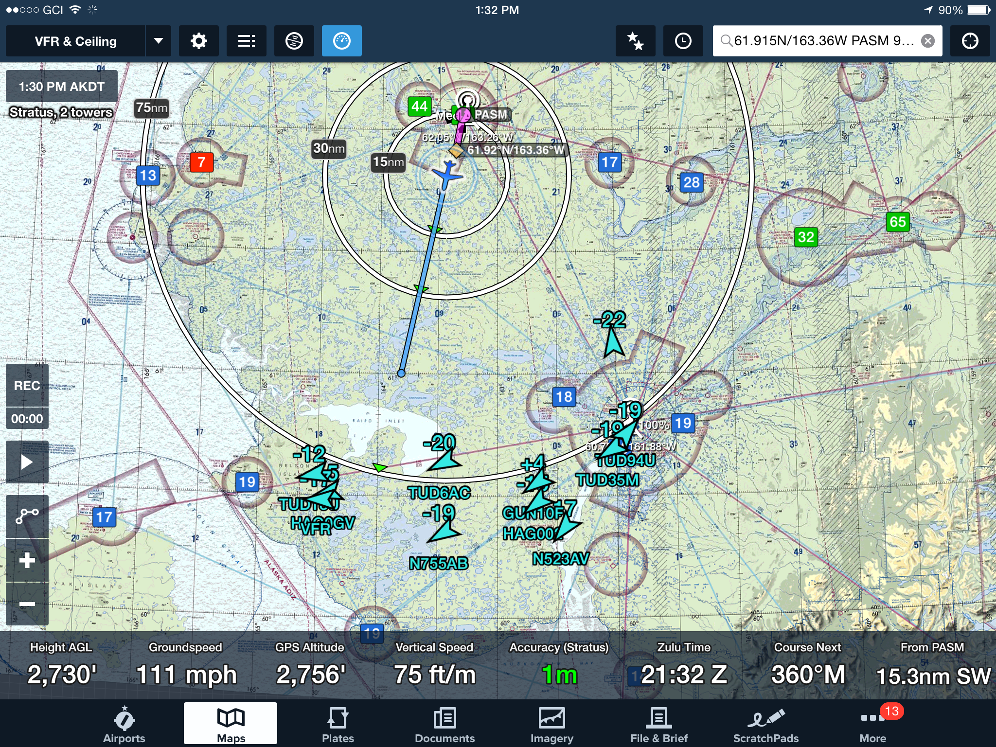
Apparently I wasnt the only one waiting for the fog to clear at Bethel. The moment it did, over a dozen planes took off from there (and apparently they were all headed to Toksook Bay — was the Avenger was having a killer yard sale I didnt know about?) Note too that they are all flying much lower than me, and I wasnt flying all that high (eg., “-19” means N755AB was flying 1900 feet lower than me).
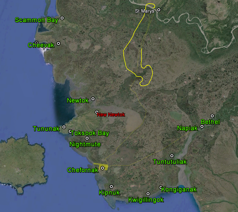
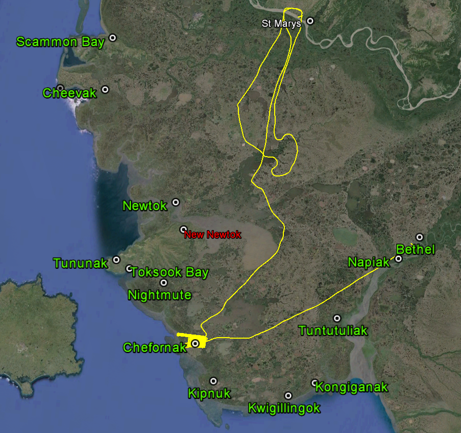
My goal for the day was to finish the coastal mapping to the point of creating a continuous mile-wide swath from Wales to Bethel. However, north of Toksook Bay looked too cruddy to even attempt and the ceilings south of it were too low to finish the southern part before it got dark. The only other high priority objective left in the area was the village of Chefornik. The ceiling was too low to fly as planned, but I could fly at half that height and do it. This meant flying 3 hours rather than the 1.5 hour planned, but in my twisted logic flying 3 hours today would save me 1.5 hours tomorrow, so I went for it. The ceilings held all afternoon and it turned into a pleasant evening. It was also nice to be back in the area again, as several pilots remembered me from a few weeks ago. I guess I’m hard to forget — I’m the only guy that flies above 1000′ feet here and the only guy that spends more than 10 minutes airborne within 5 miles of a village.
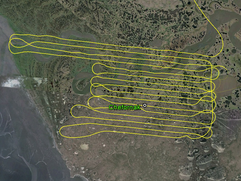
These are the flight lines I planned, mouseover to see what I actually flew. By flying half as high, I have to fly twice as much, but I get four times the resolution. I fly the original lines first in case the weather changes, and it serves as a visual guide to remind me where I’ve been.
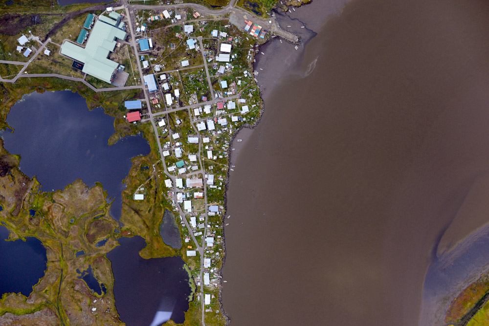
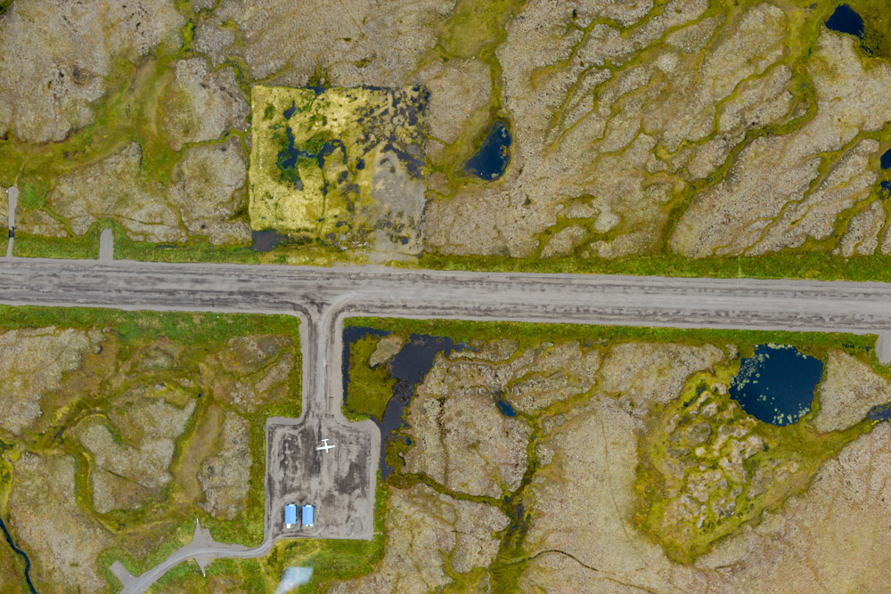
Chefornik. Most of the town is connected by boardwalks big enough to drive four-wheelers on. I’m not sure how the school bus gets around though…
I wasnt the only plane around by far. The pilots here are friendly though and dont find me too annoying.
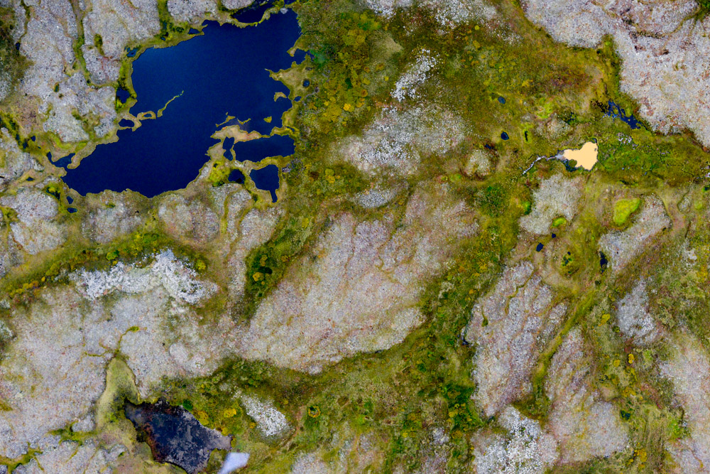
One of these things is not like the others…
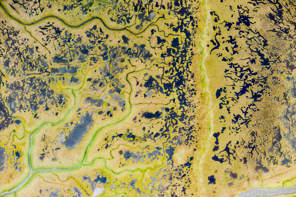
Nearly all of my mapping has been at super low tide. I think the intricacies of the mudflats are one of my favorite features out here.
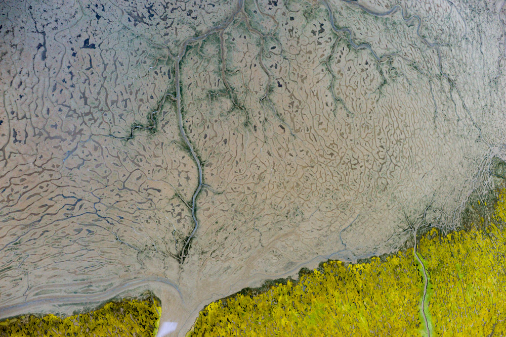
Though there are some impossibly intricate features inland too.
So it wasnt the day I was expecting, but it was a long-expected day — all of the villages are complete! Here is a list of the ones I’ve mapped in the past 38 days, in order from north to south:
- Wales
- Brevig Mission
- Teller
- Nome
- White Mountain
- Golovin
- Elim
- Koyuk
- Shaktoolik
- Unalakleet
- St Michael
- Stebbins
- Kotlik
- Emmonak
- Alakanuk
- Nunam Iqua
- Scammon Bay
- Hooper Bay
- Cheevak
- Newtok
- Tunanak
- Toksook Bay
- Nightmute
- Chefornik
- Kipnuk
- Kwigillingok
- Kongiganak
- Tuntutuliak
- Napakiak
These were all mapped at between 9 and 17 cm, depending on priority and weather, and all should have a subpixel accuracy and repeatibility. There is still one more ‘village’ remaining, a possible new townsite for Newtok, so depending on your definitions I havent quite finished the villages yet, but since it is open land I consider it in the same category as the other inland areas that remain, plus its my blog so I can define things how I like…
Mapping Chefornik was the last village on the list, now its just the remaining coast between Cheevak and Kipnuk. With just one more day of good weather…