Mapping Aufeis on the Dalton Highway
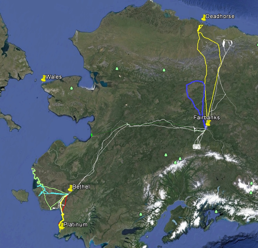
Today I flew to Deadhorse to map the stretch of the haul road that got shut down last year when aufeis from the Sag River decided to divert the river over the road. This road is the only ground linkage between the oil fields of Prudhoe Bay and the rest of the world, so when the road closes, its a really big deal.
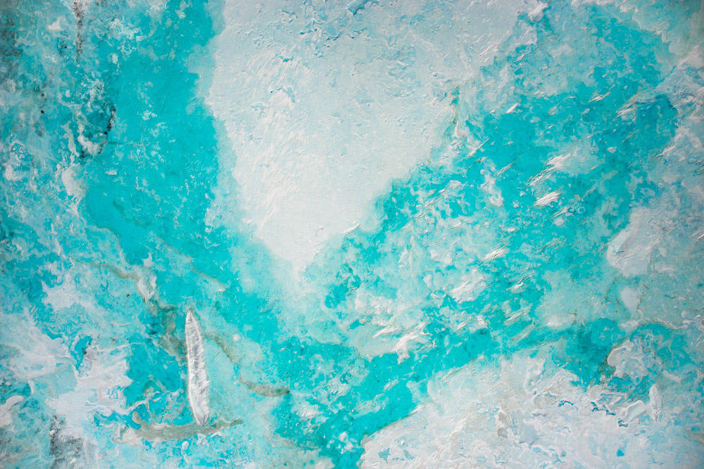
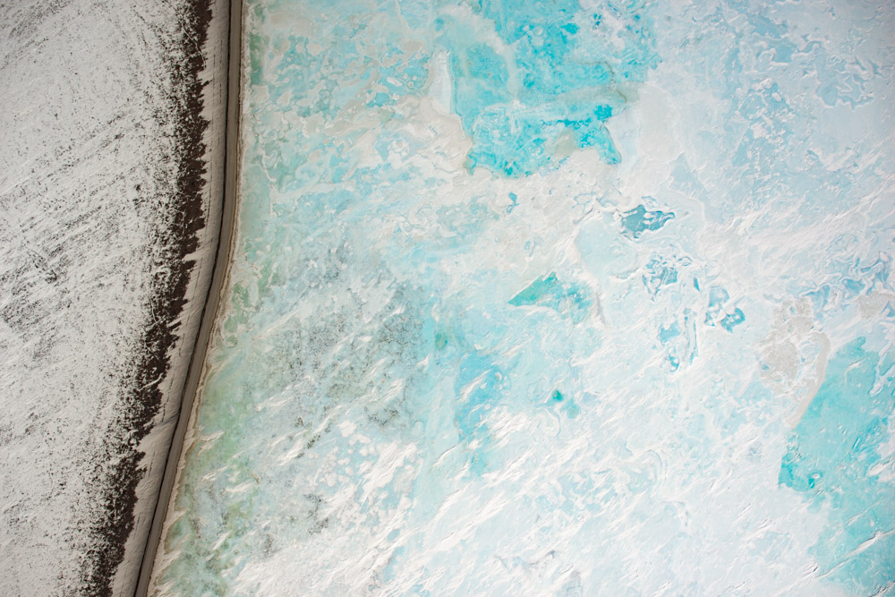
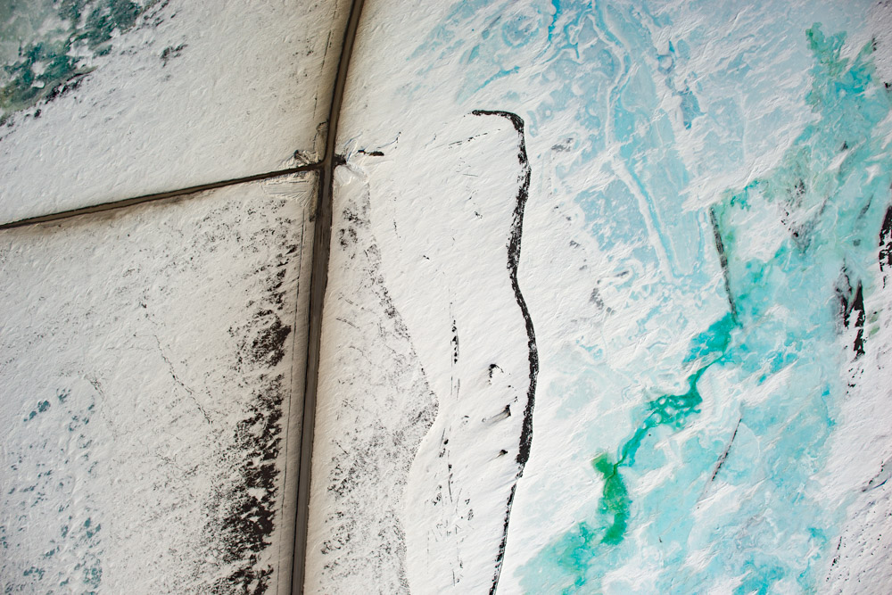
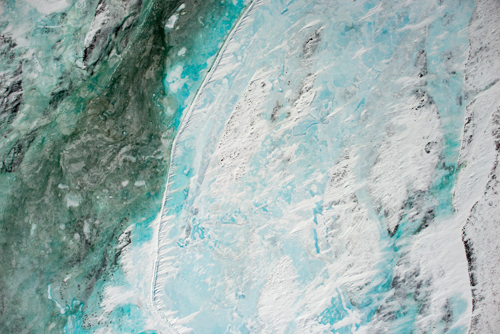
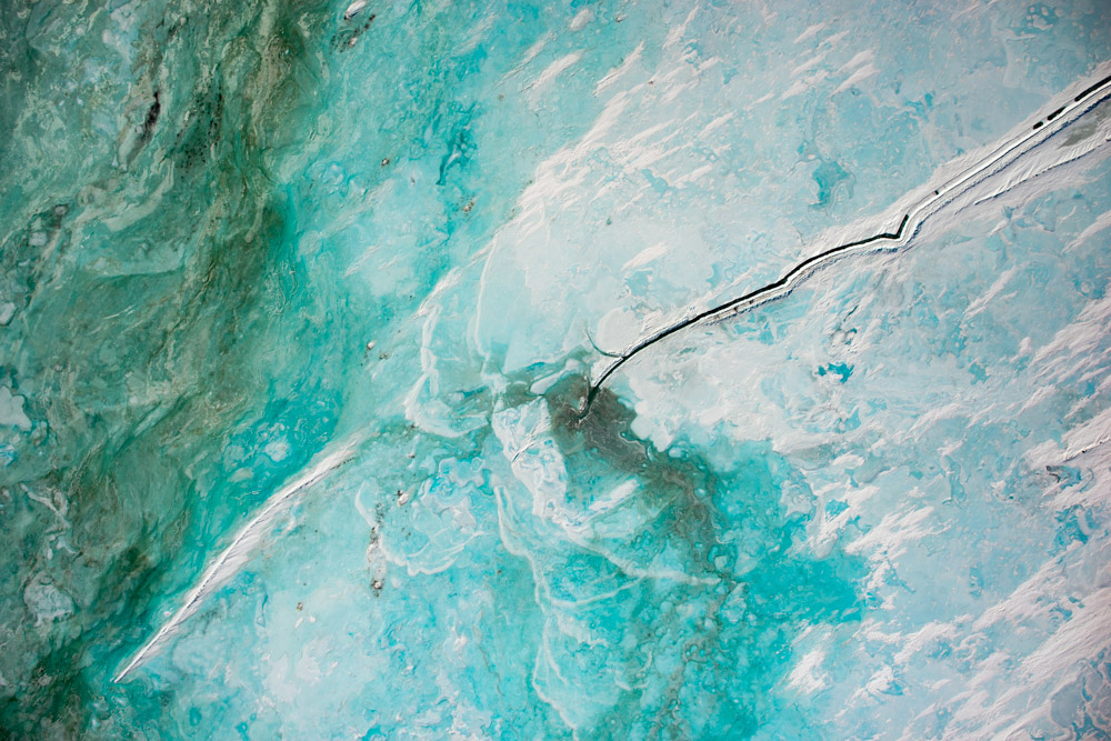
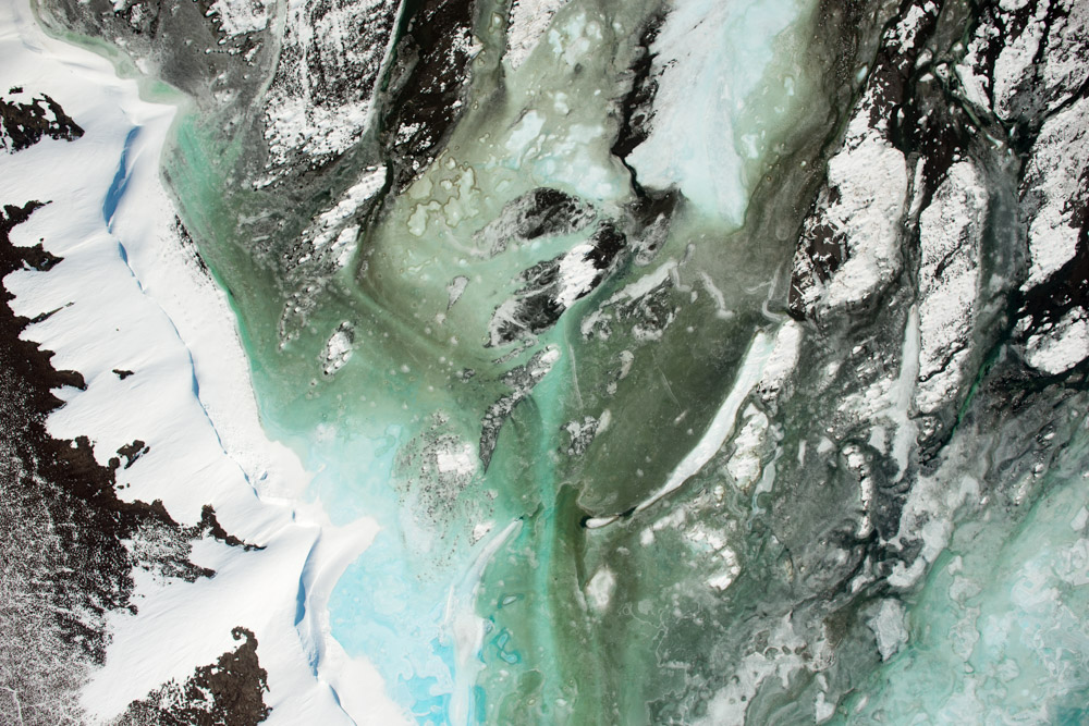
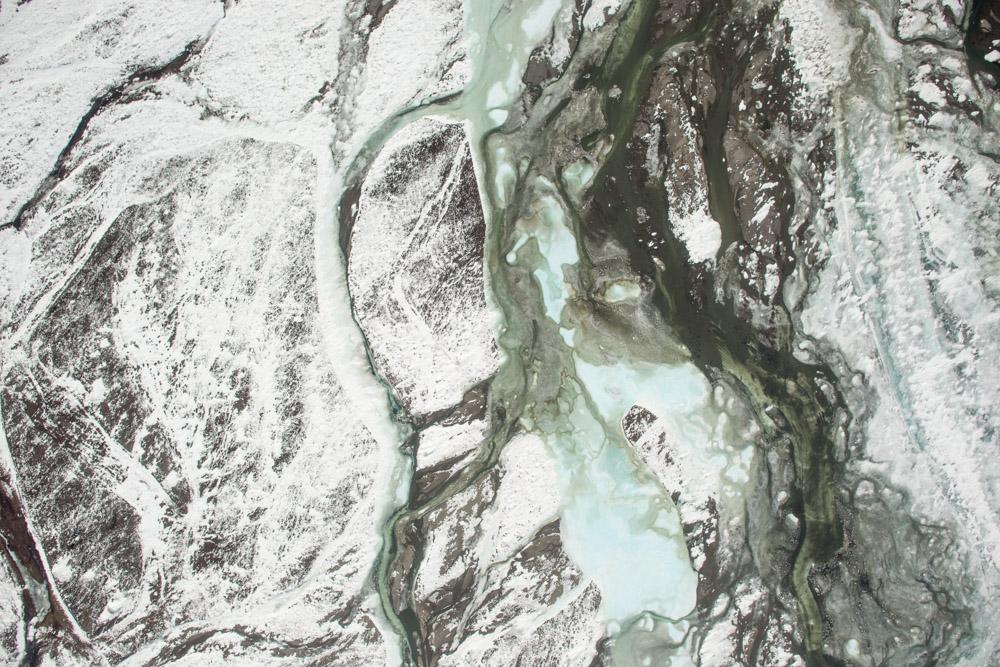
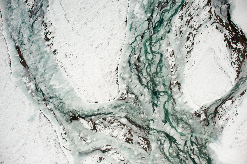
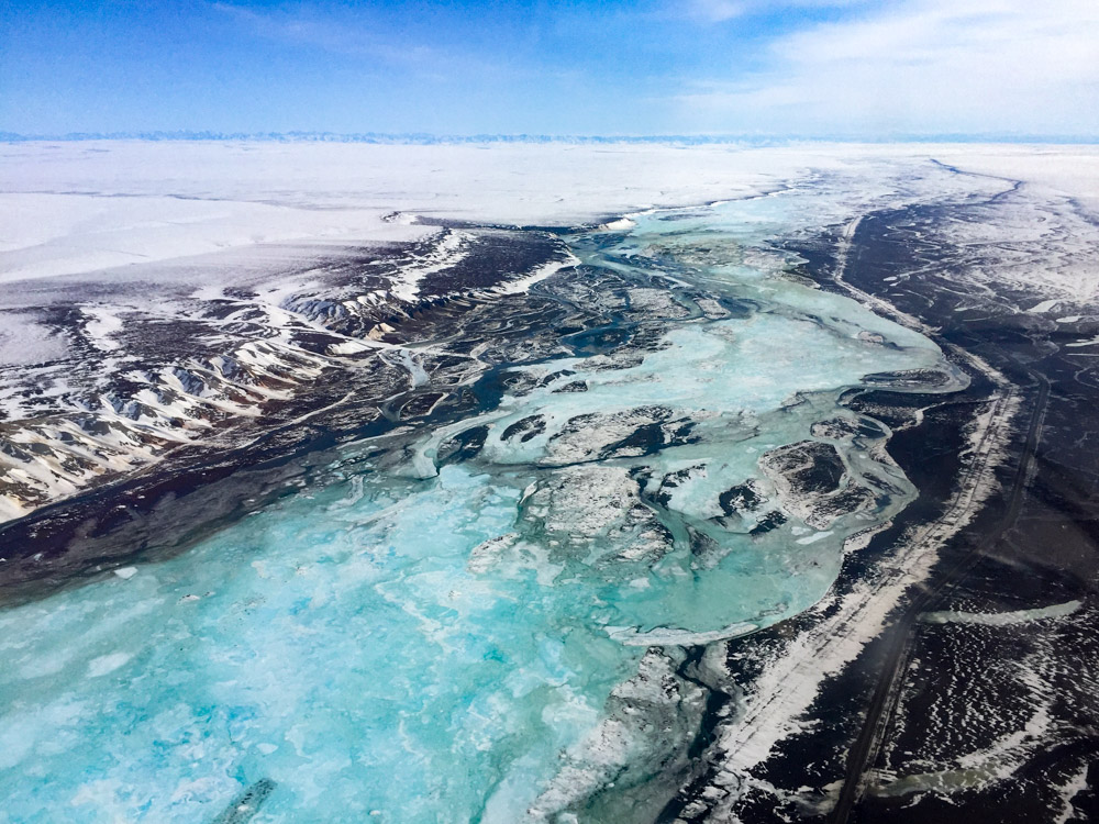
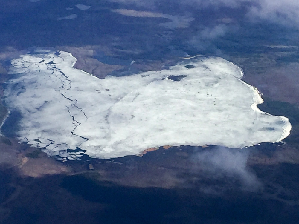
Aufeis forms by several processes, but the general idea is that when liquid groundwater bubbles up to the surface in winter it freezes when it hits the cold air, creating layers of ice which then dams the water that bubbles up a bit later, causing that water to spread out before it too freezes. This liquid water could come from a spring or it could come from base flow from a river running through gravels or it could from a tributary stream that started flowing in spring before the main river does or one of many other dynamics. My favorite patch of aufeis is at the toe of McCall Glacier. Here meltwater from summer trickles to the bottom of the glacier, runs through a layer of gravel kept thawed by the insulating effect of the ice, and bubbles up downhill from the terminus. It gets 5 meters thick in places and is still present in August, which is nice for us because we can use it as a hiking highway. There the ice is topographically confined by valley walls, which is why it gets so thick. But on a river floodplain it gets wider rather than thicker. The width means that when the river begins to flow due to melt upstream, the aufeis can cause it divert great distances. In the case of the haul road, at a location where the road is not much higher than the river, the aufeis got thick enough that when the river started flowing, it flowed over the road because the aufeis was in the way. So the idea now is to try to better understand the dynamics of this aufeis growth and what caused last year’s flood so that it can be prevented from happening again.
I had been talking with DOT for a while about this project, but funding for research is tough to come and the bureaucracy of governments are cumbersome. But the day before I planned to leave for my Bethel trip, I got a call saying that breakup was imminent and they needed a map asap. So I hung around Fairbanks a few extra days to do it, but unfortunately the weather was not cooperating and was not forecast to improve. I kept an eye on it that whole week in Bethel, but it was still solid IFR, as is often the case along the coast there. Finally, at just about the time I was finishing up in Bethel, the forecast was for improvement. Not coincidentally the improvement in the north was due to a huge low pressure system pushing its way towards Bethel and pressure to make this map was increasing, so I made an effort to get ahead of the weather. I was only partially successful.
I left Bethel on Sunday, in the rain but with a decent ceiling inside the front. To the north and east, skies were clear and calm ahead of it, so it was just a matter of breaking through. The sparse reporting along the way showed the ceilings consistently at 2000′-3000′ so it seemed doable, especially within the wide, low Yukon River valley. Unfortunately as I approached the leading edge in between reporting stations, the ceiling slowly graded into the ground. By now I had gotten used to decision making in low ceilings, the general idea is to always see where you are going and always have an out in case that changes. But here there was topography as well as trees. I could follow the river and mostly count of gravel bars being within glide slope, but at exactly the point where the ceiling was almost to ground level the river was necked into a single channel by low ridges on either side. Though I was still wearing my life jacket, at this point it seemed like diminishing returns to continue, but it was also not clear what was occurring behind me. By now I had flaps in and was just puttering along at near idle, so I turned around and found a nice meadow where I could land, on top of which just happened to be blue sky. The sloping ceiling and the blue sky told me that I was at the edge of the front, but really that was just a guess. So I spent some time circling here weighing my options — go up through the hole, land on the meadow, go back to Bethel, keep circling, go for a swim, etc. I decided to have a snack and wait. I had enough fuel to circle here for an hour if I needed to, and I thought at some point this front would keep pushing forward over lower ground where the ceiling would return again and I could see where I was going. Fortunately after my second candy bar it started to do just and by the time I finished my banana I could once again see where I was going. Twenty minutes later, I was ahead of the front and had clear skies for the rest of way home.
This was the second Sunday in a row that I got Stephen out of bed at 7AM. But it gets him overtime and it gets me gas, so win-win.
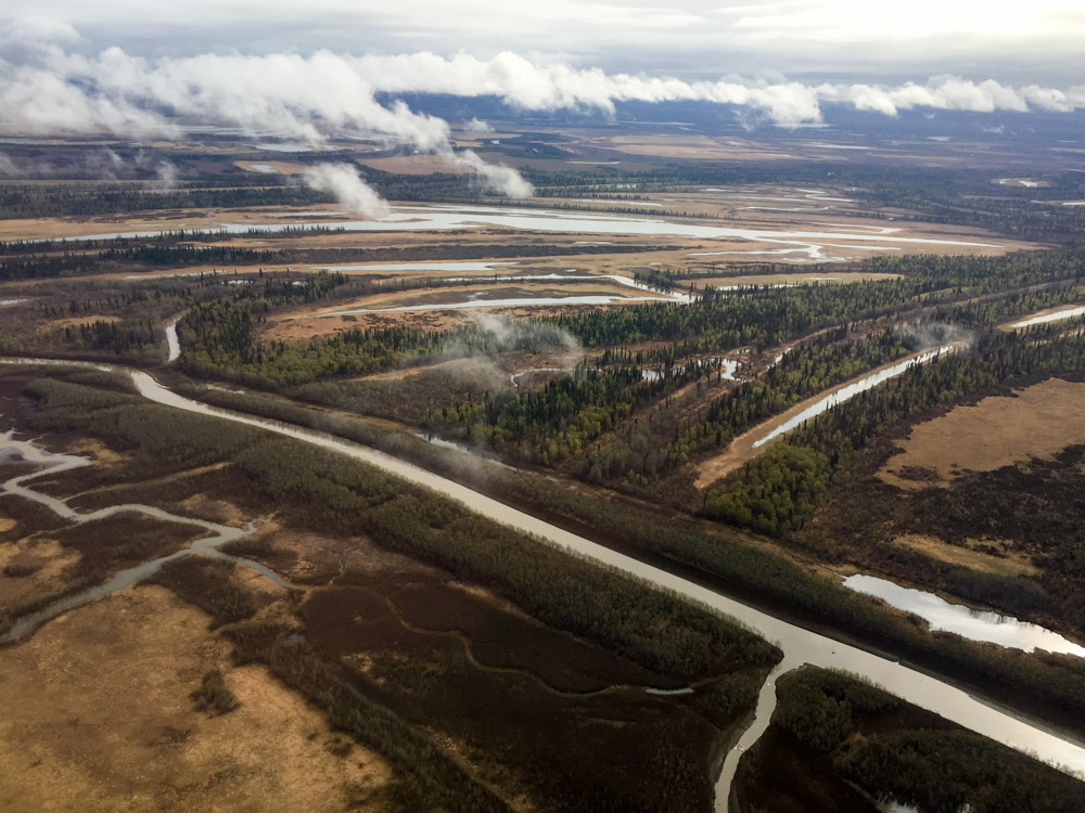
The Yukon River valley is mostly flat, but not as flat as Bethel and most of my landing strips are covered by trees.
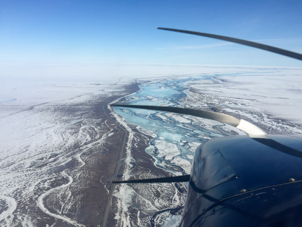
It’s pretty low, but I can see where I’m going. Twenty minutes earlier I would hesitate to drive a boat through that.
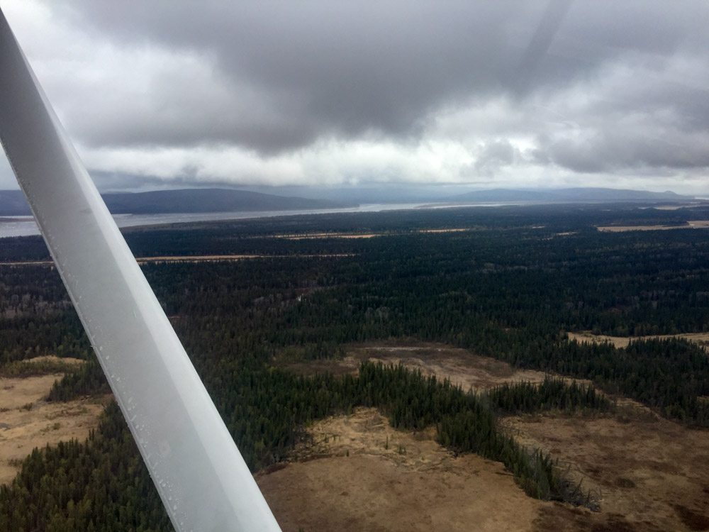
You know you were in the shit when a 1000′ foot ceiling is a relief.
The 6AM weather check the next morning was a mixed bag. I rolled over a couple times thinking about it, it was at best a 50-50 chance of success. Deadhorse was in an out of clear sky and fog, which was an enormous improvement, but so was the Brooks Range which I had to cross. I knew there was intense interest interest in getting this mapping done, so I decided to roll the dice. I probably should have stayed in bed.
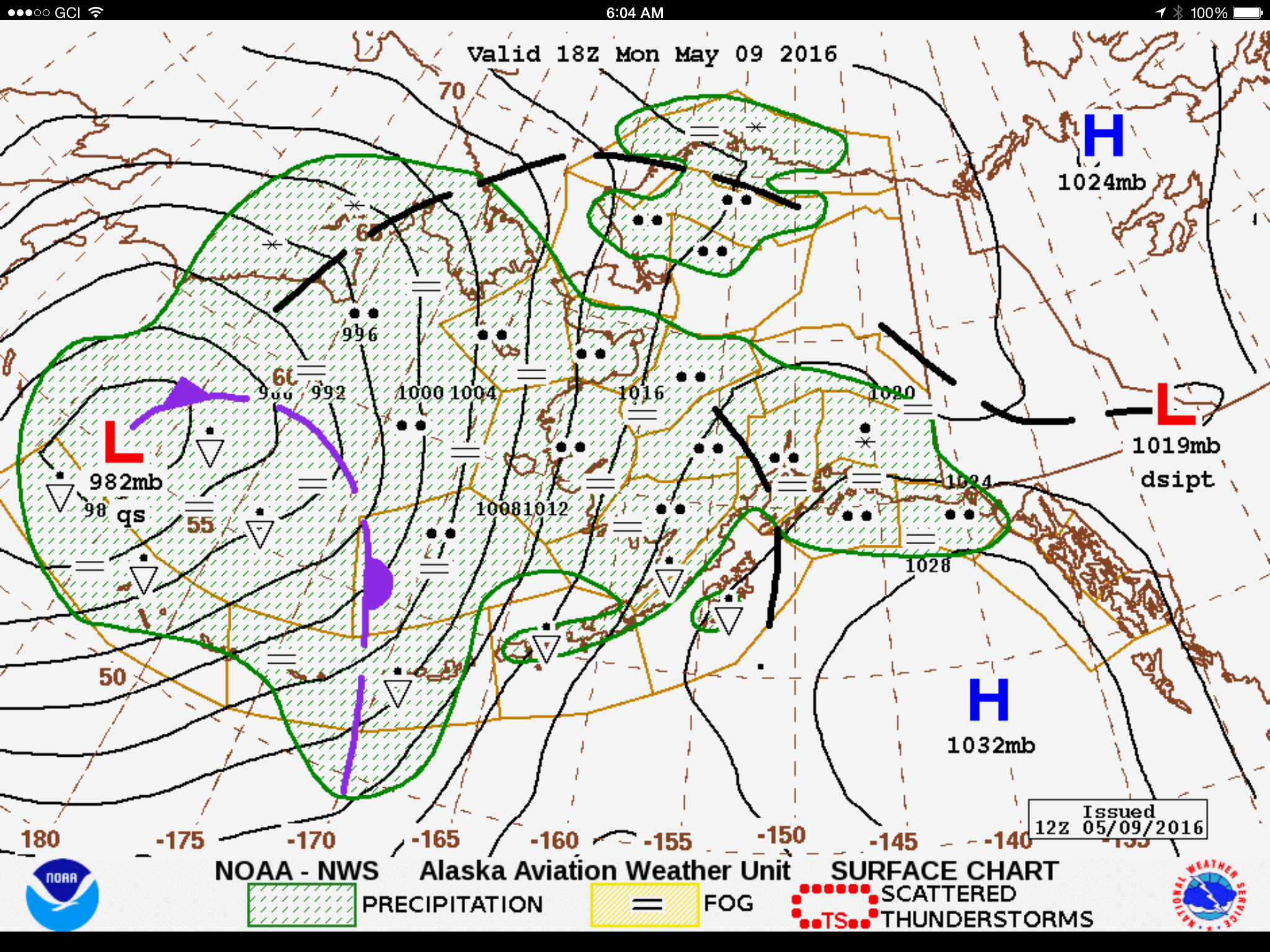
The massive low pressure to the south finally broke the trough that was sitting across the state, but the high pressures to the east still hadnt strengthened enough to fight the battle successfully.
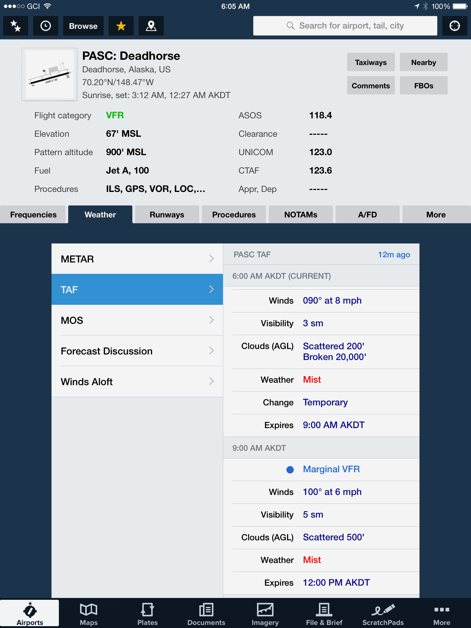
The forecast for Deadhorse was mixed — clear skies above but low fog below. When it would come and go and how far inland it would extend were anyone’s guess.
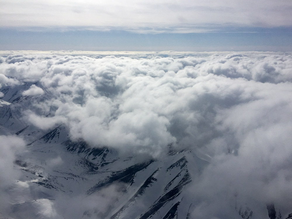
Right off the bat getting past the White Mountains was a chore and it never really got much better. There was a break over the Yukon Flats and I knew that Coldfoot was already marginal, so I climbed up over the broken layer intending to fly over the top of the Brooks Range. This would have worked, except for the 20,000′ wall of white directly over Coldfoot. Checking the camera there on the ground, there was no going under either. But it was clearer to the east, so I headed that way. At this point Deadhorse was still in and out of fog, meaning that if I burned all my fuel getting around this giant white thing I would have to land in Deadhorse to have enough fuel to get home, but if I couldn’t land at Deadhorse it meant camping and foraging on the tundra somewhere. I thought about playing the same trick as the day before and just loitering until this thing got out of my way, but that would lead to similar problems, and then there was the issue of what if it blocked my return. So after a while of poking my nose around to the east, I headed back to Fairbanks, resulting in a 5 hour round trip of mostly studying new and unusual cloud shapes.
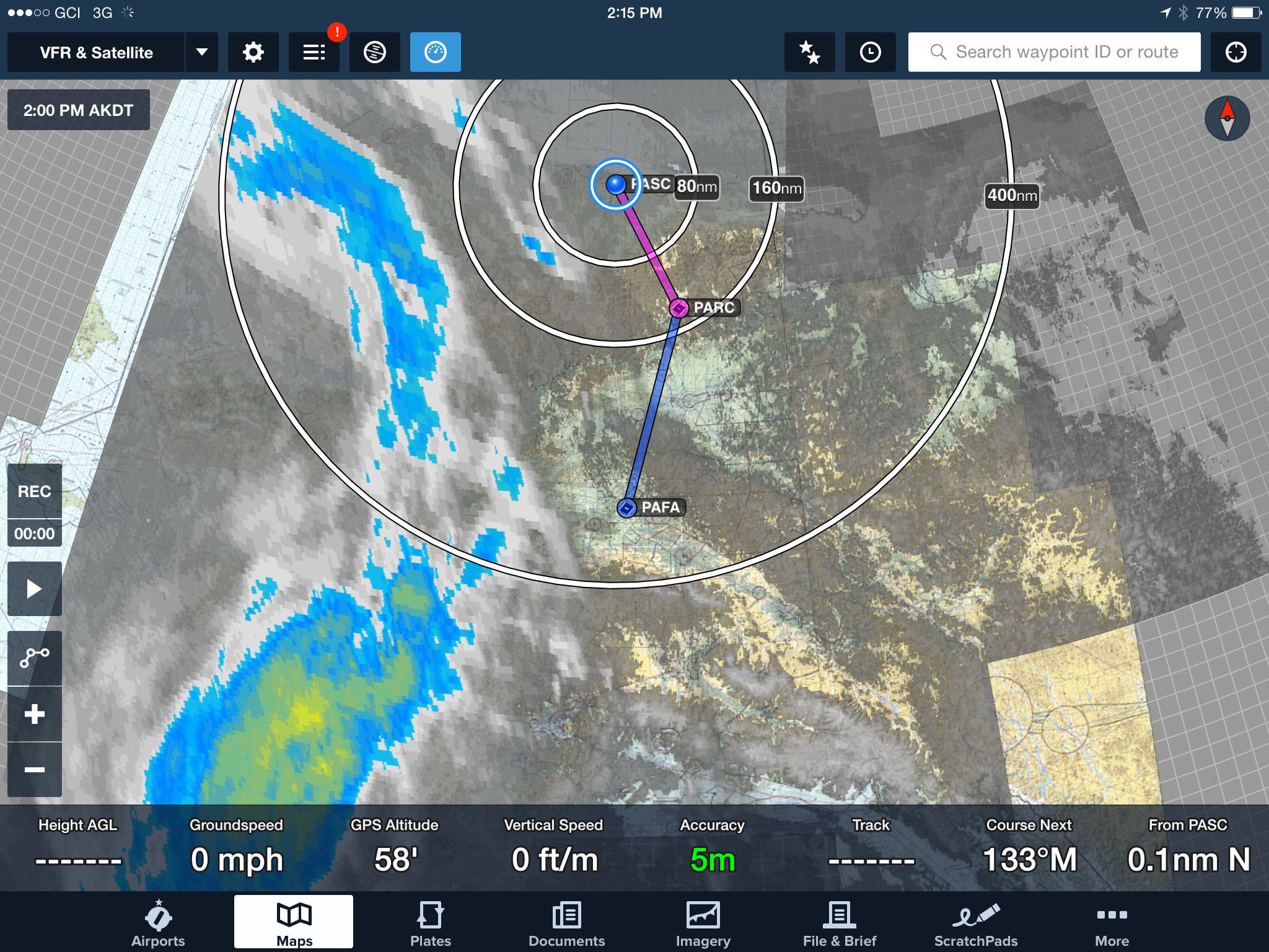
I’m shocked at how accurately located that little blue strip is — that’s exactly where I got turned around.
This is what that blue strip looked like from the air. Coldfoot is dead ahead.
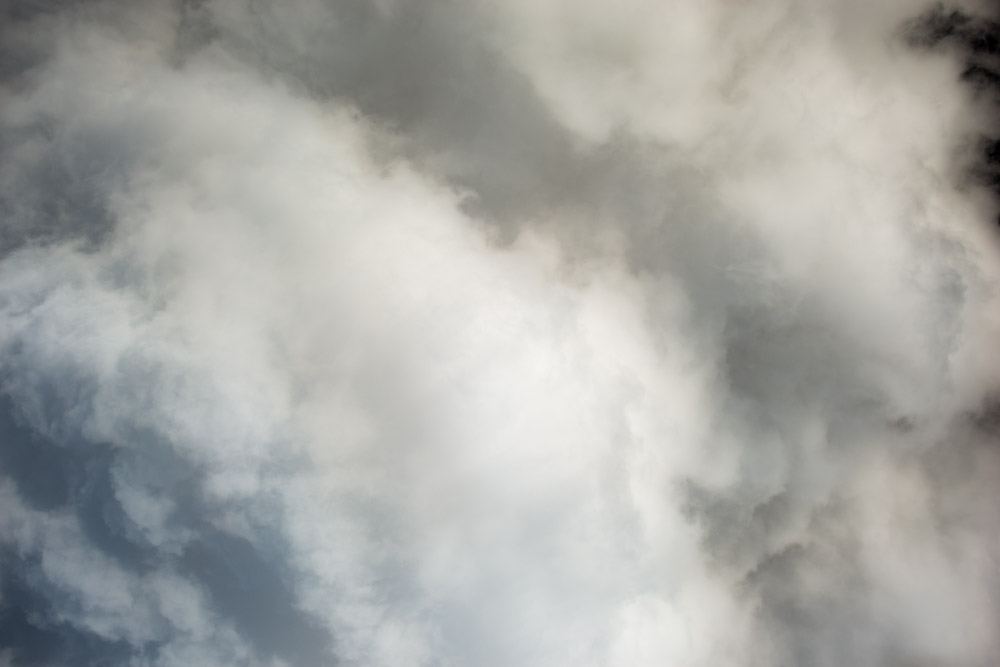
I roamed around to the east trying to find a way in, but all I saw were pretty clouds blocking my way.
After a while I gave up and headed south.
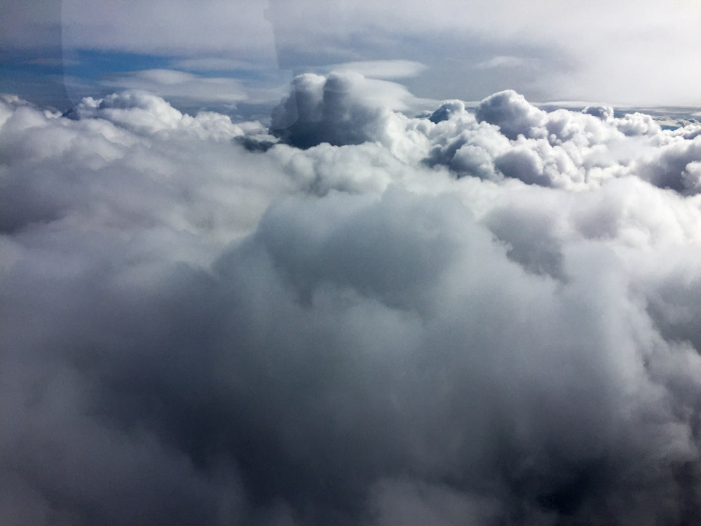
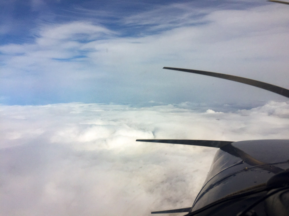
Endless variety of clouds. Here are some build-ups intersecting some lenticulars.
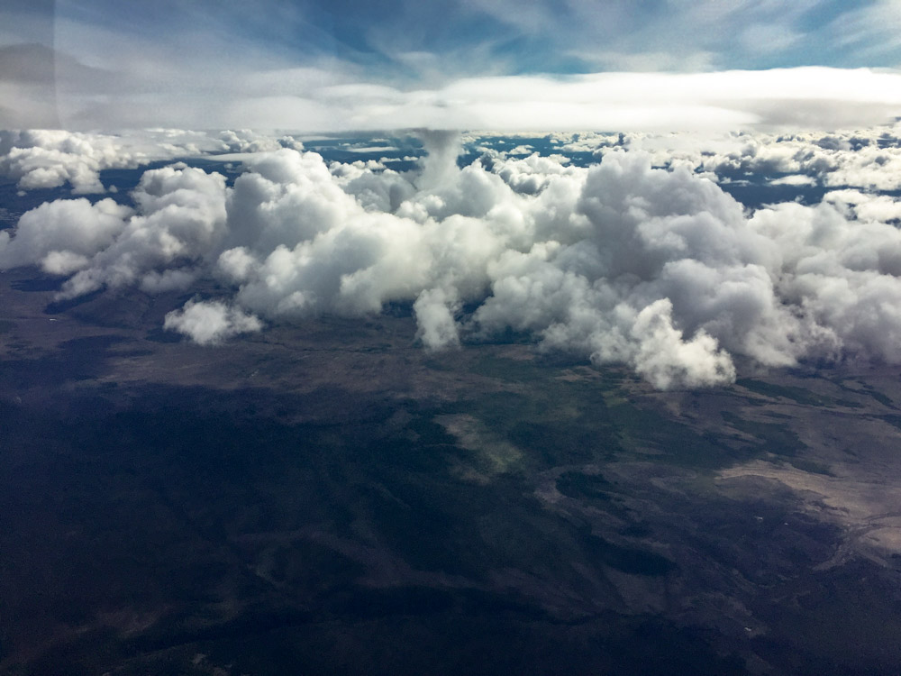
Awesome.
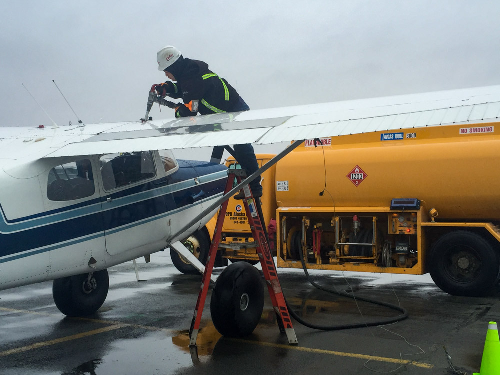
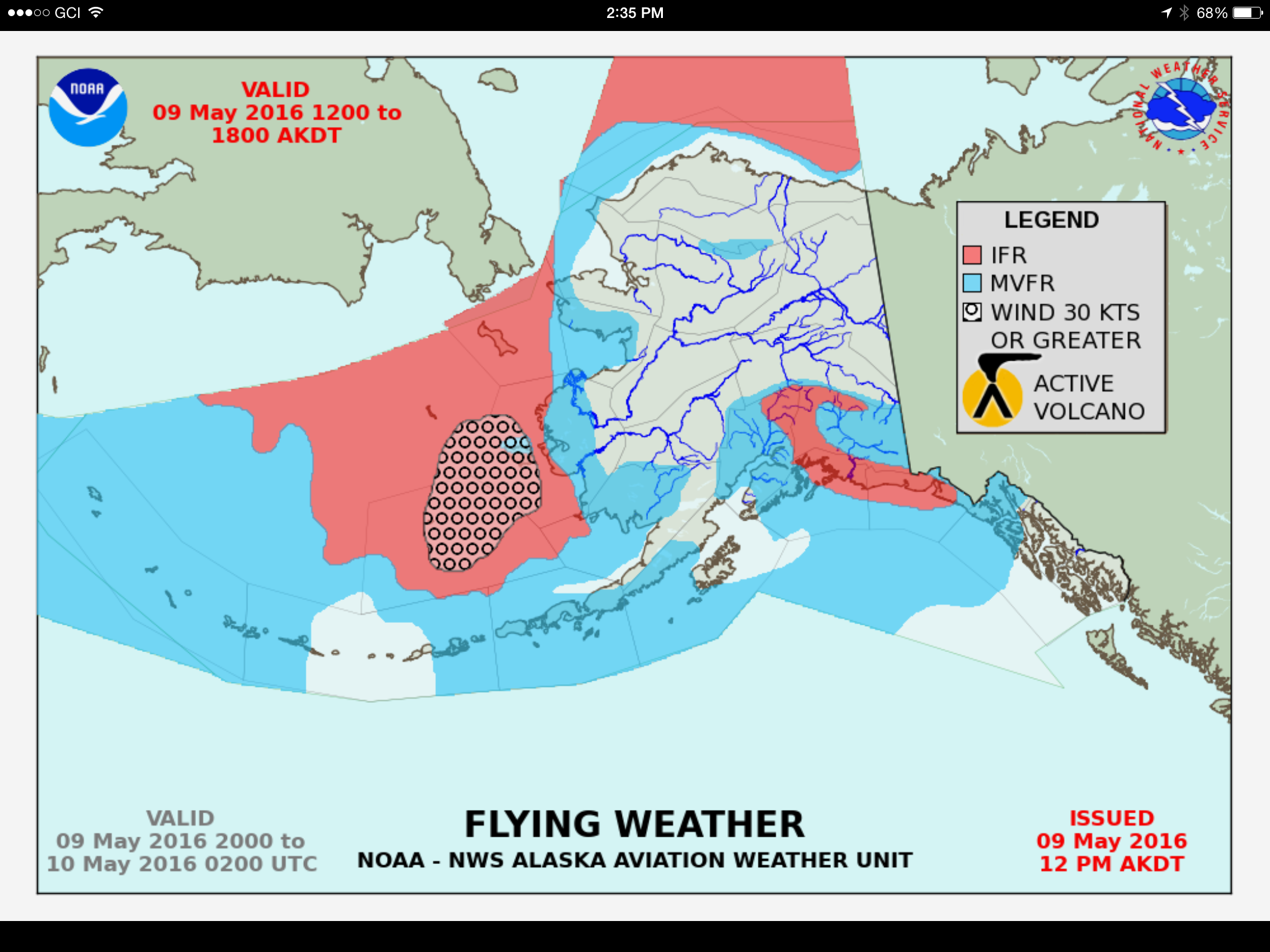
Today I woke up at 5AM and rolled over to check weather. It appeared that while the strong low to east was bringing strong winds and turbulence on its east side near us, further to the east and far north a high had moved in and created perfect flying and mapping weather. Now the odds were strongly in favor of success, so no more rolling over. I had left the plane prepped and fueled after my return yesterday, so by 7AM I was airborne and climbing up to 10,000′ feet straight away and barely saw a cloud all the way to Deadhorse, as I got propelled by the strong tailwind. Here I stopped to refuel while the weather was good. Apparently they had just gotten the self-serve pumps working that morning, as they dont get much random small plane traffic in winter, and the crew was eager to help the first customer of the year and see if everything was indeed working.
It was a race to see if I could stay in the clear before the low pushed its way over. Bethel is somewhere under the nasty looking part.
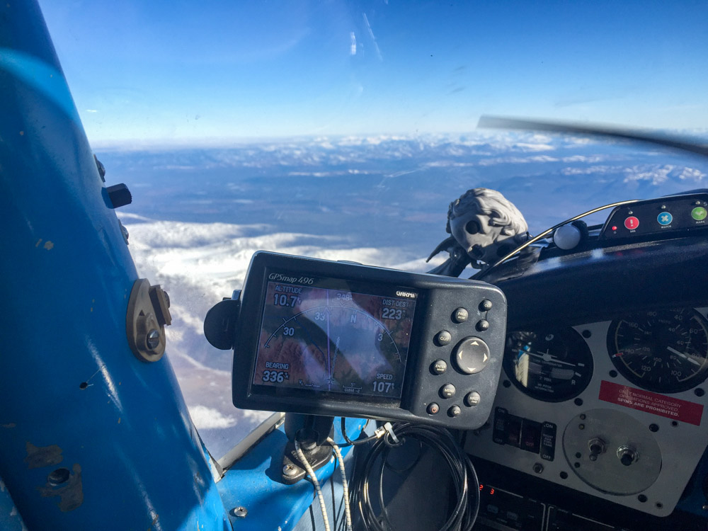
If you look closely at the GPS, you’ll see my current location today was directly on top of yesterday, where all the cloud photos above where taken. Weather really is everything.
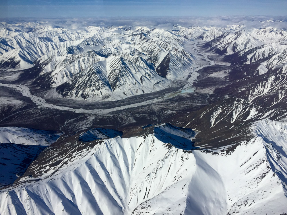
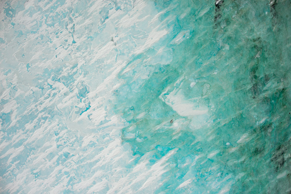
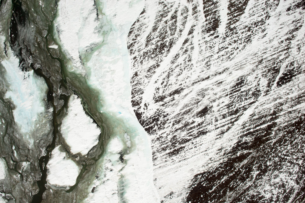
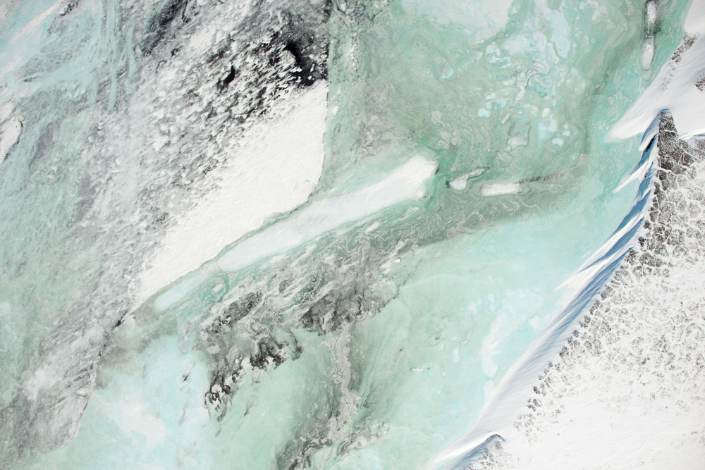
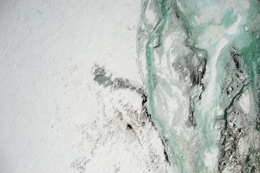
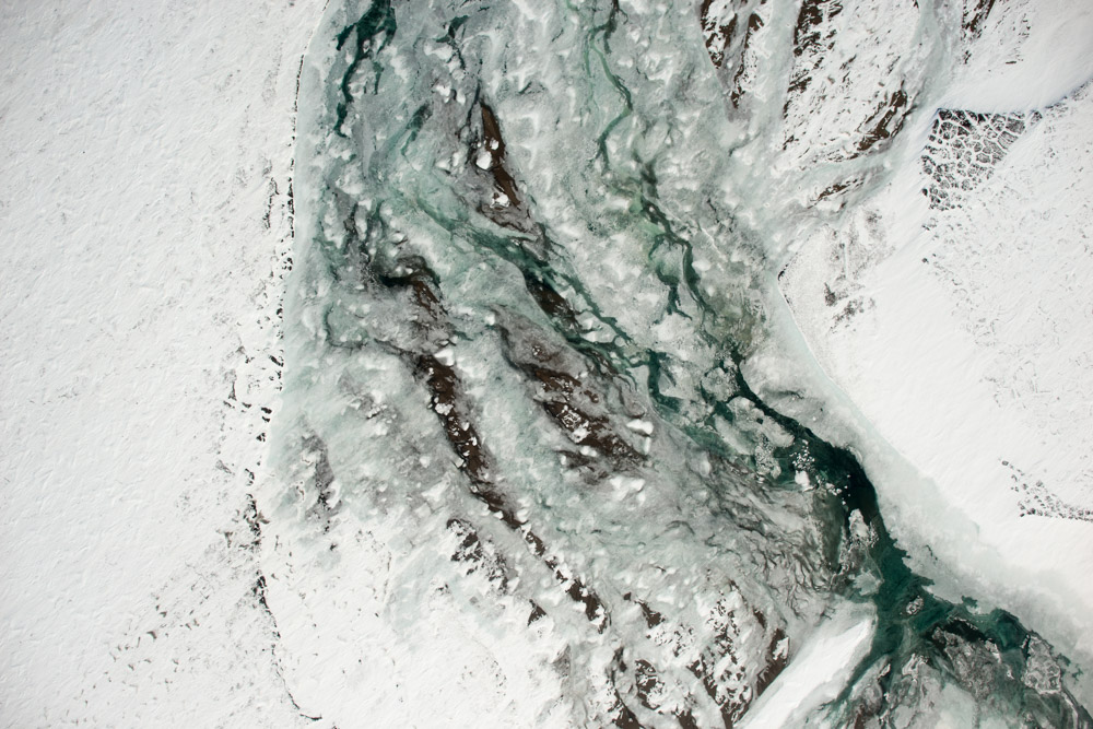
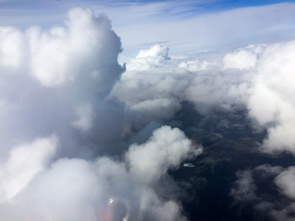
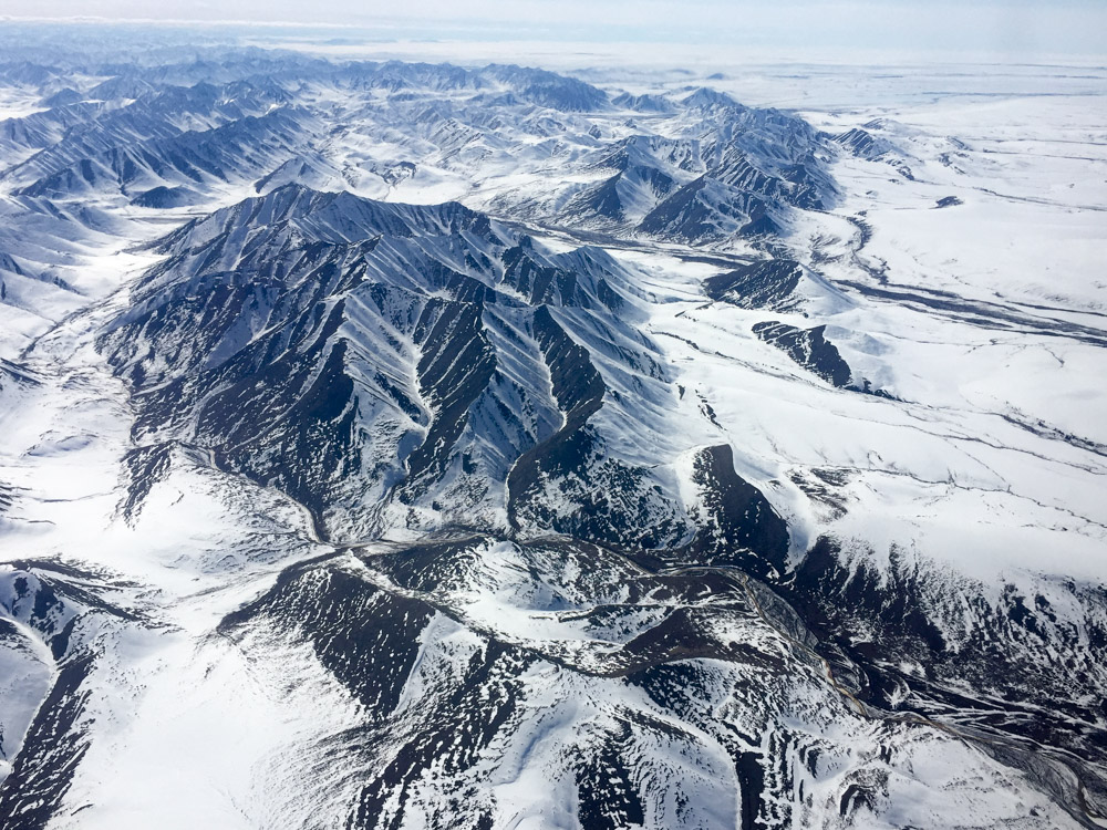
Valleys like this are a dime a dozen up here.
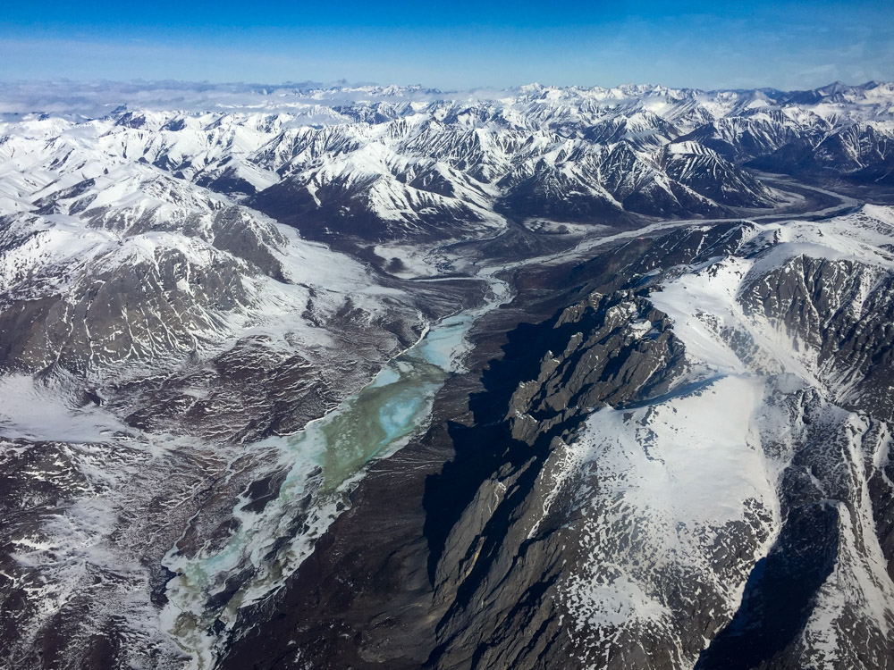
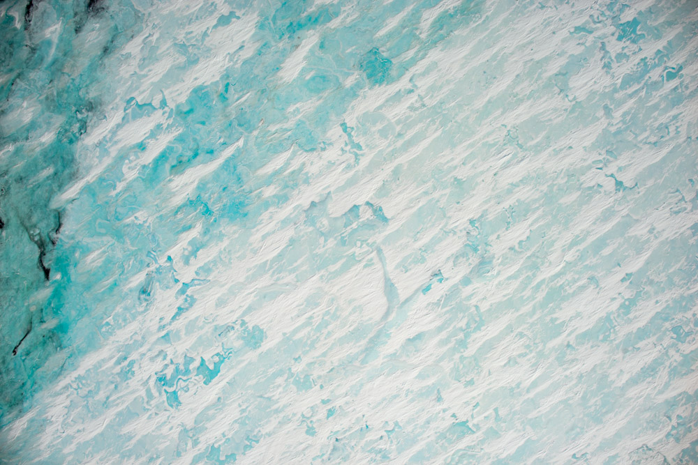
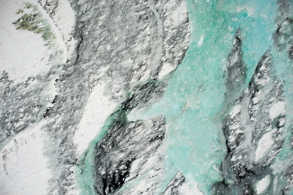
And all of them are filled with aufeis.
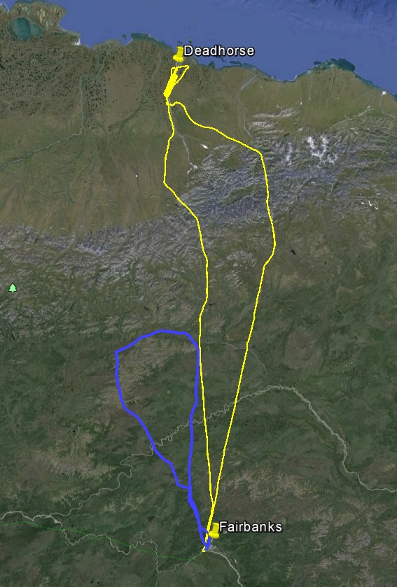
Today’s track in yellow, yesterday in blue. I went up on the left, but as the low pushed east I came back on the right.
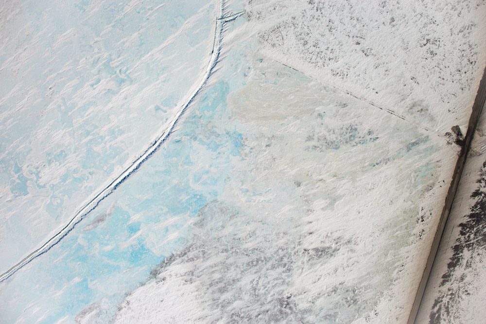
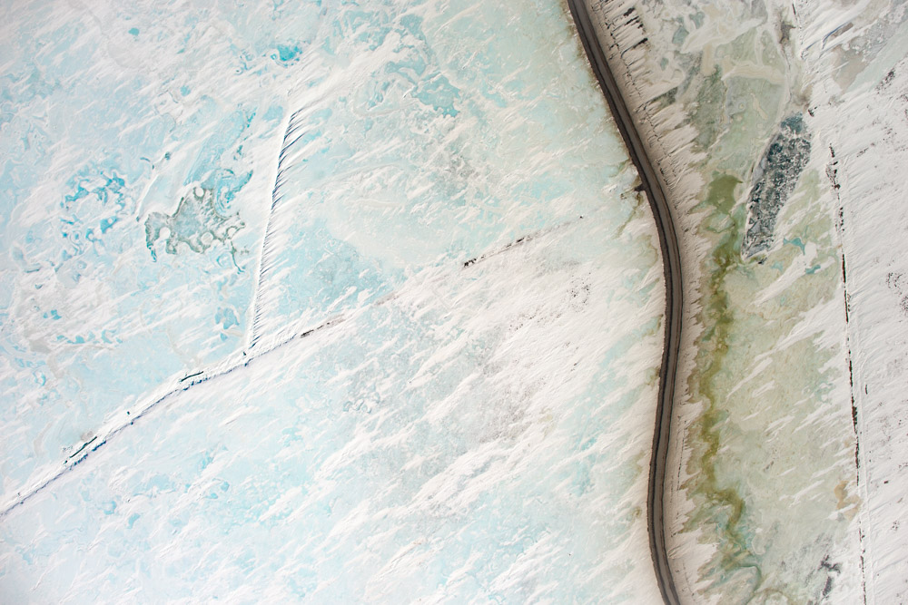
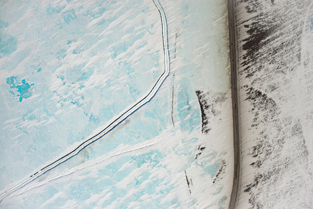
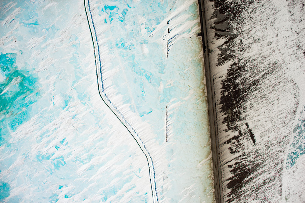
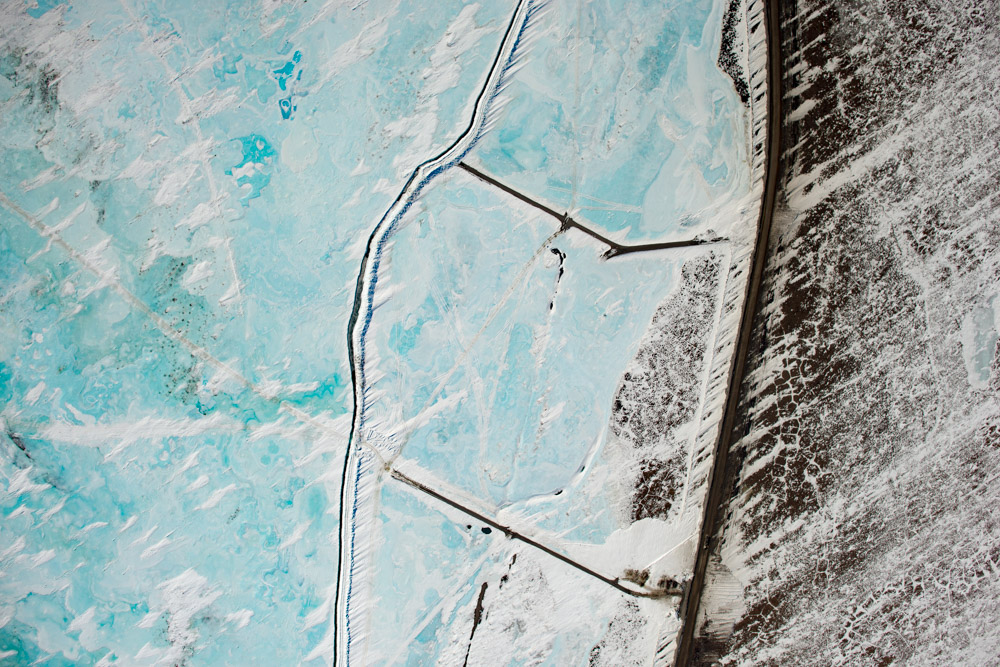
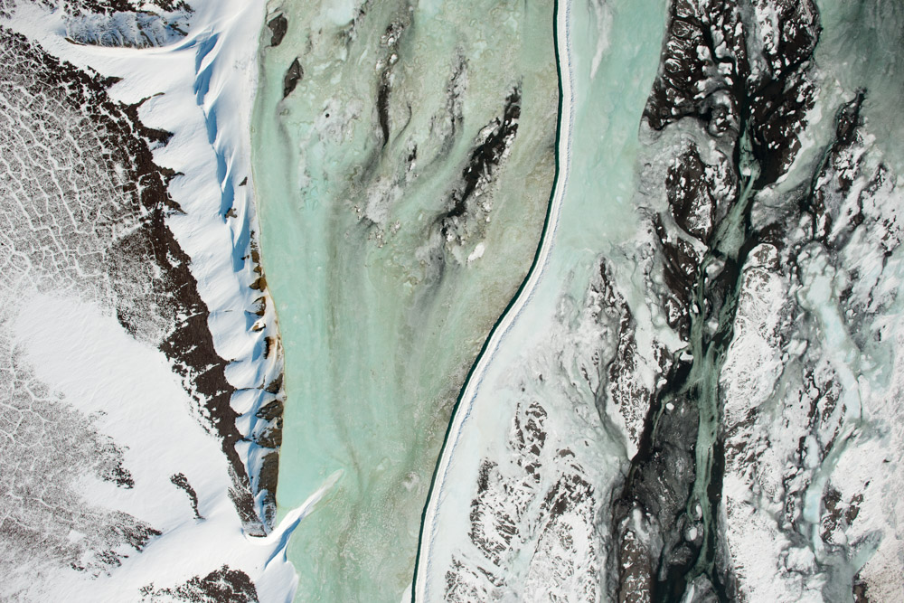
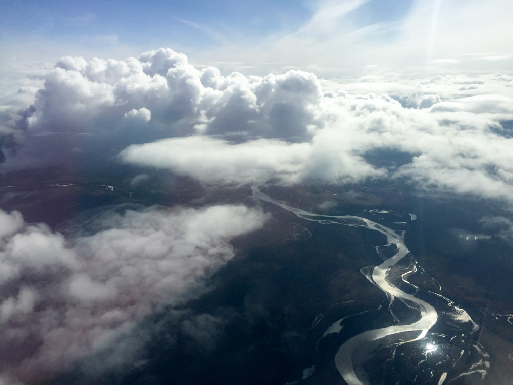
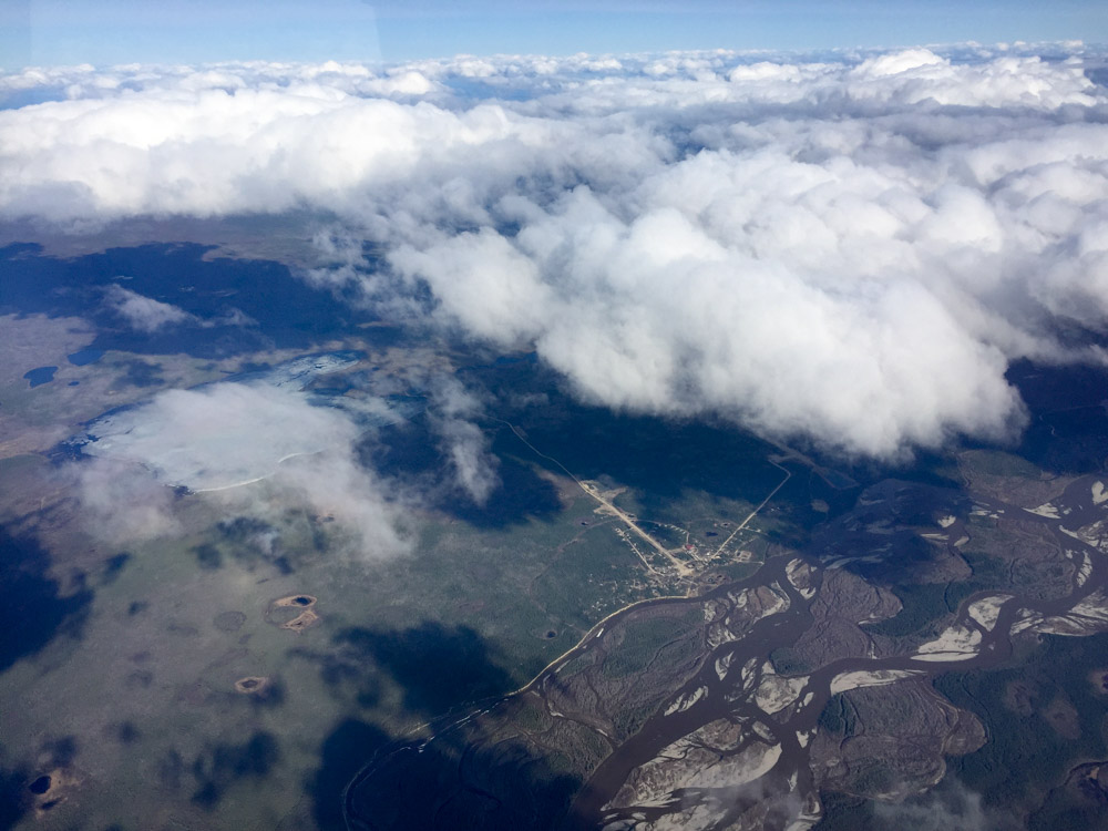
The weather in the Deadhorse area was perfect for mapping. Well, perfect for mapping is really a high overcast to eliminate shadows, but it was perfect for flying anyway — blue skies and no bumps. The mapping went well. On the way in I followed the road from up high and tried to capture the road and river for most of its length, just because I could. After refueling I worked the main block. I also think it was the perfect time for this mapping. The river looked like it was just starting to flow, yet hadnt really gotten far or started to erode ice or flood anywhere. If melt hadnt started yet, you’d have to guess where it would. But looking at the photos, you can see where the water is moving and presumably by looking at the topographic maps made from them you could predict if or where road flooding might occur. But it’s a bit too early to tell. All I can really say is that the data quality is great and an awesome map will result.
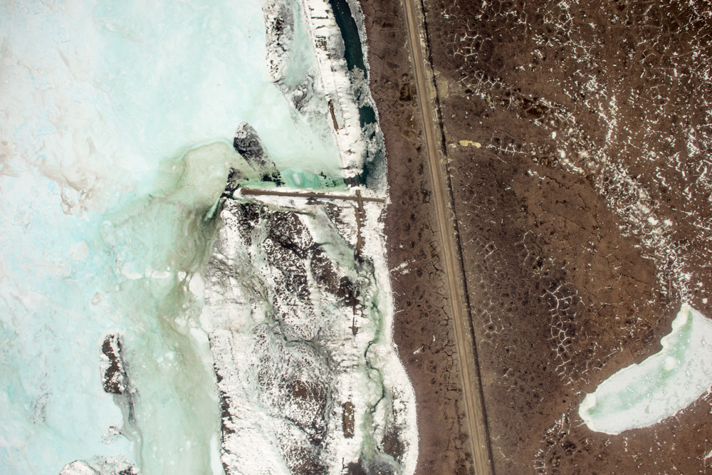
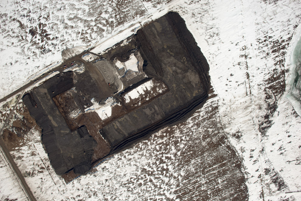
This is the study area.
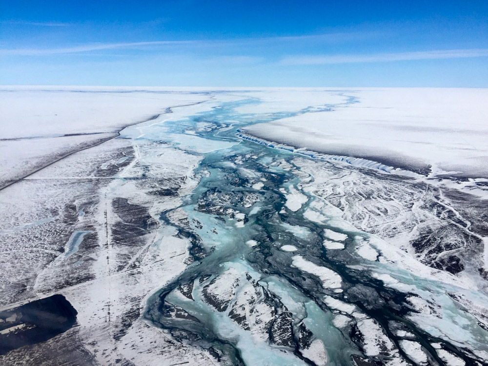
This is the study area without my nose in the way.
This is the study area looking opposite direction. I actually mapped quite a bit further upstream than the area I was given, as it seemed like there was as much potential for flooding there as where I was supposed to map.
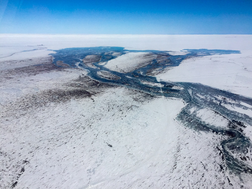
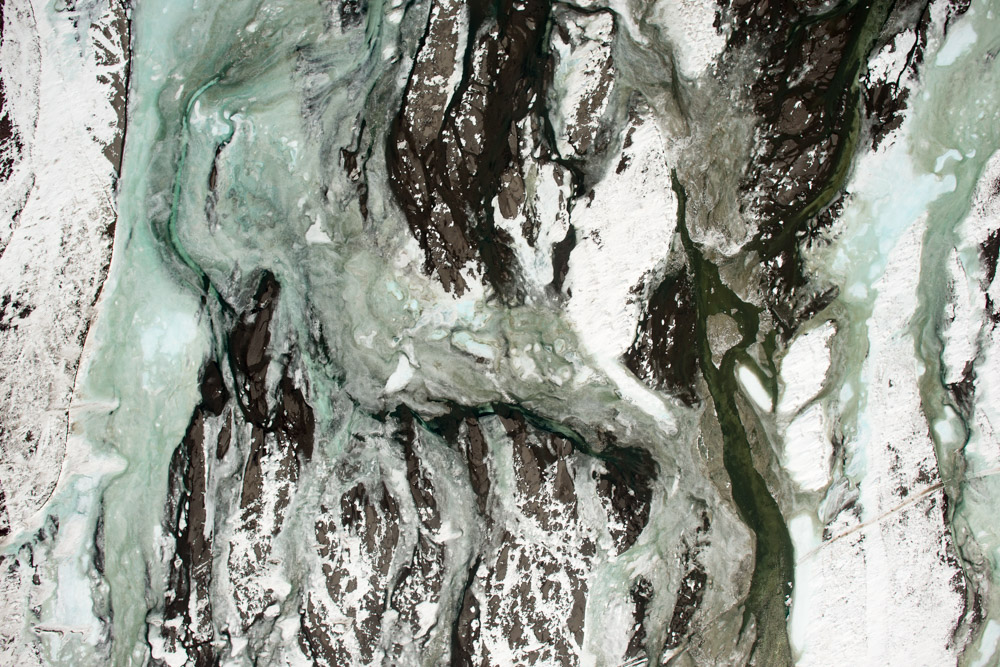
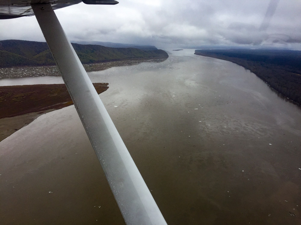
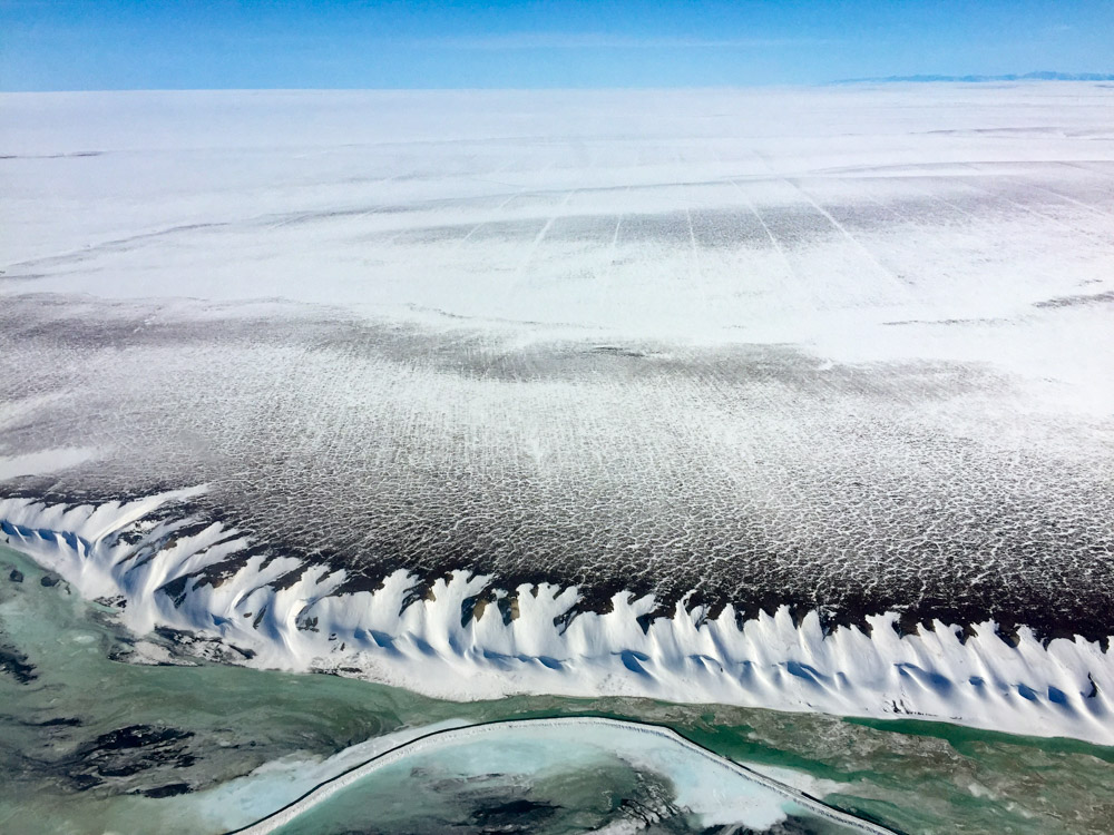
When I was done with the study area, I mapped the east (main) branch of the river down to the ocean. The road doesnt follow this branch, but I figured it would be useful to see how the branches differ. If most of the water flowed this direction, the road would be safe. Here you can see that once the water leaves the channels and hits the beach it spreads out in broad fields.
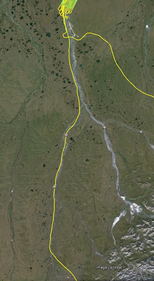
I mapped the road from where the river runs adjacent to it at a higher altitude. I was heading that way anyway, may as well map it.
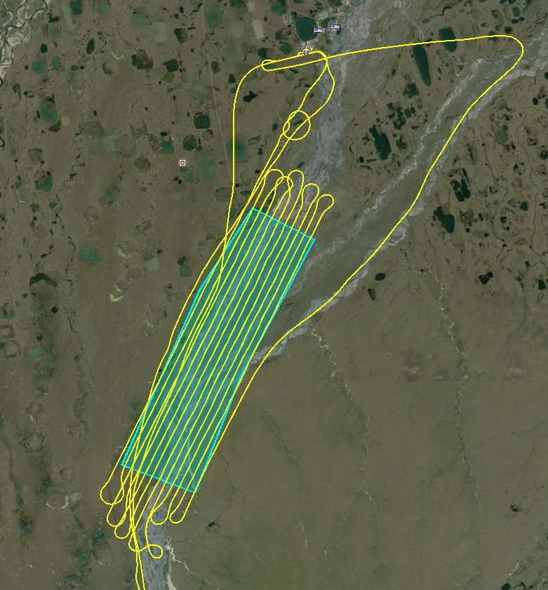
I extended my flight lines beyond the area of interest provide where I thought interesting things were happening. I strive to under sell and over deliver. Not everyone understands what that means or appreciates it, but I’ve never claimed to be a very good businessman,just an awesome map maker.
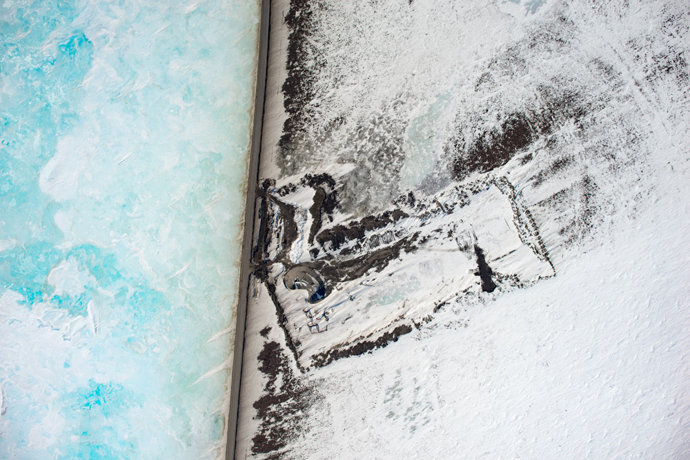
Once I was done with the mapping, I poked around a bit. Just off to the side there were old and new seismic lines. As I understand it, they create 3D seismic maps of the oil resevoirs over time, making them 4D, to see how the drilling and extraction is affecting what’s left. I used a lot of these same techniques for my PhD research studying subglacial till with seismic techniques. I’m not sure if the long-term effects of driving heavy equipment over the tundra have been studied thoroughly or not, but I know I have a tool that can make those studies better.
With my maps, we can measure snow depth not only of the huge drifts, but also what’s on top of the ice wedge polygons. We can also measure long term impacts of the seismic work on the permafrost.
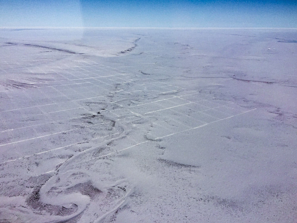
Nature abhors a vacuum. And right angles.
That’s a communication tower at bottom, but these tracks are fresh. Think if I mapped this again in summer I could find those tracks in the tundra too?
The trip home was uneventful. I climbed up to 11.5 in my little plane and cruised in the smooth air all the way home.
The foothills, looking west.
Venetie.
That’s why they call it break up.
There was a broken layer most of the way home. So I mapped it. The clouds that is. I did this for fog around McCall Glacier inadvertently for Hester last year, so I know it works. I dont know much about cloud research, but I do know I can map cloud topography and that someone somewhere would find that useful.
Awesome future cloud topography.
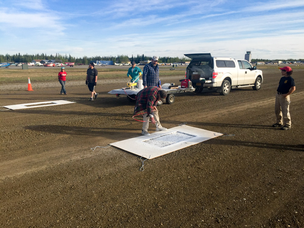
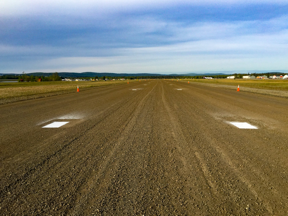
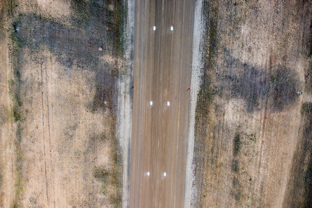
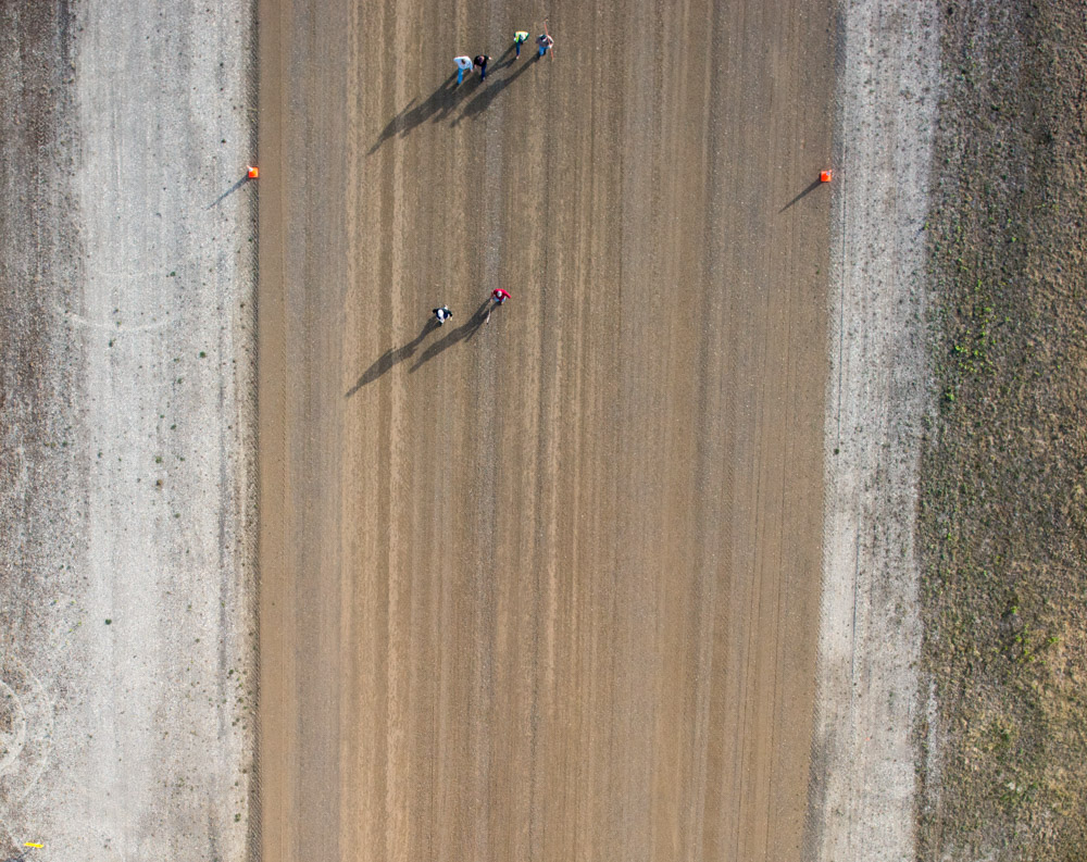
As I was on short final to Fairbanks I realized the volunteer crew was out painting the gravel strip. The marks help pilots pretend they are landing on a tiny strip in the middle of nowhere, for example if they went little too far in marginal weather and had to land in a meadow. I had already shut the fodar system down at this point and was coming in super high, so while I was shedding altitude as fast as I could I was also trying get the system turned back on so I could get an overhead picture of them. Unfortunately it was all happening a bit too quickly and I didnt get a clear shot. Maybe next year!
It’s been a busy month.
A selection of photos from today. Aufeis is cool.