
Fairbanks Fodar awarded huge project by State of Alaska
Fairbanks Fodar was just awarded a huge project by Alaska’s Department of Natural Resources — to map over 2000 miles of coastline in western Alaska.
The project is to map a 1.5 km swath of coastline from Wales to Bethel, expanded to up to 5 km at the Yukon and Kuskokwim River deltas, as well as some low-lying inland areas and villages, for a total of about 7000 km². I got the notice of intent to award over two weeks ago, but the final paperwork only got signed off today. Besides the huge geographical challenge, it’s now also a race aganst the clock — low sun angles and winter storms will shut us down by mid September. So after a few all nighters and a lot overnight shipping to compress a month of preparations into a few days, I’ll be heading west to make the most awesome maps of the coast ever created.
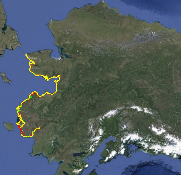
The colored area at left indicates the area to be mapped. It stretches from Wales in the north to Bethel in the south, covering some 2000 miles of coast line and over 7000 km2. These shorelines have not been mapped in 60 years because until fodar it was too expensive, literally costing millions more than our price.
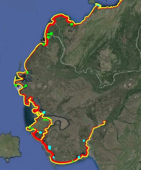
In addition to the coastlines, many nearby coastal villages and developments (green and blue squares) will be mapped to assist with community planning and flood prediction and mitigation, saving potentially tens of millions of dollars and maybe even a few lives.
Other respondents to the State’s RFP included such mapping giants as Quantum Spatial (formerly Aerometric in Alaska) and Michael Baker International. If you are unfamiliar with them, their web pages might give a sense of what I was up against. According to Quantum’s website “Quantum Spatial is the largest, most technically advanced full-service geospatial solutions provider in North America.” According to Michael Baker’s website “With more than $1 billion in annual revenue, Michael Baker International has more than 5,000 employees in over 90 offices located across the U.S. and internationally.” According to this blog, Fairbanks Fodar has no employees and currently operates out of my living room. Yet, as vetted by a panel of State experts, we have perfected a technology that produces better maps than can be made by the biggest names in remote sensing and at a substantially reduced price. That disruptive technology is called fodar, and it’s leading a revolution in a new understanding of our planet and its dynamics.