
A Mile Wide and a Micron Deep — Mapping the Coastline from Wales to Bethel
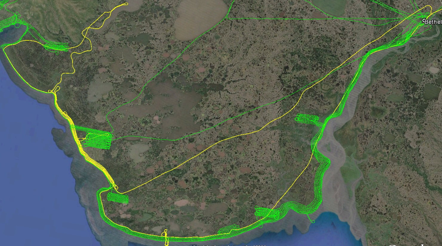
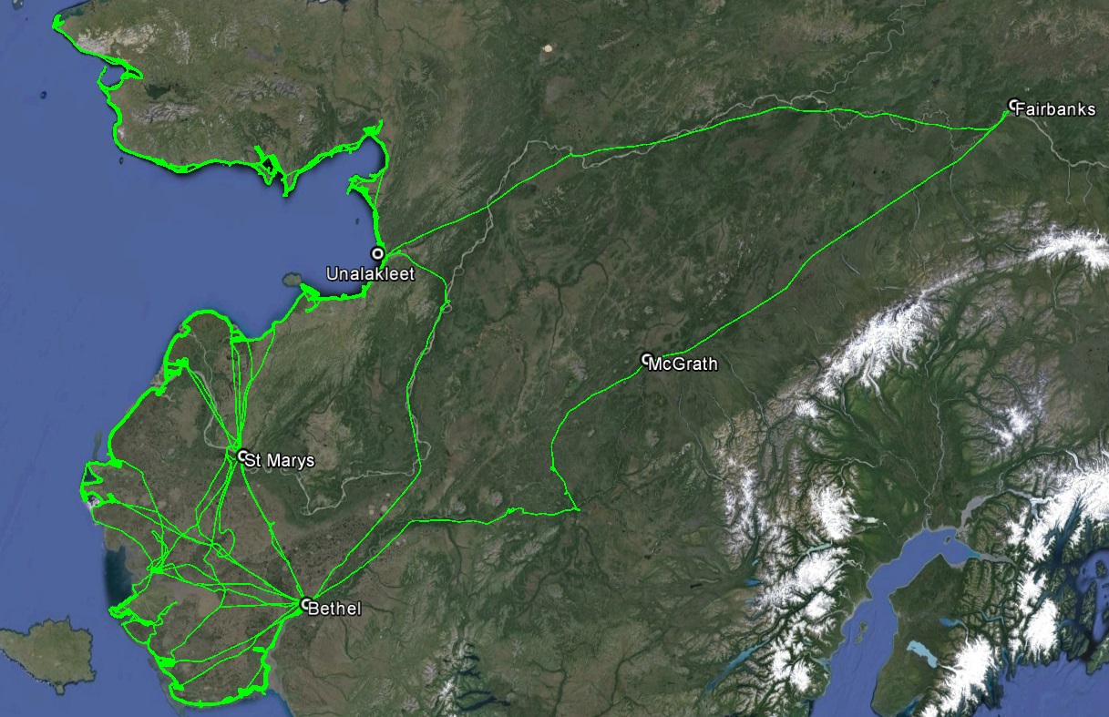
Field acquisitions for the Wales-to-Bethel project ended for the year yesterday with my return to Fairbanks, after spending 40 days in the field, flying 14,262 miles, taking 128,502 photos, mapping 94% of the coastline, and taking home lots of good memories.
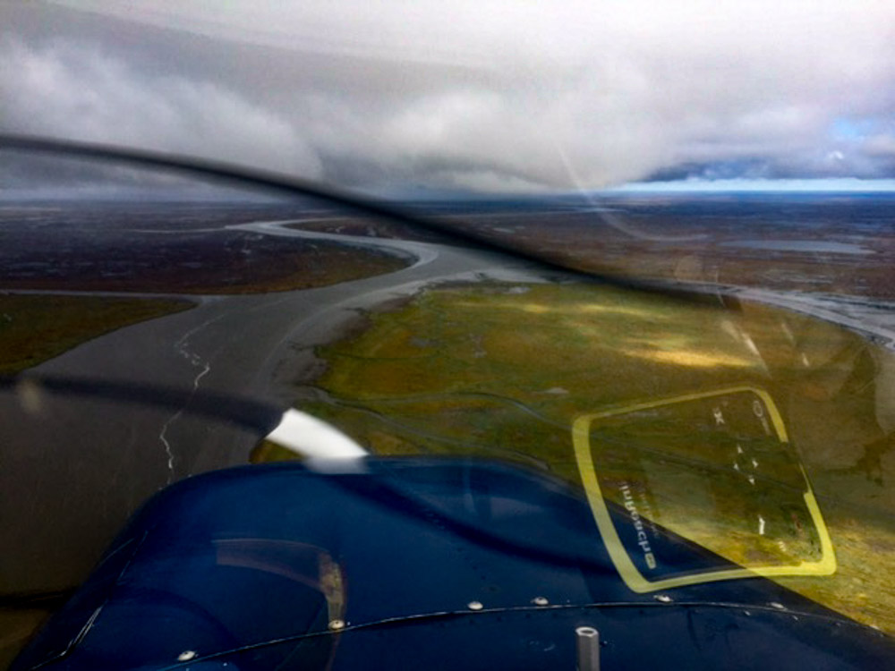
My goal on relocating to Bethel from St Marys on the 6th was to finish up the remaining southern lines, about 3 days work in good weather. St Marys was also a bit of a weather trap, so basing in Bethel was hopefully going to allow me to sneak out under lower ceilings. That was a good call, as since then St Marys has been almost constantly IFR while Bethel has seen some great days. Unfortunately, those great days did not extend all the way to the coast.
I was able to head out from Bethel on the 7th, but spent most of the time wandering up and down the coast looking for a break, which I never found. About 10-15 miles inland, the clouds came down to the ground with rain. I could utilize nearly any ceiling for my first or second pass on the coast, but no ceiling just doesnt work. It was especially frustrating to return to sunny skies in Bethel. The next day was more of the same.
I had hoped this would be the day to get the last bit of coastline finished between Cheevak and Newtok, but it was socked in solid there.
This was typical of what I was skirting around, nice 500′ ceiling to my right but rainy and down to the ground towards the left.
I caught a glimpse of the coast once!
By this point it was 8 straight days of bad weather. One of the problems with being so nearly finished is that I can’t fly to where the weather is good and map that part of the project, I have to sit and wait for the weather to get good at the two places remaining. On top of this, the weather station in Emmonak stopped reporting while I was in St Marys, so I had no information about that part of the world. Low pressures systems were dominating the weather since the end of August, as expected, and the 3 day forecast showed no signs of that changing. From the forecasts, there appeared to be some possbilities of tiny windows opening up, but nothing close to productive mapping weather. Given that acquisition is really only the tip of the ice berg when it comes to delivering maps, there is some point in the project where sitting around for weather is less productive than post-processing data, and the goal is to deliver the village maps by October 16. So even at the proposal stage we acknowledged that some time in mid-September we were going to call it good for the year and transition to processing, and that date later got fixed to September 11. So at this point, it was now or never. Or at least now or next year.
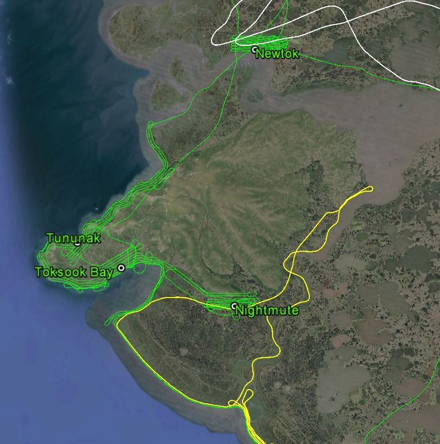
The next day, the 10th, I arrived early at the airport, even though it was in a fog, determined to eek out whatever flight time I could, as the forecast was for deteriorating weather. Once the fog broke after noon, we were treated to clear skies at the airport, but elsewhere the fog had only lifted without breaking, so it was cruising in Class G most of the way to the beach. Once there, conditions were not a lot better. Two days ago (above) I had started to the north at Newtok, but when that was closed down I was trapped to the north by a huge lake then ends in a small mountain, all under low ceilings. By the time I got around the lake and started heading south, I was most of the way back to Bethel, so called it quits as it really wasnt any better to the south anyway. Today I started to the south where it seemed better on paper and thought if I couldnt make it north where I really wanted to be at least I could work here for a while. So I added a low inland line to the Kipnuk to Nightmute stretch which had only two low coastal passes. When I arrived at Nightmute, Toksook Bay was in a cloud and raining around it. So I made another low pass back to Kipnuk, hoping it would improve on my return, which it did not. I tried skirting around the island, but here ran into the same pinch point as I faced from the north two days earlier and had to return. Here though, I was over some of the inland lines we had planned so I flew one of those back. This was the first time on the trip I turned my flight tracking device onto “watch” mode, which means if the power gets interrupted it sends out an SOS signal with my location. As I was flying around the edge of this lake (technically Baird Inlet and I think tidally influenced) under a low ceiling, I was having to dodge flocks of cranes and thought if one came through the windshield the inconvenience of getting covered in crane guts would only be exceeded by having to swim to shore after departing the aircraft. Fortunately none of them tried to hitch a ride, but by now weather to the north was starting to chase me south. I made two more passes to Kipnuk, having to fly twice as many since I was flying half as high as planned, with each one not making it quite as far north. Ceilings improved to the south and east, so I was able to get one almost full height line in past Kong on my way back to Bethel.
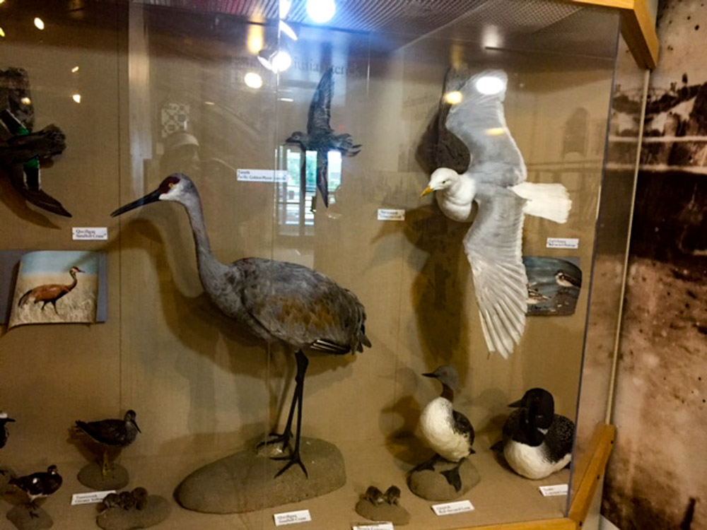
I had some down time and visited the USFWS office that manages the Yukon Delta National Wildlife Refuge and got to see a crane up close. Wouldnt want to run into one of these.
Normally the FAA classifies cranes as obstructions. In Bethel they are traffic.
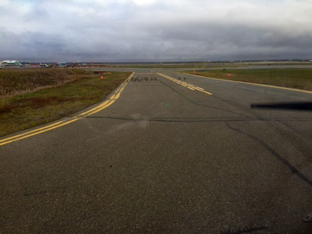
Fog at the Bethel airport.
This was typical of my last week here — 20,000′ ceiling underlain by a 200′ fog layer.
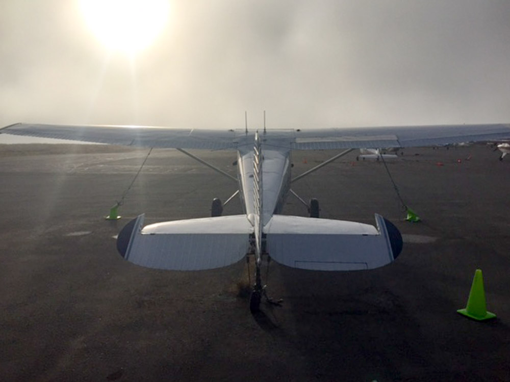
I spent a lot of time walking circles around the plane on this trip…
It was a productive day (yellow). Though in that same amount of time I could have finished the entire coast here flying at the right height, if the ceilings were higher. I took more photos this day than any other, as flying this low also means the footprint in the direction of flight is smaller so the interval between photos must be smaller.
I got turned around heading north (yellow) by the same lake as two days earlier heading south (white). As the day progressed, the low ceilings kept heading south.
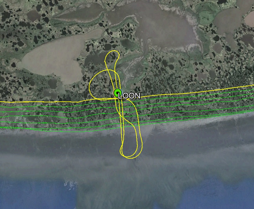
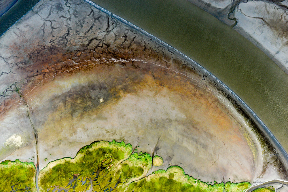
This is one of the ground control points. Ideally I would have collected images another mile inland, but we just ran out of time, so I looped inland to pick the point up. I also looped over the mudflats to the tide line so that we could get a better sense of bathymetry here. Looks like Google Earth beat us to it, at least with a low resolution image. The topographic maps we will create will be superior to any coastal maps ever made in Alaska.
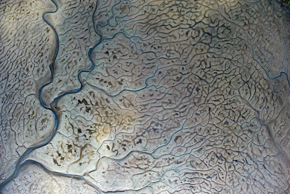
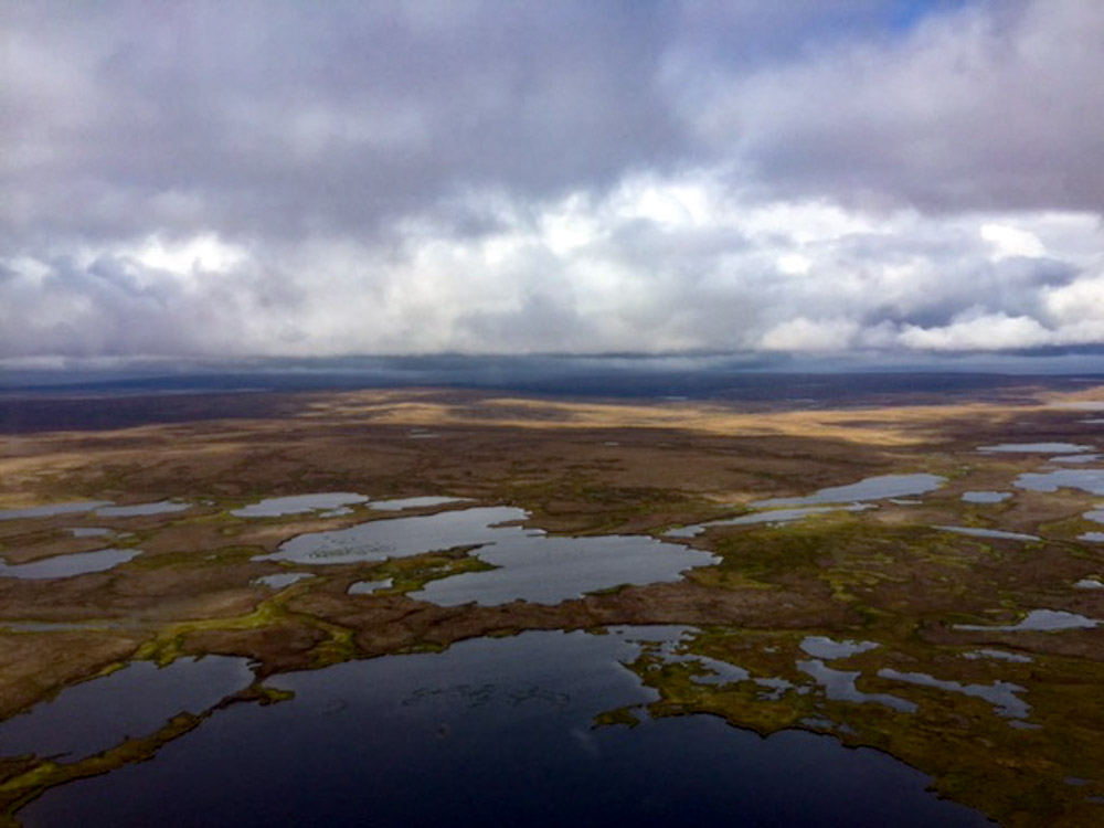
I think these mudflats are the neatest features out here, twice a day this beauty becomes invisible to humans.
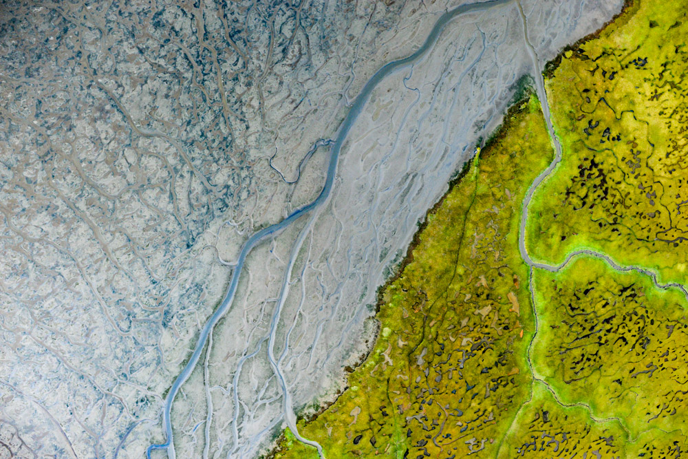
Drainage features from the land turn into drainage features beneath the sea.
Rivers seem to always have neat mudflats around them.
It will be neat to see how the various tide levels correspond to topography like this once we make the maps and analyze them.
I have the impression that land much further inland was also once beachfront property.
My plan for the next morning was the same as the past week — map that last 100 miles of coast. But it was not to be. Bethel was once again IFR all morning and the coastal stations were all reporting strong winds and bad weather. The forecast was still calling for deteriorating weather, including thunderstorms and turbulence in the coming days. Though ceilings were low and a few green blobs in the area, there was a streak of clear skies that extended from Aniak to Fairbanks. Though I feel increasingly comfortable with low ceilings on the Y-K delta, on the way home I wanted a clear view of where I was headed, and thought this might be my only chance for a week, so I took it.
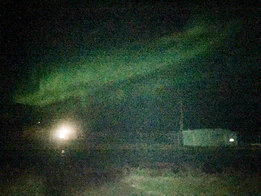
Unfortunately it was after 2PM by the time Bethel cleared and I launched. I reached Aniak without much issue but north of there ceilings were in the 2000′-3000′ levels, with terrain reaching almost that high. On their own, these conditions are fine, but add to it late afternoon rain and those ceilings drop and limit visibility. Add to that later afternoon thunderstorms and you have a recipe for more excitement than I was interested in. Suffice to say that by the time I reached McGrath I was happy to be on the ground and in no mood for reaching Fairbanks after dark. Fortunately, literally a stone’s throw away from the ramp are several bars, and I enjoyed ringing the bells in all of them to celebrate the success of the project with my new-found friends until the taps ran dry. Capping it off was an outstanding aurora show, apparently nature’s way of saying that summer is now officially over.
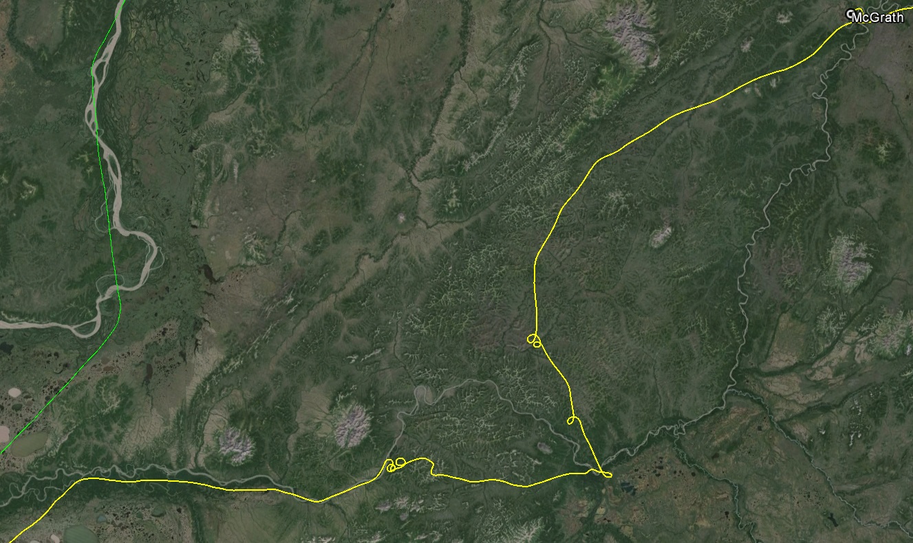
I was hoping to fly a straight line to McGrath, but it didnt work out that way.
The curly-Qs in the previous image also correspond with changes in altitude. I really wanted to get home.
Those curly-Qs are associated with the weather on the right, which this photo makes look bright in comparison to reality. I snuck in to McGrath following the ray of sunshine at left.
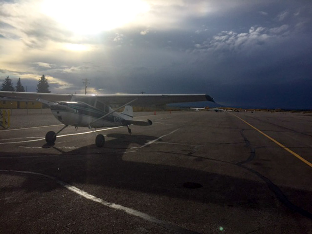
While fueling the plane I contemplated my choices: either fly through that or walk across the street to the several bars in downtown McGrath.

This was the only exterior indication that this cabin was a bar. My kind of place, and definitely the right call.
This really was an aurora. We also saw Hairy Man, just entering the shadows to the left…
Though the forecast indicated otherwise, the next morning once again showed a swath a clear skies from McGrath to Fairbanks, so exactly 8 hours later after the bars closed I was in the plane heading northeast, and before long I was on the ground in Fairbanks in the peak of fall colors.
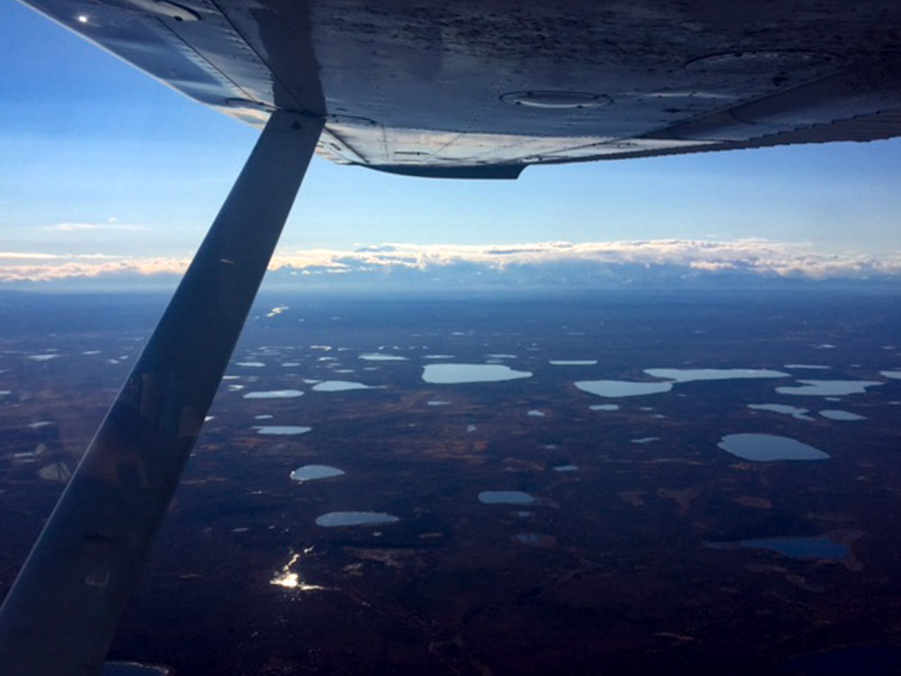
You can just see the top of Denali below my right wing. There seemed to be a lot of snow on the surrounding peaks…
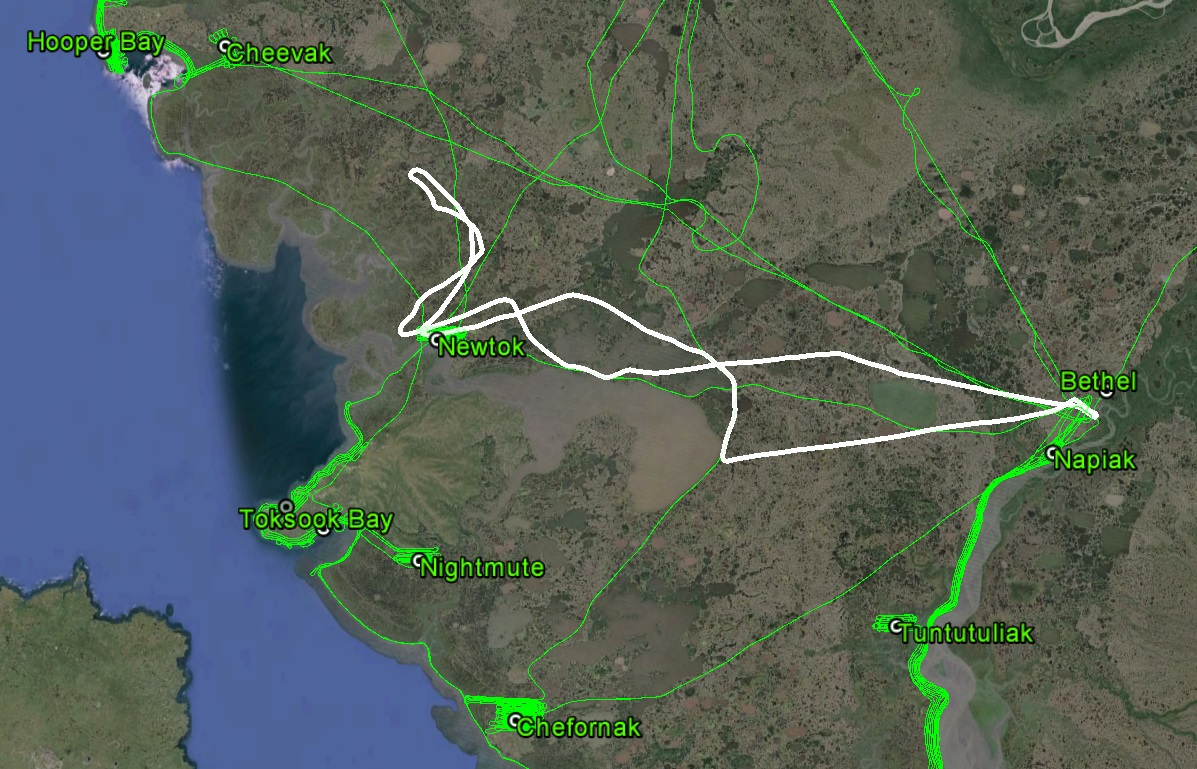
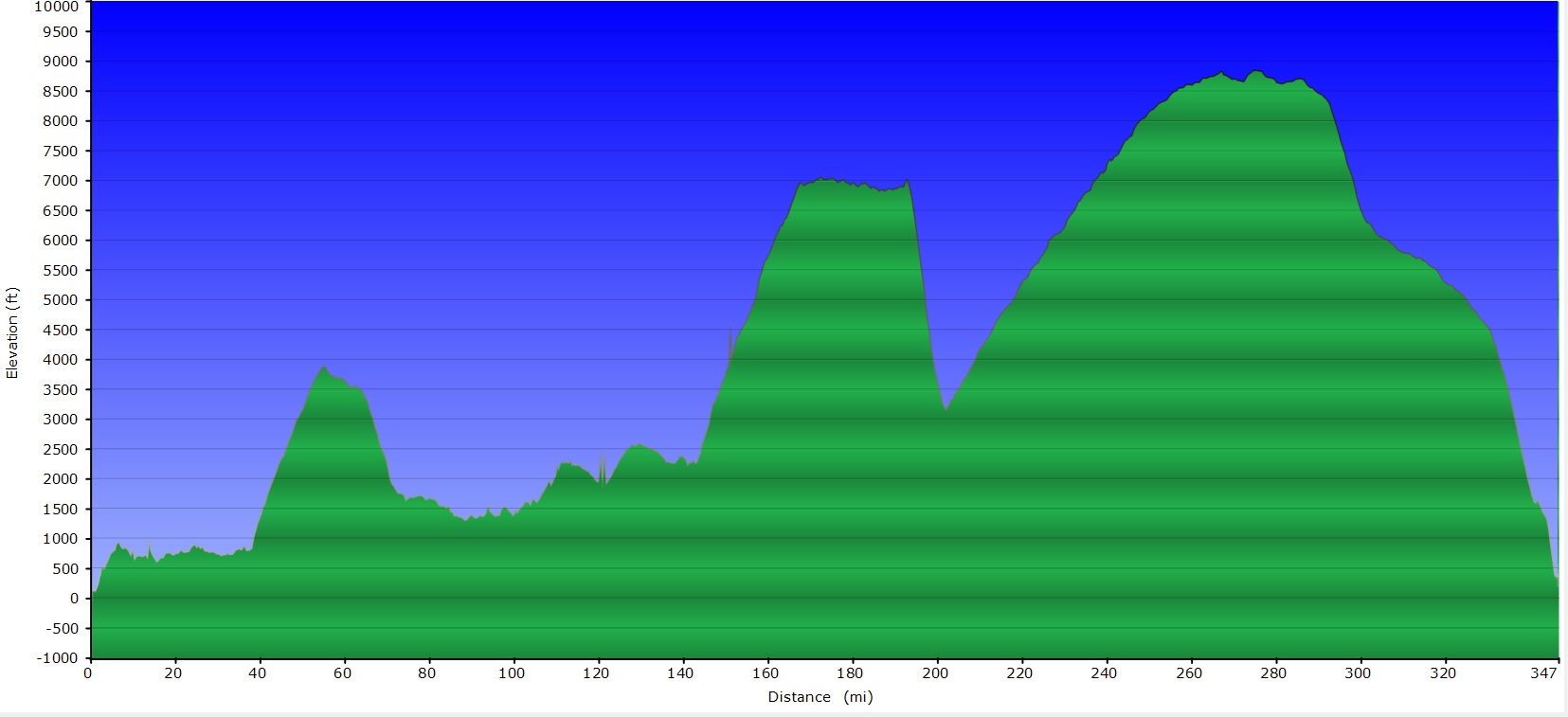
I had the opportunity to compile a few statistics in the bad weather of the past week. As planned, I had a bit less than 1500 miles of coastline to map. (As it turns out, measuring the lengths of coastlines is tricky, as it depends on how long your ruler is. That is, coastlines can be highly crenulated, so using a 1 meter ruler and a 100 meter ruler give you more than 2x difference, maybe much more depending on the crenulations. My ruler is about 100 m with the plane.) I mapped a mile wide swath of more than 1400 miles of that, or about 94%. I also mapped 29 out of the 29 coastal villages, or about 100%. Given the late start to the project, we had come up with a prioritization scheme in case we didnt miraculously get a month of perfect weather, and these two items were at the top of that list, and when combined together and measured by planned flight times, the overall completion percentage is over 96%. These acquisitions roughly total 1500 square miles, or about 4000 square kilometers, though I believe the actual data once processed will be 20% more than this as I acquired more inland lines whenever possible. Add to this that much of what I acquired was at twice the resolution as planned, and I’d say we hit a home run with this effort. Of the total that remains, comparing what is left, as planned, to what was originally planned, we’re at about 83% completion. These additional areas include adding a second mile inland to the flatter delta areas in the south and the inland side of Nelson Island, between Toksook Bay and Baird Inlet (the spot I wasnt able to get around the past week). If I had perfect weather and no other complications, I could knock these out in two days, but practically speaking its 3-4 days work. In any case, it’s a manageable amount to complete quickly once snow melts next year. So, in the final analysis, we didnt complete the project, but we completed much more than I think anyone expected, and are now in a position to deliver nearly all of the high priority data on schedule. Plus I think we also demonstrated how using a small, light aircraft with a single pilot/operator can greatly outperform traditional platforms and with traditional hardware which are not as nimble and due to their operational expense cannot afford to fly low and double their flight time to get the job done. In any case, we now have in hand an amazing data set that in a few months will become the best topographic maps ever made of the western coast of Alaska, and a great resource for protecting villages from storm surge and measuring coastal erosion for decades to come.
In forty days, starting at the end of July, we mapped a mile wide swath of coast-line from Wales to Bethel (or at least 94% of it…).
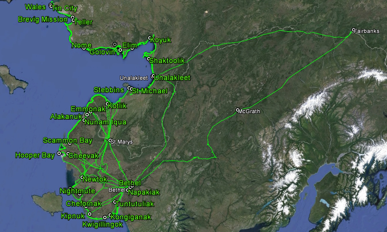
And we mapped all 29 coastal villages along the way.
Also a big thanks to all of those new-found friends in the field who helped me out, including the good pilots and mechanics at Renfro’s Alaskan Adventures in Bethel, Ryan Air in Emmonak and St Marys, Bering Air in Nome, and the patrons and staff of Joe’s Bar and McGuire’s Bar in McGrath, as well as to Alaska’s Department of Natural Resource’s Coastal Hazards Program for giving us the chance to pull this off.