
A big day in Norton Sound
After nearly a week of waiting for the weather to break, today the clouds lifted and I was able to map the coast from Unalakleet to Golovin Bay, in a 9 hour flight capturing 7900 photos.
The past week’s weather was not very encouraging. Ceilings rarely lifted above 1500′ and when they did it wasnt for long. A few days ago I almost launched for Bethel as the weather was good there, but I knew that this coming week was the best for Norton Sound in terms of tides. Besides the complications of the flying itself and the weather, tides are also an important acquisition constraint. The basic idea is to capture as much land as possible, which means flying during low tides. In this way, we can use the maps to determine tidal extents for different water levels. This connection between bathymetry and topography is also critically important for understanding storm surge dynamics and especially for tsunami dynamics. Unfortunately for me, Unalakleet has an annoying tidal frequency — usually once per day between 9 Am and 2PM. This week, however, was a neap tide and when I launched this morning, the tides were at their lowest of the month, exposing mudflats and sandbars over 500 m away from shore — it was the perfect moment to measure them.
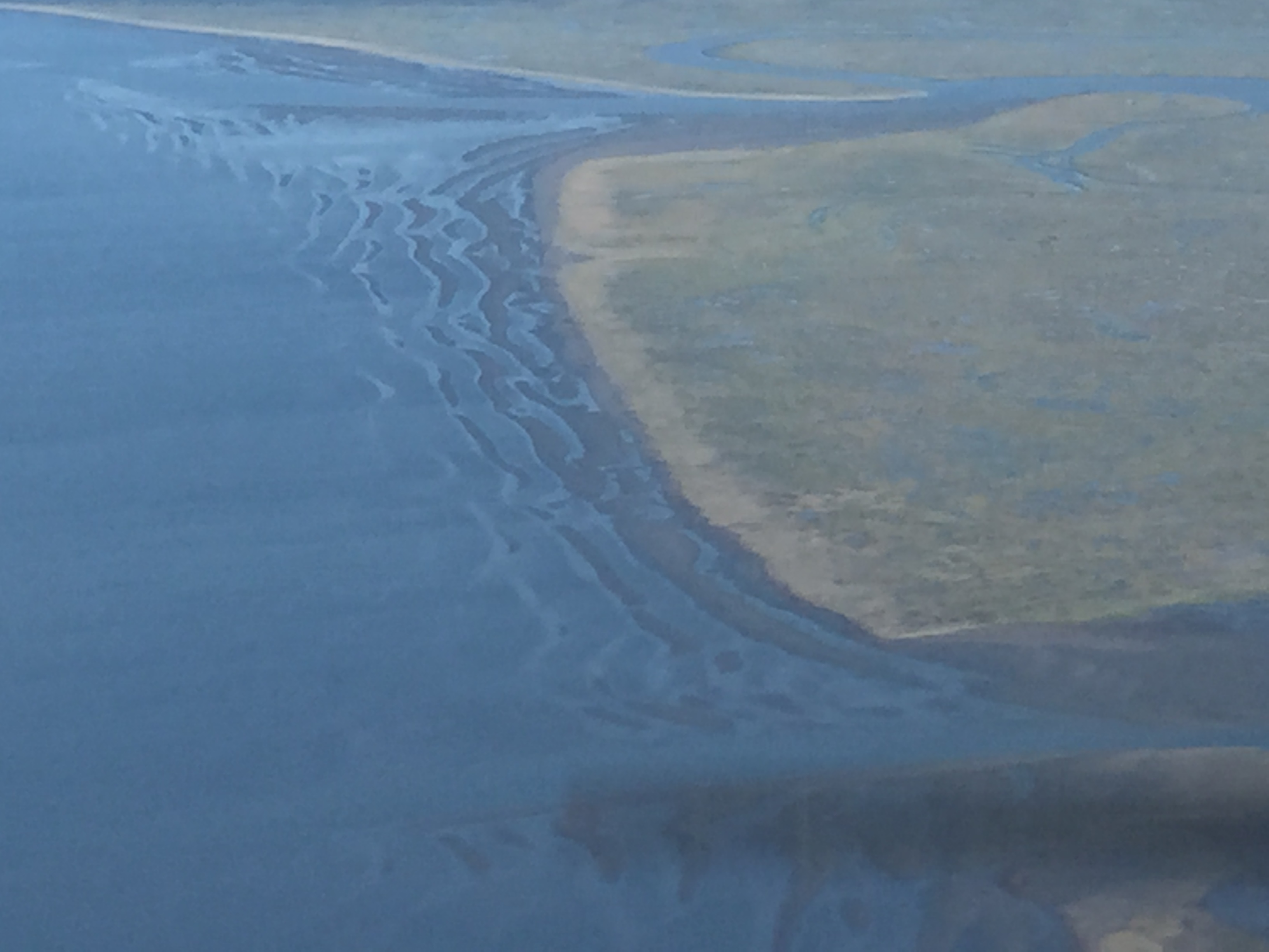
An example of the mudflats exposed by low tide. Lot’s of structure there.
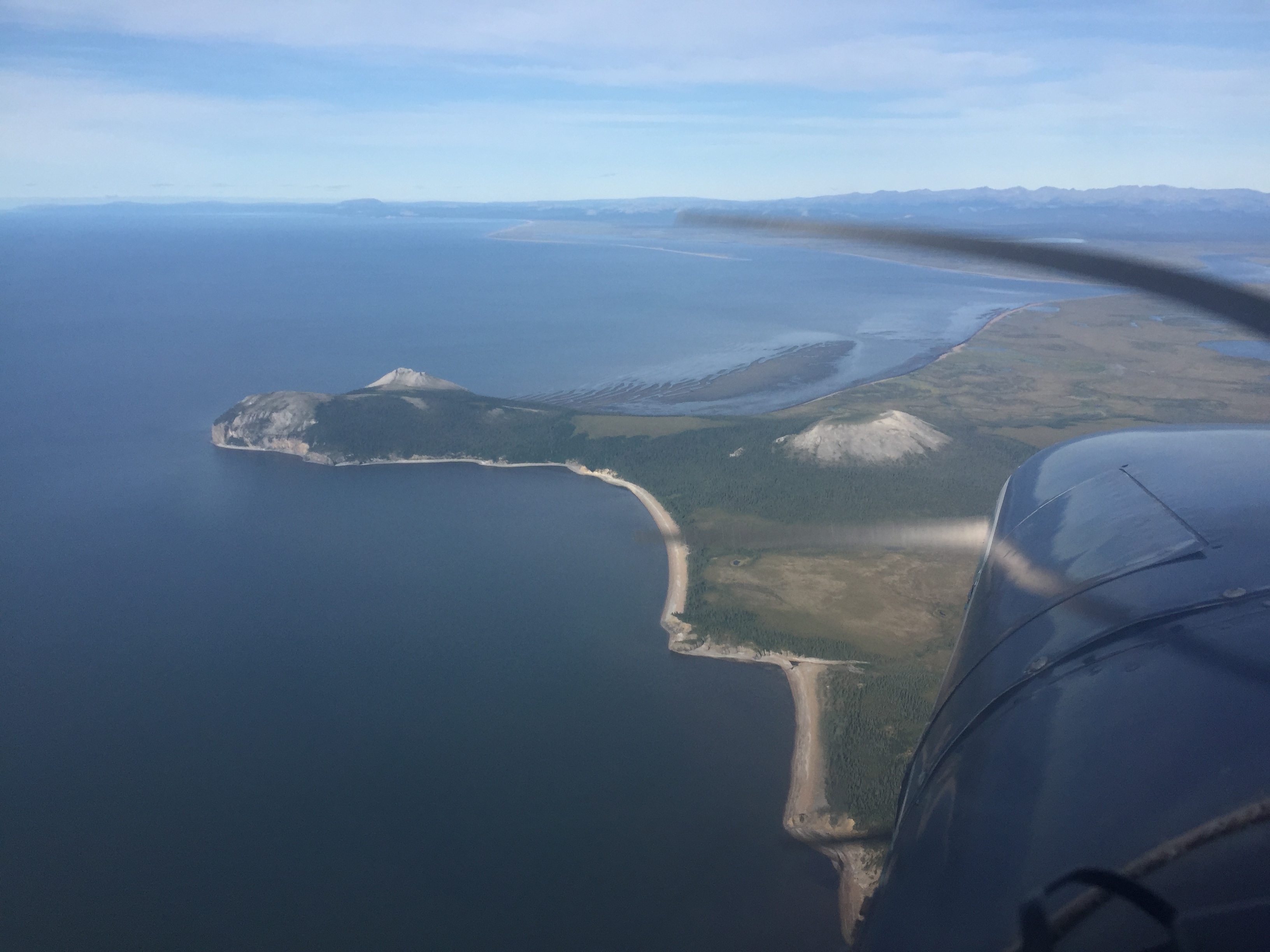
The coast was characterized by several rocky peninsulas like this. Note the sand bar exposed behind it.
I decided to focus on the area between Unalakleet and Elim. To capture the beach, I need to make 4 passes, covering almost 2 km inland. Along the way, I run different flight lines over villages to capture them at higher resolution and cover their inland boundaries. Not really being sure how long this weather window would last, my focus is on capturing all of eastern Norton Sound as quickly as possible during this neap tide. It is not the most efficient way to do things in terms of saving money or flight time, as it will mean that to get further north or south from here I will have to commute over areas that I’ve already done. But it seems like the most sensible plan as it means that in one more day I can finish the southern half of the sound during the good tides; tides elsewhere are essentially completely different. And while I did complete all of the coastlines north of here today, I was ran low on fuel and so couldnt finish the inland lines starting about an hour north of here or map Shaktoolik, so I have a few more hours left for that. At that point, though I can leave Unalakleet and base out of Bethel. From Bethel I have options to work to the south or to the west, depending on weather, and the tides there seem to operate on a more civilized nighttime-high schedule, so hopefully it will just be a matter of waiting for weather… I’ll also to come back and spend a few days in Nome but given the weather delays thus far, I think the strategy needs to be hitting the most target rich environments first and cleanup the smaller areas afterwards.
If Elim were located anywhere close to civlization, it would be a resort town. I was only there 15 minutes to refuel, but got invited to go fishing and visit the hot springs.
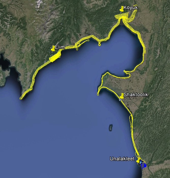
My tracks from today, 770 miles and 7900 photos. Only about 10x that to go…