
There’s No Place Like Nome
Taking advantage of a tight weather window, I flew 16 out of 28 hours, covering 1500 miles while taking 15,000 photos of lots of coast and four more villages, and ended up in Nome.
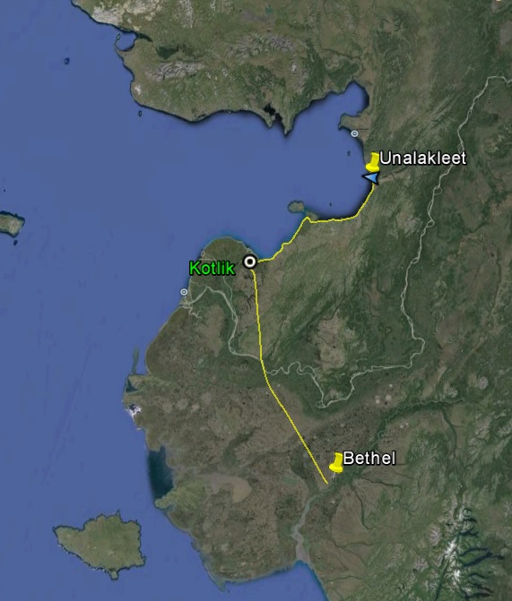
My original plan had been to finish the northern coastlines at the start of the project before moving south to Bethel. However, when I finished eastern Norton Sound and everything that was within easy reach of Unalakleet, the weather was more promising towards Bethel than Nome, so I headed south. Having completed a lot of the Bethel area work, my next plan was to make a break for Nome once Nome weather looked better than Bethel weather. The forecast a few days ago was for a huge storm to hit the entire region, but it was coming from the south and looked like there might be a small window in Nome before it hit. So I prepped for depature for Saturday morning, woke up at 5AM to check weather, only to find Bethel IFR… As the day progressed, weather came up and down all along my route and I was pretty much resigned to spending a week in Bethel waiting out the coming storm, but around 4PM things started looking better. So by 5PM I was airborne, heading north.
It was a pleasant evening all along route with generally favorable ceilings. As I flew over St Mary’s and got cell coverage briefly, I sent a note to Mick and the survey team based there, but they were apparently out flying, collecting the ground control that will be used for my maps.
My original hope when planning an early departure was to map Emmonak, Alaknuk, and Kotlick on the way, plus whatever I could of the Yukon Delta, but given how late it was and the fact that it looked pretty angry towards Emmonak, I headed for Kotlick to find conditions just about right for mapping it. The village was just on the edge of whatever system was towards the south, so I was flying beneath angry wet clouds and bright sunshine within the few mile area of the village, but it nonetheless turned out ok photographically and it was nice to check one more village off the list.
Heading towards St Michael, I finally got to lay down one track along the section of coast that had thwarted me several times trying to access from the north. But past there, a system was coming from the east, with angry roiling clouds descending towards the coast between me and Unalakleet. Fortunately it didnt block the way, and Unalakleet had high ceilings and was having a pleasant, though chilly, evening about 10PM. Maggie’s hotel was once again empty and she upriver, but she left me a key to help myself.
A (mostly) beautiful evening flight.
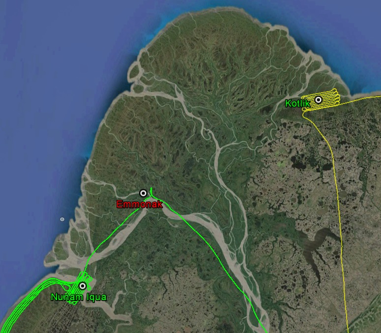
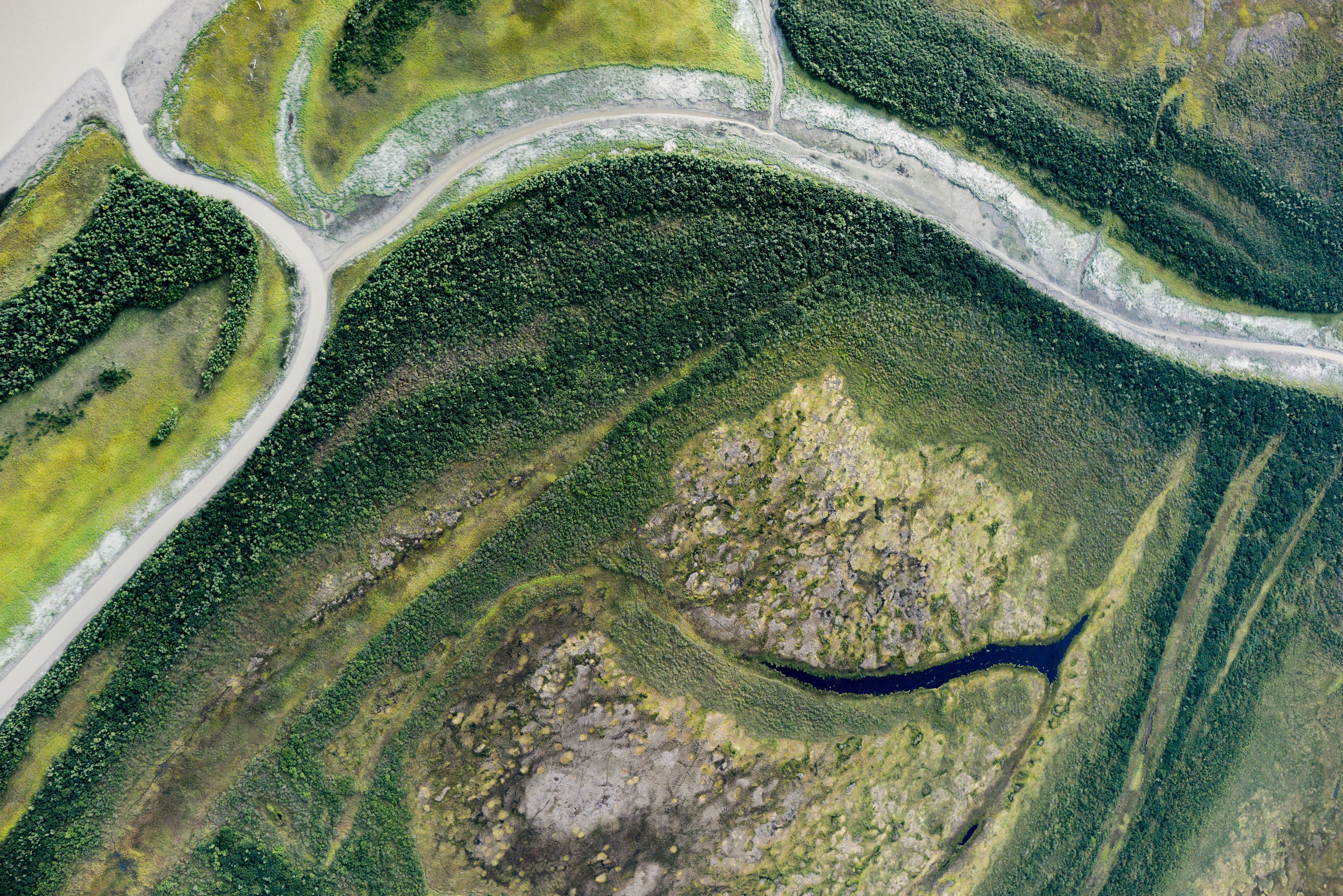
Where North meets South — the Yukon River delta.
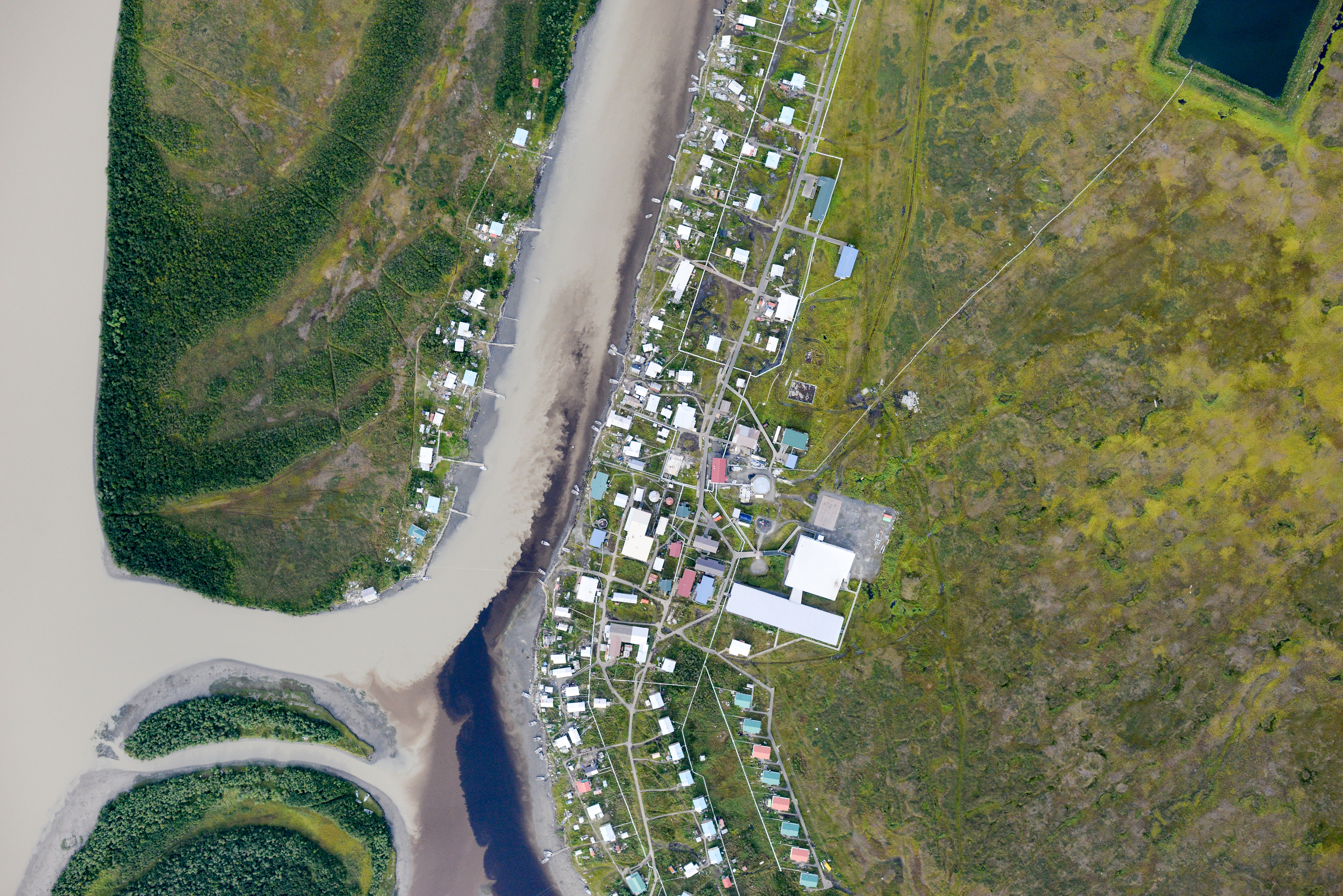
Kotlik. The villages on the Yukon Delta are the tidiest I’ve seen anywhere in Alaska.
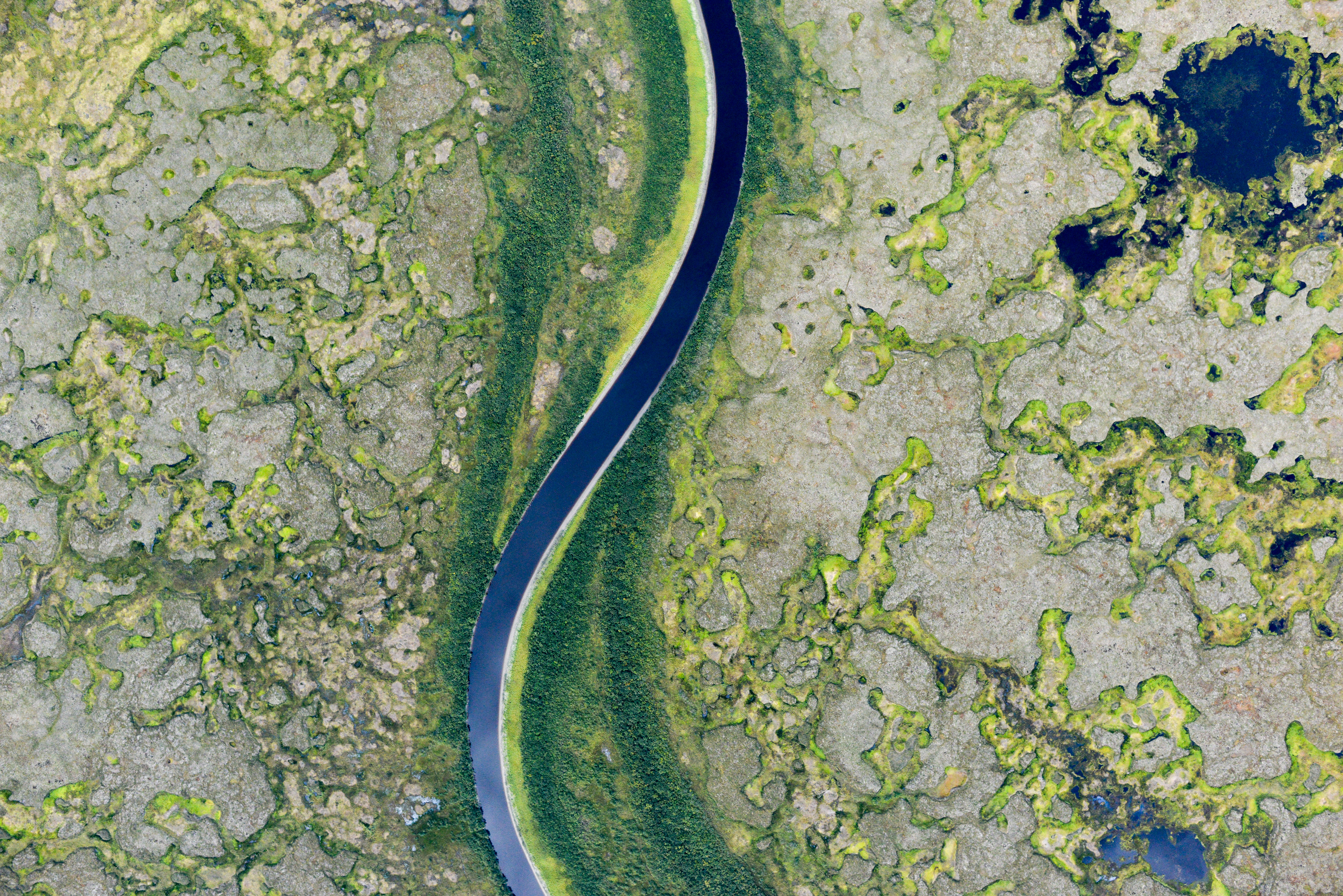
The patterns and forms on the flats never cease to amaze.
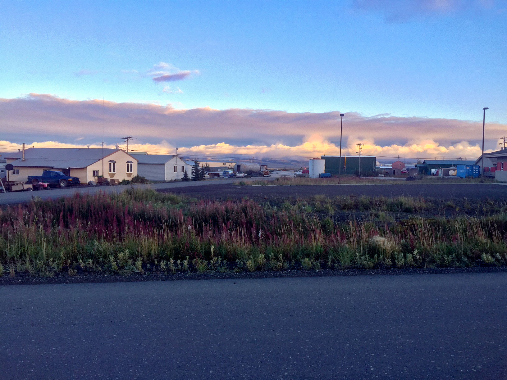
A small front was pushing west, south of Unalakleet. It was a brisk night, with winter not far away. The fireweed have lost their leaves and are starting to turn to cotton.
Sunday morning showed great weather to the north but was still predicting the storm moving in to the south, so I was anxious to get on my way. I was a bit concerned about getting fuel there early on a Sunday morning, which turned out to be well founded. No one was in the shop and no one answered the phone or the call out numbers. That was another reason I didnt want to burn too much fuel yesterday, so I would still have enough to make it to Nome. So I fueled my wings using my internal bladders, hoping I would have just enough to map the villages en route, fuel in Nome, and then head back out if conditions still permitted. Fortunately that plan worked out perfectly.
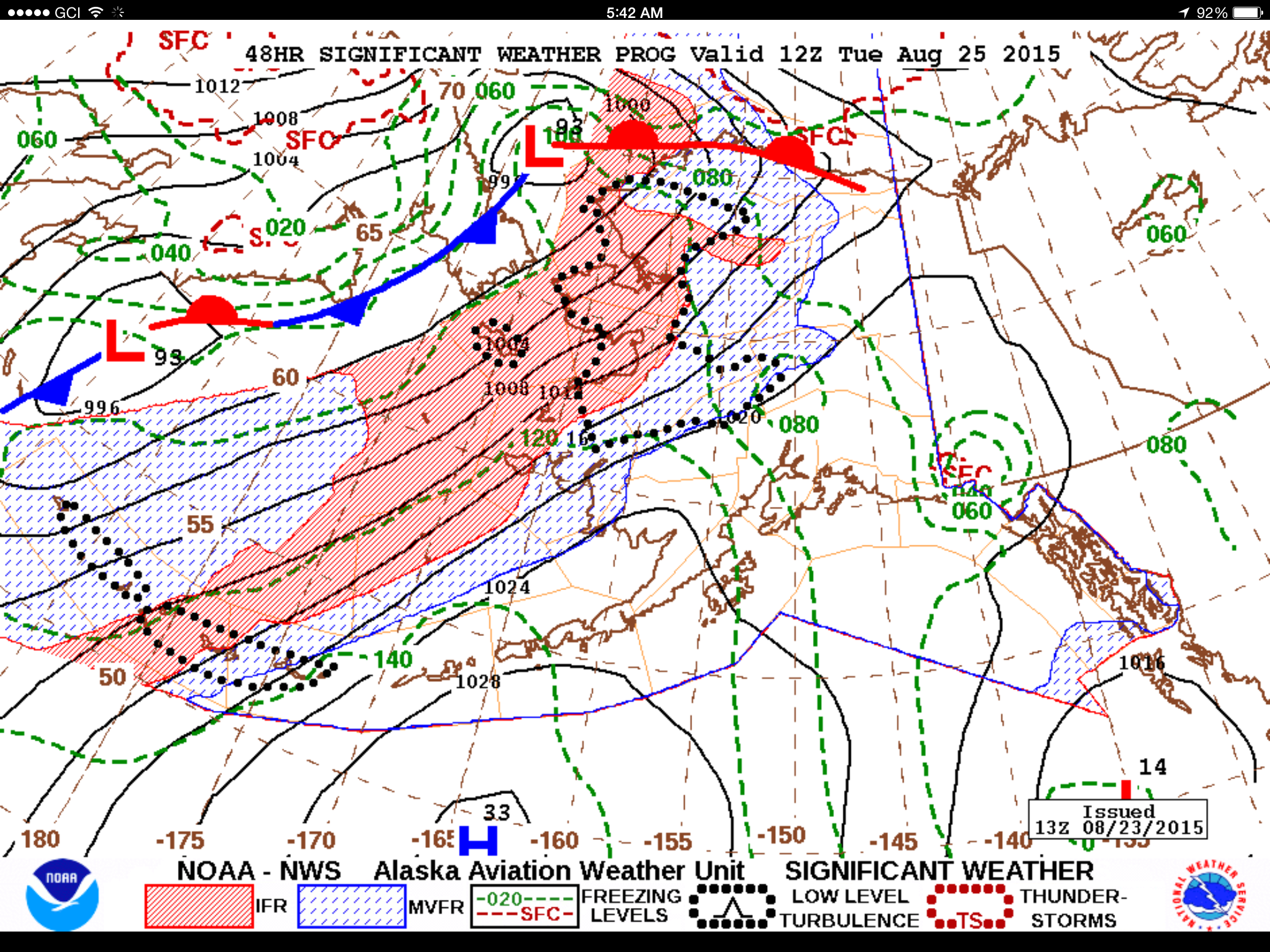
This was the storm that I was trying to outrun, as predicted when I left Bethel. Red means IFR (or I Follow Roads, because I cant see anything else…), black dots mean your bladder better be empty and your knuckles OK without blood flow for long periods. Essentially the only decision here was where to spend a few days not flying.
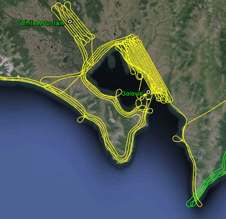
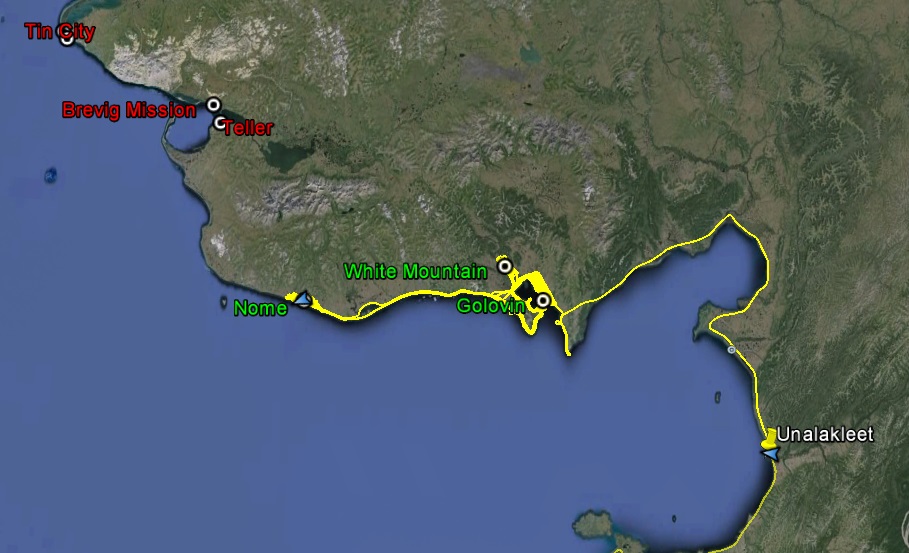
Golovin Bay is a very scenic location. Why the locals of Golovin decided to build their houses and infrastructure at sea level when there are nice hillsides half a mile away boggles me a bit, but no one consults me on these things. Golovin was the biggest mapping project of all of the towns, as I was mapping at high resolution over a very large area, presumably much of which is going to become their future town site the next time the current one gets submerged. I cant imagine what they were thinking as this small plane spent 2+ hours flying back and forth over them without landing, but I didnt hear any gunshots, so I guess that was a good sign. After finishing up there, I still had enough fuel to map White Mountain, only a few miles away, before heading to Nome.
Golovin is about as close to sea level as you can get.
In technical photogrammetric parlance, we call this mapping the hell out of an area.
The weather was predicted to go down in Nome by 4PM, but at 4PM it was still a beautiful day there. So after refueling, I headed back out to Golovin Bay to map the shorelines. The two peninsulas that form the bay had cloud cover, but it was kind of coming and going. So I would make a lap around the western one, then do some shoreline, then another lap, as conditions warranted. The eastern peninsula never really opened up, but I had gotten the most important parts done already, and hopefully on my way back I’ll be able to clean up the remaining bits. In any case, I’ve now got continuous shoreline coverage Kotlik to Nome, albeit with a few small sections needing reinforcement.
I was a little concerned about mapping the town of Nome, as I was unfamiliar with the landmarks and if it was anything like Bethel it would be too scary to contemplate with all of the barely-organized traffic around. But I figured if there was a good time, it would 8PM on a Sunday evening. I guess there really is no good time, as I had to deal with a half dozen private planes that seemed like they were going out hunting, a few small commercial planes, and an Alaska Airlines jet. Nome has no control tower. There is a guy that sort of relays traffic information there, but more or less its run like a small airport but with big planes. In any case, it all worked out fine and I think Nome will be happy to know it will soon have a new map.
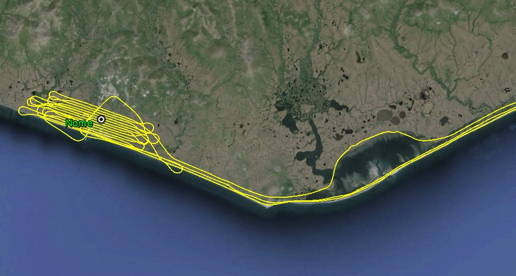
I mapped Nome last. Just as I was finishing up about 9PM, a cloud layer formed over town almost instantly that would have been in my way, so it was perfectly timing all around today.
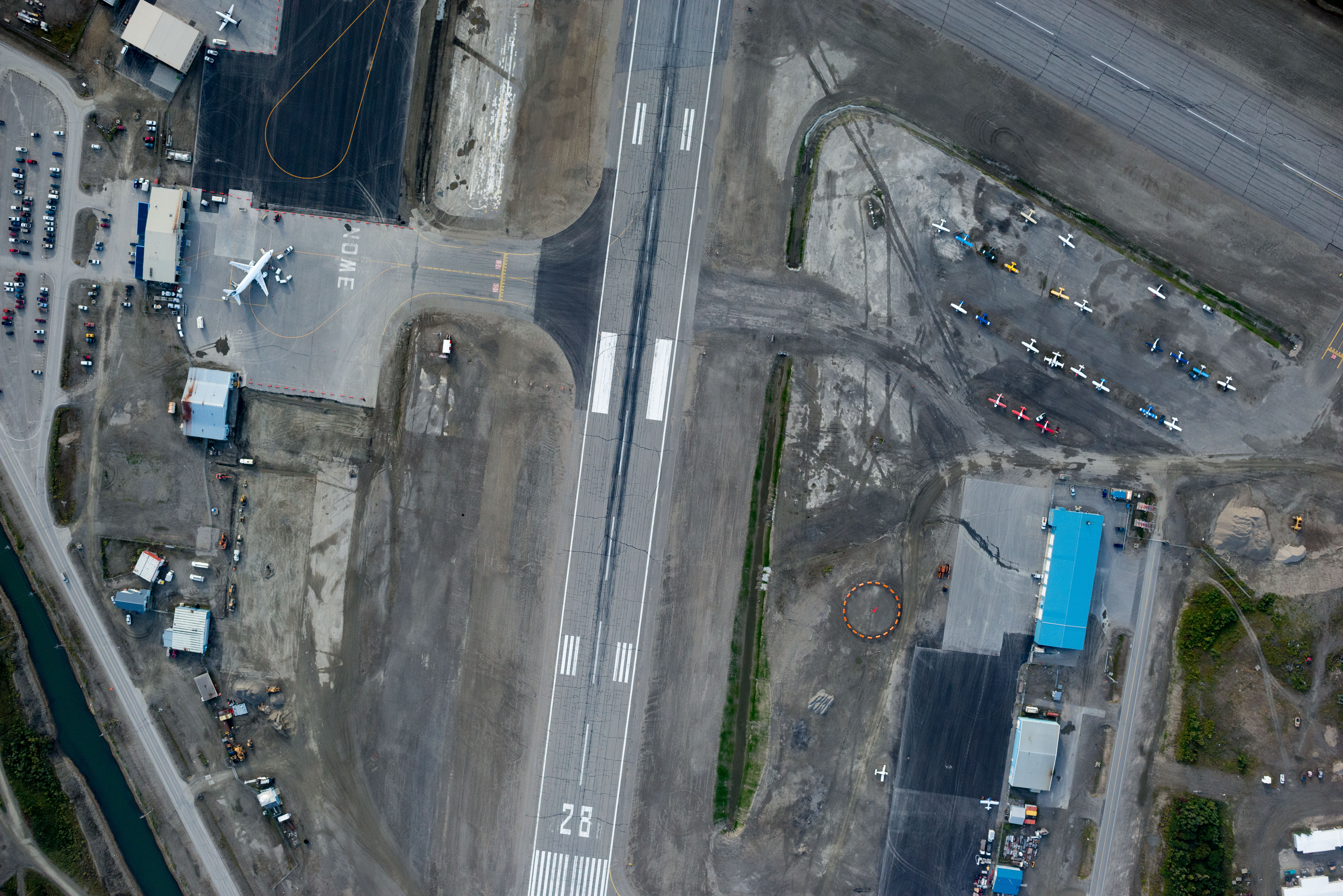
The Nome Airport, with Alaska jet on the tarmac.
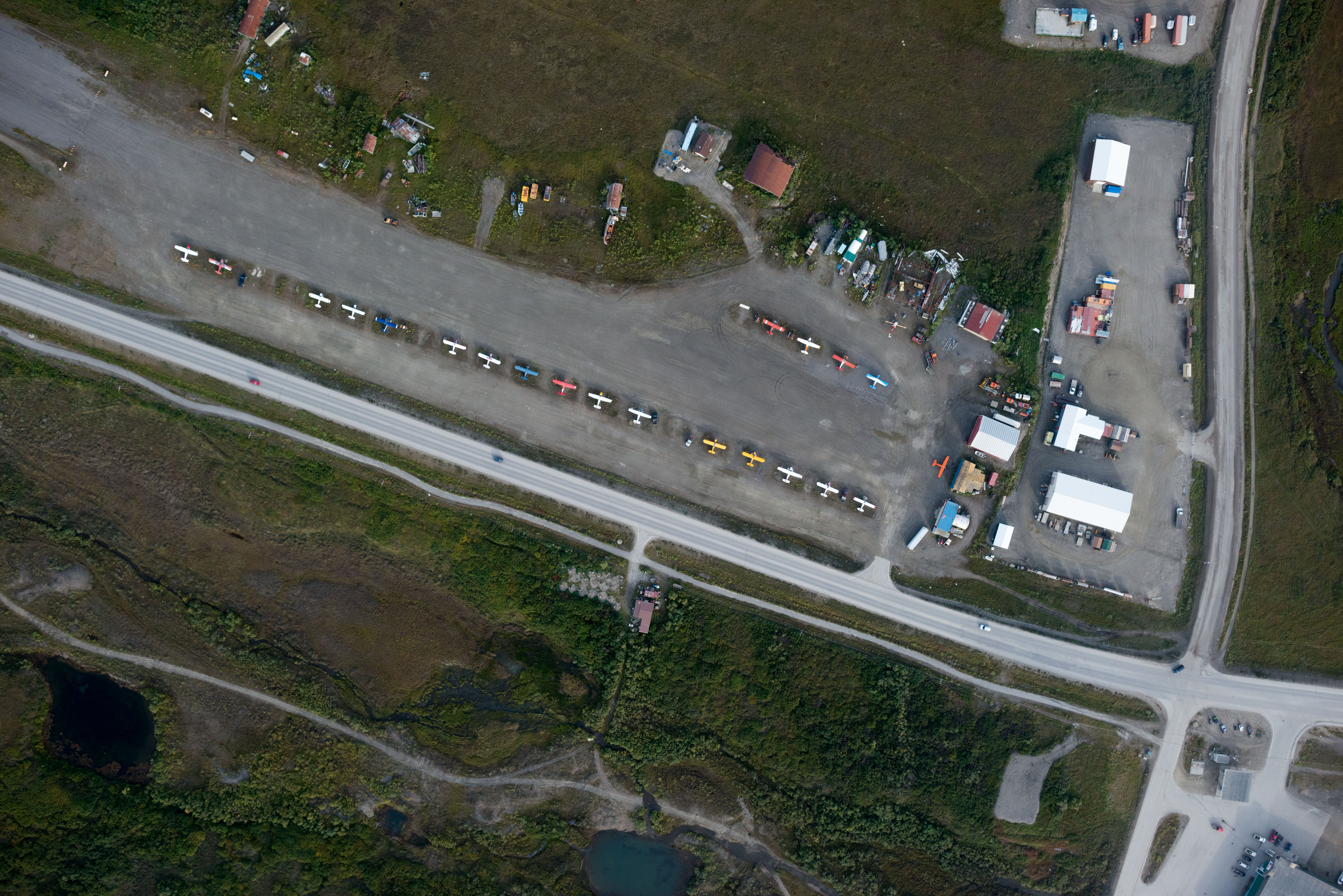
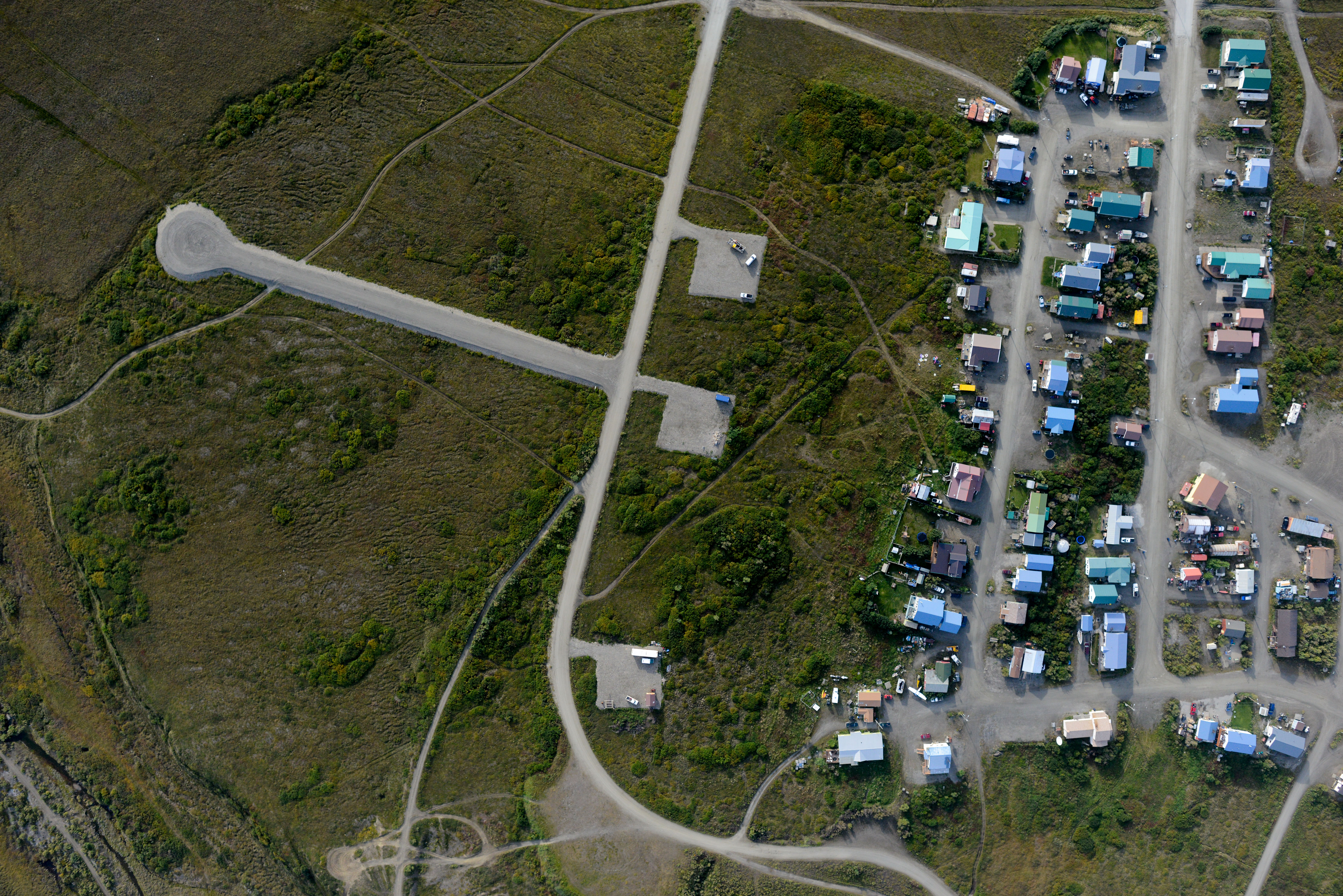
Nome City Field, a small strip less than a mile away. No jets there…
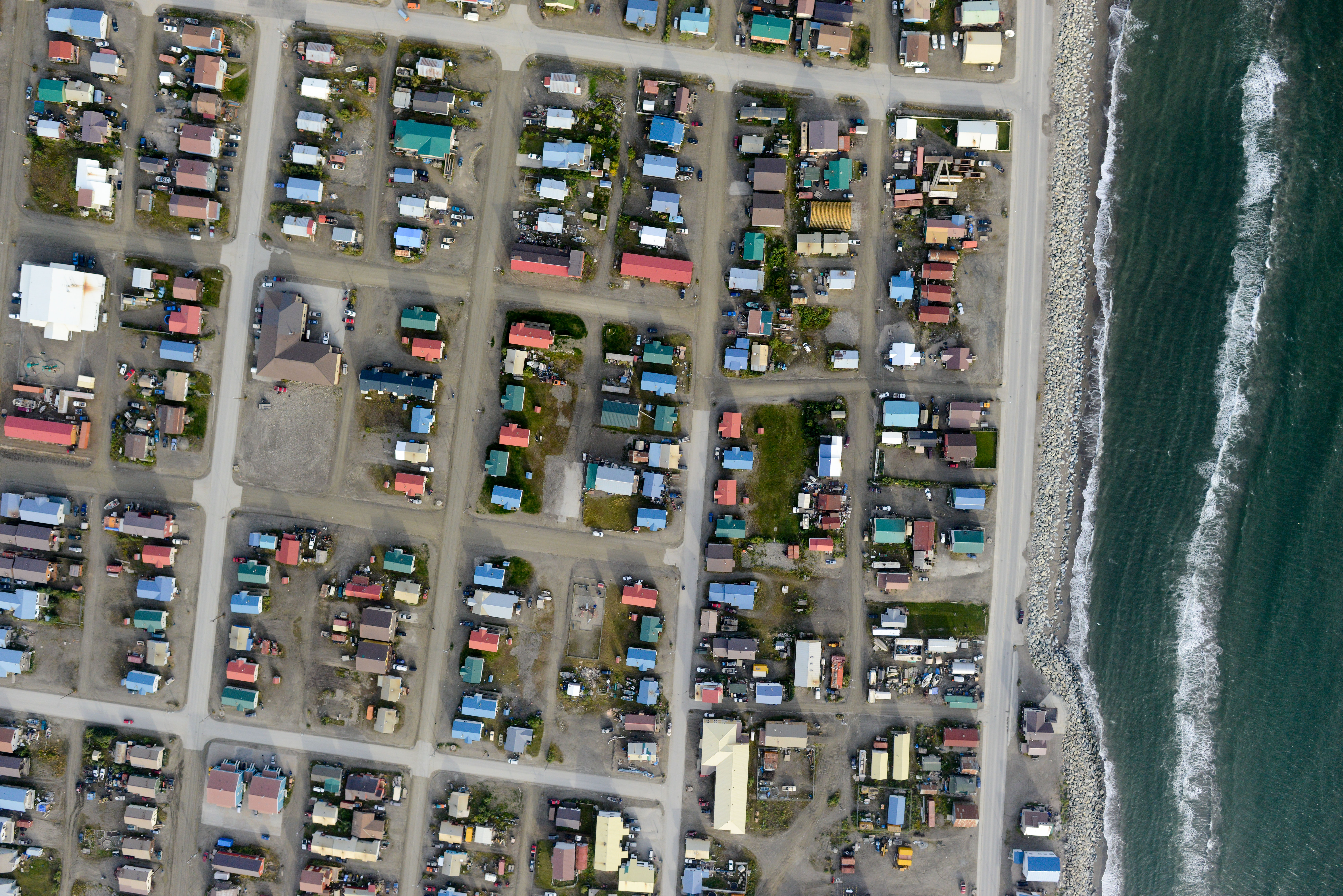
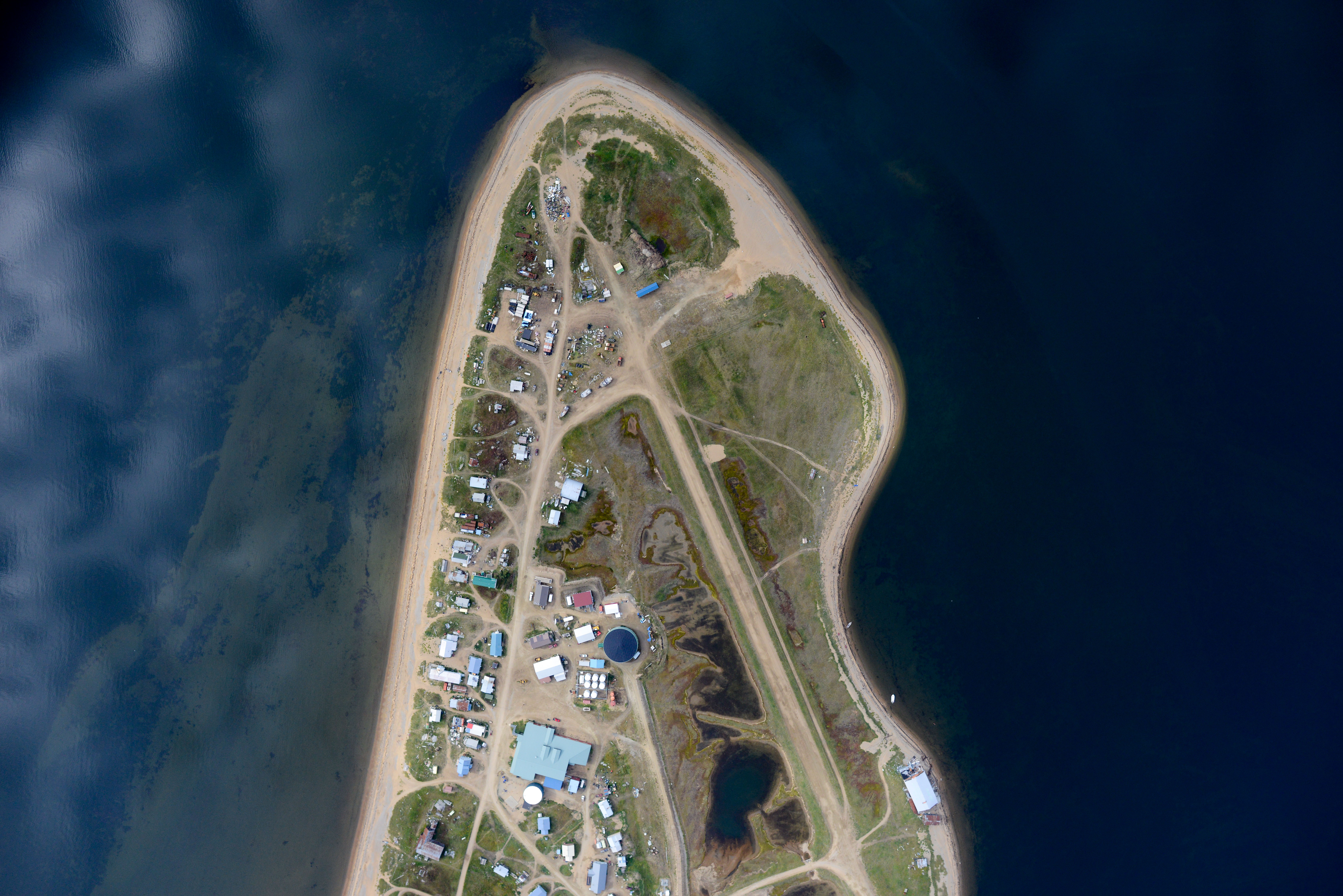
Nome is a bit more than a village. But it’s still coastal.
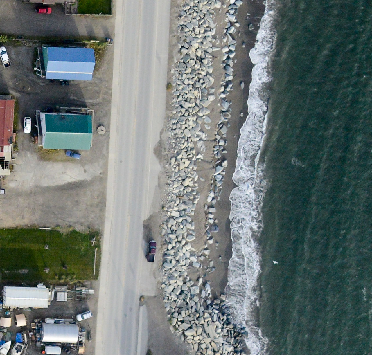
Here’s a closeup of those rocks. Note the truck for scale.
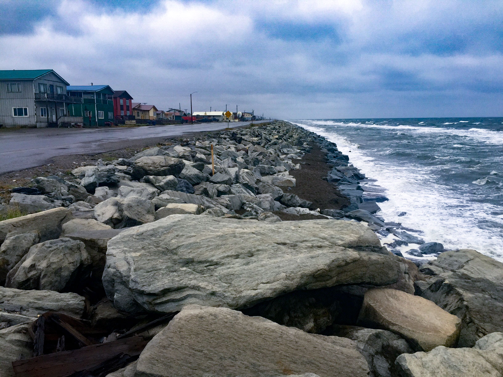 Here are those same rocks from the ground. They are braced for impact, but it is a losing battle in the end.
One Nome subdivision is apparently in the process of constructing a giant trebuchet to launch storm debris back into the ocean.
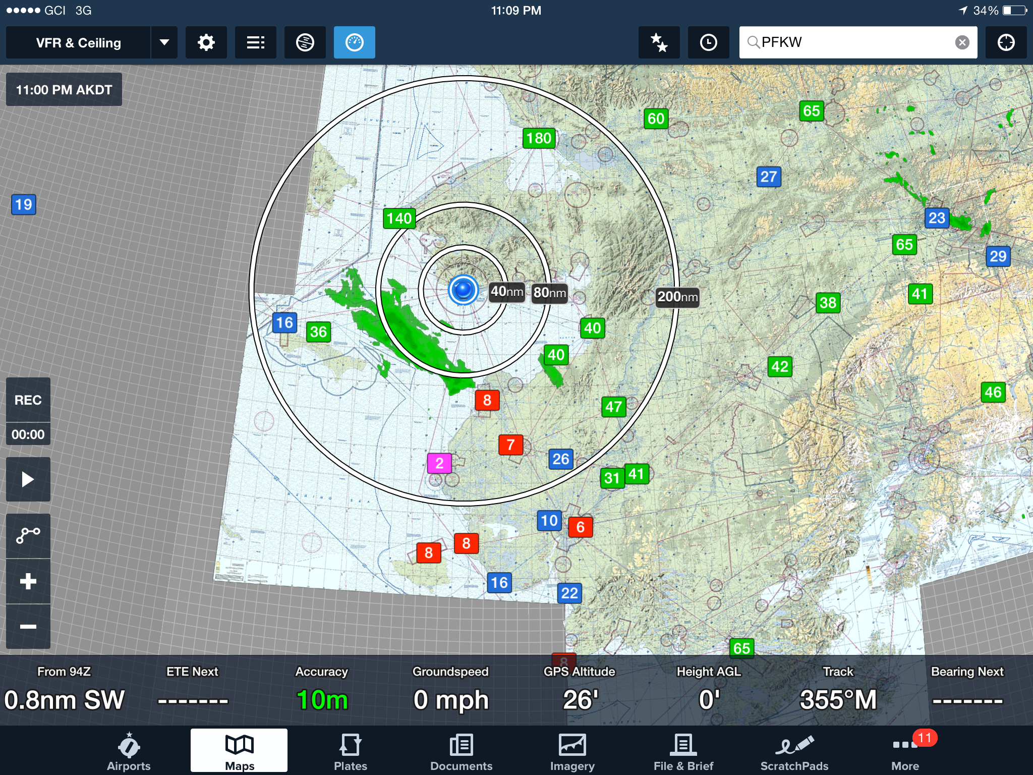 Last night the big green blob was headed our way, but hadnt yet reached. I’ve learned not to fly into those…
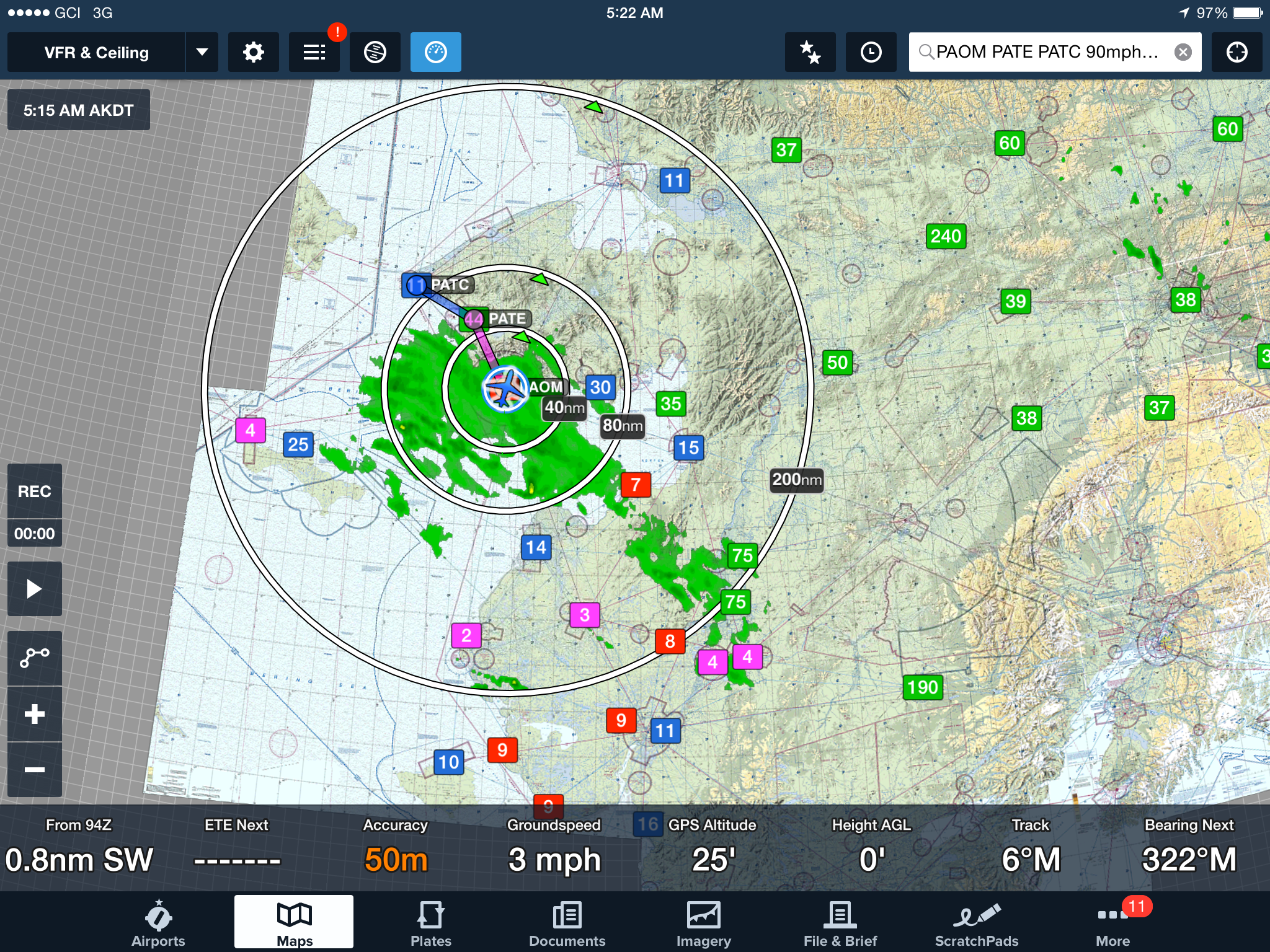
Early this morning it had already engulfed us. The numbers are cloud ceilings in hundreds of feet. So “2” means 200 feet.
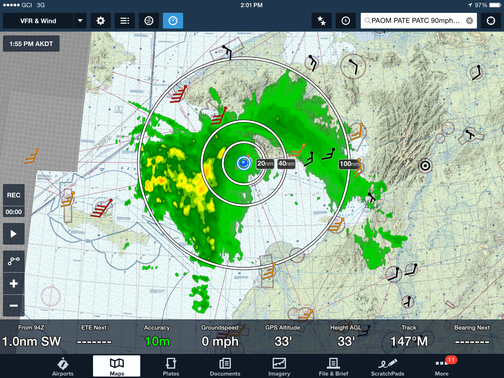
By early afternoon, the green blob was turning yellow. I’m not sure what that means, but I doubt it means improved flying weather. The arrows are wind speed, with each full barb being another 10 knots. So Wales (to the upper left) is blowing 45 knots.
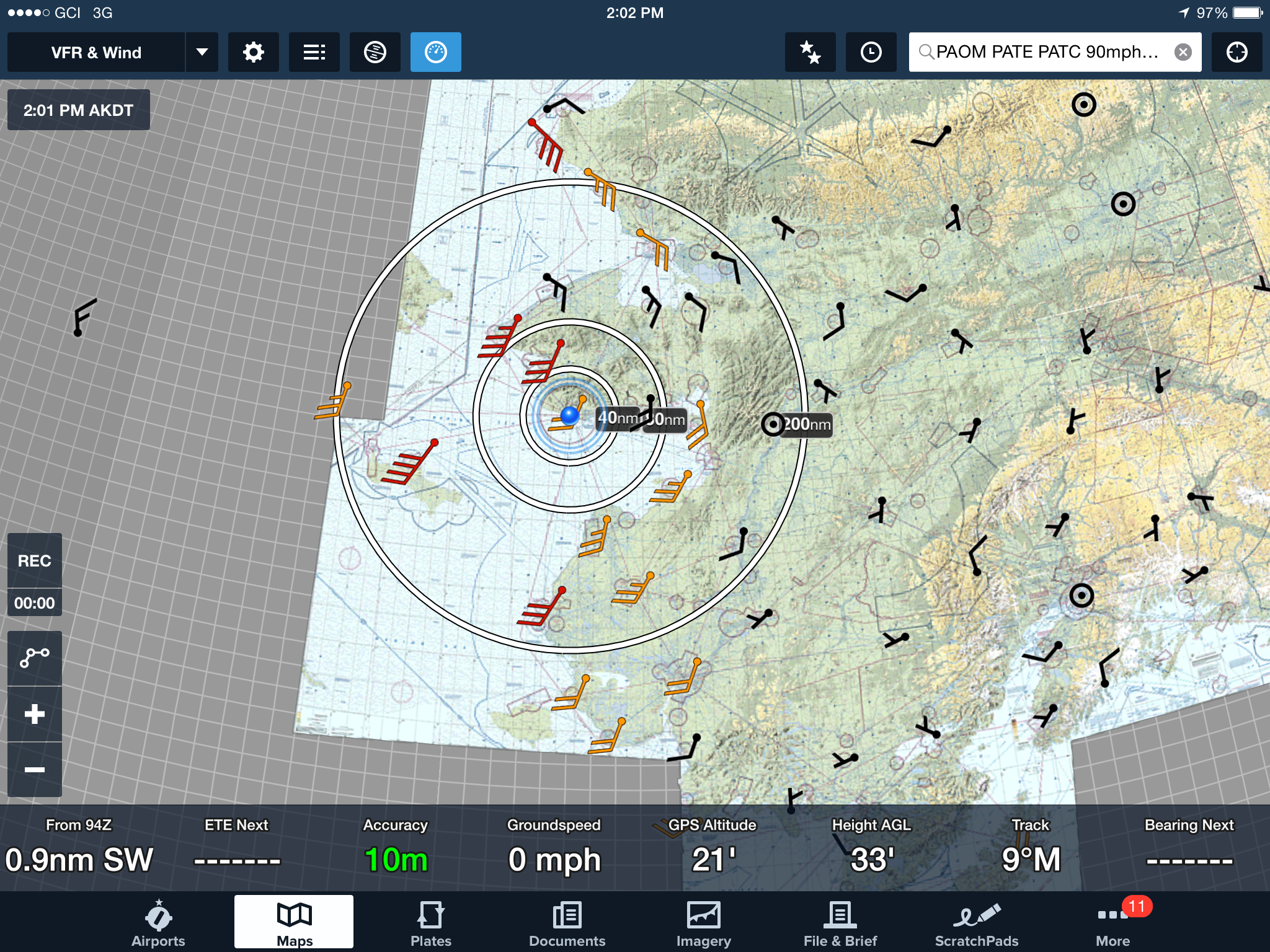
Low pressure systems form a counter-clockwise wind vortex around their centers. You can see this from airport weather stations, with the center presumably to the north-west of Nome.
About 1100 miles and 12,000 photos, squeezed in between just normally bad weather and unusually bad weather. But there could be worse places to be stuck. With one more day like yesterday, I could finish the remaining work up to Wales (next to Tin City) and be essentially finished north of the Yukon River delta.