The Bombs of St Mary’s
Today I flew from Nome to St Mary’s, doing some final cleanup en route before getting chased off the coast just as I thought I was going to map the Yukon River delta.
I fueled last night so that I could get an early start today, hoping the forecast would prove correct and I could head south. The whole coast was showing clear skies, so I was at the airport early only to find frost covering the airplane. But with a bit of homemade de-icing fluid and early morning sunshine, I was able to melt it off and still take advantage of the weather window.
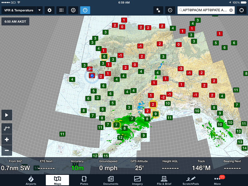
Temperatures across the state at 7AM this morning were in the 30s many places, including Nome. The faint yellow circles are where they are shutting down the airspace for a “VIP” visit later this week.
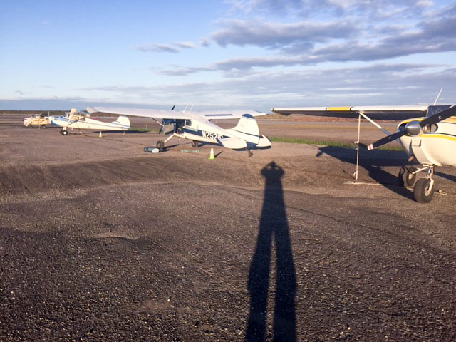
I had a fair amount of frost on my wings, which I’m trying to melt in the early morning sun.
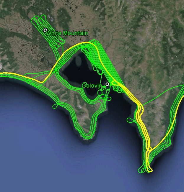
I cleaned up the east side of Golovin Bay along the way. Flying mostly east, to the north on my left it looked pretty ugly, but over the coast to the south I could see Shaktoolik across Norton Sound, tempting me to fly direct. I resisted the temptation, but I did climb up to 5500′ for a while for the first time the entire trip. As I got to Koyuk though I had to drop down again as even in that 30 minutes the weather was changing, and underneath the broken layer I was hitting small squalls. The part of the weather reports I usually ignore was that there was high level turbulence predicted, and with the number of lenticulars in the sky it seemed likely correct, but at my level it was mostly thermal bouncing.
I didnt think I was going to get the high lines on the southern tip of the peninsula, but just as I was leaving it opened up. If you dont like the weather now, just wait five minutes…
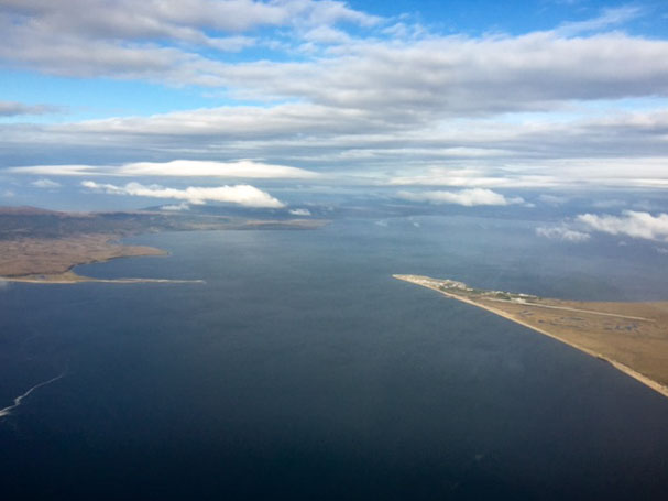
It was pretty clear over my head, but to the north of Golovin it looked unpleasant.
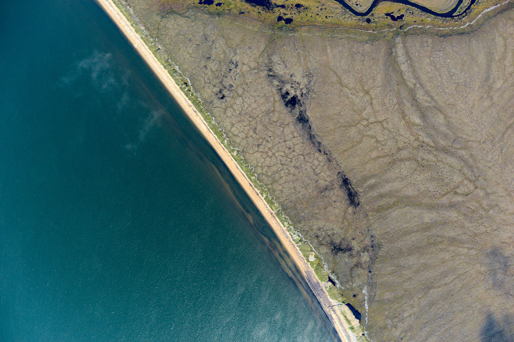
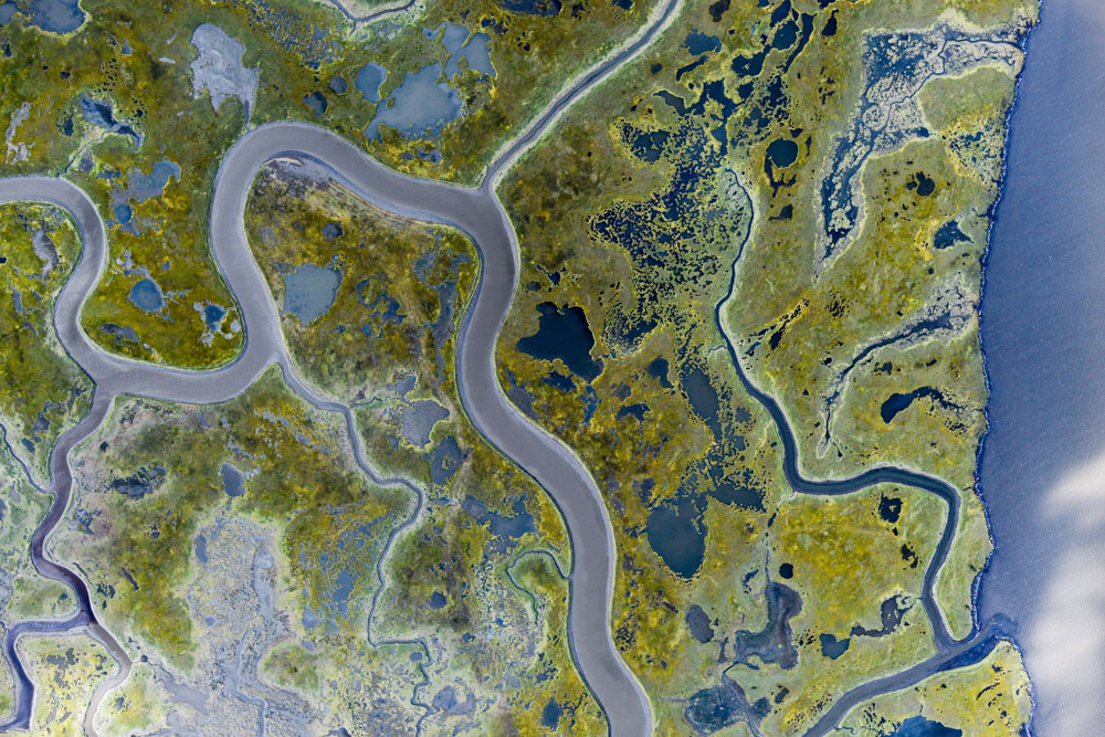
The 2.5 m high bathtub ring of driftwood can be found everywhere in Norton Sound, like here in Golovin. Look really closely at the beach in the upper part of the photo.
Downwind for 20, Golovin. I think I’m the only guy that flies above a thousand feet here.
After refueling in Unalakleet I continued south and did a little cleanup around St Michaels and Stebbins. I could see all the way down the coast and even though it was almost 3PM by now, I thought today could be the day I finally map the Yukon River delta by making it a late night. The ceilings seemed stable at over 3000′, though behind me and to my left it felt like I was being chased by bad weather (though it seems that way a lot, maybe I’m just paranoid). So I made one pass most of the way down to Kotlik, and because it looked so good to the south, I thought I would turn around and go up and back to Stebbins to finish out that section before the weather changed up there. It was indeed a bit lower and thicker, but still good enough. By the time I got back to where I turned around however, my nice high ceiling had disappeared and I was looking into a wall of gray with a ceiling 1000′ feet lower. I got down underneath where it was raining, then thought I would skirt around it inland, so as not to risk covering the camera glass with water. Given how perfect it was 20 minutes earlier, I thought it must be an isolated shower that I could easily get around and just cleanup what I missed once it moved off. But I kept flying further and further south with no sign of getting around it. Then I realized it was spontaneously getting larger. I looked around and it seemed that in every direction now, every cloud in what had been a nice broken layer was beginning to dump down rain. By this point I was halfway to St Mary’s and feeling like I was under attack, weaving my way in between the squalls, which seemed to be merging together behind me. The wind was picking up as well, so I just kept going, as it was clear that there was no possibility for mapping until the clouds were empty. Plus having never been to St Mary’s, I thought it was best to get there before 5PM on a Saturday, to have some possibility of getting refueled and finding a place to sleep. But even though I didnt get to map the delta, at least I’m finished nearly all the way up to it and in easy striking range of it, as I can just look out the window and take advantage of whatever opportunities arise.
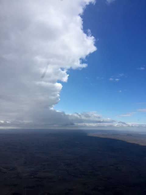
I thought once I passed under this I would have the rest of the afternoon for mapping.

Not much later I ran into this. I tried to skirt it, but it just kept going and going.
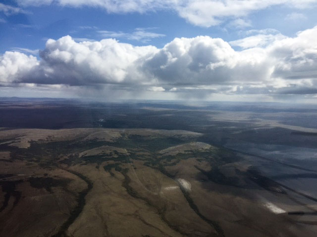
Then I realized that I was under attack by individual clouds.
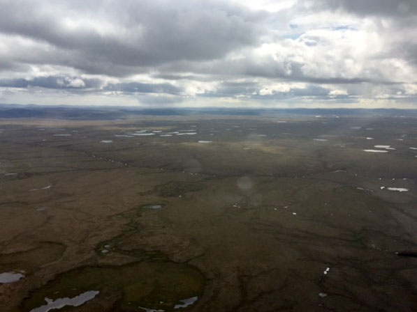
One-by-one they all opened up until it was a sea of gray. I decided that was my cue to land somewhere.

The wind had picked up everywhere too.
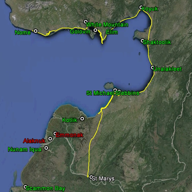
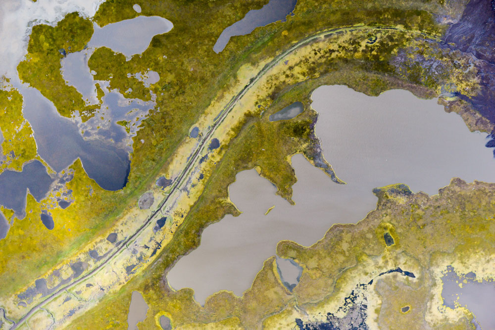
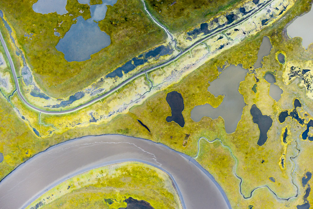
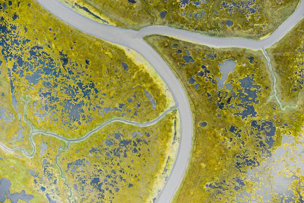
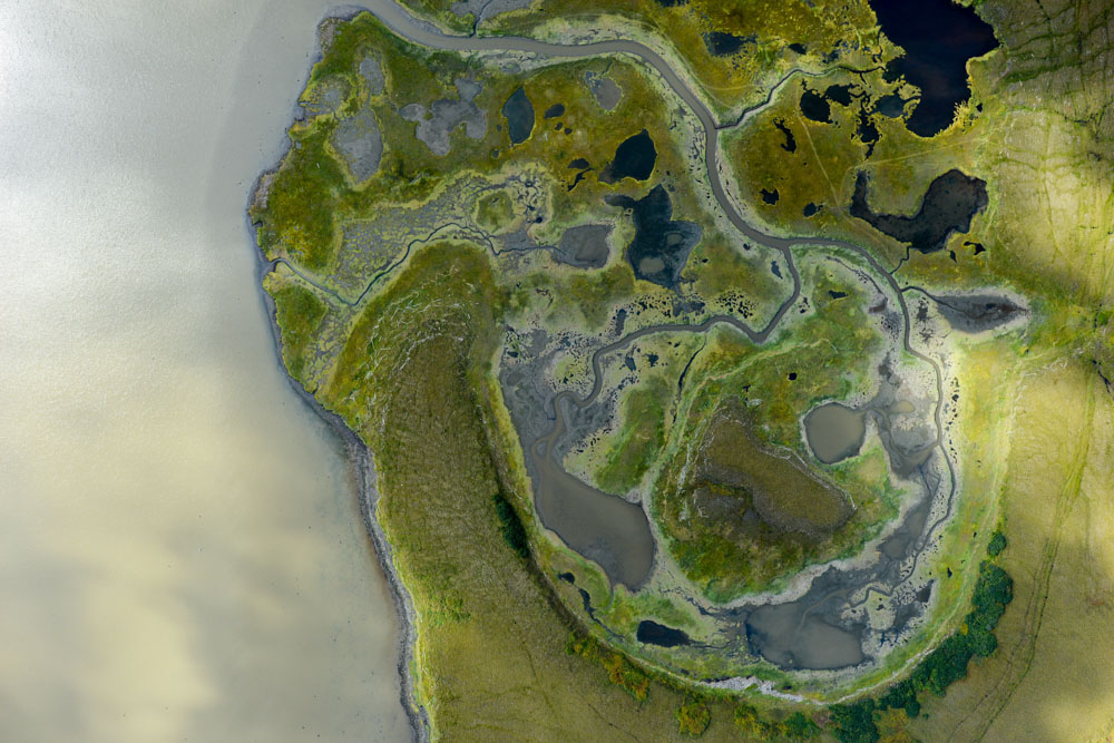
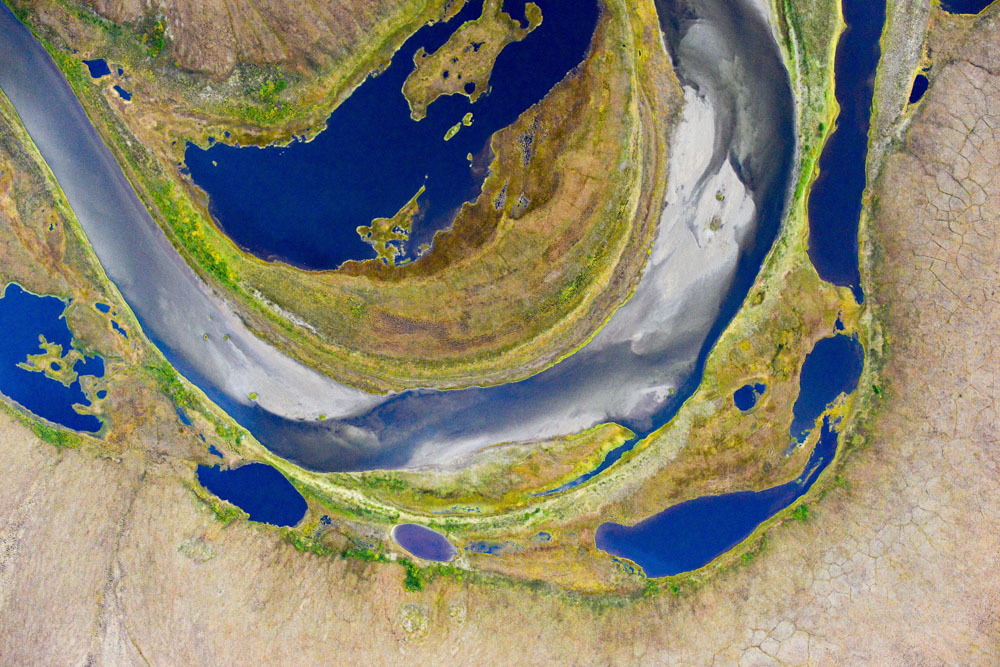
But it was a successful day nonetheless, having finished the north to where I just broke from the coast, and now in easy striking range of the Yukon River delta and the remaining to villages there. Some pretty pictures from the day below.