
Mapping the Golden Pixel
North met South when I mapped the Golden Pixel on Monday, creating a continuous mile-wide swath of imagery from Wales to Cheevak, in a 24-hour mapping marathon taking advantage of a 36 hour weather window.
I relocated to St Mary’s several days ago to take advantage of its proximity to both the Yukon River delta and the southern Y-K delta. As winter draws near, the next priority was the Yukon River delta. Basing in St Mary’s eliminated 2+ hours of commuting from either Unalakleet or Bethel, at the expense of small village dynamics and double the fuel prices. It turned out to be the right move.
Sunday, the day after I arrived here, was fortuitously a weather day. It looked flyable, but the winds were quite strong everywhere and the charts were calling for moderate turbulence and mixed ceilings. After several very long days of mapping in the Nome area and the commute here, I was not anxious to battle the winds, and sitting in my room the entire building was shaky in the wind. I talked with a passenger on a commercial flight who told me it was not very pleasant and that was enough for me, especially as the forecast was for some great weather the next day.
The ceilings were low where I wanted to go (to the northwest of the blue dot) and the winds were strong all over as a system moved through.
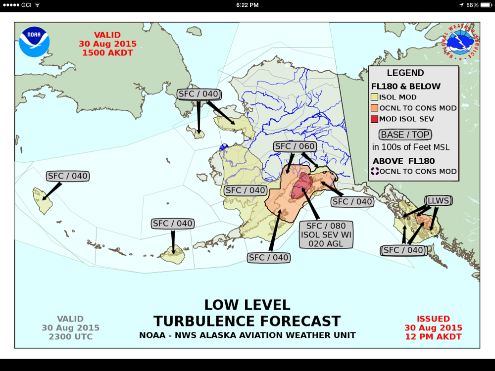
Plus they were calling for moderate turbulence all over that area. It’s not that turbulence bothers me, it’s just not good mapping weather. Yeah, that’s the ticket.
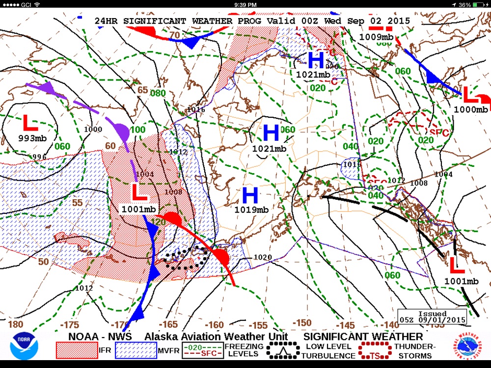
The forecast was calling for great weather tomorrow. Apparently it takes several high pressure systems to make good weather out here, as one by itself still brings moisture just like a low pressure, just from the other direction.
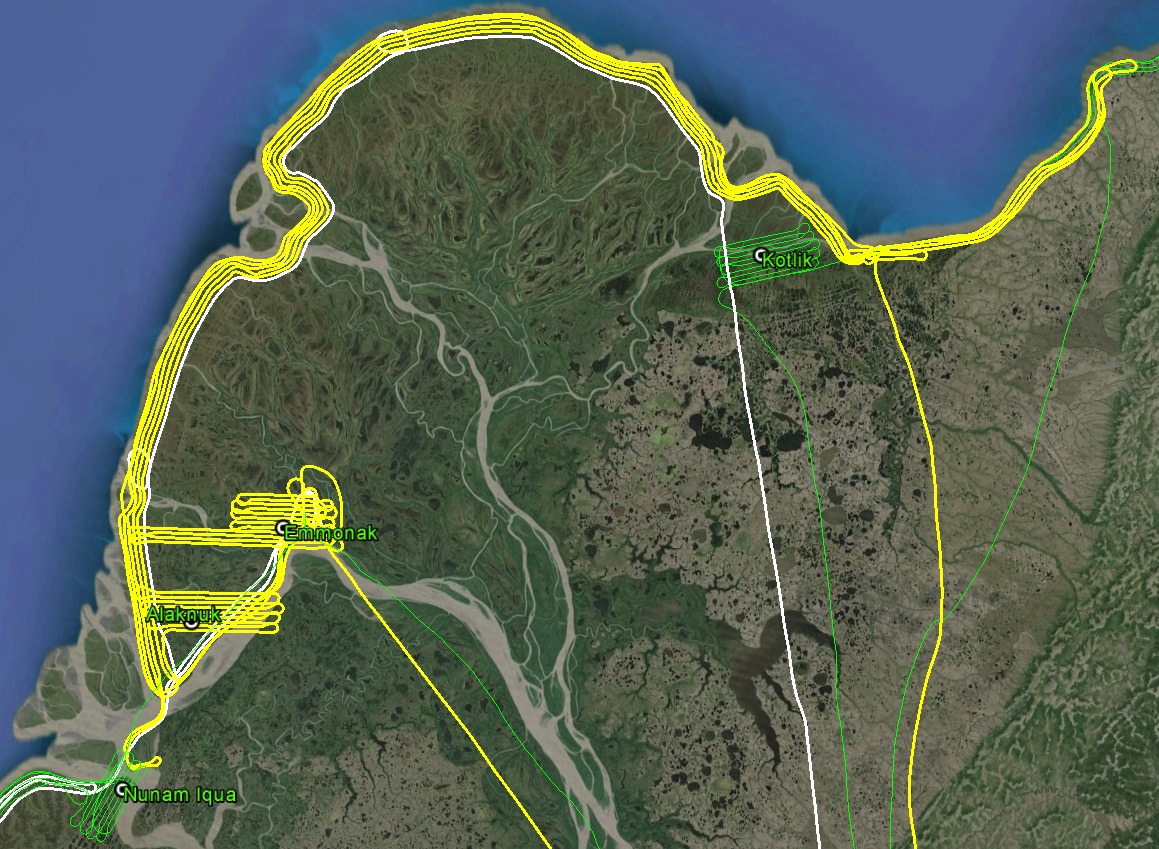
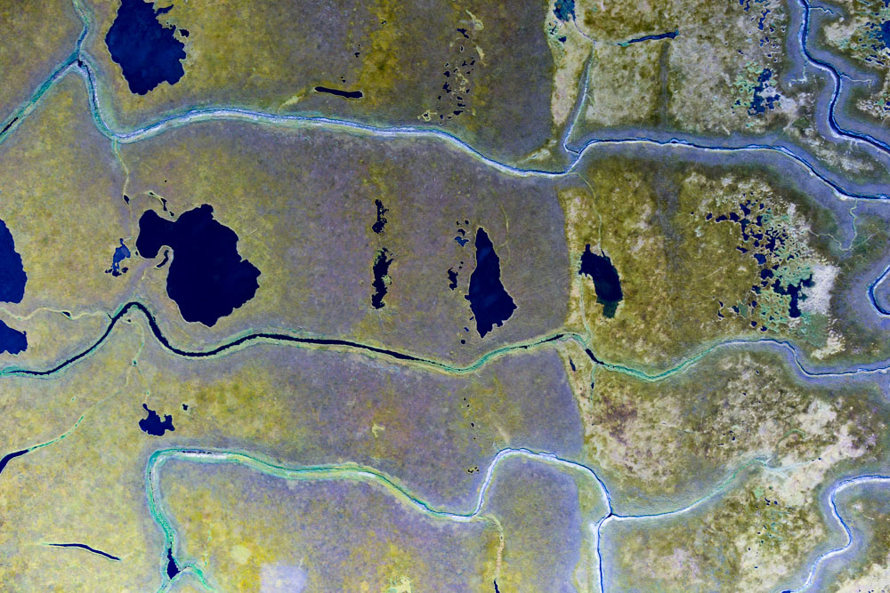
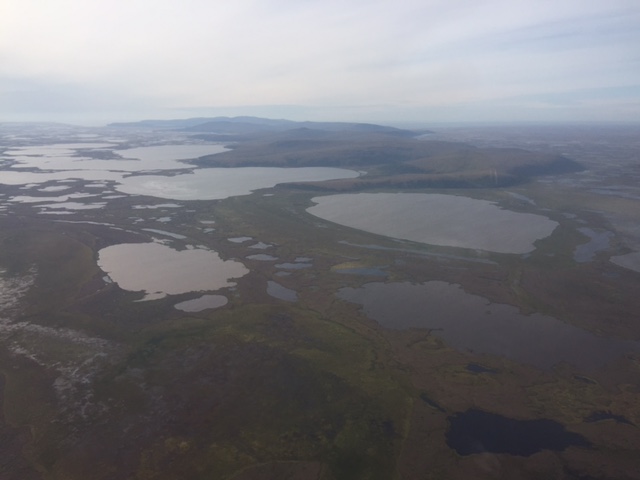
Fortunately that forecast was correct. I was prepped and ready for an early start and headed first for the area north of Kotlik where I had been chased out on Friday, to clean up the connection to the upper Yukon River delta. I think this area is one of my favorites of the whole trip. It’s not particularly scenic compared to elsewhere, but I remember looking at it from Stebbins early in the trip, when it was completely cloud covered one minute and then completely clear 20 minutes later and I could see all the way to the delta, so it formed kind of a magically quality about it. But soon enough it was done and I was excited to finally map the delta itself and form the connection between the northern and southern sections of the study area.
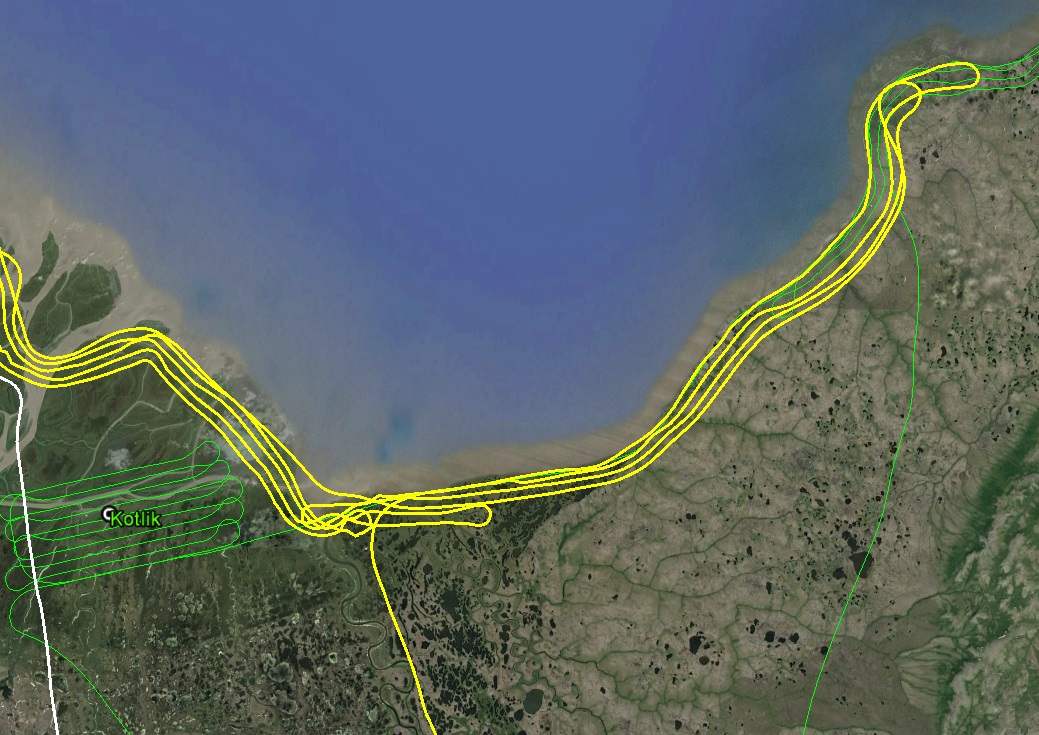
I started the day where I had finished two days earlier (green) when I got chased out of the area by cloud bursts.
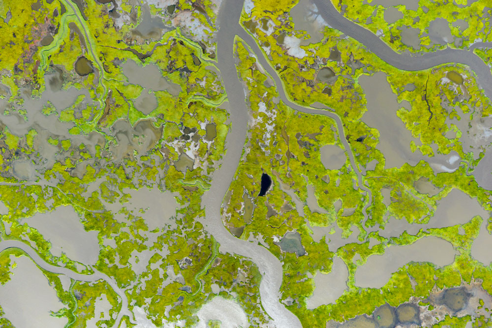
I’ve been continually surprised at how accurate the weather charts are here. On them that morning they predicted a little band of MVFR in the middle of the delta and sure enough there was a low band of clouds forcing me down to half my intended height. It was a little disappointing as I had hoped finally to make some long mapping runs and now I was having to improvise new plans about which half of the delta to map first. But it was still early in the morning and I hoped they might lift or burn off as the ground heated up, so I focused on mapping the two remaining villages north of Cheevak – Emmonak and Alaganuk.
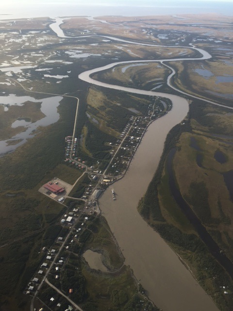
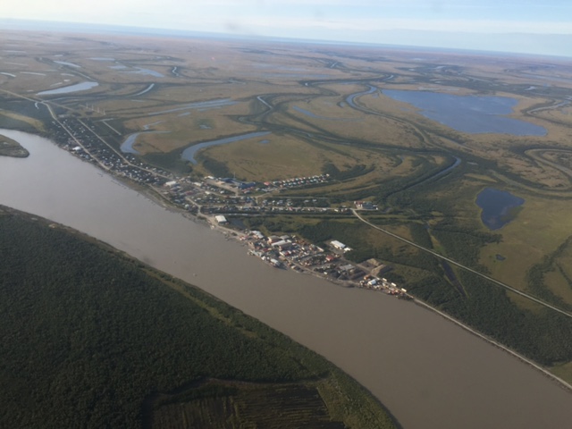
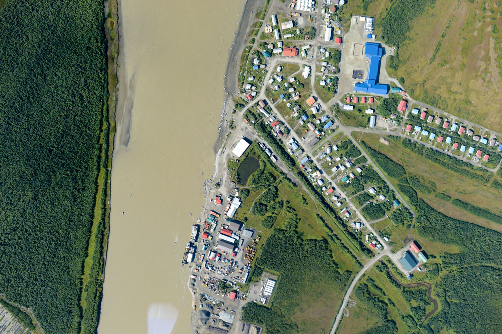
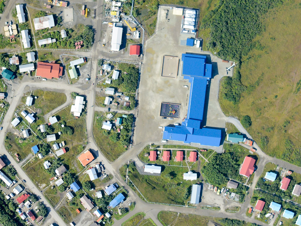
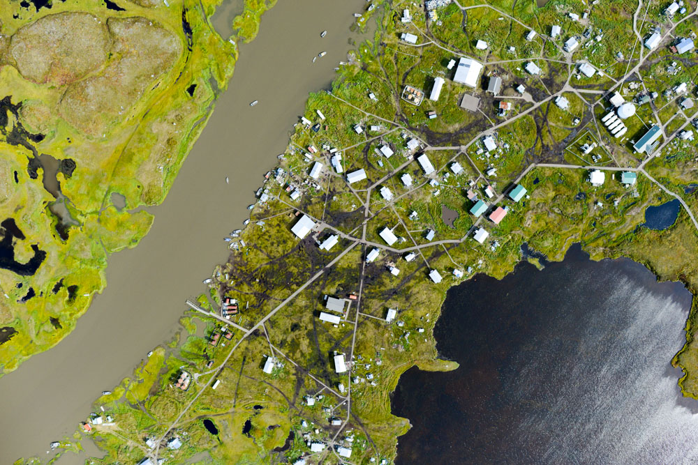
Having flown over a lot of villages, these two strike me as being the tidiest of them all. It also looks like a little more planning and care went into their layout and construction. I also think Emmonak has one of the prettiest views from any of the airports I’ve landed in, and I like the fact that there are hangars and other resources there if needed. In any case, mapping these went well enough and I landed at Emmonak to refuel and have a snack.
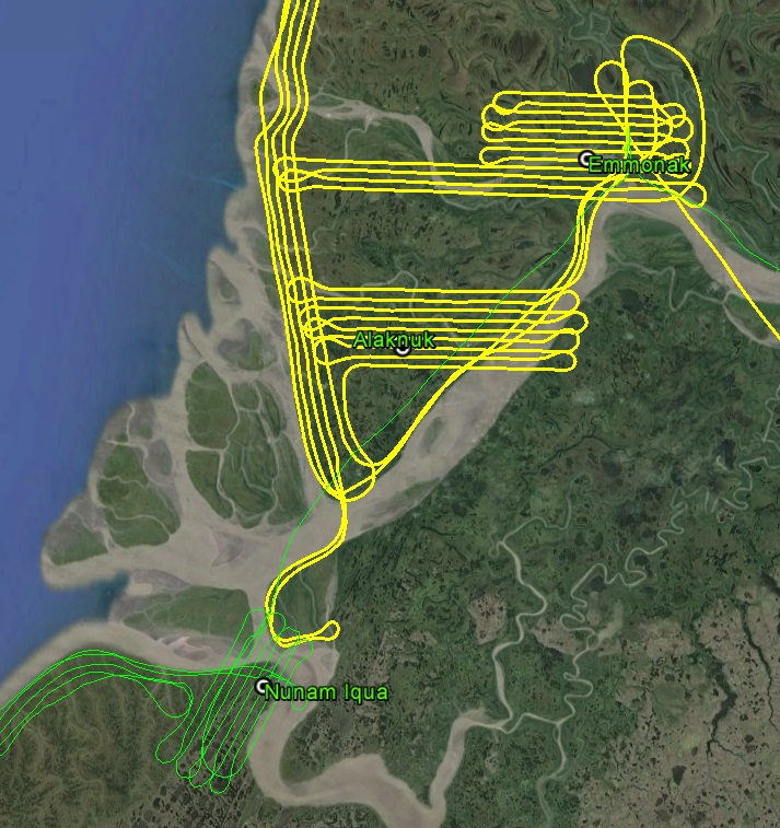
Last two villages north of Cheevak complete, and green met yellow just north of Nunam Iqua.
Alakanuk.
Alakanuk.
Emmonak.
Emmonak.
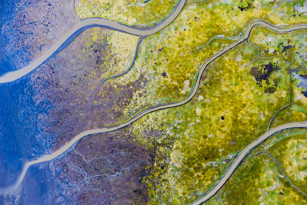
Villages on the Yukon River delta struck me as being the tidest anywhere.
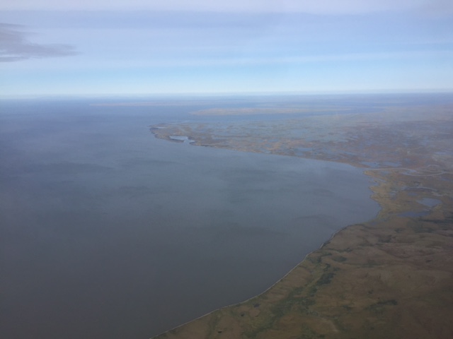
By the time I launched it was early afternoon and I could see the entire delta was now clear of clouds. To the south towards Scammon Bay there was still a low layer of scuz, but it didn’t show signs of moving this way. It was largely a calm beautiful day, probably the best of the trip, and it now seemed clear that this was the day when I could finally join the north and south flight lines.
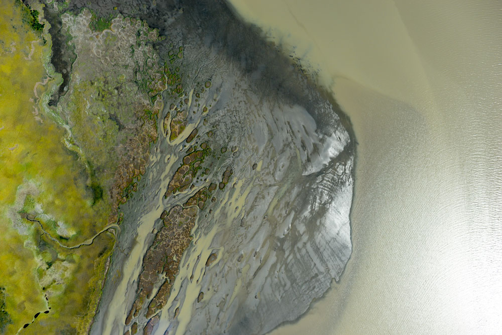
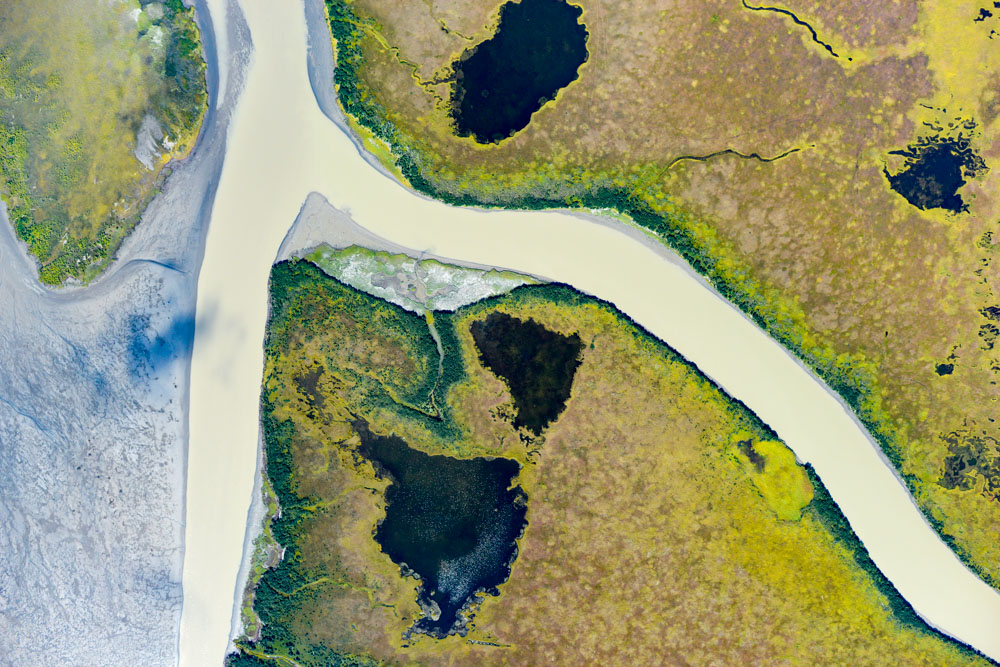
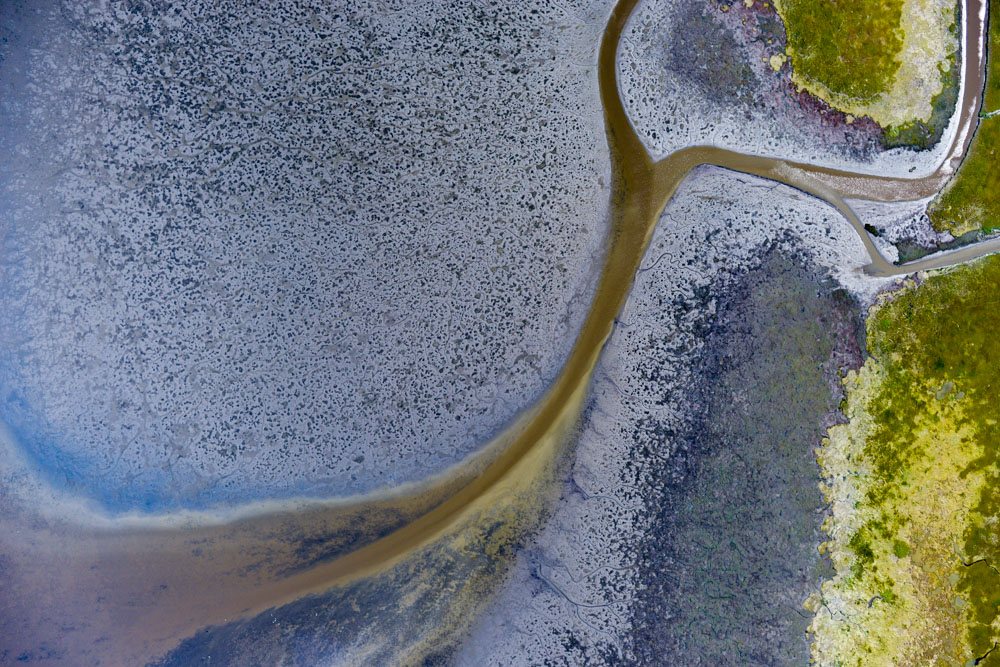
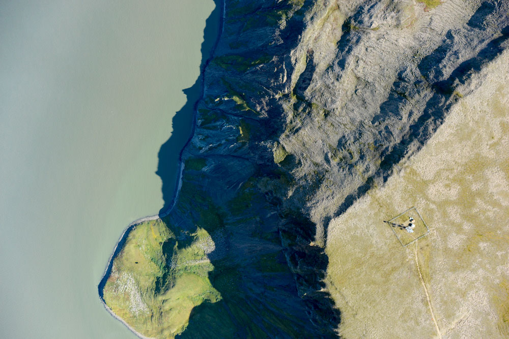
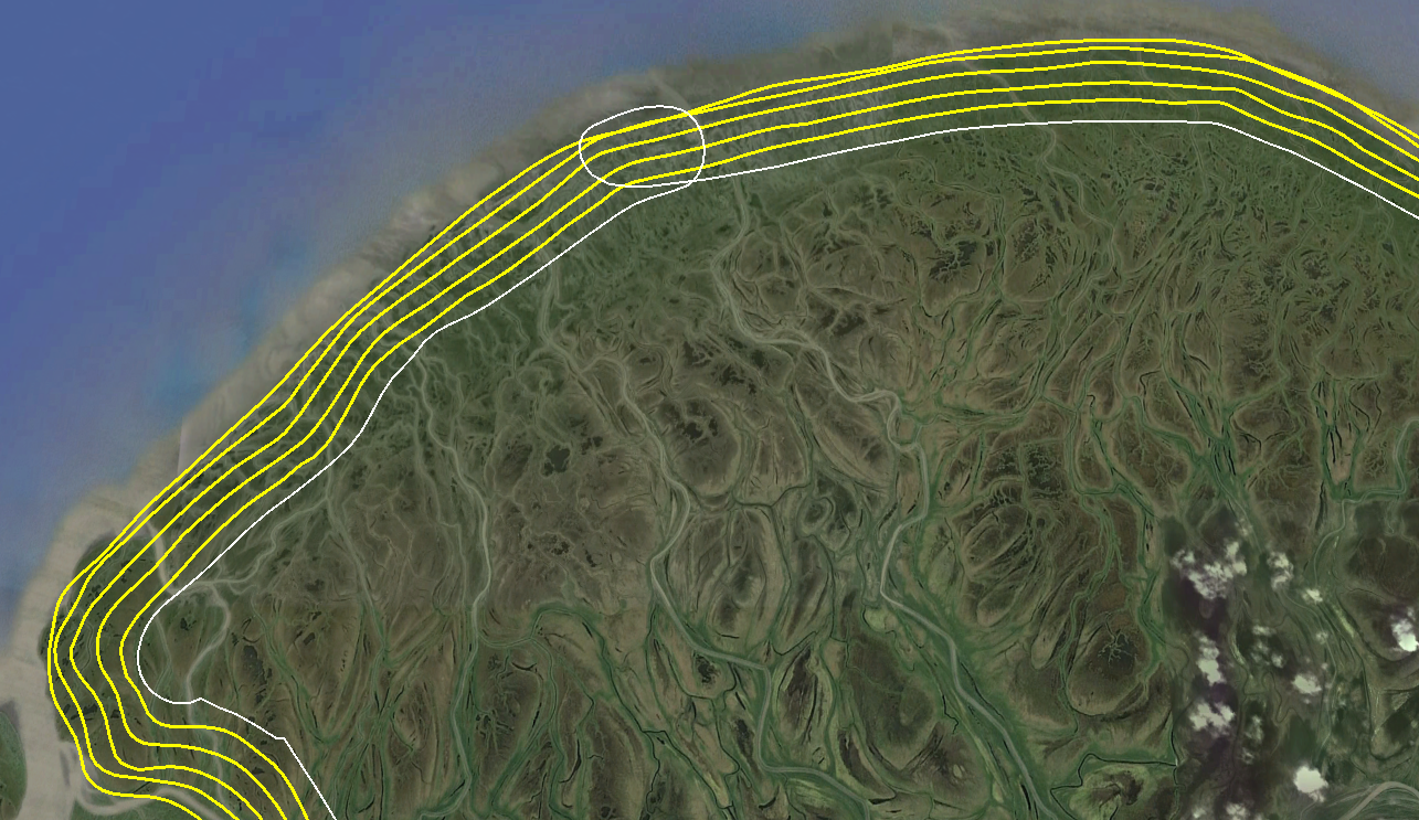
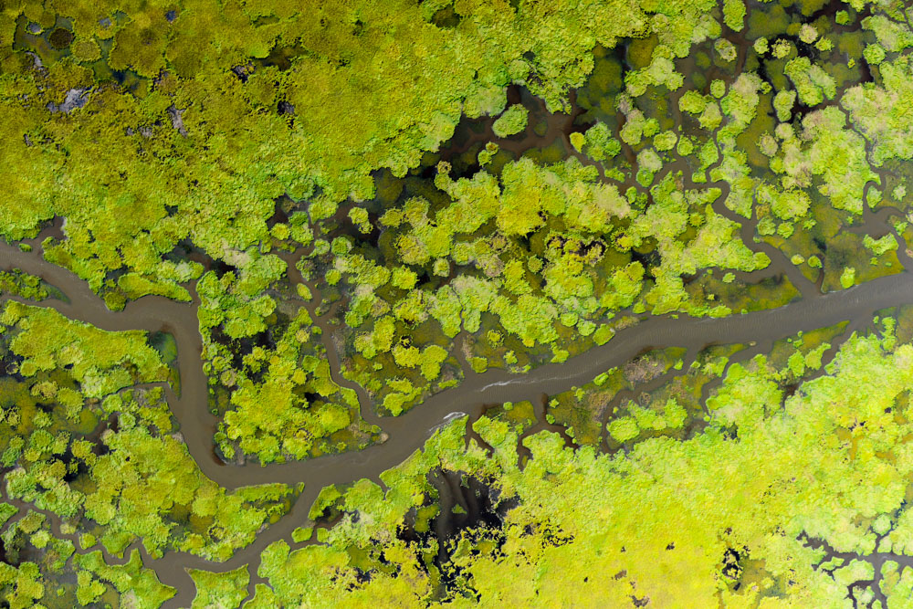
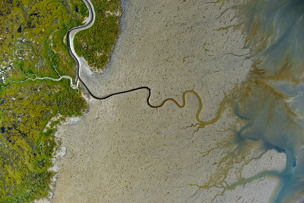
After making two more passes over the delta from the Emmonak side, I headed towards Nunam Iqua, which was as far I got previously coming up from the south. Separating Nunam Iqua from Emmonak is the Yukon River itself and some strange river/bay/lake thing that extends east beneath it, forming a small peninsula. Not wanting to divert too much time to this symbolic union, I made two passes over this peninsula, effectively forming the bond. Though that small peninsula itself had no particular scientific value in the context of our priorities for the project, it is effectively the last turning point of the project. Like getting all of the corners and edge pieces completed in a jigsaw puzzle, we’re now at the stage of this work where it’s just a matter of fitting the few remaining pieces into the small holes that remain. The challenge is getting the clouds to stop covering the holes.
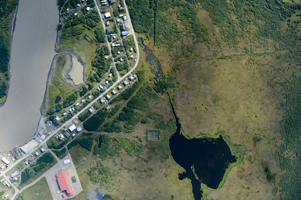
The Golden Pixel, symbolically joining the North and South flight lines, is hidden in this photo.
I made another two passes on the delta afterwards, completing 5 of the planned 10. I probably had enough fuel to make one more, each takes about an hour, but it was by now after 7PM and I had been flying for 10 hours or so, and not being terribly familiar with the area I wanted to be sure I had enough fuel to divert from St Mary’s if I needed to, which fortunately I didn’t. It took an hour or two to download data, check its quality, and back it up, during which time I saw the forecast for tomorrow was more of the same, so I fell asleep around midnight looking forward to another big day, finishing up the delta.
It was a big day for the project, linking the North and South together. It was also just a big day, with over 11 hours of flying and almost 10,000 photos taken.
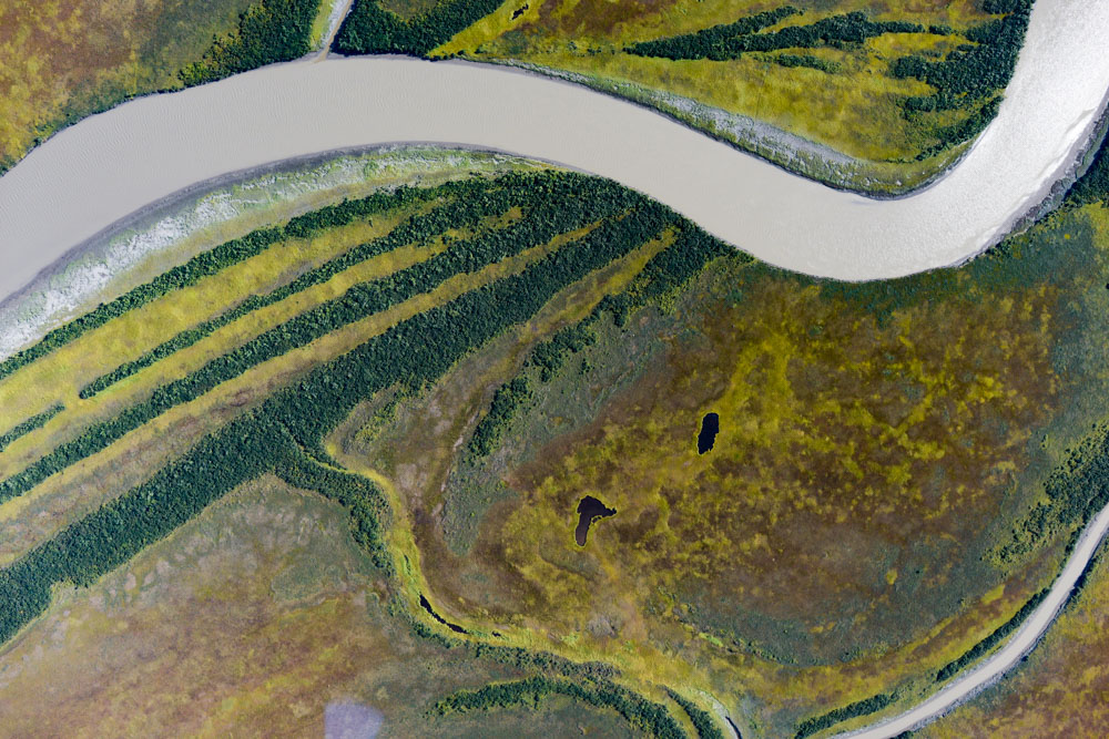
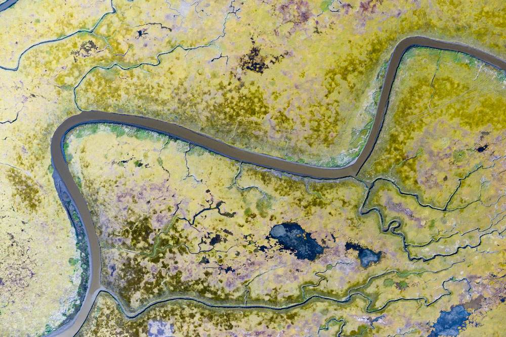
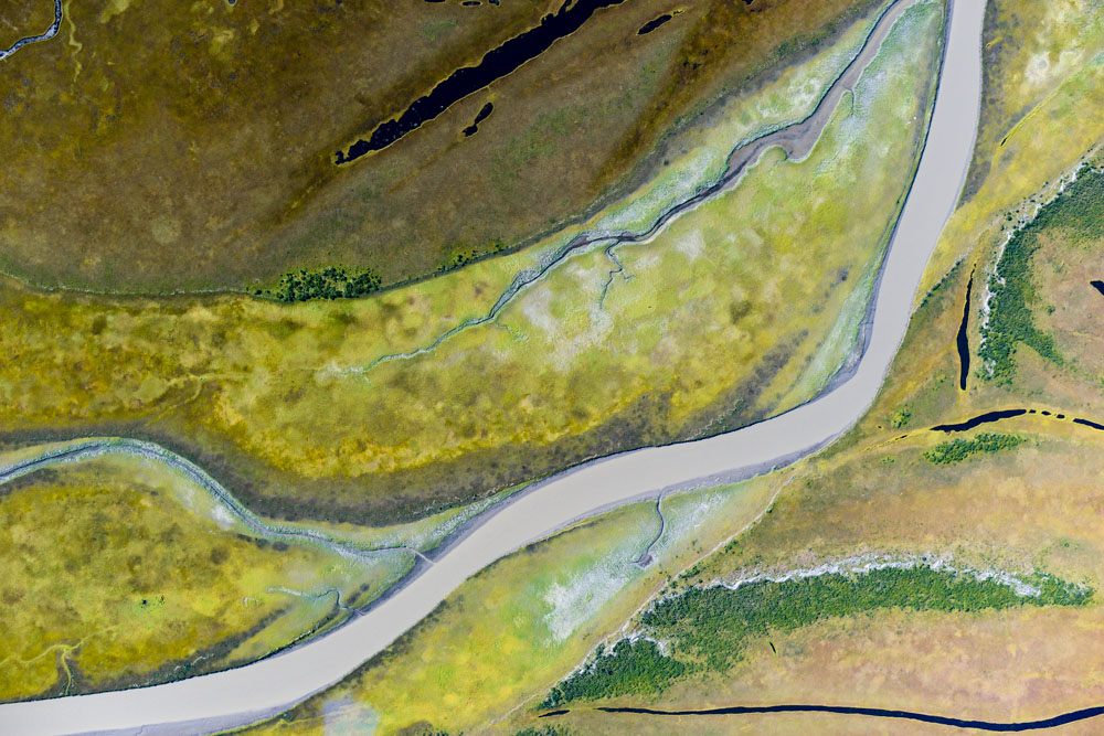
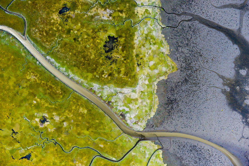
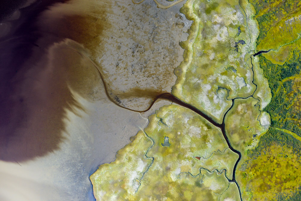
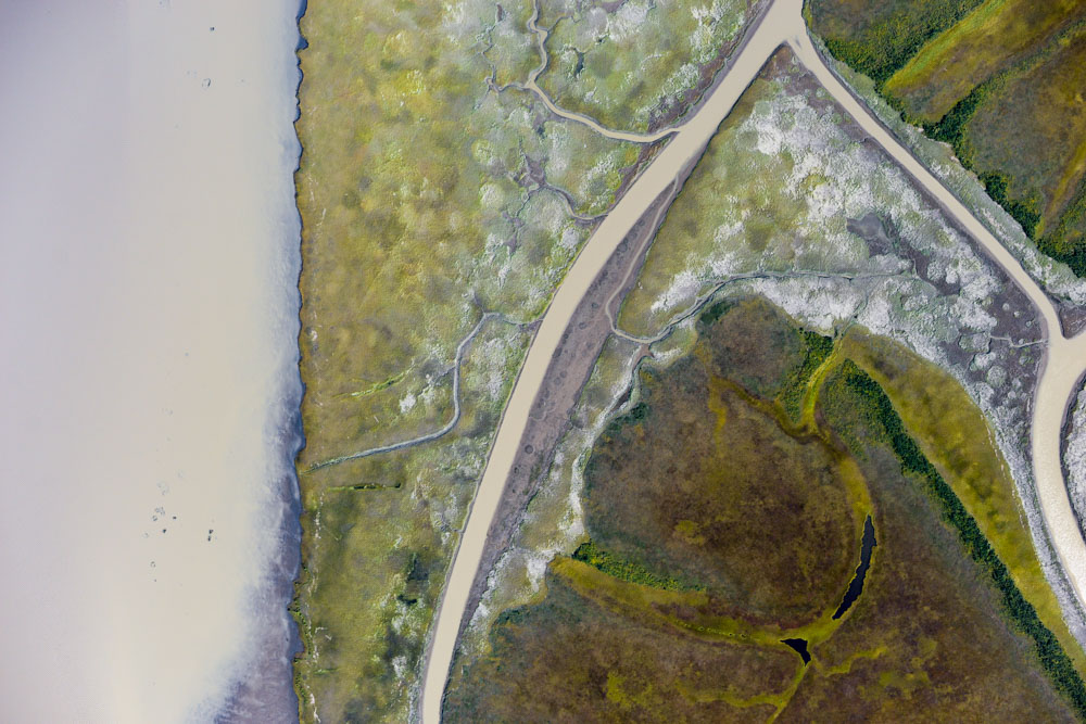
Some of the 10,000 photos from the day below…
The weather yesterday indeed was spectacular again, but a persistent layer of ground fog was obscuring the coast. I gave it until 10 AM to burn off, but it was still there. As everywhere from Wales to Bethel except the detla was clear of fog , I headed south for a rematch with the Toxic Avenger.
A low ground fog stretched from St Mary’s to Emmonak, so I headed south.
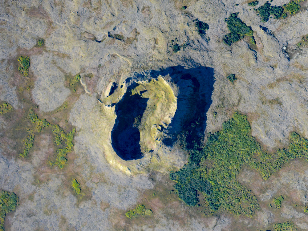
Apparently this was once a volcanic area, as there were a bunch of little craters like this. Else, an intergalatic armada got lost in the fog here.
Unlike my previous trip to Toksook Bay, it was crystal clear and nearly calm, revealing how spectacular the area is. The bay sits within the only topography for a hundred miles to the east, so it looks more massive than it really is but is picturesque nonetheless. The weather allowed me to map it completely, as well as do some cleanup in Nightmute, which was quite a struggle last time I was there.
The maps label this peninsula as part of an island, as there are tidal rivers on either side of it. As islands go, it seems pretty mainlandy. What I want to know is how the musk ox get off of it. Even if they can swim, how do they not get stuck in the surrounding muck?
Toksook Bay.
Tunanak.
The peninsula that Toksook Bay and Tunanak are on is the largest topography along the coast until past Bethel.
The clouds began building up over the peninsula by early afternoon, and the winds picked up as well.
It was by now about 3PM. For the last hour or so, a cloud layer had been forming just offshore and extending to the east and south. Winds were also picking up. More importantly, the tide had just come in. While working over Toksook Bay, I had the choice to either finish it up completely or run a line up and back to Cheevak to make a complete connection from Wales to Bethel. That was really my hope for the day, which ironically meant that I had to hope for low ceilings over Toksook, as I knew I would not have enough time to do both. But I knew that the villages were the priority and that I might never get a ceiling suitable for mapping the peninsula again, so despite having the weather and the fuel, I had to leave that last bit of coast for another time and I headed to Newtok a few miles away. I saw a few musk ox on my way out, but by now the winds were so squirrely and there was other traffic inbound so I didn’t map them. I guess they are around a lot, as the radio weather broadcasts say to beware of musk ox on the runways.
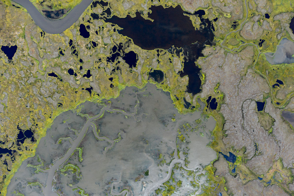
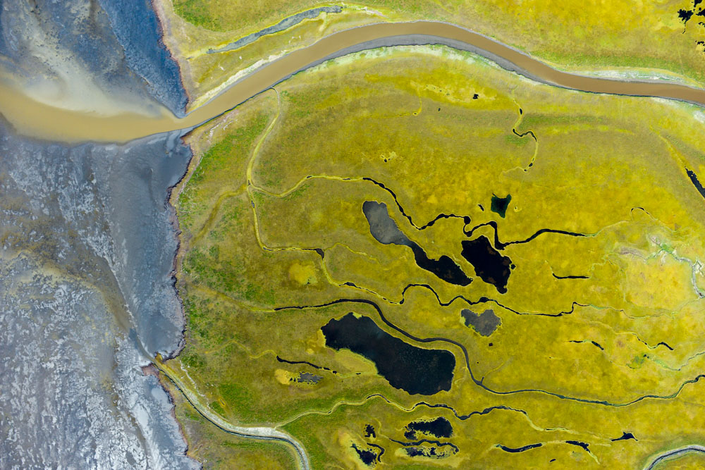
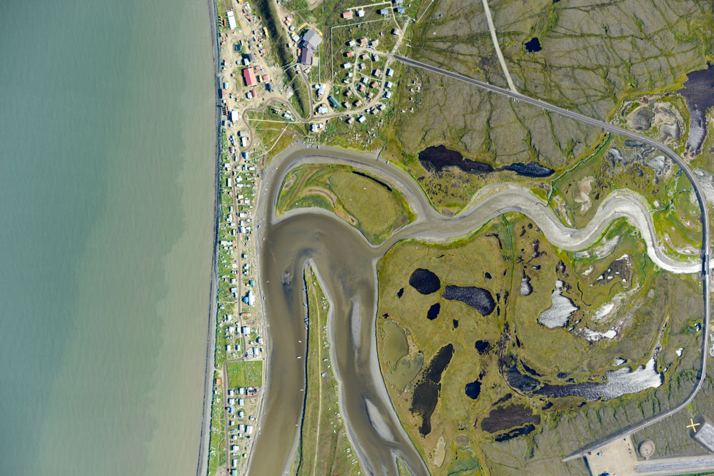
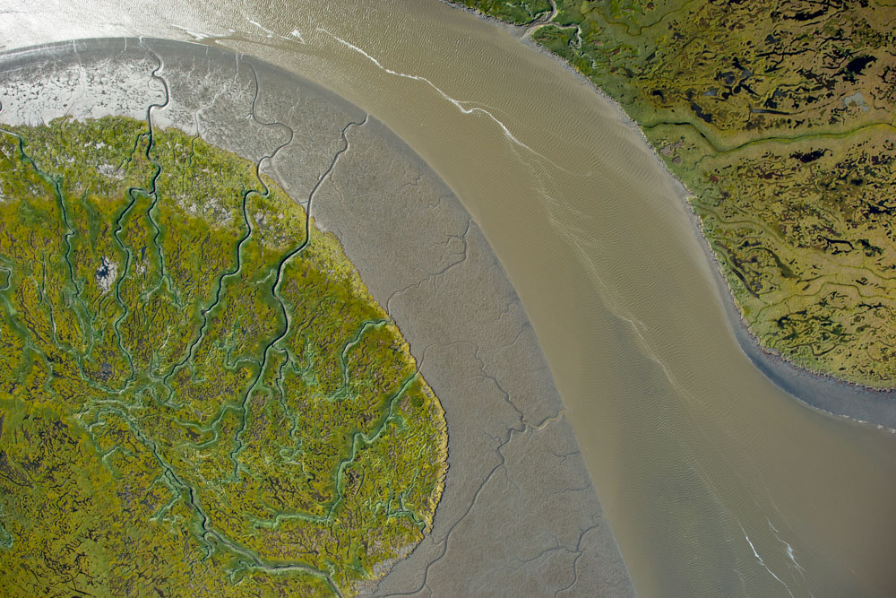
The tide extends quite far inland here, as mudflats turn into ponds and vice versa with the tides. Unfortunately for me, there was an early afternoon high tide today.
By now the winds were picking up considerably, with lenticulars forming above me and a chop forming at my level. As I was mapping Newtok I heard some of the commercial pilots discussing the winds at Toksook Bay and Tunanuk, which was the first time I’ve heard anyone talk about landing conditions in the somewhat macho pilot culture here, so I took that as I sign that I got out of there just in time. Those runways are a bit crazy anyway, as one end spits you out directly into the ocean and the other end directly into terrain and neither seem to be aligned with the winds.
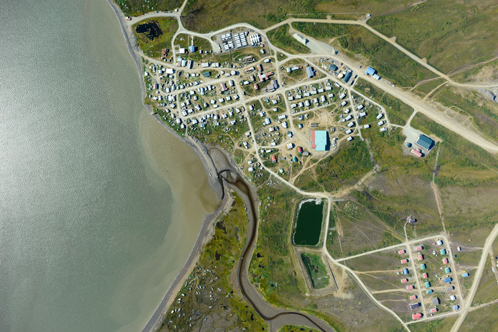
The tide indeed had come in as predicted, as what had been beautifully intricate inland mudflats were now shallow lakes. Newtok itself looked like it was almost underwater. I think of all the villages I’ve seen, this one seems the most precariously located. Even the ‘land’ behind it was mostly water. I saw small boats stranded miles inland, probably washed away at some point as they seemed randomly located, but probably only inches about the highest tides. With Newtok complete, there was only one village out of the 30 left to do – Chefornik to the southeast.
Newtok. Flying over, it had the appearance of being built on tundra that was floating on the water.
By now it was 5PM and the choice was either to head back to St Mary’s or head back to the Yukon River delta, which had been fog free since about noon, as the weather to south was deteriorating. So I headed north trying to outrace the tide, which would not cross the mean high water mark for another 2 hours on the delta.
I started by doing some cleanup in the upper dash. I had a little engine trouble when I was here the first time, and in my attempt to do something about it I turned off the camera accidentally, and I was so focused on staying airborne at that point I didn’t realize it for 20 minutes. Unfortunately I had planned to repeat this from the north, and trying to remember the landforms from the south got me turned around, so I flew about 3 times more than I needed to but in the end not only covered the gap but expanded the lines inwards beyond the plan.
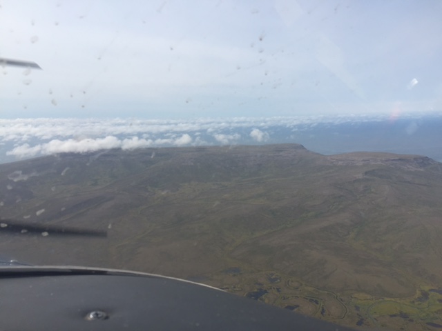
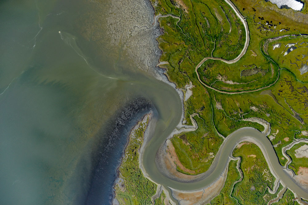
I snuck up behind the hill that forms Hooper and Scammon Bays. It seems bigger from the other side. You can see a bit of haze building up to the south, but it was still clear to the north.
You could see all the way to Nome. With just three more days like this…
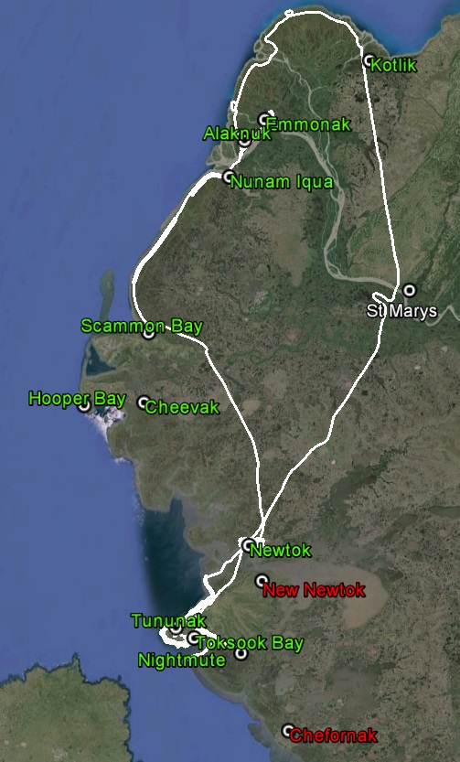
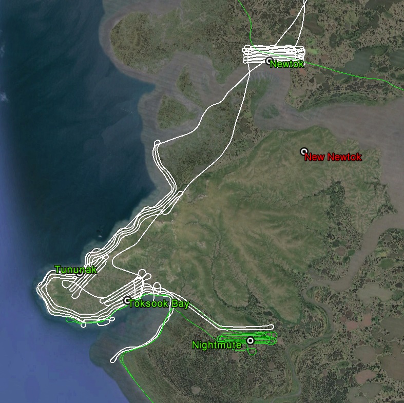
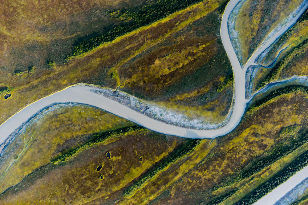
Lot’s of commuting today (white lines), but lots of mapping too. Cherfonak is the only village not yet mapped. New Newtok (my name) is undeveloped as yet.
Given the weather to the south, I was anxious to get as much as possible done here in case it was my last opportunity for the trip. So with the cleanup to the north and south of the delta completed, it was just a matter of slogging out the remaining lines on the delta itself. So snuck in one last line from Emmonak to Kotlik as the sun began to set, making 6 out of the 10, getting back to St Mary’s about 10PM after about 11 hours of flying.
I made several curly-Qs while mapping the 6th line (white), as the tide had come in by then and I thought by comparing photos at high and low tides we might be able to get some ground truthing on both the maps and the measurements made from them, as the water level form a nice, well, level line.
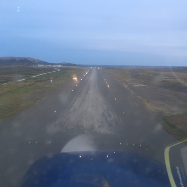
Short final 17, St Marys. It’s been a while since I’ve had to turn the lights on.
What happens at this point is all weather dependent. On the one hand it would be nice to get the last 4 lines on the Yukon River delta knocked out. On the other hand it would be nice to finish the southern coast to make a continuous swath along the entire route. Finishing either is a full day’s work with good weather. Plus there’s another two days or so dealing with some inland lines. I’ve got about a week left to get done what I can, and with a week of good weather I could finish it all. The good news is that having finished down to Kotlick I’m within striking distance of all the remaining area, and all of the remaining areas are low elevations. So at this point I think everything is of equal priority – wherever the weather opens up first is where I go next.
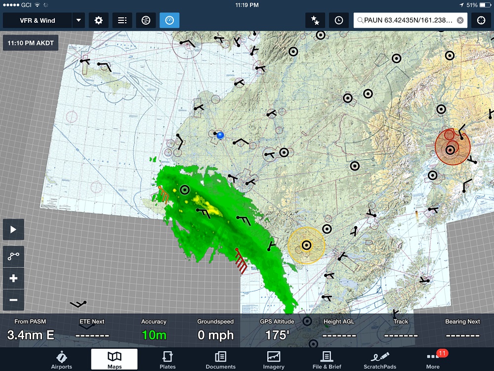
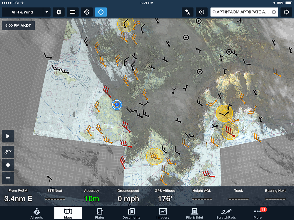
The Toxic Avenger finally woke up as I was finishing up there and started chasing me north.
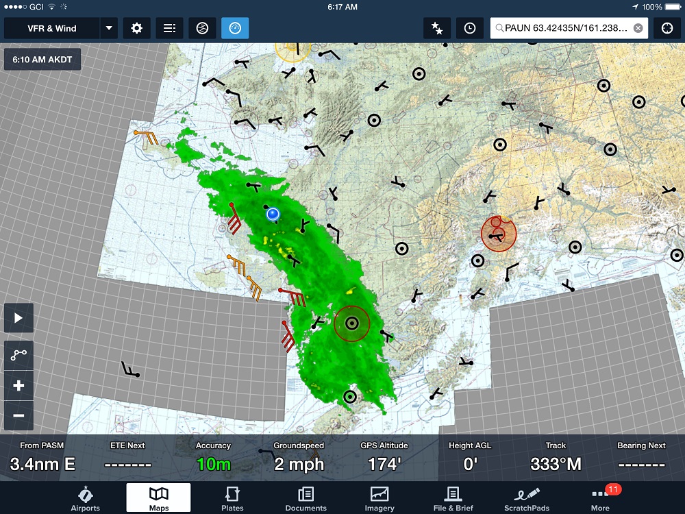
By this morning it had caught up with me (blue dot) and Obama (red circle), and shut down a great 36 hour weather window.
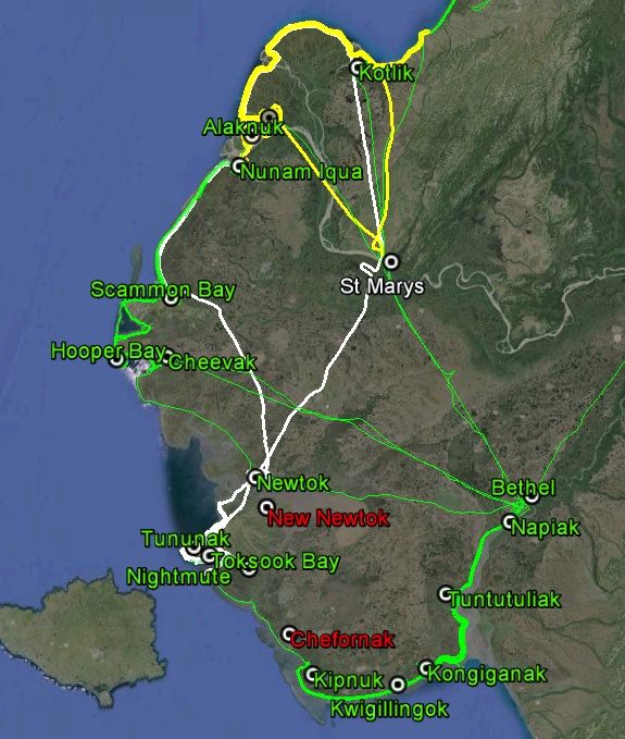
It was a big two days (yellow and white). The only edge piece left in the giant jigsaw puzzle is between Newtok and Cheevak, and the only village left is Chefornak. With just three more days of good weather…