
Mapping the Dash
The Yukon and Kuskokwim Delta have formed one giant delta over millions of years and the area is generally known as the Y-K delta for short. The current deltas are separated by about two hundred miles. So today I mapped the northern half of the dash between the Y and the K (note that I flew this on 8/14 but didnt upload the post until 8/15).
Once again the furthest west locations were calling the best weather, so I retraced my flight lines from yesterday. As I approached Cheevak, I could see that the southern part of the dash was dark and moody, so I headed north. I did a little final cleanup from yesterday in Hooper Bay and soon was mapping new ground, connecting Hooper Bay to the Yukon Delta. The ceilings we’re great and the line long and straight. It felt like making progress, and all I needed was another 10 days of weather like this to finish the job.
As I reached the Yukon delta and turned to make my second pass I could see the clouds that chased me out of Hooper Bay were following me. I was barely able to get to the start of the line, so I cut my third pass short and returned to start again to try to finish the southern part before it closed in completely. That had nearly already happened and where I had just turned early was now covered in a broken layer. So I decided to go all the way to the delta again so I would have at least three complete lines that were cloud free and just take my chances with the last line. I got about half of the way back on the last before the clouds turned me and by this time what had been a beautiful day here was turning stormy as the weather from the south caught up to me. Nunam Iqua was in a squall on my previous line, but on my final one it was in between squalls, so I decided to map it. I had already decided I wasn’t going to my to push further into the Yukon Delta as I wanted to have plenty of fuel for the way home in case I had to divert, which could mean a hundred miles or more in this region.
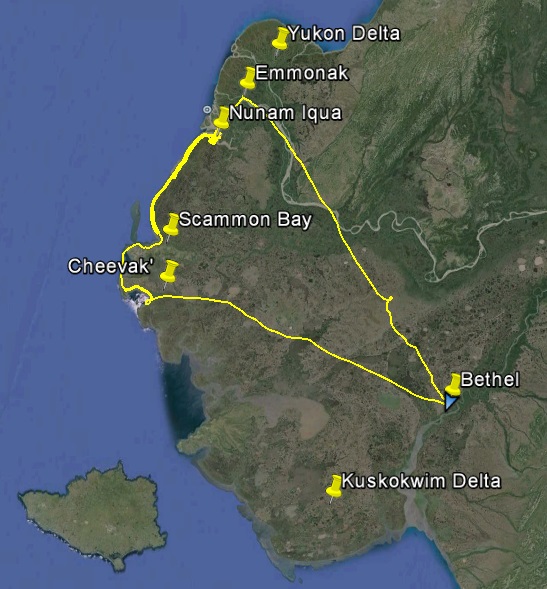
I mapped the northern part of the dash between the Y-K Deltas.
Looks more like a dash sideways.
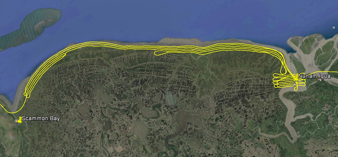
Turning the corner from Scammon Bay to the dash.
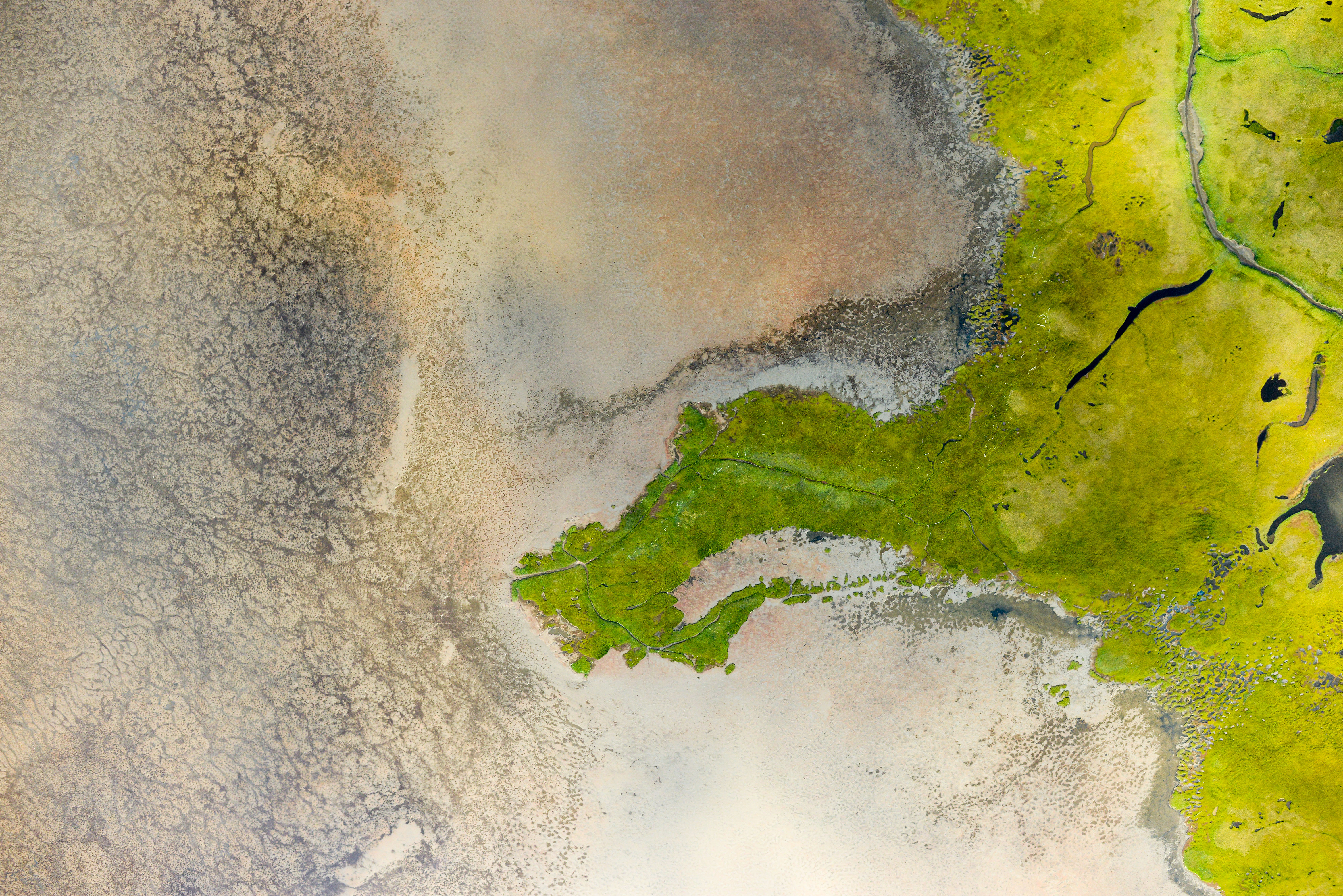
The bays have the most complicated coastlines due to the mudflats, but even on the coast it is not straightfoward (for me) to tell where the mean high water line is, so I dont envy someone trying to determine that from just photos. Fortunately the DEM I will create from these photos will make that a snap. Below are just some sample photos showing the complication and beauty; you should be able to right click of them to save a full resolution version.
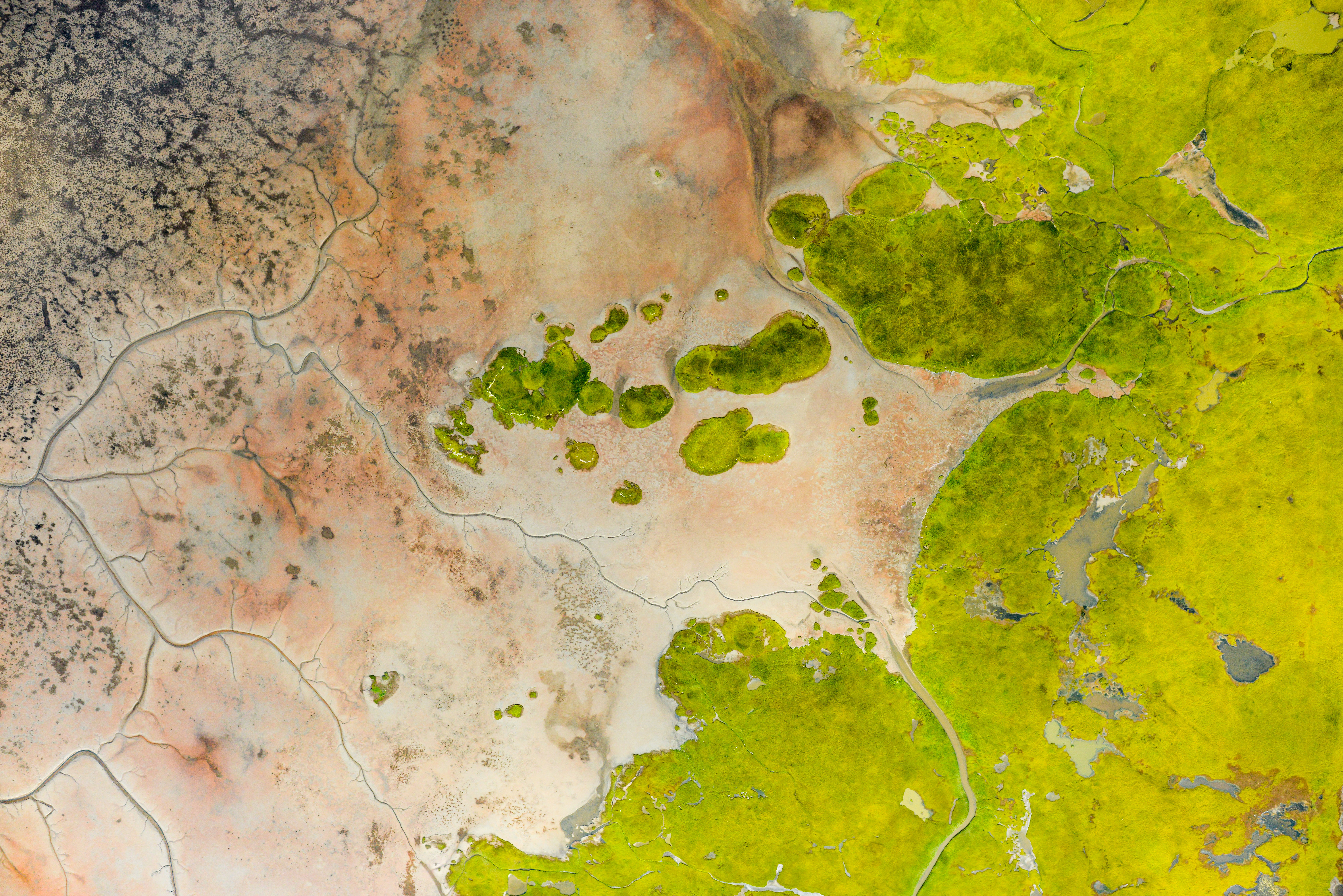
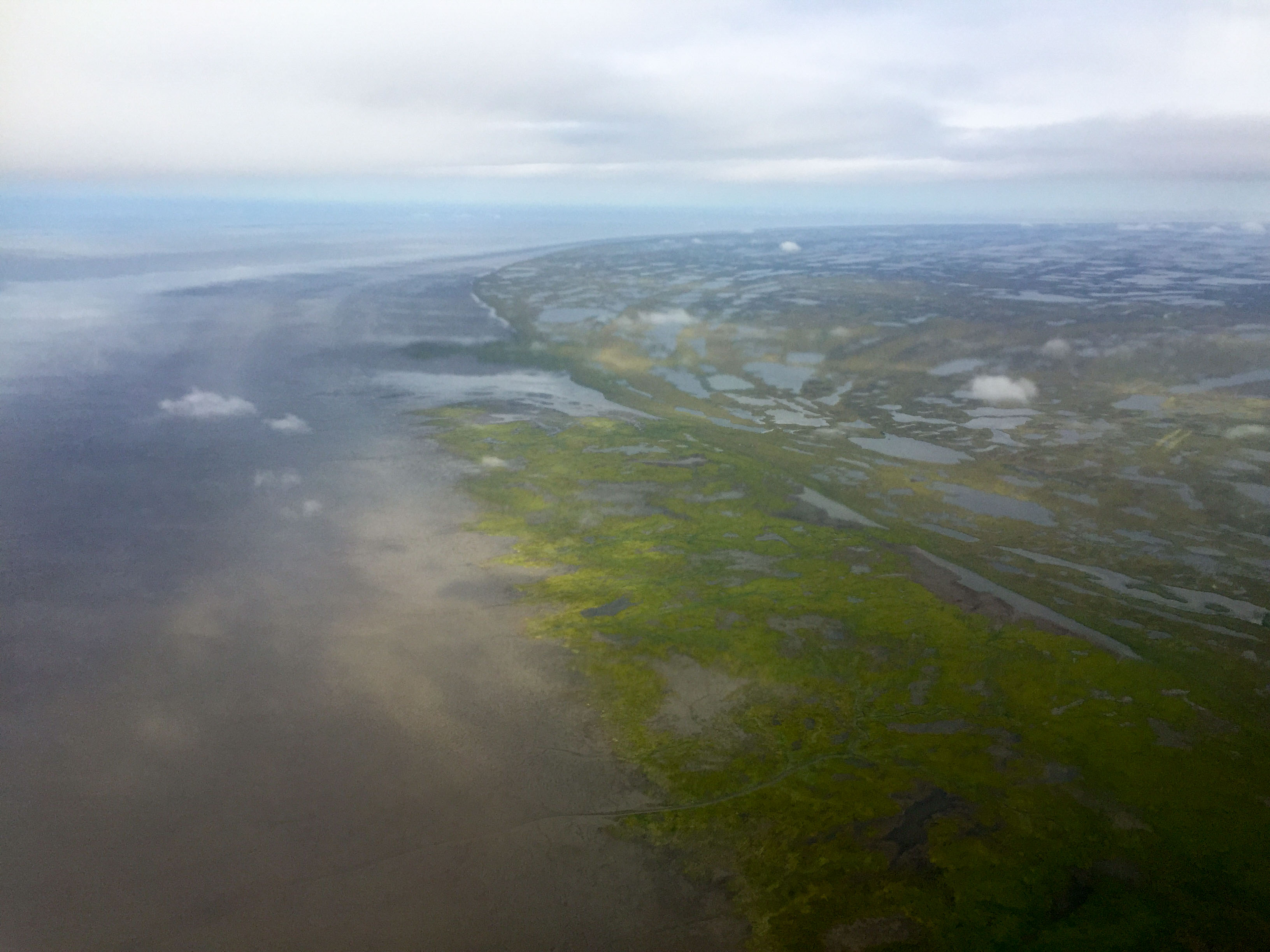
There’s not much between Nunam and the ocean. I was pretty pleased how this came out, considering I took it in the rain.
Once finished with Nunam I landed at Emmonak to refuel. This was the only weather station in the area and it was calling beautiful weather, which it was. Here anyway. Ten miles south it sucked and was getting worse. But here it was really nice and I was tempted to stay. I almost had to. When I landed I noticed my steering was a little squirlier than normal, and sure enough my tail wheel was flat. Fortunately I carried a spare tailwheel for just such eventualities. And more fortunately the good folks at Grant Aviation have a hangar here and I was able to borrow the perfect sized ladder to prop the tail on to change the wheel. This all went fairly smoothly and soon enough I was on my way again. That’s when the real fun began, but perhaps a story best told over beers…
 The good folks at Grant Aviation in Emmonak lent me a small ladder for a few field repairs.
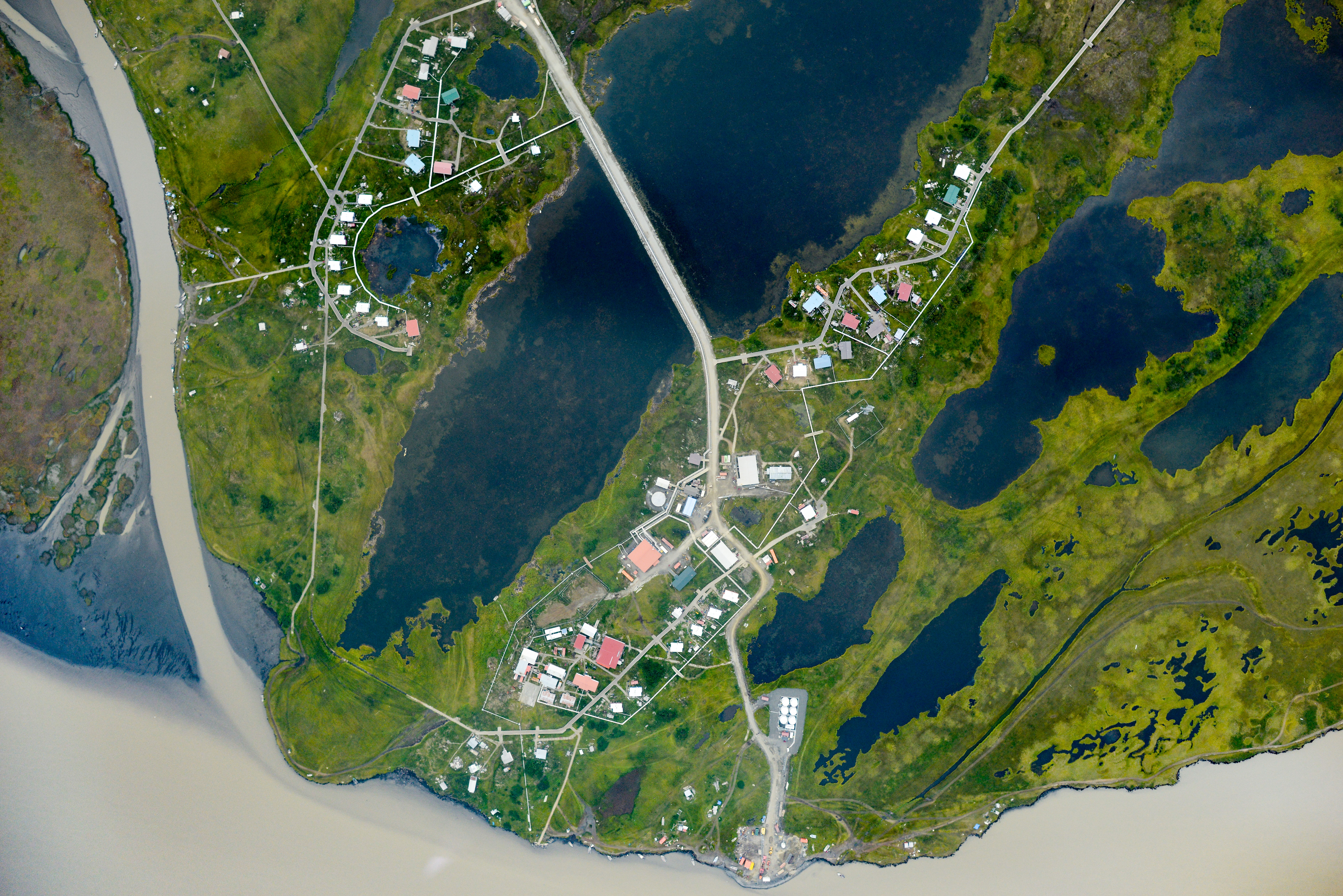
I wasnt there long, but it seemed like a nice place.
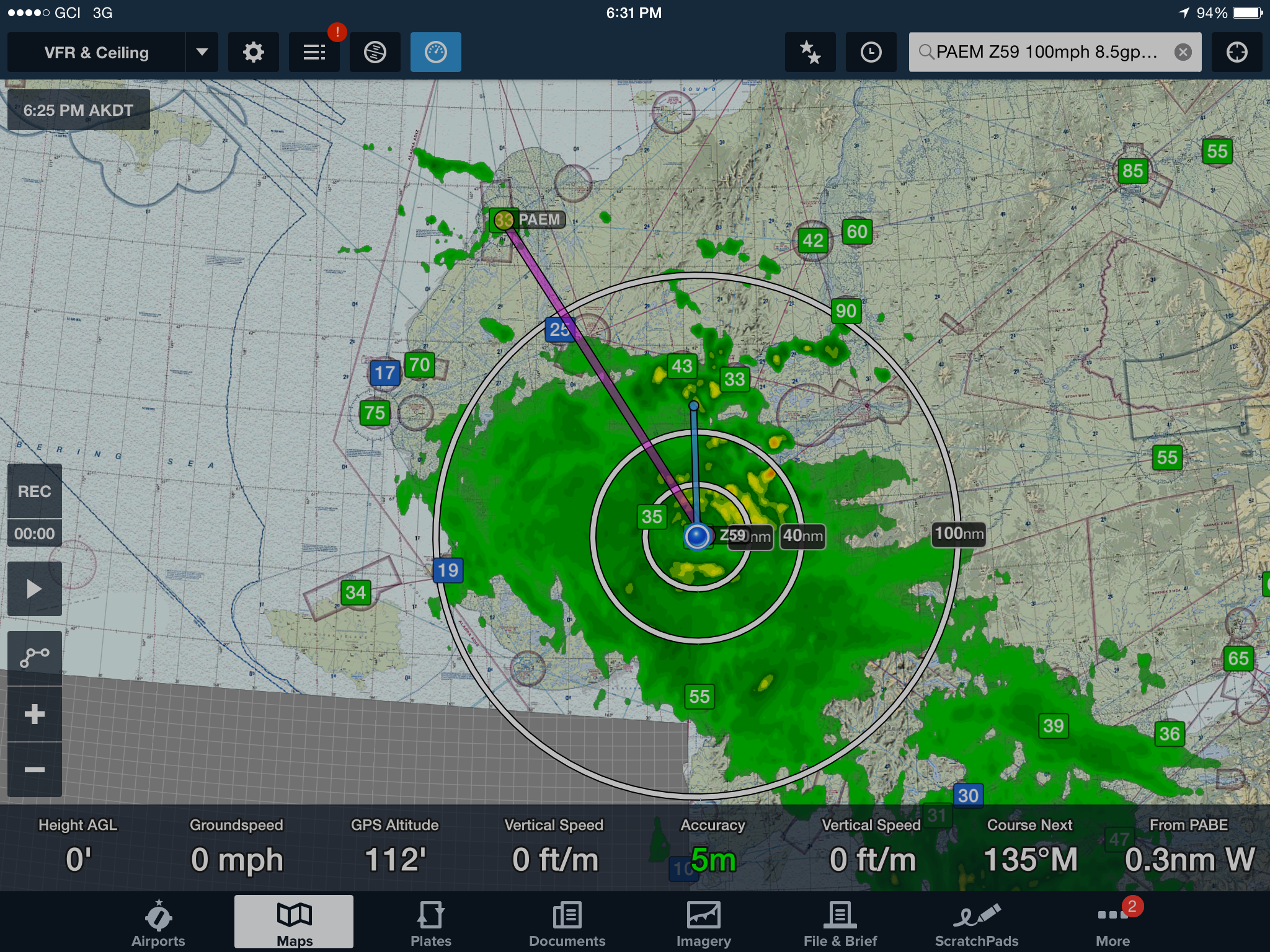
The purple line was roughly my route from Emmonak to Bethel. Just before I entered the green blob shown here on my GPS I asked a pilot who had just come out of the blob in the opposite direction how it was, he said “Not bad, some 500 and 2”. I spent the next 50 miles learning what 500 and 2 really means out here…
Once on the ground I checked the forecast, which was essentially the same as current conditions for the next few days, and not something I felt I needed to repeat for a while. So then I checked Alaska Airlines for flights home and saw seats available on the 9pm flight. It now being 7pm, I was appreciative of the hospitality of the good pilots at Renfros to give me a lift to my room to pick up my gear, and before I knew it I was on a plane tearing through the green blobs again, this time writing a blog on my iPhone, and with flesh colored knuckles.