
From East to West, Fodar Knows Best
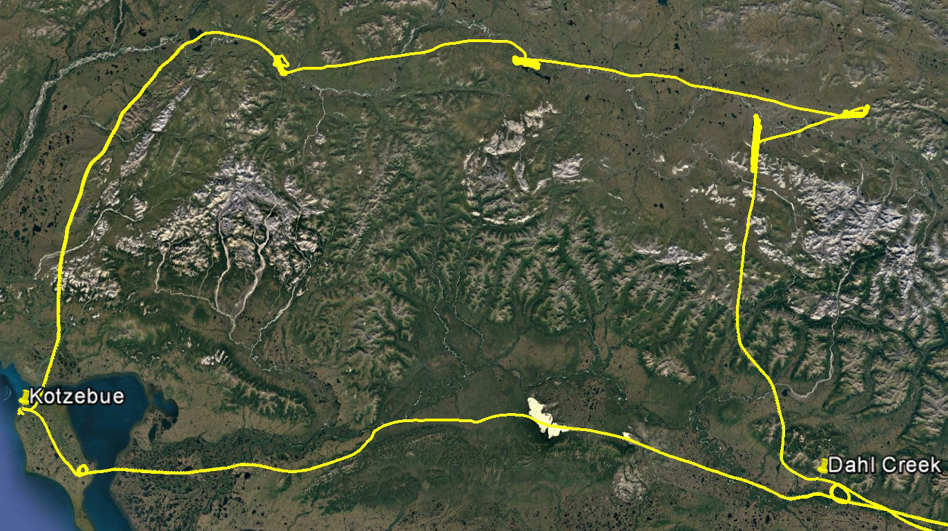
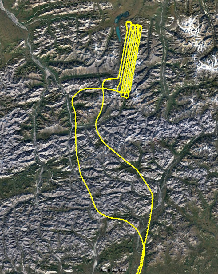
I returned today after another blitzkreig mapping mission to support long-term studies of Arctic permafrost and glacier melt in response to a changing climate, flying 20 hours out of 34 while ranging over 80% of the width of the Brooks Range. The permafrost of interest is located in the Noatak River valley, where thermokarst processes are causing slumps of earth to cascade downhill. Dave Swanson at NPS has been tracking the evolution of these slumps since 2011 using fodar and its earlier variants, and now has the longest (perhaps only) time-series of near-annual topographic change of such features; you can see an example here. The glaciers are located in the Peters Lake watershed and this is now the fourth time in two years that we have mapped them, as part of a study led by Darrell Kaufman of NAU to understand the water balance here well enough to model it into the future and past. As far as I know, these two studies have the most comprehensive time-series of high resolution topographic maps for change detection of the Alaskan Arctic (besides my own work), such that we can accurately determine changes on the scale of centimeters over vast areas. While having one great map is cool, the real power of fodar is determining changes that no other technique can by comparing these maps over time.
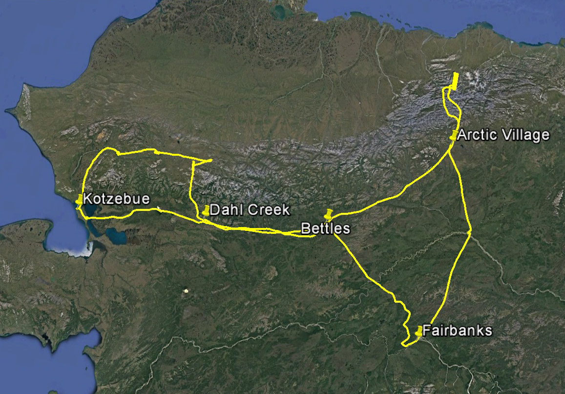
That’s about 500 miles from Kotzebue to the glaciers, and a lot to ask of the weather.
I had been trying map the Peters glaciers for the past several weeks, but the weather wasn’t cooperating. A persistent low pressure trough has been parked there most of the summer, and low pressure combined with high relative humidity, glaciers, sunshine and steep mountains is a recipe for cloud cover. My last attempts were about two weeks ago when I was able to map the low-lying Dalton Highway near Prudhoe Bay, and I’ve been on standby since. Earlier in the week it seemed that finally a high pressure system was moving in, so every morning I was up at 4 ready to go, but it just wasnt moving fast enough. Finally yesterday it seemed that a new system was pushing across from the west. Not knowing how long it would last, I decided to try to tackle the Noatak sites first, thinking that if I could bust through the crappy interior weather I could catch the system while it was over the Noatak, then follow it east to the glaciers. This plan mostly worked, though as it turned out if I had waited another day my life would likely have been a lot easier.
When I got to the plane about 5AM yesterday, Fairbanks was surrounded by low clouds, especially to the north and west, but the cameras showed cleared skies beyond this, so I fought my way out. It really does feel like fighting. For those who fly IFR and just blast off through and over the clouds, it’s just a matter of following a magenta line and keeping the rubbery parts of the plane facing down. But I’ve never been brave enough for that as I like see where I’m going and being sure that I have some reasonable chance of landing on whatever I’m flying over. This required a lot of cloud and cloud-layer dodging, as well as a fair amount of time, but eventually I broke out into clear skies on my way to Bettles. Bettles itself was open, but was apparently at the edge of some sort of system, such that the ceiling sloped from +10,000′ down to zero just north of the field. But it was good enough to land and splash in some gas, as I would need every ounce to get to where I was going and back again with suitable margin of safety. I checked weather and the cameras and my next stop showed clear skies, as did all of the cameras to the west coast from there, so I headed off again.
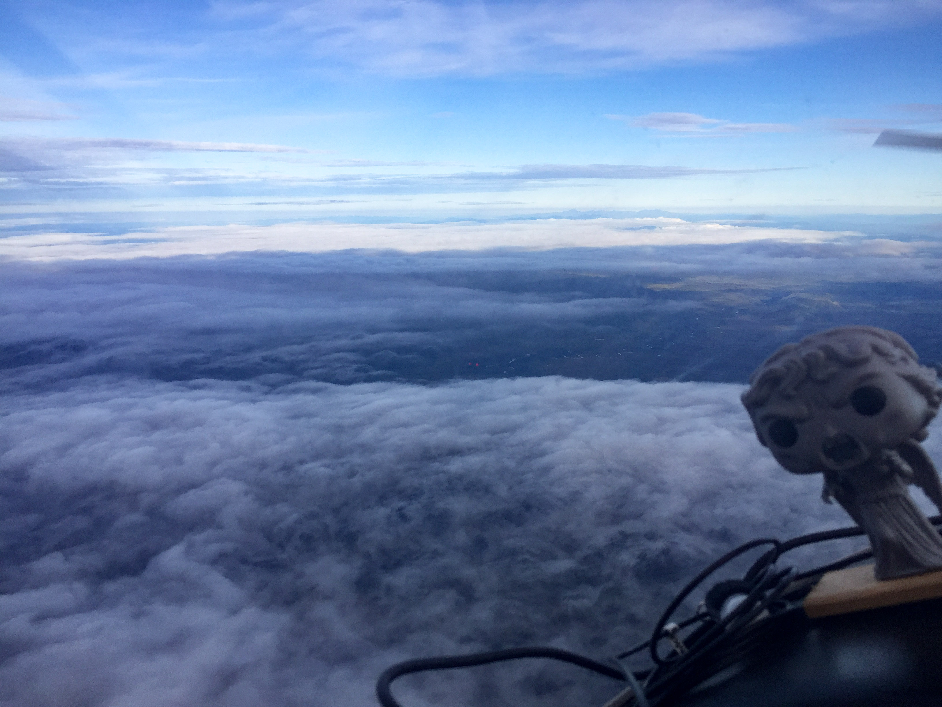
Weeping Angel wasn’t very happy about dealing with all these clouds so early in the morning. Neither was I.
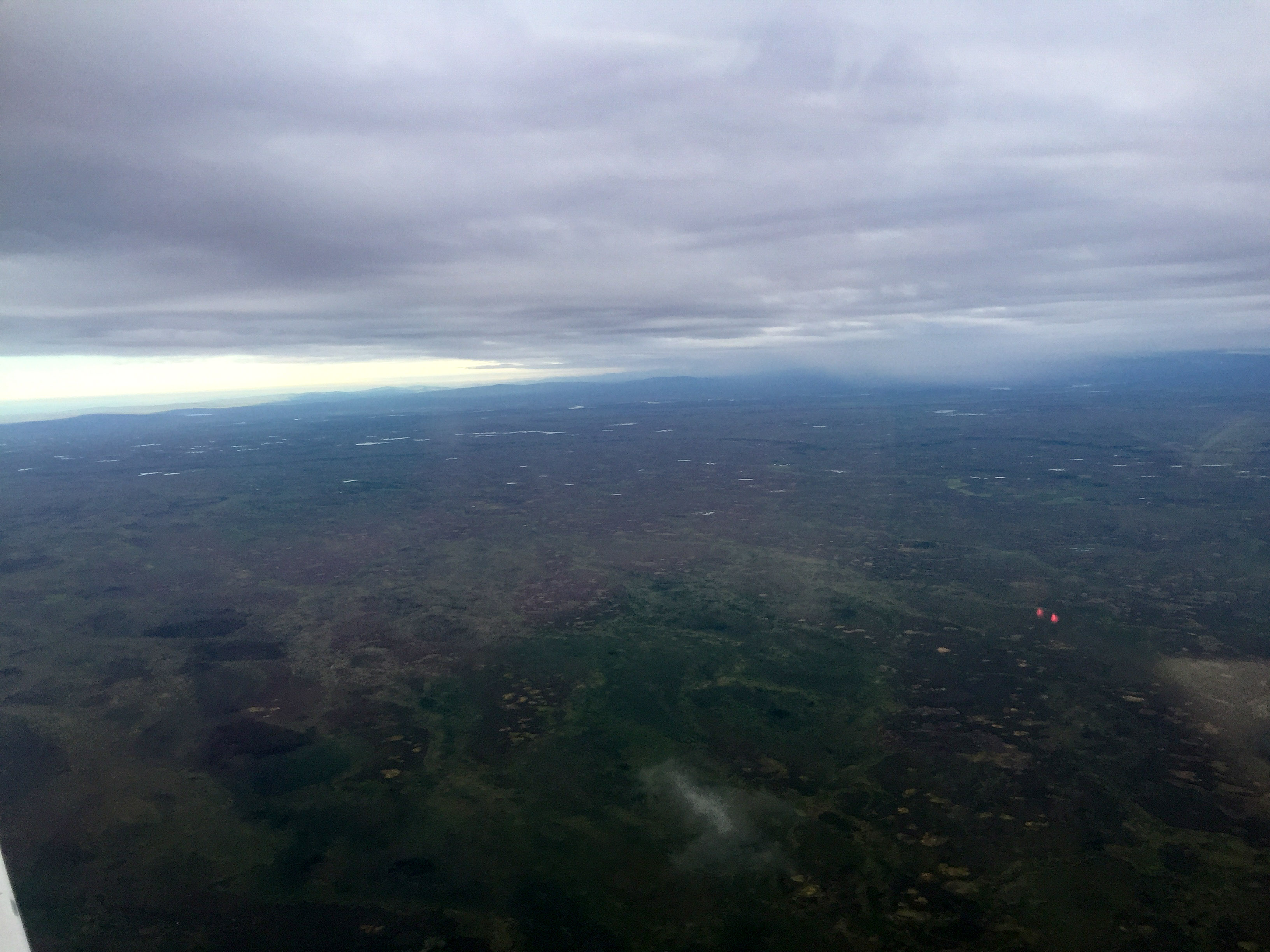
Low clouds and ground fog are the worst.
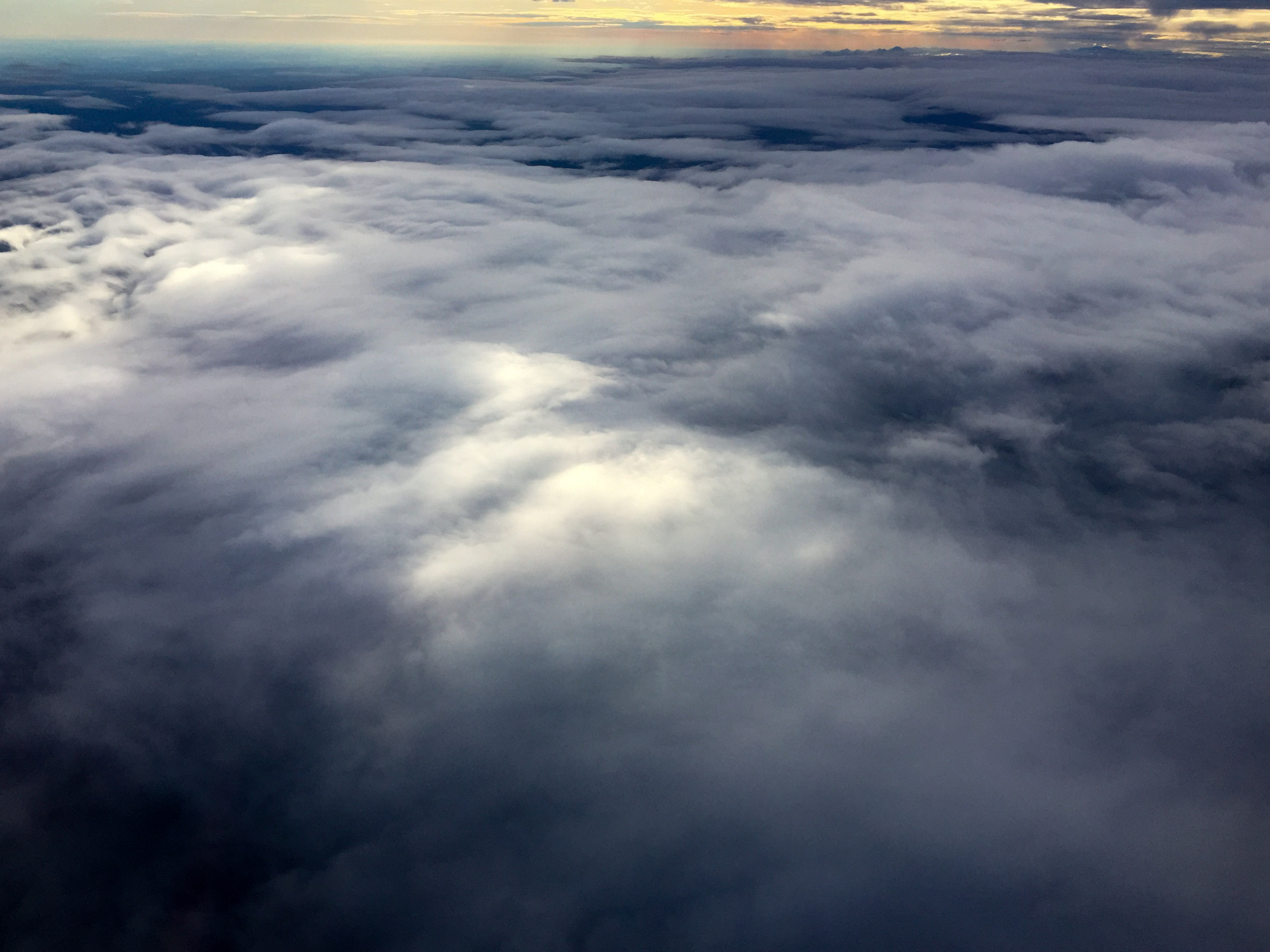
It didnt really open up until the Yukon River bridge.
It was beautiful up until Bettles, but fortunately it wasnt really in the way.
I have often wondered whether weather stations and webcams somehow influence weather for the better, as it seems often the case that the stations report great weather but are surrounded by bad. As I left Bettles to stay in calmer air I climbed over a broken layer of clouds that had more than a 5000′ ceiling. I dont mind flying over clouds as long as I know that there is a high ceiling beneath them and a big river valley with lots of gravel bars below that. And given the cameras, I thought it was just a local thing, but this layer persisted for more than 100 miles and ended exactly outside of camera range from my next stop at Dahl Creek, where I need to splash in some of the fuel I was hauling to maximize my range for the actual acquisitions. Worse, as I looked back underneath I realized that there no longer a hard ceiling but mixed layers and some ground fog, definitely not something I was looking forward to having to deal with on the way back. Fortunately the weather from here onwards was mostly clear with some scattered layers around 5000′, high enough for me to map beneath them without hassle.
Looking back the way I came, I wasn’t looking forward to returning this way.
I was hoping the Noatak wasnt like this.
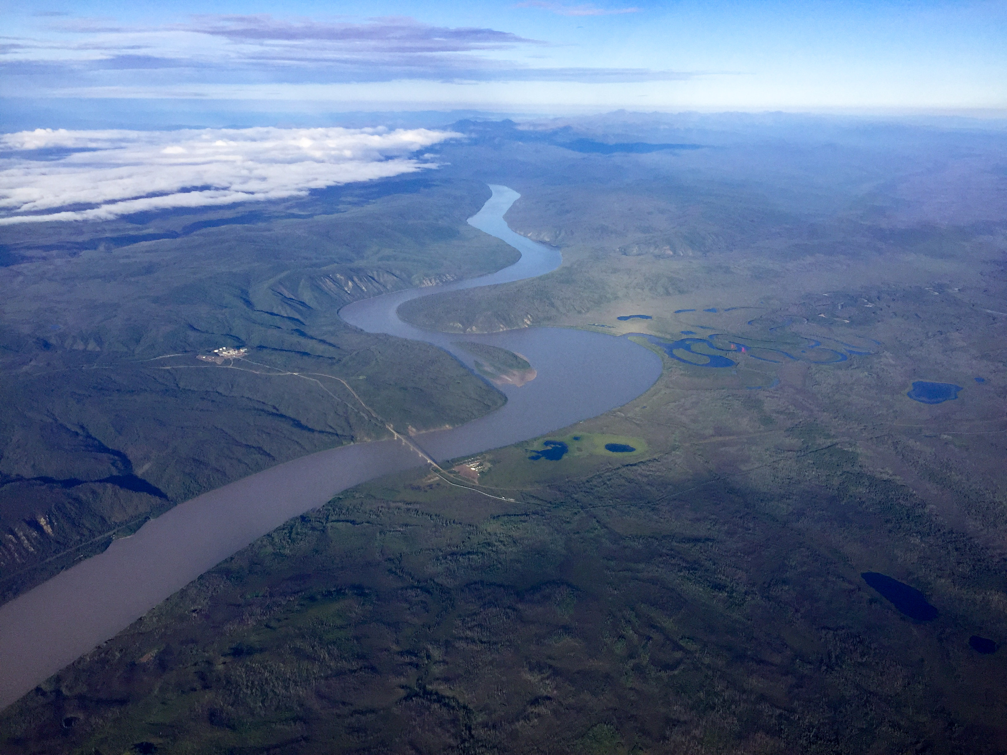
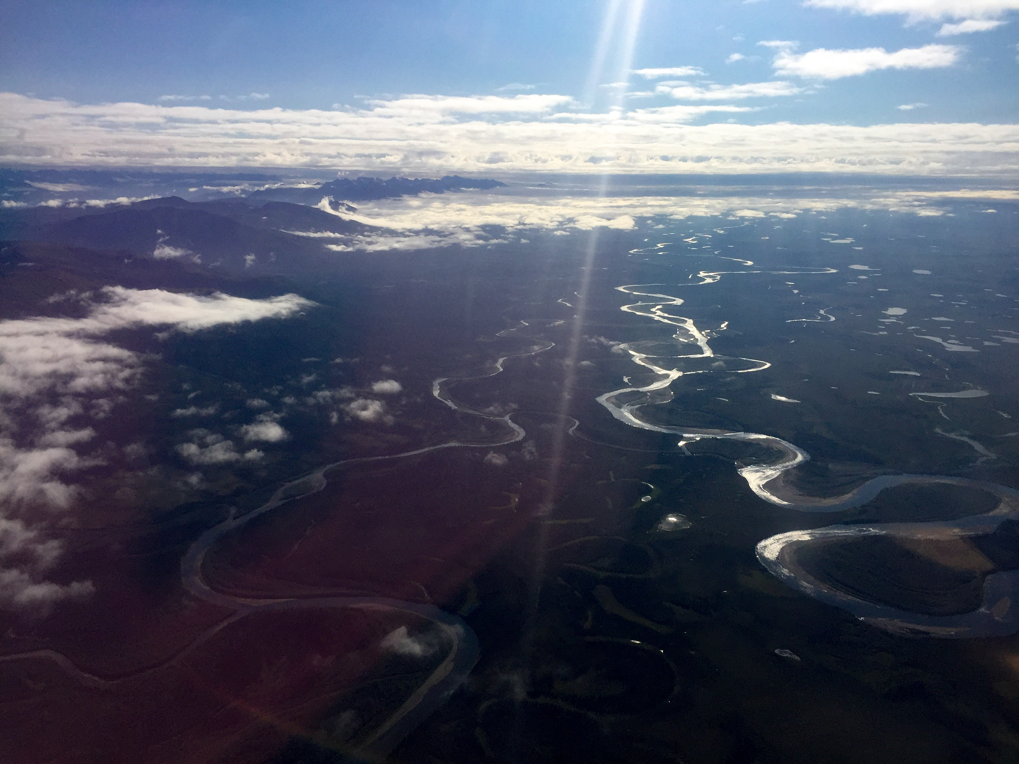
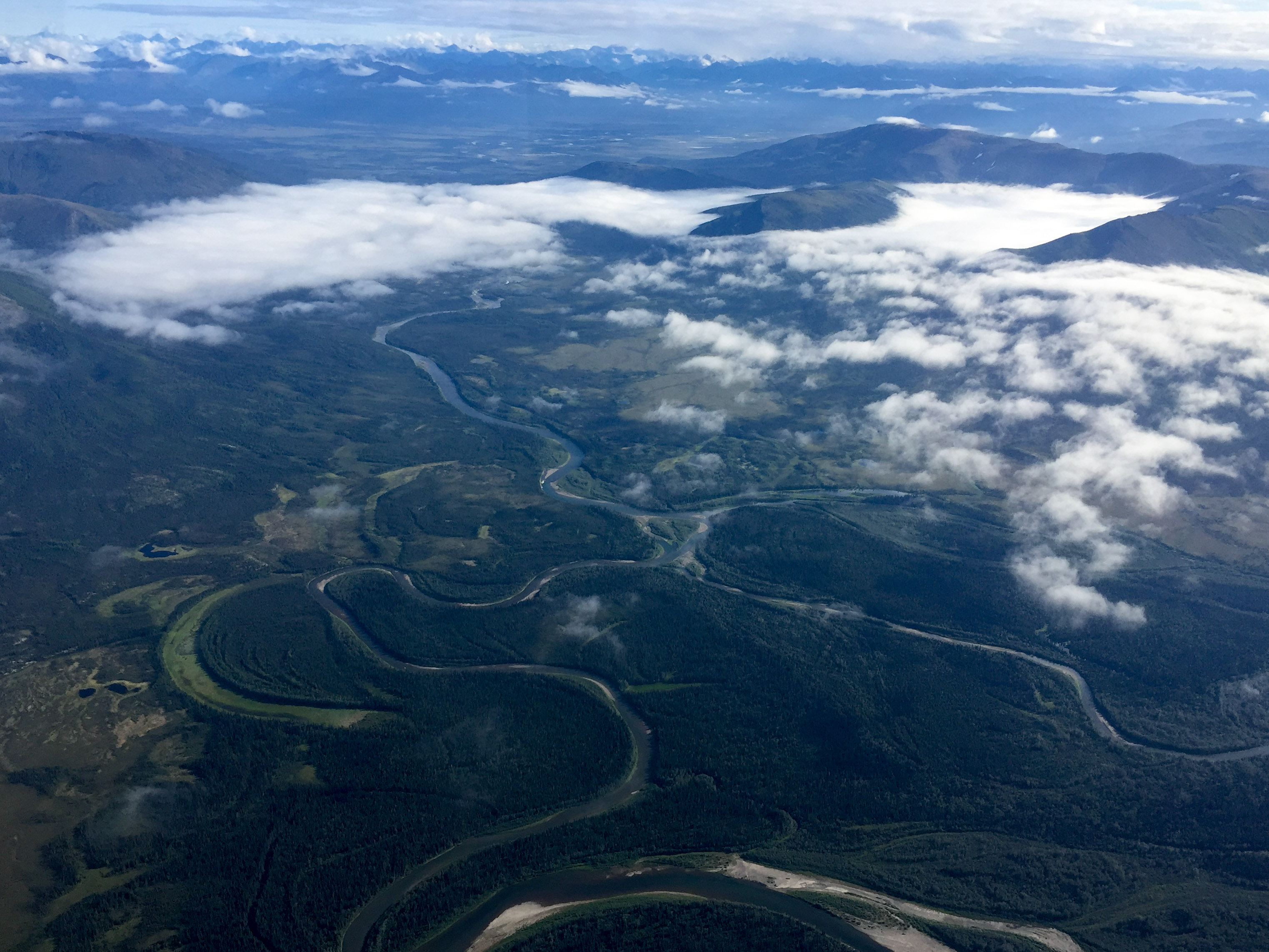
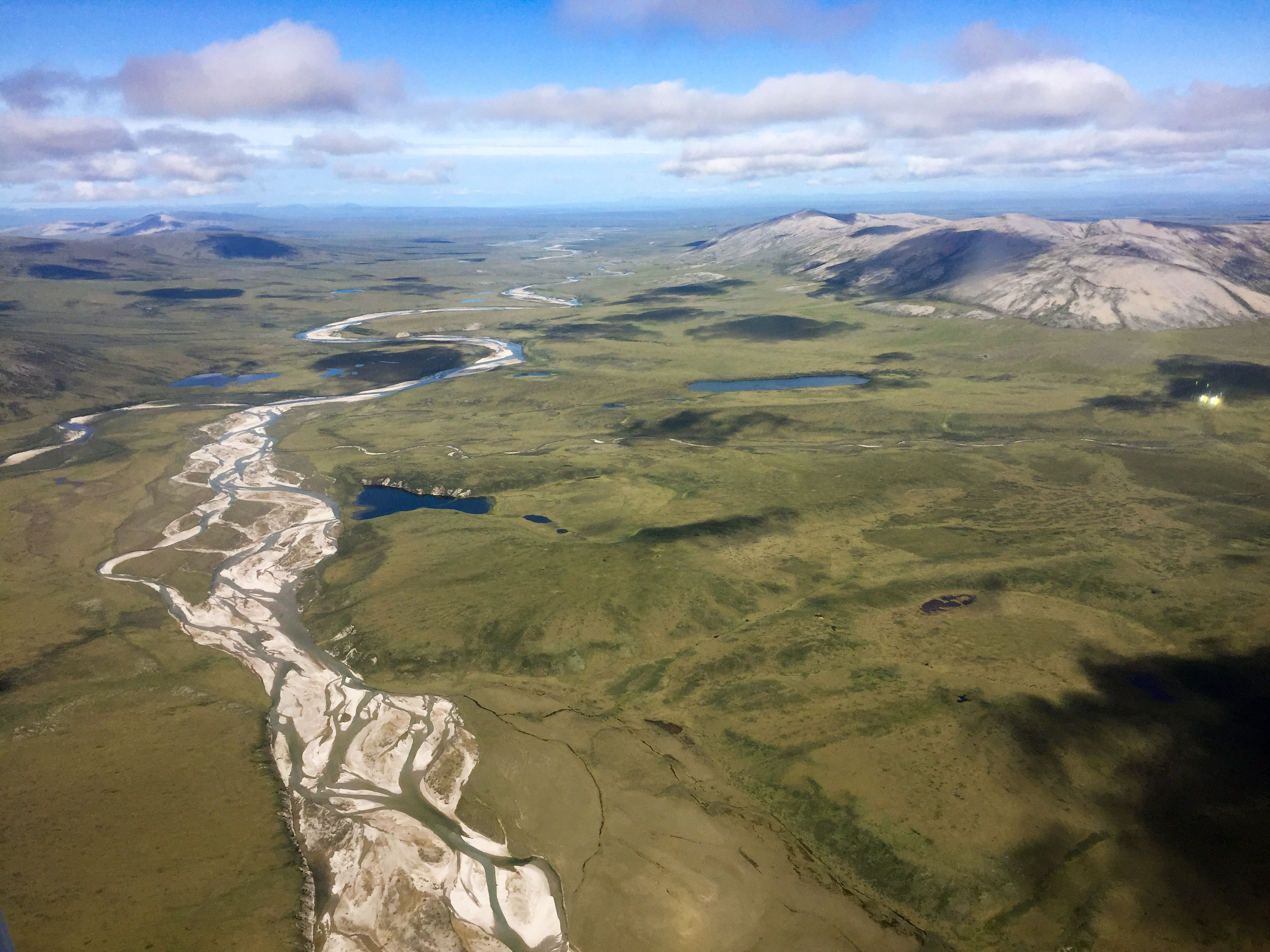
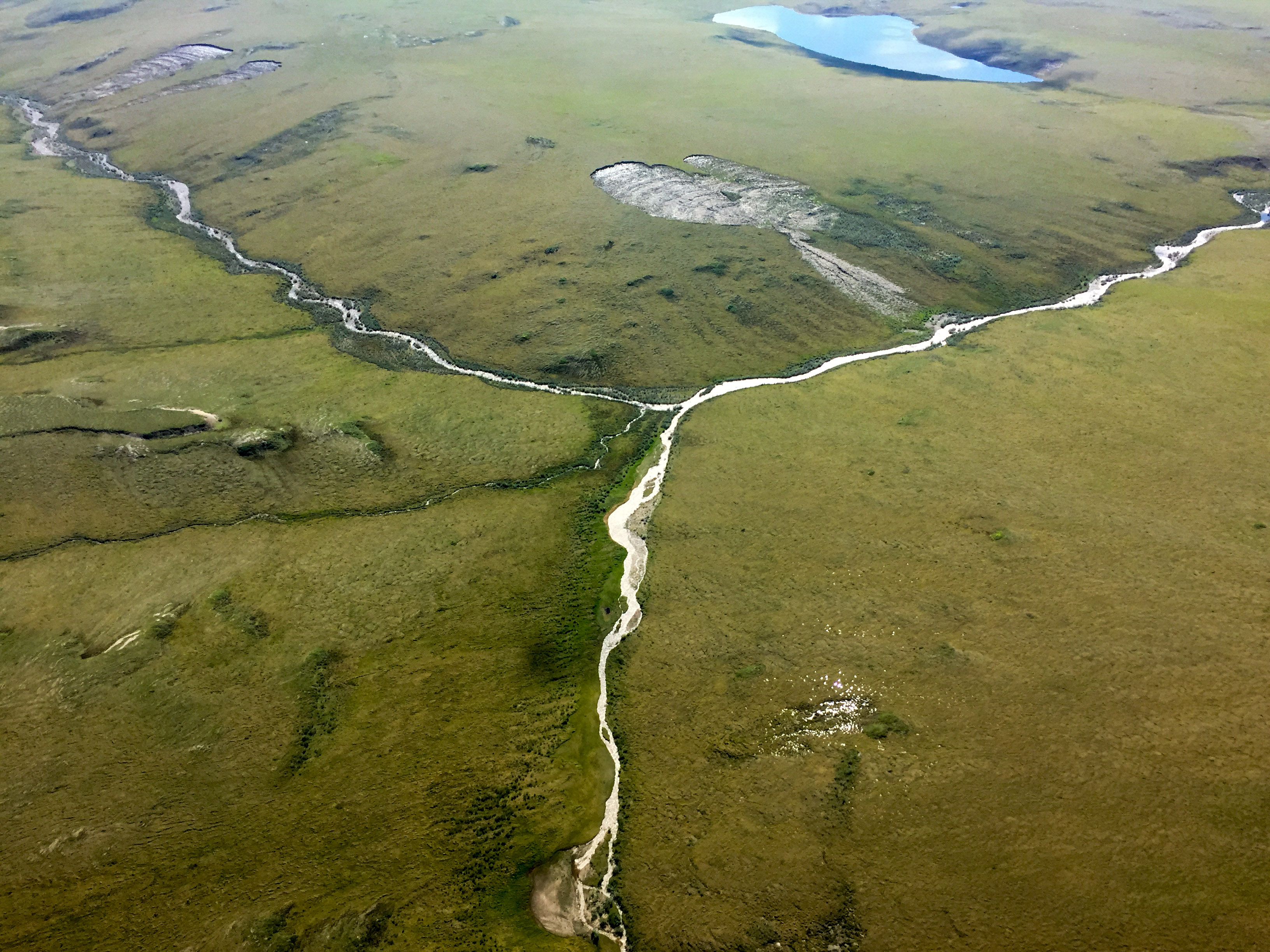
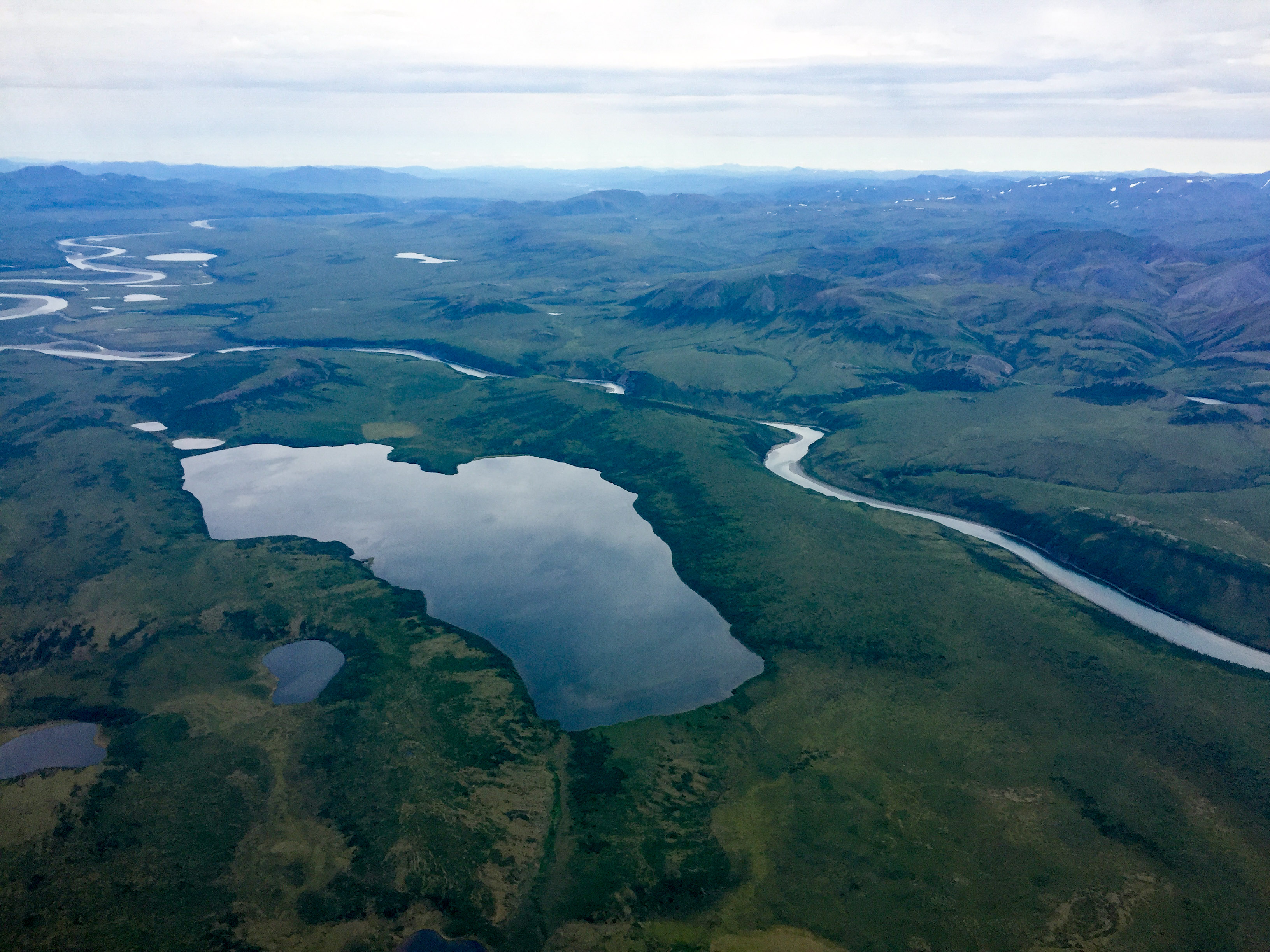
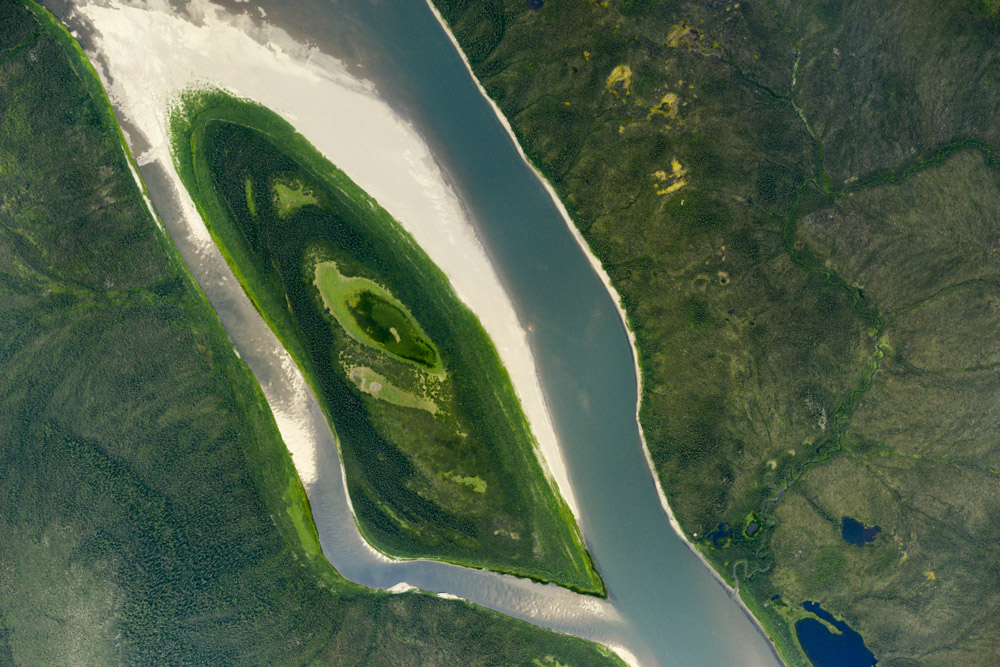
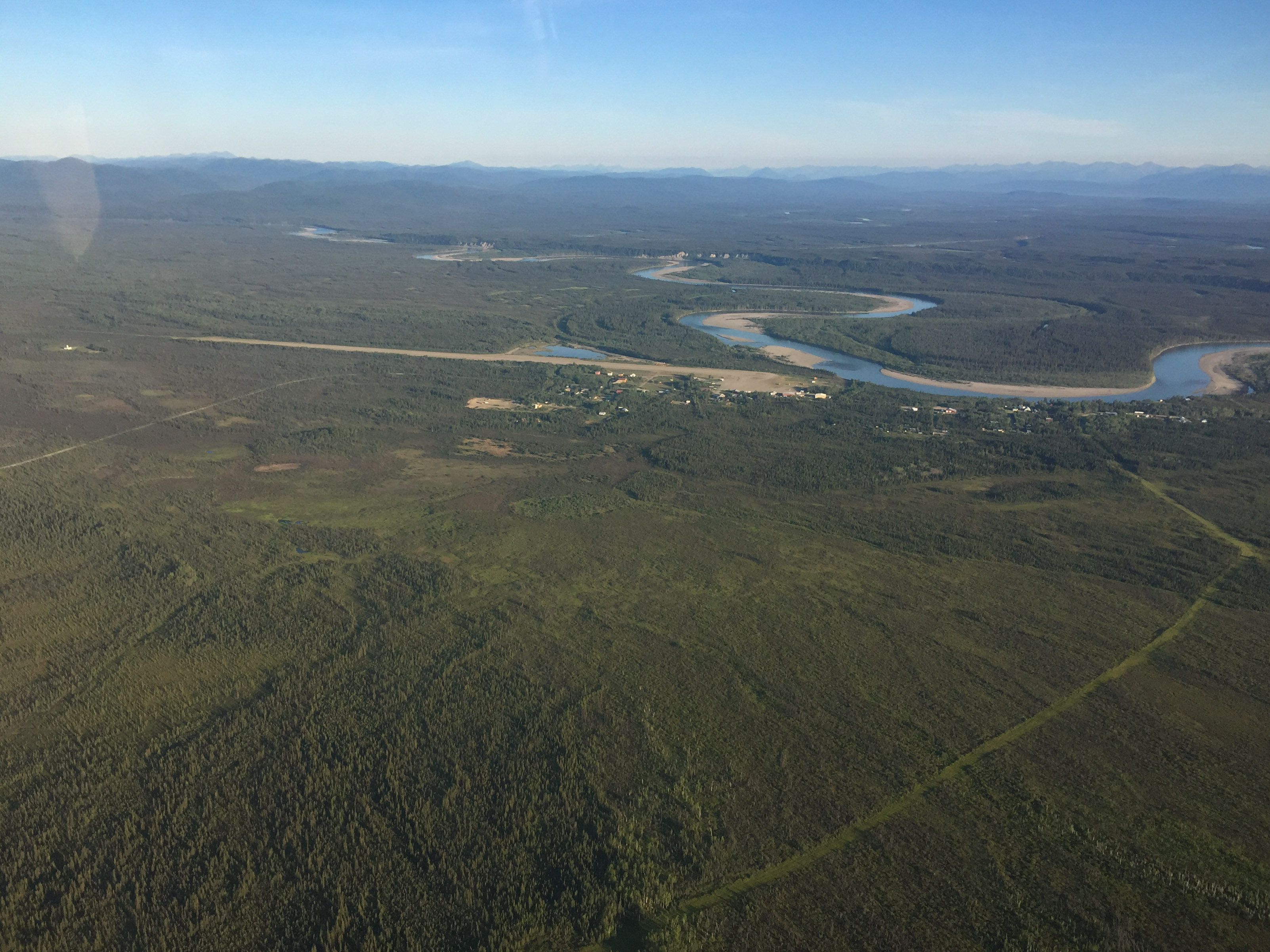
The Noatak River valley is quite scenic. It’s an ancient, wide glacial valley surrounded by rugged, but not too high, mountains. There are tons of interesting permafrost features and a pretty river running through the middle of it. The river was low, exposing runway-length gravel bars nearly everywhere. As I understand it, glacier ice from the last ice age still exists beneath the tundra here, at least in places, and it is this ice that is melting and causing the slumps, or at least some of them. I’m not exactly sure how these slumps were selected for study, but there are tons of them around and the general idea is that not enough is understood about them to predict where and when they occur or what impact they may have on ecosystems, carbon dynamics, and the like. In any case, the winds were light and bumps tolerable and before long I had mapped the closest six of them on the list. The next two were quite a haul to the west and would bring me nearly to Kotzebue, so I had considered basing from there to get them, but given the weather it seemed like the time to get them was now.
Fortunately the Noatak valley was open. This is just a small tributary I followed into it.
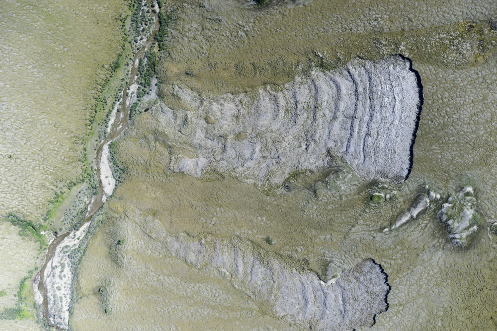
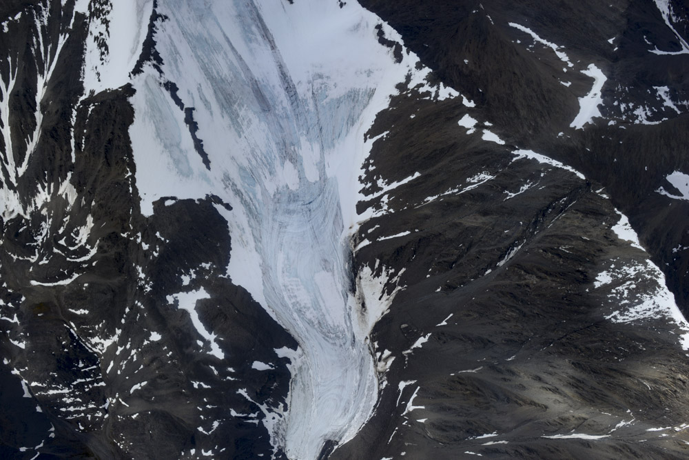
The Evil Twins at left, and Orpaned Twins at right. Detachments like these are common in the area. What’s not really known is whether their rate of formation is increasing or not, or their dynamics of formation.
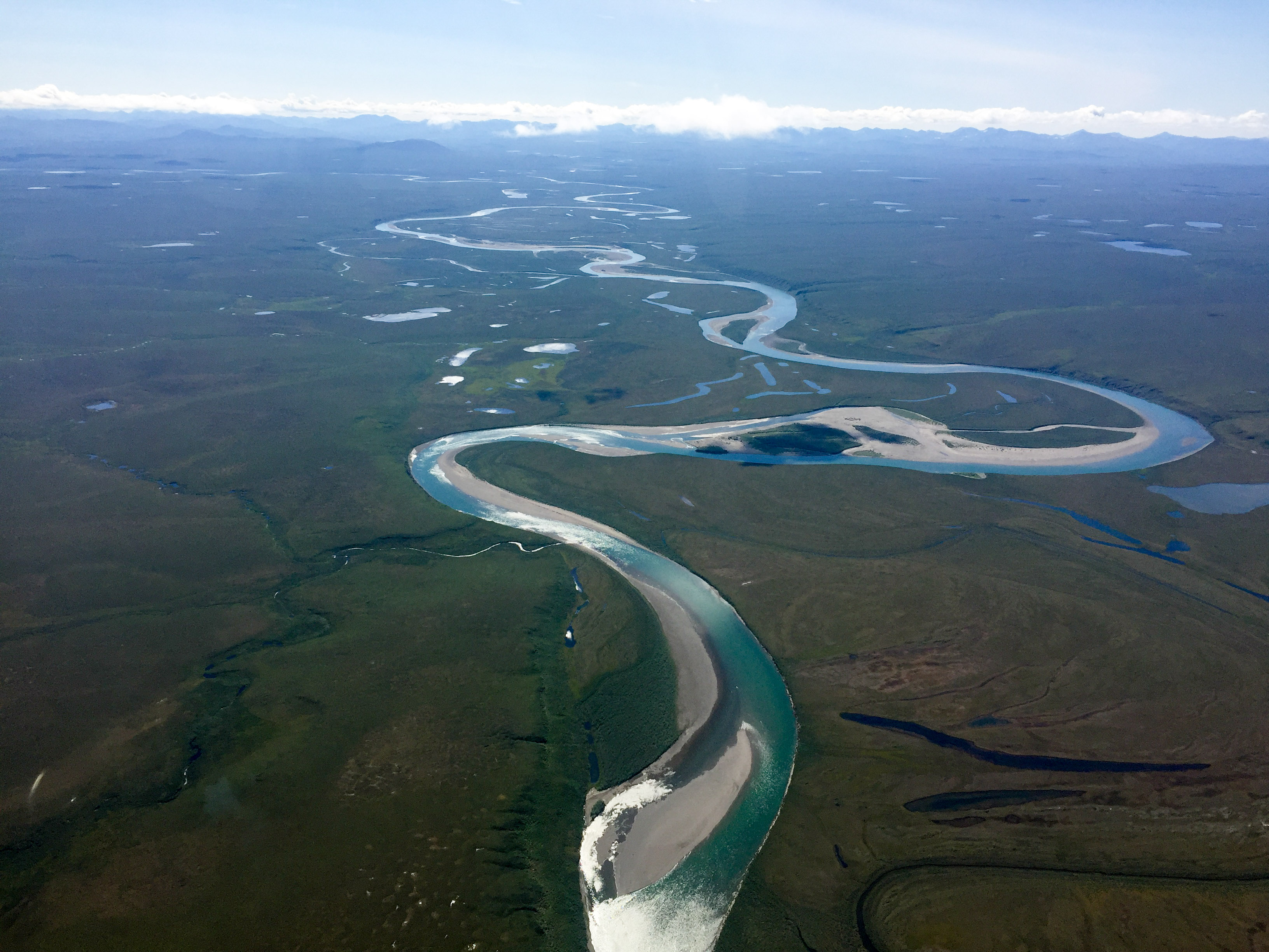 The Noatak River seems like it would be a pleasant one to float.
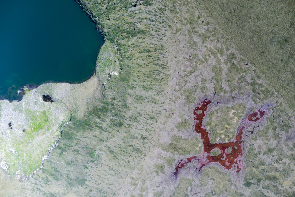
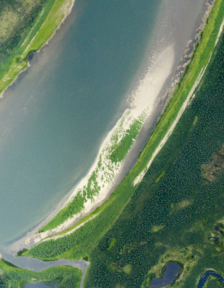
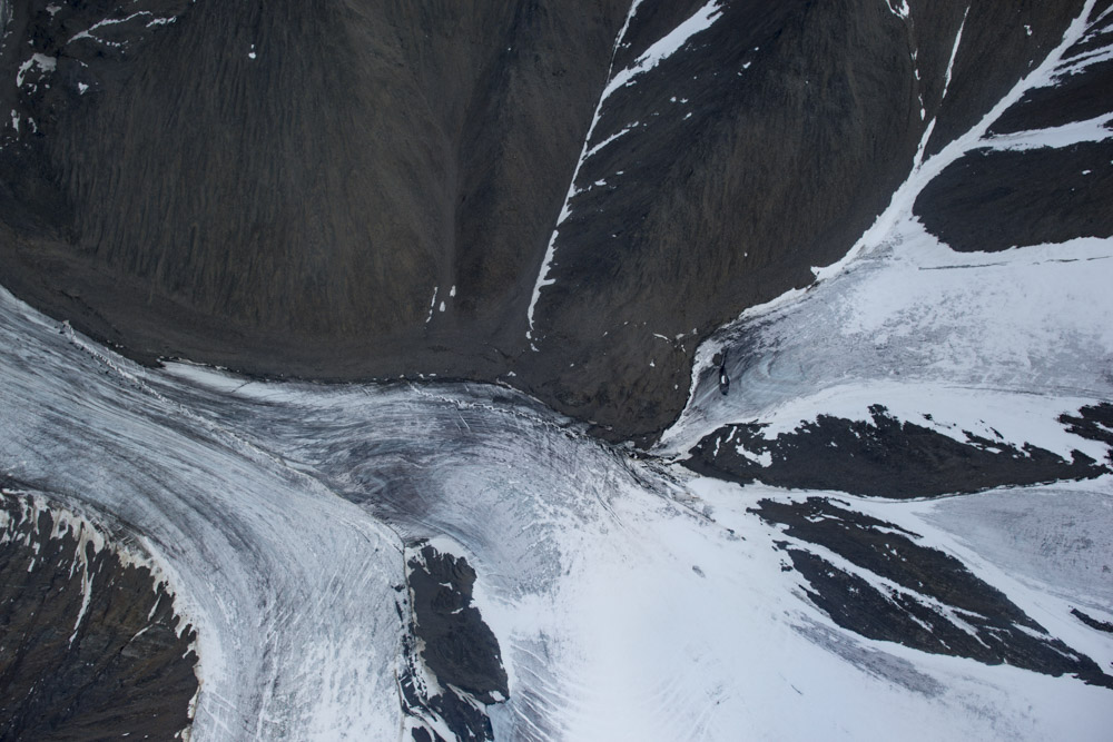
Thaw slump at left, whale crater at right.
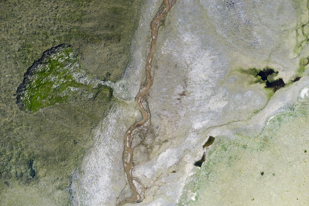
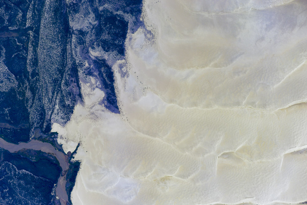
This one feeds into an aufeis patch that has completely melted already.
The challenge to all of this work is fuel and weather, or rather the lack of refueling stations and the lack of weather reporting stations. Imagine traveling across Oregon with fuel and lodging only at either end and one weather station in between, with similar gradients in weather. So at this point, I had no idea if the weather had deteriorated or improved between Bettles and Dahl Creek, and no way to find out but to see for myself. By mapping the furthest slump, however, I would have enough fuel with me to get most of the way back to Bettles and return to Dahl Creek if I couldnt make it in, but at that point I would not have enough fuel to go anywhere else and would have to have some brought to me. This beats landing in the weeds, but is still not a desirable option. So I decided that since I was so close to Kotzebue that I may as well divert there to tanker up and give me options to fly wherever I liked within the State and back. By the time I left Kotz it was after 4PM. Since I now had fuel, I no longer needed to go to Bettles, but Bettles was a 3 hour flight that put me in close range of Peters Lake and Fairbanks was a 4.5 hour flight that left me further from the glaciers, meaning much less sleep to utilize what might only be a one day window. So I opted to make for Bettles, and fortunately the clouds of the morning were gone and it was like travelling through completely different country. And even more fortunately there was room at the inn, so after refueling and prepping the plane for an early start, I scarfed a nice steak and drank a gallon of assorted canned drinks before collapsing into bed.
The mapping itself only took about 2 hours, but six times that just to get there and back (almost).
Lot’s of scenery on the way back.
There once were glaciers here.
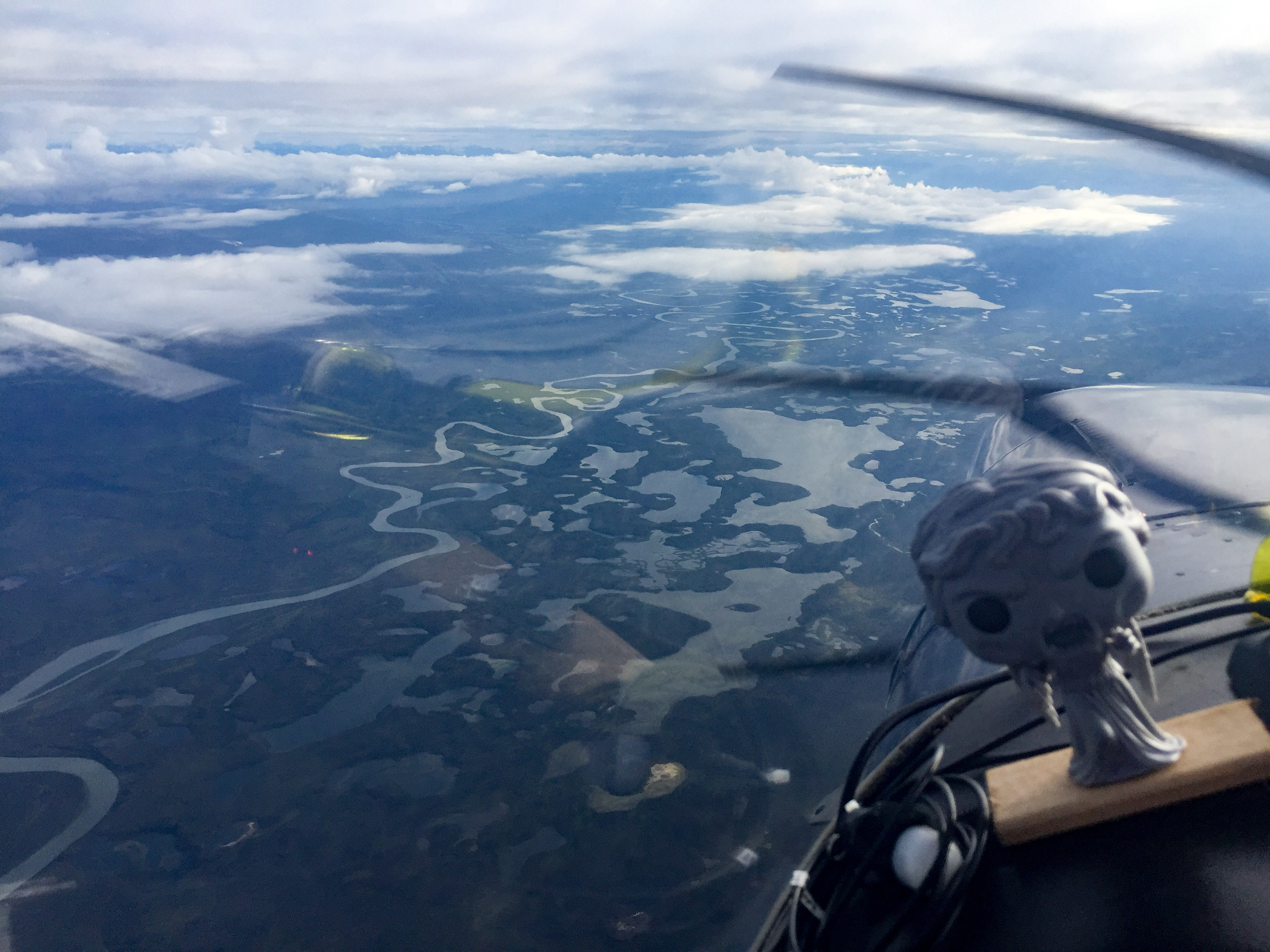
I mapped some of the Kobuk River on the way back. It’s got really cool sandbars.
The shrubbery here grew on the crests of former sand ripples.
I mapped the Kobuk Sand Dunes on the way home too.
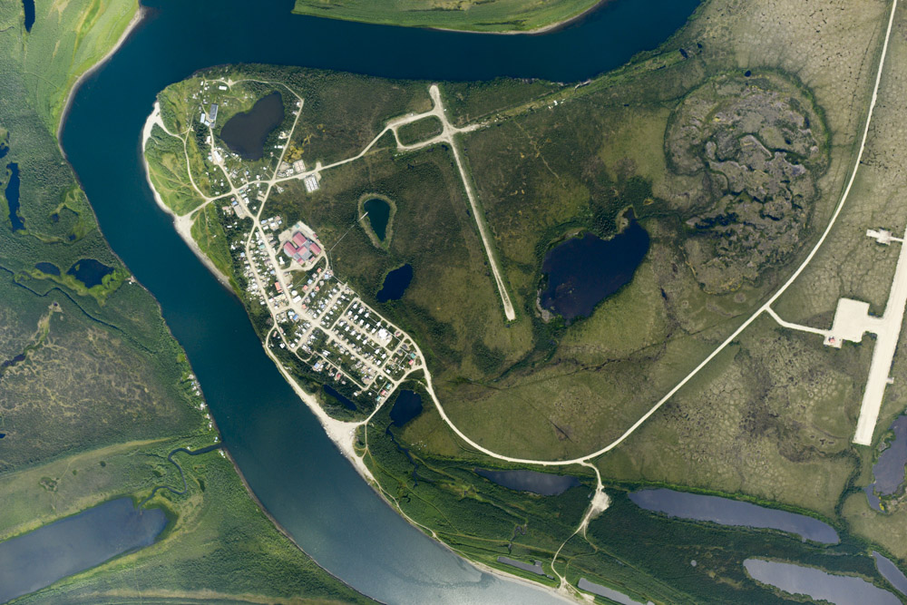
And a few villages. This is Shugnak, next to Dahl Creek.
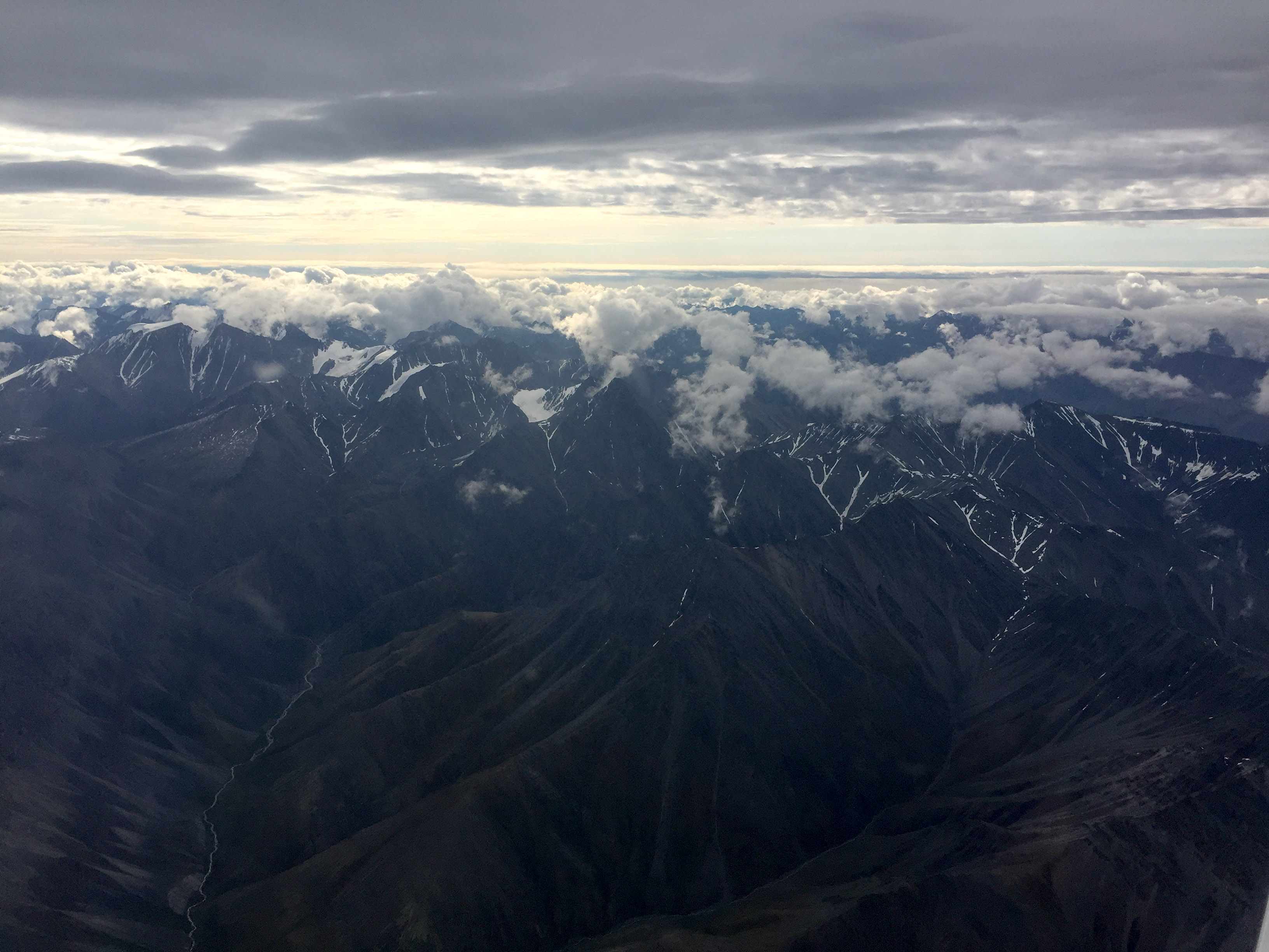
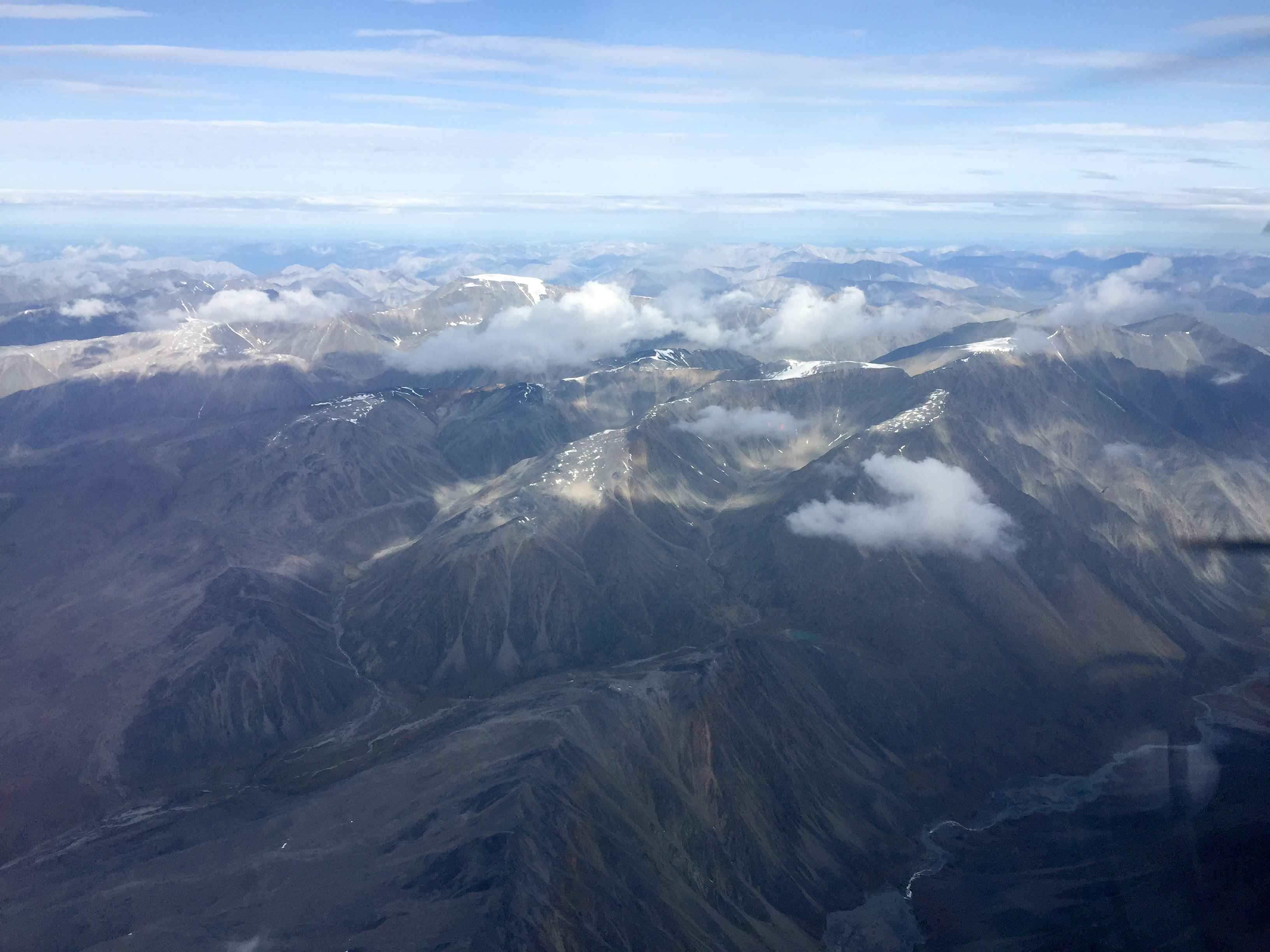
The forecast the next morning showed the entire state to be clear and calm, except for the one location I wanted to go which showed thunderstorms already active at 6AM. There was no sense not giving it a try since I was already most of the way there, but sure enough the weather was great until I got up to Arctic Village. Here there were mixed layers that appeared to be remnants of the previous day’s activity, with some of them still raining and giving an ominous look to the upper valley. But again I was here, so no sense not having a look. The overcast was too high to fly over, so I dropped underneath and made my way towards the glaciers. As I skirted the bigger clouds and got around the rain, I could see up ahead that the overcast ended. I would have had to turn around if it hadnt as I was already too low to map, but what was ahead didnt look any more encouraging. All of the mountains were ringed with dewpoint point clouds at lower elevations and above them there were already cumulus building up. To the east and west it looked much better and I could see the mountains there shining in the sunlight, but right where I was heading it was grim. I followed a valley more in the sun alongside the direct route and climbed up again to my mapping altitude, but every 5 minutes I was thinking this was silly and I should turn around as it was just a tangle of clouds where I needed to be. Once I got far enough north I snaked my way back towards the watershed, and sure enough the valley was in the clear, though surrounded by clouds starting from the mountain tops up past my altitude. So I started mapping.
It was beautiful in Bettles in the morning, as it was nearly everywhere in the State except where I was headed.
Coming into Arctic Village, Weeping Angel wasn’t liking our chances.
Once past the scuz at Arctic, our chances didn’t look much better.
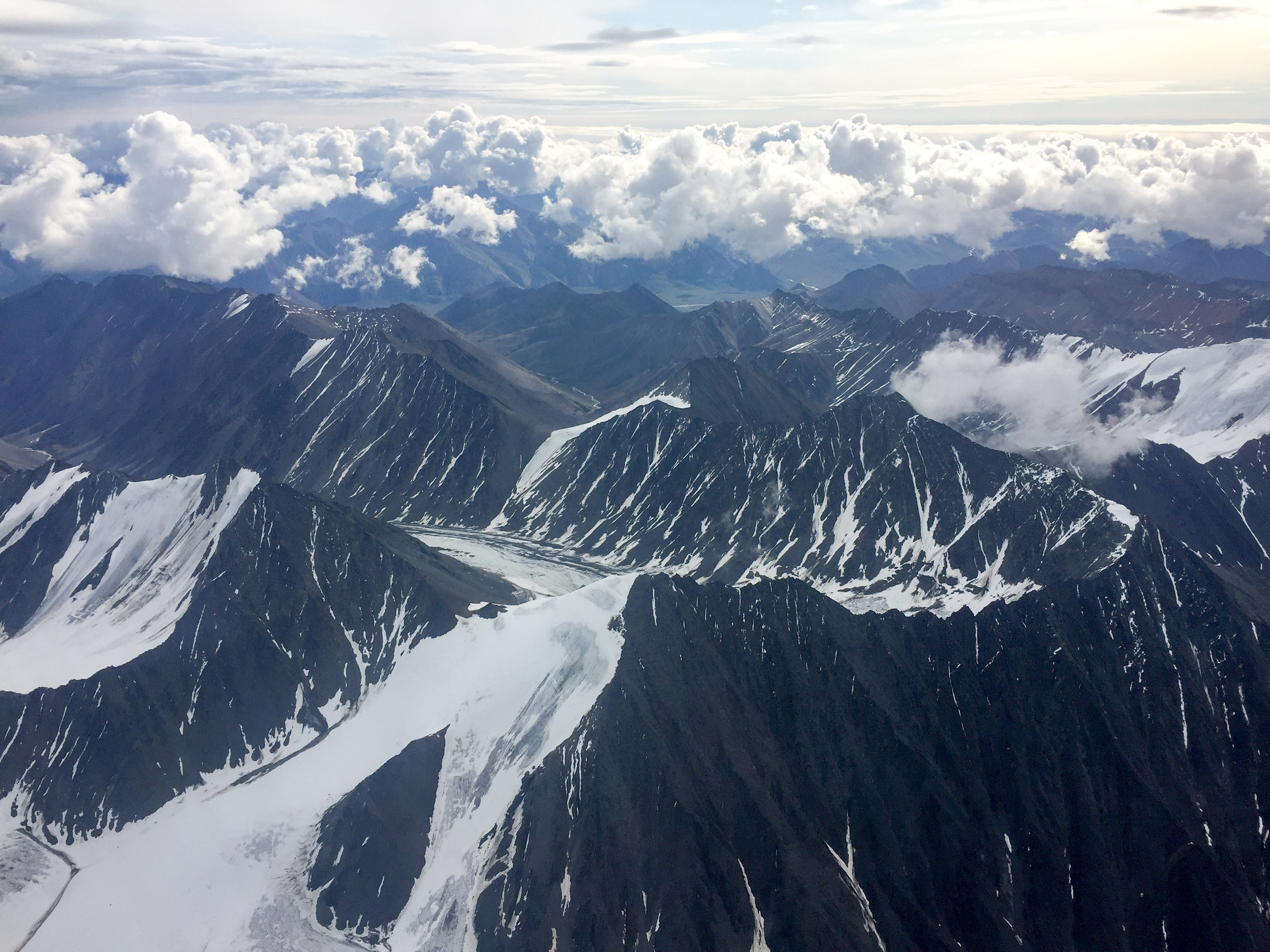
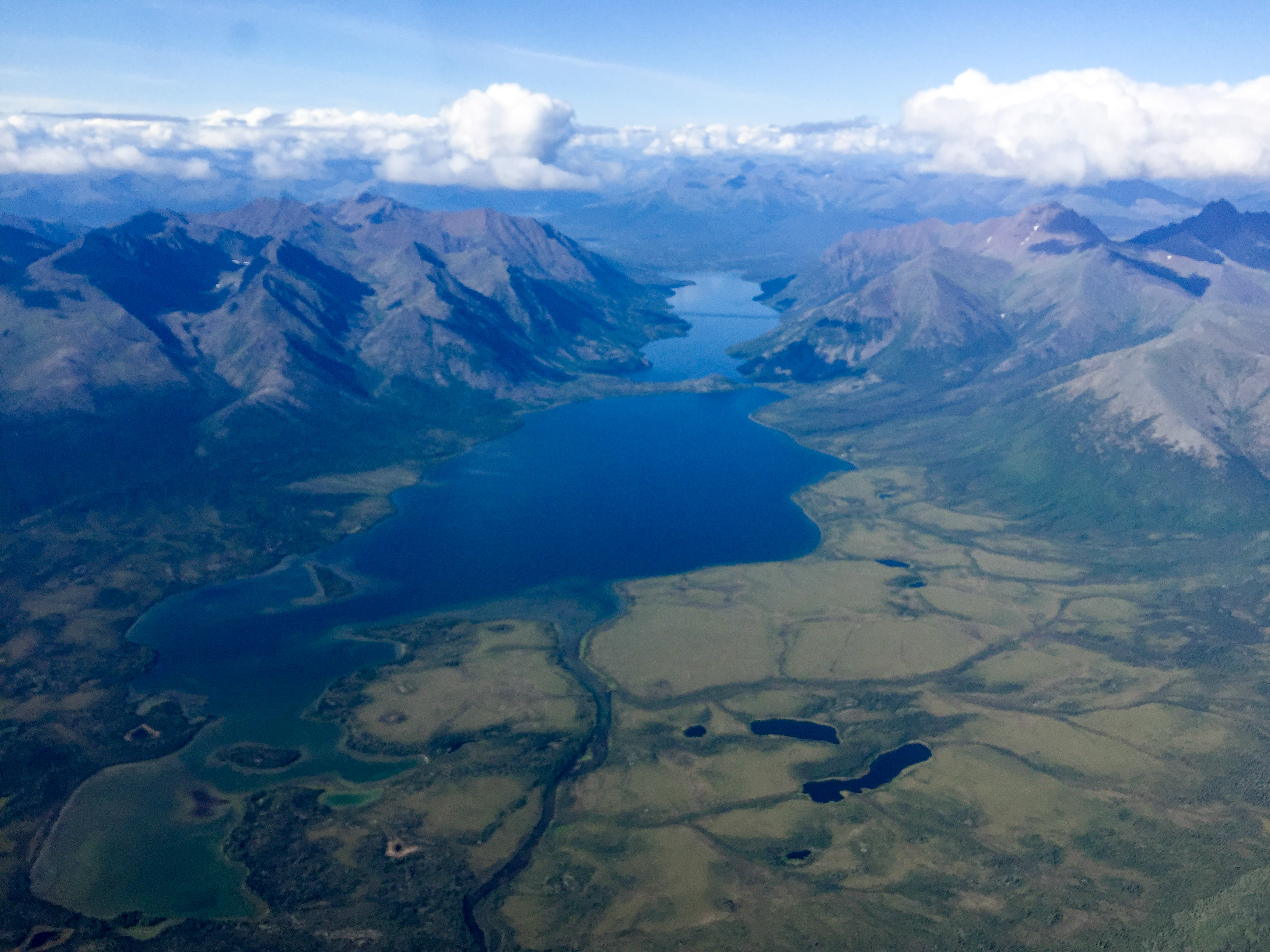
But once we got to the watershed, the glaciers were in a cloud-free bubble, so we mapped them.
Heading North from Arctic Village, I swung to the west to stay in better conditions before cutting in to the glaciers. On the way back the scuz was gone, but replaced by buildups.
Fortunately the air was mostly calm when I began. As I got to the northern end of the line over Mt Chamberlin, however, it was clear that there was a much stronger wind on the coastal plain which bounced me around a little. By my next line, lenticulars were forming above me and I was starting to get pushed around a lot more. It was reasonably gentle, but at that point I was still on the west side of the mountains with an east wind, so I was getting pushed down, but only over the highest terrain. I remember thinking that Mt Chamberlin must be made at me for measuring that it wasnt the highest peak in the Brooks Range, as it was only right there that I was having the problems. I used my turns to climb back up and fortunately a line or two later I was on the upwind side catching lift and soon found myself at 11,500′ and pushing the nose down so as to not get any higher. As I flew lines south I could see that buildups were forming where I came from and around me, and by now even the west side of my valley had clouds forming below and obscuring the hills. I hadnt landed at Arctic initially because I was pretty certain I was going to be turning around in a few minutes, so by now fuel was also becoming a concern. I could also see from here that both McCall and Esetuk Glaciers were cloud covered, so there was no chance of mapping them. In my past three acquisitions here I mapped the whole watershed, even though the contract is for only the east side where the glaciers are, as the whole watershed allows us to directly measure total snow depth as well as get a better surface for modeling. So once I got the glaciers done and not really sure if I could go back the way I came, I headed west into what was still open skies before turning south to head home. As I looked back I could see that the lenticulars that were descending upon me were now gone, but the watershed was closed in with normal buildups, so I probably hit the best window for the day. Not far to the south it was apparent that the ugliness I saw was pretty local and by the time I got back to Arctic Village the nastiness of the morning was gone, but replaced with fresh buildups, though widely scattered and easy to avoid. I had enough fuel to make it to Ft Yukon, where I bumped in Kirk who had just landed from a shopping run with the family. We had a nice conversation about the changes in aufeis over the past decade that he has observed, and it reminded me that pilots that do the type of off-airport bush flying that he does probably have some of the best knowledge of changes in surface conditions of anyone in the state.
If only the glaciers were over there…
It was a bit sketchy, but good enough.
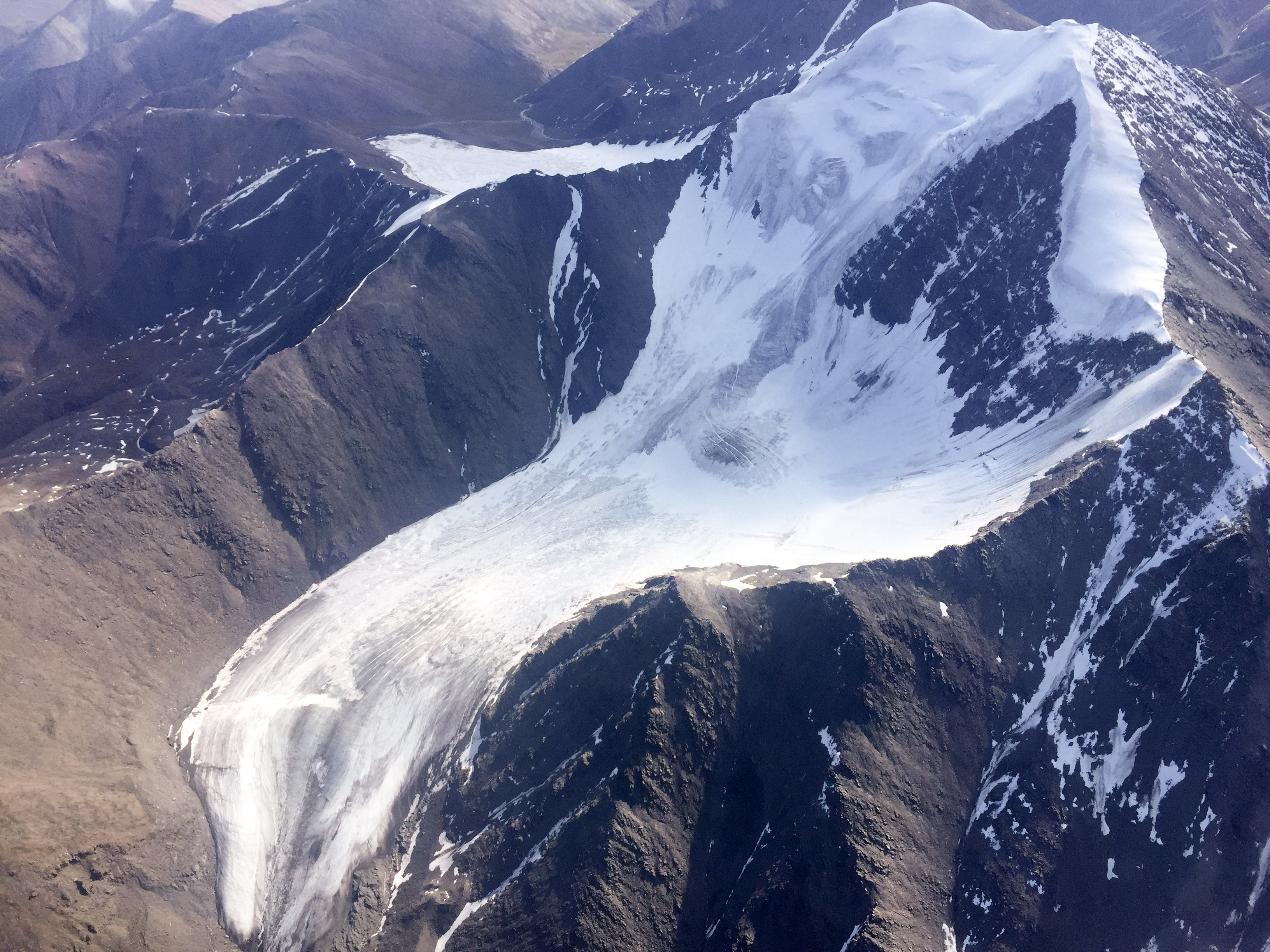
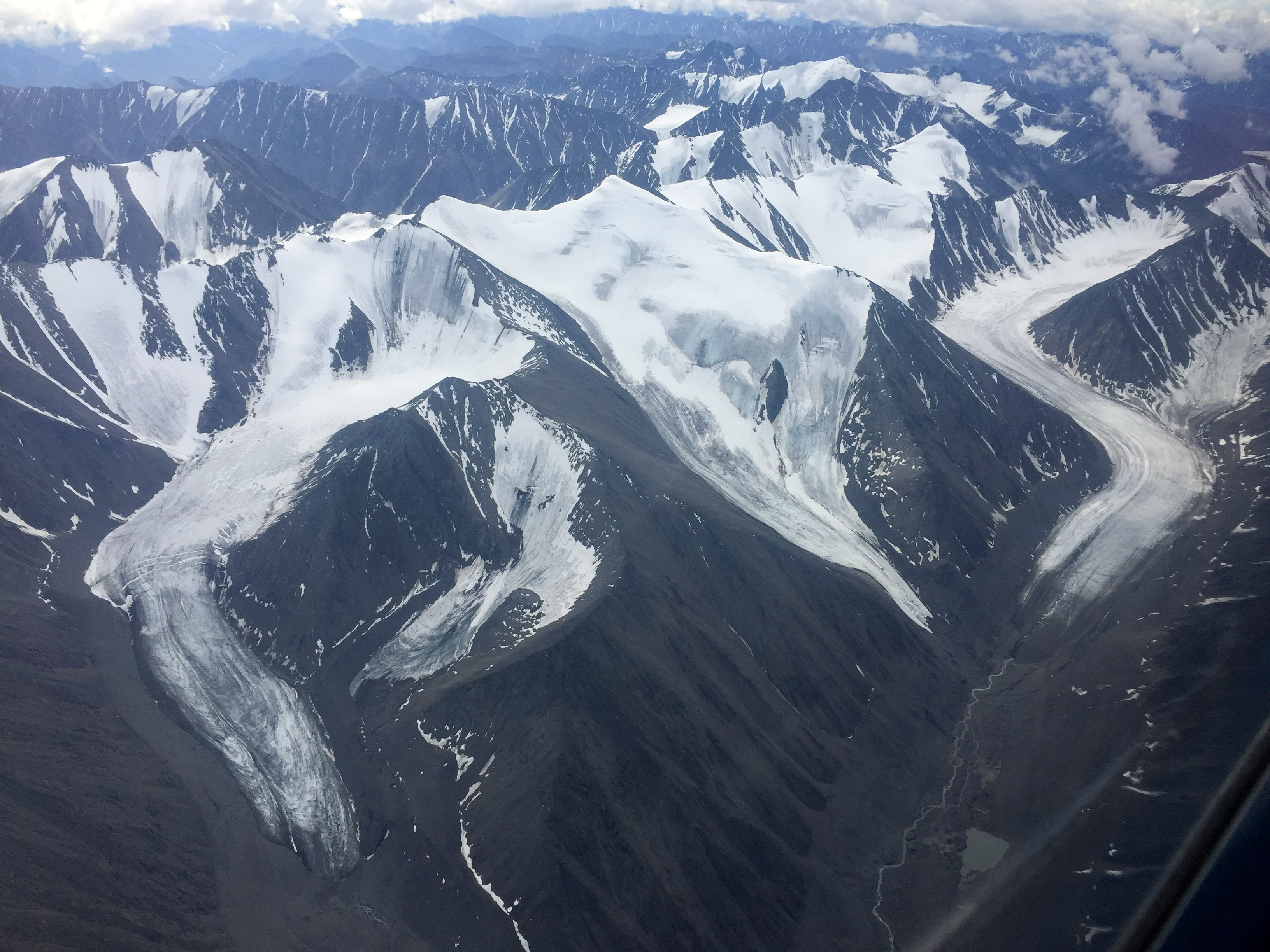
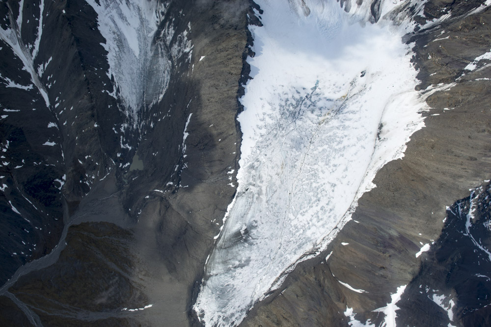
Chamberlin Glacier. The idea behind this acquisition was to capture the glaciers in mid-summer, before the snow melted completely, to determine how well our melt-models capture reality. Ask and ye shall receive…

The trip home from there was uneventful, though I did make it up to 12,500′ for the first time, trying to get over the just-forming thunderstorms around Fairbanks which kept me that high until I was almost on top of the airport. By now it was late afternoon, and I had just enough time to download data and change clothes before Taco Tuesday began. As it turns out, the forecast is for several days more of good weather, so likely had I started today I would have not learned so much about clouds, but who knows. I do find it remarkable though how accurate the forecasts and current condition charts are given how little local information there is to input into the models. But they are far from infallible. I watched a documentary recently where Eisenhower said something like ‘Proper planning is essential to winning wars, but plans are useless in battle’. That certainly applies to getting this job done too.
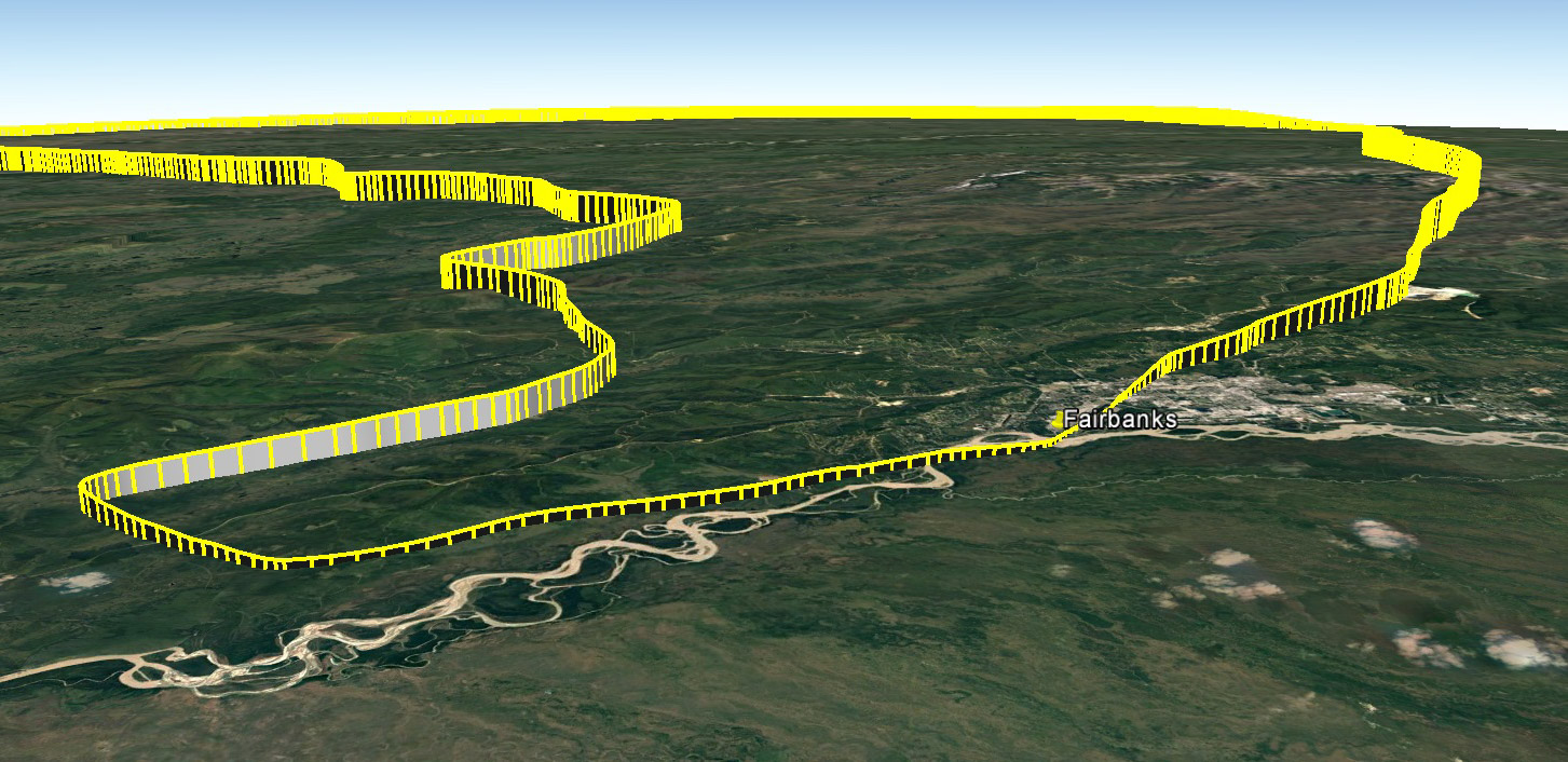
The trip out of Fairbanks (left) took a circuitous route trying to get around clouds and fog while trying keep branches from getting stuck in the tail. The return was much straighter, but made my ears pop.
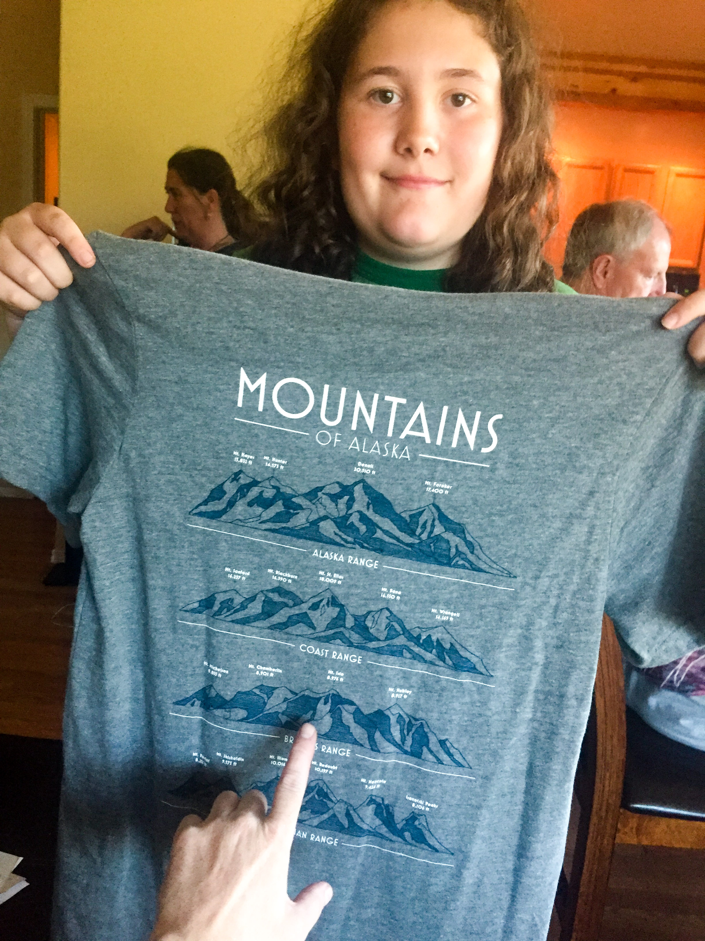
Turner got this shirt in Talkeetna a few days ago.
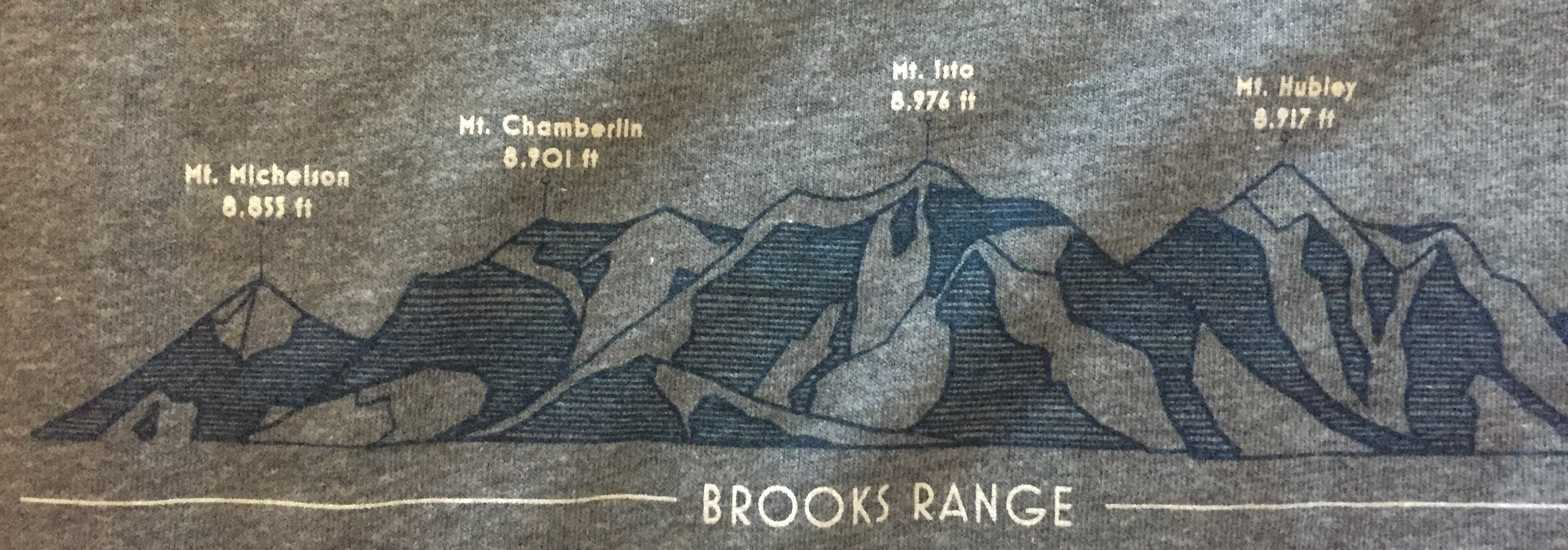
It’s got the peak heights correct (almost)! Fodar knows best!